Spain Hanger

Wood, Forest in Surrey Waverley

England

Spain Hanger

Toll House, Chiddingfold What looks to be an ex-toll house. The brick fabric looks late for a toll house so may well have served the Petworth Turnpike Trust in its dying years. It would have replaced a Toll House SSE on the North side of the ford/bridge at Northbridge.

Milestone Society National ID: SY.CHI
Toll House, Chiddingfold Credit: Lionel Joseph

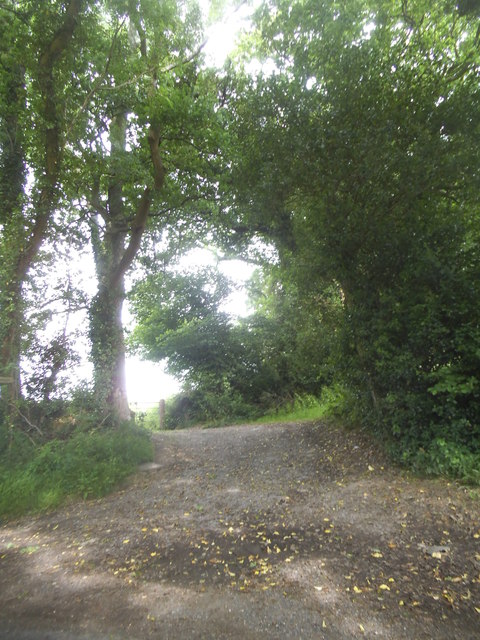
Spain Hanger is a picturesque woodland area located in Surrey, England. Situated near the village of Shere, it covers approximately 150 acres of stunning natural beauty. The hanger is part of the larger Surrey Hills Area of Outstanding Natural Beauty, which is renowned for its rolling hills, ancient woodlands, and diverse wildlife.

The woodland in Spain Hanger is predominantly composed of broadleaf trees, such as oak, beech, and birch. These trees create a dense canopy, providing shade and shelter for a variety of plant and animal species. The forest floor is covered in a rich carpet of ferns, bluebells, and wildflowers, which bloom in vibrant colors during the spring and summer months.

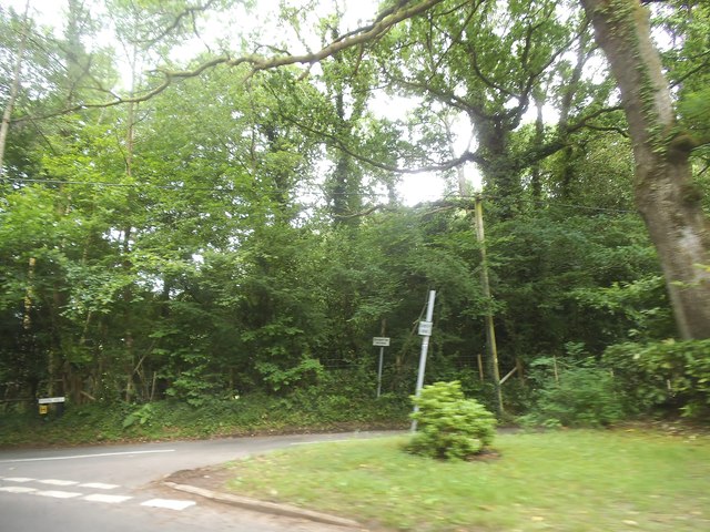
The hanger offers a peaceful retreat for nature enthusiasts and walkers, with a network of well-maintained footpaths and bridleways. These trails allow visitors to explore the woodland and discover its hidden gems, such as secluded ponds, ancient ruins, and breathtaking viewpoints overlooking the surrounding countryside.

Wildlife thrives in Spain Hanger, with numerous bird species, including woodpeckers, nuthatches, and tawny owls, calling the forest home. Squirrels can be seen darting through the trees, while deer occasionally make appearances, adding to the area's natural charm.

The hanger is managed by the National Trust, ensuring its conservation and protection for future generations to enjoy. Visitors are encouraged to respect the woodland and follow the established guidelines to preserve its fragile ecosystem.

Whether it's a leisurely stroll, a peaceful picnic, or a chance to immerse oneself in the beauty of nature, Spain Hanger in Surrey is a true gem that offers an unforgettable experience for all who venture into its enchanting woodland.

If you have any feedback on the listing, please let us know in the comments section below.

Spain Hanger Images

Images are sourced within 2km of 51.116189/-0.64245017 or Grid Reference SU9536. Thanks to Geograph Open Source API. All images are credited.

Toll House, Chiddingfold What looks to be an ex-toll house. The brick fabric looks late for a toll house so may well have served the Petworth Turnpike Trust in its dying years. It would have replaced a Toll House SSE on the North side of the ford/bridge at Northbridge.

Milestone Society National ID: SY.CHI
Toll House, Chiddingfold
What looks to be an ex-toll house. The brick fabric looks late for a toll house so may well have served the Petworth Turnpike Trust in its dying years. It would have replaced a Toll House SSE on the North side of the ford/bridge at Northbridge. Milestone Society National ID: SY.CHI
Prestwick Lane at the junction of Combe Lane
Combe Lane, Combe Common
Ridgley Road at the junction of Coxcomb Lane
Prestwick Lane, Combe Common
Cottage on Combe Lane, Chiddingfold
Shops on The Green, Chiddingfold
Shops on The Green, Chiddingfold A very small Boots, one of the few large chains who kept their village shops as well.
Shops on The Green, Chiddingfold
A very small Boots, one of the few large chains who kept their village shops as well.
House on The Green, Chiddingfold
Phillips of Wormley
Phillips of Wormley
The Winterton Arms, Chiddingfold
Houses on Petworth Road, Chiddingfold
Petworth Road, Chiddingfold
Old house on Petworth Road, Chiddingfold
Path to Langhurst Manor
Pook Hill at the junction of Prestwick Lane
Show me another place!

Spain Hanger is located at Grid Ref: SU9536 (Lat: 51.116189, Lng: -0.64245017)

Administrative County: Surrey

District: Waverley

Police Authority: Surrey

What 3 Words

///topples.targeted.originals. Near Chiddingfold, Surrey

Related Wikis

St Teresa of Avila Church, Chiddingfold

St Teresa of Avila Church is a Roman Catholic Parish church in Chiddingfold, Surrey. It is situated on the corner of Petworth Road and Woodside Road in...

Chiddingfold

Chiddingfold is a village and civil parish in the Weald in the Waverley district of Surrey, England. It lies on the A283 road between Milford and Petworth...

Witley railway station

Witley railway station is a station on the Portsmouth Direct Line in Surrey, England. It is 38 miles 36 chains (61.9 km) down the line from London Waterloo...

Tigbourne Court

Tigbourne Court is an Arts and Crafts style country house in Wormley, Surrey, England, 1 mile (1.6 km) south of Witley. It was designed by architect Edwin...

Netherside Stream Outcrops

Netherside Stream Outcrops is a 2.9-hectare (7.2-acre) geological Site of Special Scientific Interest north-east of Haslemere in Surrey. It is a Geological...

Wormley, Surrey

Wormley is a village in Surrey, England in the parish of Witley, around Witley station, off the A283 Petworth Road about 5 km (3.1 mi) SSW of Godalming...

Oakhurst Cottage

Oakhurst Cottage is a tiny 16th or 17th-century cottage in Hambledon, Surrey, in the United Kingdom. It is a Grade II listed building.The cottage was given...

King Edward's School, Witley

King Edward's Witley is a private co-educational boarding and day school, founded in 1553 by King Edward VI and Nicholas Ridley, Bishop of London and Westminster...

Nearby Amenities

Located within 500m of 51.116189,-0.64245017
Bus Stop
Woodside Road
Naptan AtcoCode: 40004411438A
Naptan Bearing: N
Naptan CommonName: Woodside Road
Naptan Indicator: N-bound
Naptan Landmark: Woodside Road
Naptan NaptanCode: surgjmpg
Naptan Street: Woodside Road
Naptan Verified: no
Source: naptan_import
Lat/Long: 51.1163561/-0.6487013
Bus Stop
Woodside Road
Naptan AtcoCode: 40004411439A
Naptan Bearing: S
Naptan CommonName: Woodside Road
Naptan Indicator: S-bound
Naptan Landmark: Woodside Road
Naptan NaptanCode: surgjmpj
Naptan Street: Woodside Road
Naptan Verified: no
Source: naptan_import
Lat/Long: 51.1164978/-0.6485115
Bus Stop
Ridgeley Garage
Bus: yes
Naptan AtcoCode: 40004411992A
Naptan Bearing: W
Naptan CommonName: Ridgeley Garage
Naptan Indicator: W-bound
Naptan Landmark: Ridgeley Garage
Naptan NaptanCode: surgmtpd
Naptan Street: Woodside Road
Naptan Verified: no
Public Transport: platform
Source: naptan_import
Lat/Long: 51.1140869/-0.6430098
Bus Stop
Harts Grove
Naptan AtcoCode: 40004411993A
Naptan Bearing: E
Naptan CommonName: Harts Grove
Naptan Indicator: adj
Naptan Landmark: Woodside Road/Harts Grove
Naptan NaptanCode: surgmtpg
Naptan Street: Woodside Road
Naptan Verified: no
Source: naptan_import
Lat/Long: 51.1166373/-0.6357483
Bus Stop
Harts Grove
Naptan AtcoCode: 40004411995A
Naptan Bearing: W
Naptan CommonName: Harts Grove
Naptan Indicator: Opp
Naptan Landmark: Woodside Road/Harts Grove
Naptan NaptanCode: surgmtpm
Naptan Street: Woodside Road
Naptan Verified: no
Source: naptan_import
Lat/Long: 51.1164845/-0.6357528
Bus Stop
Ridgeley Garage
Bus: yes
Naptan AtcoCode: 40004411996A
Naptan Bearing: E
Naptan CommonName: Ridgeley Garage
Naptan Indicator: E-bound
Naptan Landmark: Ridgeley Garage
Naptan NaptanCode: surgmtpt
Naptan Street: Woodside Road
Naptan Verified: no
Public Transport: platform
Source: naptan_import
Lat/Long: 51.1139318/-0.6428144
Barrier: kissing_gate
Lat/Long: 51.1177856/-0.6373571
Barrier: kissing_gate
Lat/Long: 51.1173115/-0.637353
Great Oaks Farm
Landuse: farm
Note Retag: CS #48756035
Source: os_street_view
Lat/Long: 51.112865/-0.6431708
Natural: spring
Source: os_street_view
Lat/Long: 51.1185538/-0.6425525
Moore's Farm
Landuse: farm
Note Retag: CS #48756035
Source: os_street_view
Lat/Long: 51.1174894/-0.6380952
Dog Kennel Hill
Place: locality
Source: os_street_view
Lat/Long: 51.1156125/-0.635678
Barrier: stile
Lat/Long: 51.1126311/-0.6422506
Barrier: stile
Lat/Long: 51.113856/-0.6421536
Post Box
Collection Plate: CP1
Collection Times: Mo-Fr 16:00; Sa 09:30
Last Checked: 2020-09-17
Operator: Royal Mail
Post Box Type: pillar
Ref: GU8 114
Royal Cypher: EIIR
Royal Cypher Wikidata: Q33102113
Source: survey
Lat/Long: 51.1135553/-0.6406488
Post Box
Collection Plate: CP7D
Collection Times: Mo-Fr 09:00; Sa 07:00
Last Checked: 2020-09-17
Old Ref: GU8 32
Operator: Royal Mail
Post Box Type: lamp
Ref: GU8 32D
Royal Cypher: EIIR
Royal Cypher Wikidata: Q33102113
Source: survey
Lat/Long: 51.1166797/-0.6484663
Grit Bin
Description: For highways use only.
Operator: Surrey County Council
Ref: 11930
Source: survey
Lat/Long: 51.1140387/-0.6424159
Grit Bin
Colour: yellow
Description: This grit bin is for highways use only.
Operator: Surrey County Council
Ref: 11815
Source: survey
Lat/Long: 51.1135887/-0.6406225
Waste Basket
Colour: green
Covered: no
Source: survey
Lat/Long: 51.1138918/-0.6420816
Waste Basket
Colour: green
Covered: no
Source: survey
Lat/Long: 51.1136185/-0.6406025
The data included in this document is from www.openstreetmap.org. The data is made available under ODbL.

Have you been to Spain Hanger?

Leave your review of Spain Hanger below (or comments, questions and feedback).