Stillers Copse
Wood, Forest in Surrey Waverley
England
Stillers Copse

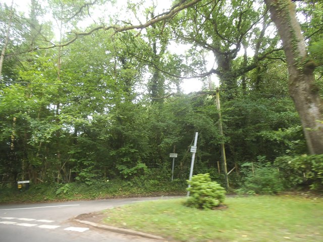
Stillers Copse is a picturesque woodland located in Surrey, England. Covering an area of approximately 100 acres, it is a haven for nature enthusiasts and those seeking tranquility in the heart of the county. The copse is situated near the village of Shackleford, just a few miles south of the popular town of Godalming.
As visitors enter Stillers Copse, they are greeted by a diverse mix of trees, including oak, beech, and birch. The woodland floor is blanketed with a rich carpet of wildflowers during the spring and summer months, creating a vibrant and colorful atmosphere. The copse is also home to a variety of wildlife, including deer, squirrels, and a plethora of bird species, making it a popular spot for birdwatching.
Tranquil footpaths wind their way through the copse, allowing visitors to explore its natural beauty at their own pace. These well-maintained trails offer opportunities for leisurely walks, jogging, or even horseback riding. Along the paths, strategically placed wooden benches provide resting spots for visitors to soak in the peaceful ambiance of the copse.
Stillers Copse is managed by a local conservation group, ensuring the preservation of its natural environment. The organization conducts regular maintenance activities to control invasive species and protect the copse's delicate ecosystem. Educational programs and guided walks are also held to engage visitors and create awareness about the importance of conservation.
Overall, Stillers Copse is a hidden gem in Surrey, offering a serene retreat for those in search of natural beauty and tranquility. Whether it's a leisurely stroll, birdwatching, or simply enjoying the peaceful surroundings, this woodland provides an idyllic escape from the hustle and bustle of everyday life.
If you have any feedback on the listing, please let us know in the comments section below.
Stillers Copse Images
Images are sourced within 2km of 51.119231/-0.63037315 or Grid Reference SU9536. Thanks to Geograph Open Source API. All images are credited.


Stillers Copse is located at Grid Ref: SU9536 (Lat: 51.119231, Lng: -0.63037315)
Administrative County: Surrey
District: Waverley
Police Authority: Surrey
What 3 Words
///milk.restores.blossom. Near Chiddingfold, Surrey
Nearby Locations
Related Wikis

St Teresa of Avila Church, Chiddingfold
St Teresa of Avila Church is a Roman Catholic Parish church in Chiddingfold, Surrey. It is situated on the corner of Petworth Road and Woodside Road in...

Chiddingfold
Chiddingfold is a village and civil parish in the Weald in the Waverley district of Surrey, England. It lies on the A283 road between Milford and Petworth...

Tigbourne Court
Tigbourne Court is an Arts and Crafts style country house in Wormley, Surrey, England, 1 mile (1.6 km) south of Witley. It was designed by architect Edwin...

Oakhurst Cottage
Oakhurst Cottage is a tiny 16th or 17th-century cottage in Hambledon, Surrey, in the United Kingdom. It is a Grade II listed building.The cottage was given...

Witley railway station
Witley railway station is a station on the Portsmouth Direct Line in Surrey, England. It is 38 miles 36 chains (61.9 km) down the line from London Waterloo...

St Dominic's School
St. Dominic's School in Hambledon, Surrey, England is a co-educational day school, one of the oldest special schools in the United Kingdom. It specialises...

Wormley, Surrey
Wormley is a village in Surrey, England in the parish of Witley, around Witley station, off the A283 Petworth Road about 5 km (3.1 mi) SSW of Godalming...

Hambledon, Surrey
Hambledon is a rural scattered village in the Waverley borough of Surrey, situated south of Guildford. It is dominated by a buffer zone of fields and woodland...
Nearby Amenities
Located within 500m of 51.119231,-0.63037315Have you been to Stillers Copse?
Leave your review of Stillers Copse below (or comments, questions and feedback).