Godalming East Grove

Wood, Forest in Surrey Waverley

England

Godalming East Grove

The Pirrie Hall
The Pirrie Hall Credit: Alex McGregor

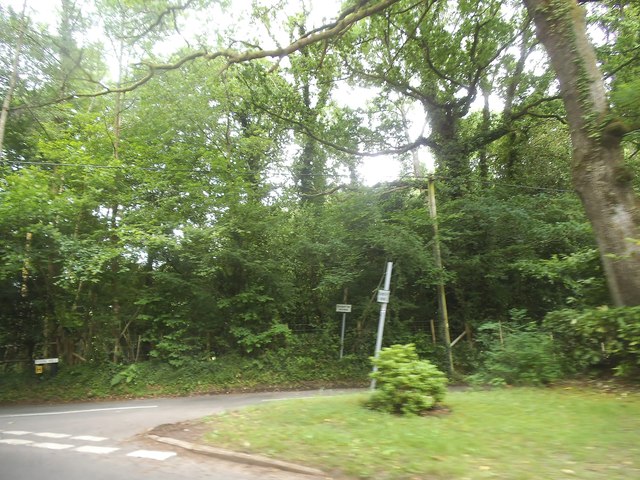
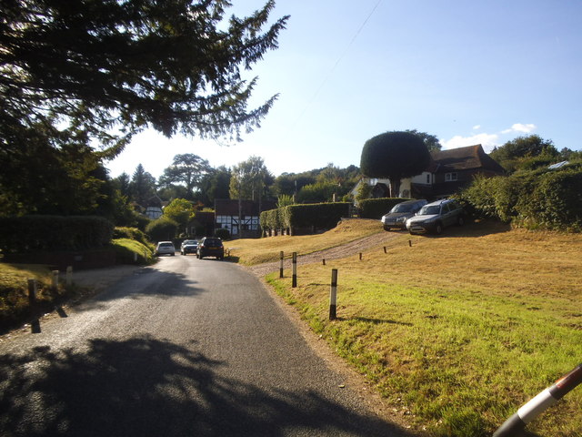
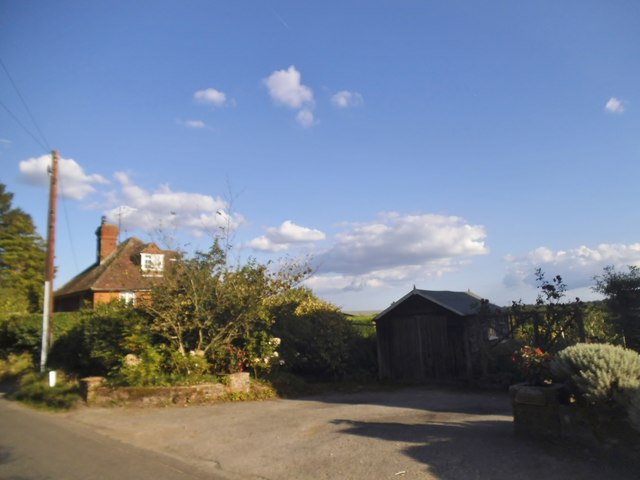
Godalming East Grove is a charming woodland area located in Surrey, England. Covering a vast expanse of approximately 200 acres, it is a popular destination for nature enthusiasts and those seeking tranquility amidst the beauty of the English countryside.

The grove is predominantly composed of dense woodland, characterized by towering trees that provide ample shade and create a serene atmosphere. The diverse range of tree species includes oak, beech, and birch, among others, lending an enchanting quality to the landscape. This rich biodiversity also supports a variety of wildlife, including deer, foxes, and a wide array of bird species.

Traversing through the grove, visitors can explore numerous well-maintained footpaths and trails, which allow for leisurely walks or more adventurous hikes. The paths wind their way through the woods, offering stunning views of the surrounding flora and fauna.

Within Godalming East Grove, there are also several picnic areas where visitors can relax and enjoy the peaceful surroundings. These areas are equipped with benches and tables, providing a perfect spot for families and friends to gather and enjoy a meal amidst the natural beauty.

The grove is well-preserved and carefully managed by local authorities to ensure the preservation of its natural habitat. It is also a designated Area of Outstanding Natural Beauty, further highlighting its importance and value.

Overall, Godalming East Grove is a splendid location for those seeking solace in nature. Its lush woodlands, picturesque trails, and abundant wildlife make it a true gem in the heart of Surrey.

If you have any feedback on the listing, please let us know in the comments section below.

Godalming East Grove Images

Images are sourced within 2km of 51.132723/-0.65074099 or Grid Reference SU9437. Thanks to Geograph Open Source API. All images are credited.

The Pirrie Hall
The Pirrie Hall
The Eagle Statue, Brook Lodge
Toll House, Chiddingfold What looks to be an ex-toll house. The brick fabric looks late for a toll house so may well have served the Petworth Turnpike Trust in its dying years. It would have replaced a Toll House SSE on the North side of the ford/bridge at Northbridge.

Milestone Society National ID: SY.CHI
Toll House, Chiddingfold
What looks to be an ex-toll house. The brick fabric looks late for a toll house so may well have served the Petworth Turnpike Trust in its dying years. It would have replaced a Toll House SSE on the North side of the ford/bridge at Northbridge. Milestone Society National ID: SY.CHI
Prestwick Lane at the junction of Combe Lane
Combe Lane, Combe Common
Prestwick Lane, Combe Common
Phillips of Wormley
Phillips of Wormley
Pook Hill at the junction of Prestwick Lane
House on Prestwick Lane, Combe Common
The White Hart, Witley
Brook Road at the junction of Petworth Road
House on Brook Road, Sandhills
Phone box on Brook Road, Sandhills
Brook Road, Sandhills
Houses on Park Lane, Brook
House on Park Lane, Brook
House on Brook Road
House on Brook Road
Show me another place!

Godalming East Grove is located at Grid Ref: SU9437 (Lat: 51.132723, Lng: -0.65074099)

Administrative County: Surrey

District: Waverley

Police Authority: Surrey

What 3 Words

///watches.centuries.promotion. Near Wormley, Surrey

Related Wikis

Witley railway station

Witley railway station is a station on the Portsmouth Direct Line in Surrey, England. It is 38 miles 36 chains (61.9 km) down the line from London Waterloo...

Wormley, Surrey

Wormley is a village in Surrey, England in the parish of Witley, around Witley station, off the A283 Petworth Road about 5 km (3.1 mi) SSW of Godalming...

King Edward's School, Witley

King Edward's Witley is a private co-educational boarding and day school, founded in 1553 by King Edward VI and Nicholas Ridley, Bishop of London and Westminster...
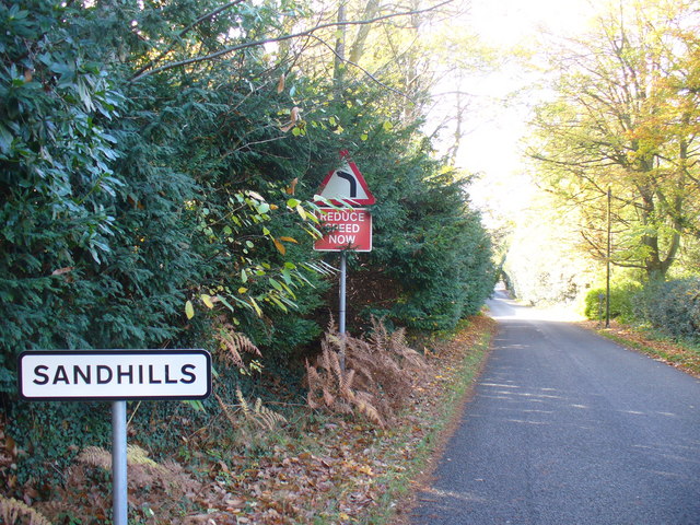
Sandhills, Surrey

Sandhills is a small hamlet located between the villages of Wormley and Brook in Surrey, UK. It is part of the Surrey Hills Area of Outstanding Beauty...

Tigbourne Court

Tigbourne Court is an Arts and Crafts style country house in Wormley, Surrey, England, 1 mile (1.6 km) south of Witley. It was designed by architect Edwin...

Brook Brick Pit

Brook Brick Pit is a 0.9-hectare (2.2-acre) geological Site of Special Scientific Interest west of Wormley Surrey. It is a Geological Conservation Review...

Brook, Surrey

Brook is a hamlet in the civil parish of Witley in the Waverley district in south-west Surrey. It is in the far west of Wormley, beyond Sandhills with...

St Dominic's School

St. Dominic's School in Hambledon, Surrey, England is a co-educational day school, one of the oldest special schools in the United Kingdom. It specialises...

Nearby Amenities

Located within 500m of 51.132723,-0.65074099
Source: Landsat
Lat/Long: 51.1292362/-0.6540546
Source: Landsat
Lat/Long: 51.1299736/-0.6519732
Source: Landsat
Lat/Long: 51.1309584/-0.6494573
Source: Landsat
Lat/Long: 51.1318802/-0.6477068
Witley
Public Transport: stop_position
Railway: stop
Train: yes
Lat/Long: 51.1330968/-0.6460162
Source: Landsat
Lat/Long: 51.1336512/-0.6453851
Wormley Hill
Natural: peak
Source: npe
Lat/Long: 51.1370395/-0.6521245
Bus Stop
Witley Railway Station
Naptan AtcoCode: 40004411159A
Naptan Bearing: N
Naptan CommonName: Witley Railway Station
Naptan Indicator: Just after
Naptan Landmark: Witley Station
Naptan NaptanCode: surdtwaj
Naptan Street: Combe Lane
Naptan Verified: no
Source: naptan_import
Lat/Long: 51.1328342/-0.6443184
Bus Stop
Witley Railway Station
Naptan AtcoCode: 40004411159B
Naptan Bearing: S
Naptan CommonName: Witley Railway Station
Naptan Indicator: Just Before
Naptan Landmark: Witley Station
Naptan NaptanCode: surdtwam
Naptan Street: Combe Lane
Naptan Verified: no
Source: naptan_import
Lat/Long: 51.1329677/-0.6442002
Post Box
Check Date Collection Times: 2022-03-20
Collection Plate: CP7
Collection Times: Mo-Fr 16:45; Sa 09:30
Operator: Royal Mail
Post Box Type: wall
Ref: GU8 33
Royal Cypher: EIIR
Royal Cypher Wikidata: Q33102113
Lat/Long: 51.1332149/-0.6456755
Wormley
Place: village
Source: os_street_view
Wikidata: Q8036878
Lat/Long: 51.1354099/-0.6467123
Witley
Public Transport: stop_position
Train: yes
Lat/Long: 51.1331033/-0.6459547
Post Box
Collection Times: Mo-Fr 16:00; Sa 09:15
Letters Only: yes
Post Box Type: wall
Ref: GU8 22
Royal Cypher: GVIR
Royal Cypher Wikidata: Q33102169
Lat/Long: 51.1351714/-0.6497869
Bench
Lat/Long: 51.1341199/-0.6557094
Witley
Naptan AtcoCode: 9100WITLEY
Network: National Rail
Network Website: https://www.nationalrail.co.uk/stations/wty/
Network Wikidata: Q26334
Operator: South West Trains
Railway: station
Ref Crs: WTY
Source: Landsat
Wikidata: Q1882728
Wikipedia: en:Witley railway station
Lat/Long: 51.1331013/-0.6459792
Bicycle Parking
Bicycle Parking: stands
Capacity: 16
Covered: yes
Lat/Long: 51.1332646/-0.6457345
Bicycle Parking
Bicycle Parking: rack
Capacity: 12
Covered: yes
Lat/Long: 51.1332724/-0.645606
The data included in this document is from www.openstreetmap.org. The data is made available under ODbL.

Have you been to Godalming East Grove?

Leave your review of Godalming East Grove below (or comments, questions and feedback).