Bellows Wood

Wood, Forest in Buckinghamshire

England

Bellows Wood

Scout Hut, Parish Hall and the Shop, The Lee Situated in Lee Clump Road HP16 9NB, these buildings are from left to right: Lee Common Scout Hut, the Shop at The Lee, and The Lee Parish Hall. A red post box can be seen by the Shop at The Lee.
Scout Hut, Parish Hall and the Shop, The Lee Credit: David Hillas

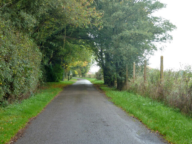
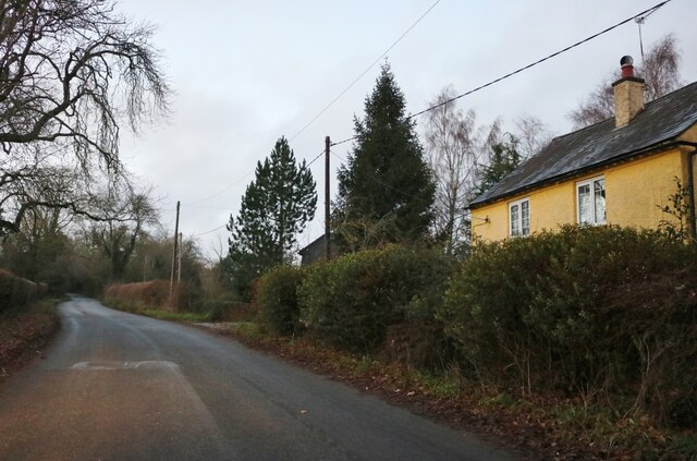
Bellows Wood is a picturesque woodland area located in Buckinghamshire, England. Covering an area of approximately 50 acres, it is known for its natural beauty and diverse range of flora and fauna. The wood is situated near the village of Bellows, which it takes its name from.

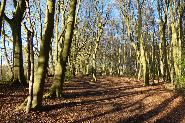
The wood is predominantly made up of deciduous trees, such as oak, beech, and ash, which provide a stunning display of colors throughout the seasons. In spring, the woodland floor is carpeted with bluebells, creating a breathtaking sight. The rich biodiversity of the area attracts a variety of bird species, including woodpeckers, owls, and thrushes, making it a popular spot for birdwatchers.

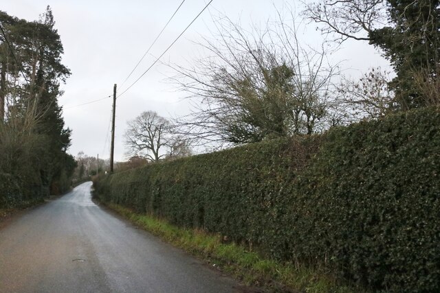
Bellows Wood offers a network of well-maintained walking trails, allowing visitors to explore its beauty at their own pace. These trails wind through the wood, passing by tranquil streams and small ponds, providing opportunities for peaceful reflection and relaxation. The sound of the rustling leaves and birdsong creates a serene atmosphere, making it a perfect place for nature enthusiasts and those seeking a break from the hustle and bustle of daily life.

The wood is also home to a range of wildlife, including deer, foxes, and rabbits. The diverse ecosystem supports a variety of insects and small mammals, making it a haven for nature lovers and photographers. The wood is managed by the local authorities to ensure the preservation of its natural habitat and to allow visitors to enjoy its beauty for years to come.

If you have any feedback on the listing, please let us know in the comments section below.
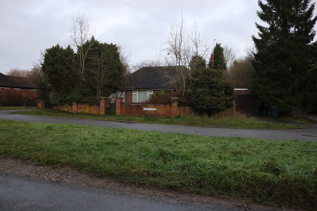
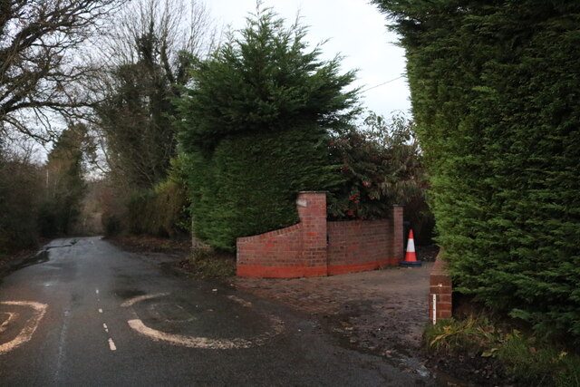
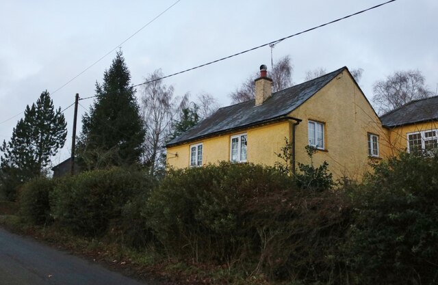
Bellows Wood Images

Images are sourced within 2km of 51.721638/-0.66830569 or Grid Reference SP9203. Thanks to Geograph Open Source API. All images are credited.

Scout Hut, Parish Hall and the Shop, The Lee Situated in Lee Clump Road HP16 9NB, these buildings are from left to right: Lee Common Scout Hut, the Shop at The Lee, and The Lee Parish Hall. A red post box can be seen by the Shop at The Lee.
Scout Hut, Parish Hall and the Shop, The Lee
Situated in Lee Clump Road HP16 9NB, these buildings are from left to right: Lee Common Scout Hut, the Shop at The Lee, and The Lee Parish Hall. A red post box can be seen by the Shop at The Lee.
Signpost in Lee Clump Road This photo shows the signpost pointing towards the Parish Hall and Shop at The Lee, <a title="https://www.geograph.org.uk/photo/6943422" href="https://www.geograph.org.uk/photo/6943422">Link</a> refers. A sign below the signpost indicates that the Shop is open.
Signpost in Lee Clump Road
This photo shows the signpost pointing towards the Parish Hall and Shop at The Lee, Link refers. A sign below the signpost indicates that the Shop is open.
Chartridge Lane Lowdne's Wood to the left.
Chartridge Lane
Lowdne's Wood to the left.
Paddocks south of Chartridge Lane
Field west of Chartridge Lane
Westdean Lane Climbing up from Pednor Bottom towards Chartridge.
Westdean Lane
Climbing up from Pednor Bottom towards Chartridge.
Pednor Bottom
Pednor Bottom
Hollow Way This lane is mapped with this name at least at its eastern end, but most of the way it runs along the top of a ridge, and nowhere is it a hollow way. It is used by National Cycle Route 27.
Hollow Way
This lane is mapped with this name at least at its eastern end, but most of the way it runs along the top of a ridge, and nowhere is it a hollow way. It is used by National Cycle Route 27.
Clouds above Three Gates Farm A day of ever-changing patterns of sunlight and shade as illustrated by this photo that shows a dramatic contrast between the two.
Clouds above Three Gates Farm
A day of ever-changing patterns of sunlight and shade as illustrated by this photo that shows a dramatic contrast between the two.
Warning sign - don’t feed the horses At one end of the dry valley of Ballinger Bottom.
Warning sign - don’t feed the horses
At one end of the dry valley of Ballinger Bottom.
Ballinger Bottom A dry valley in the Chilterns.
Ballinger Bottom
A dry valley in the Chilterns.
View towards Ballinger Bottom On part of the Chiltern Link route. The fence shown in the foreground has a path running alongside it, visible from here but not from the valley floor from where it is obscured by trees. Likewise, the valley bottom cannot be seen from here for the same reason.
View towards Ballinger Bottom
On part of the Chiltern Link route. The fence shown in the foreground has a path running alongside it, visible from here but not from the valley floor from where it is obscured by trees. Likewise, the valley bottom cannot be seen from here for the same reason.
King's Lane, South Heath
Potter Row, South Heath
Bud Cottage on Potter Row, South Heath An earlier visit <a title="https://www.geograph.org.uk/photo/5738161" href="https://www.geograph.org.uk/photo/5738161">Link</a>
Bud Cottage on Potter Row, South Heath
An earlier visit Link
Potter Row, South Heath
Woodland, Great Missenden Beeches in a publicly accessible wood to the east of South Heath.
Woodland, Great Missenden
Beeches in a publicly accessible wood to the east of South Heath.
Show me another place!

Bellows Wood is located at Grid Ref: SP9203 (Lat: 51.721638, Lng: -0.66830569)

Unitary Authority: Buckinghamshire

Police Authority: Thames Valley

What 3 Words

///diver.ivory.dynamics. Near Great Missenden, Buckinghamshire

Related Wikis

Pednor House

Pednor House (formerly known as Little Pednor) is a house near Chartridge parish of Buckinghamshire. It has been listed Grade II on the National Heritage...

Ballinger, Buckinghamshire

Ballinger is a hamlet and common in the parish of Great Missenden (where at the 2011 Census the population was included), in Buckinghamshire, England....

Chartridge

Chartridge is a village in Buckinghamshire, England situated 2 miles North West of Chesham. Chartridge is also the name of a civil parish in Chiltern...

Pednor

Pednor is a hamlet in the parish of Chartridge, in Buckinghamshire, England. It is located in the Chiltern Hills two miles northwest of Chesham and seven...

The Lee

The Lee (formally known as just Lee) is a village in Buckinghamshire, England. It is located in the Chiltern Hills, about 2 mi north east of Great Missenden...

Hundridge

Hundridge is a hamlet in the parish of Chartridge, in Buckinghamshire, England. It is located in the Chiltern Hills to the west of the town of Chesham...

Asheridge

Asheridge (recorded Esserugge in the 13th century) is a small hamlet in the parish of Chartridge, in Buckinghamshire, England. Prior to 1898 it was part...

Hyde End

Hyde End is a small hamlet, in the civil parish of Great Missenden. it is located between the hamlets of Hyde Heath and South Heath along the B485 road...
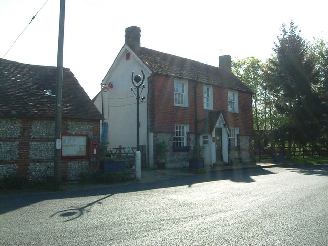
Nearby Amenities

Located within 500m of 51.721638,-0.66830569
Great Pednor Farm
Landuse: farm
Note Retag: CS #48756035
Source: OS 1:25k
Lat/Long: 51.7192959/-0.6660748
Power: pole
Lat/Long: 51.7256247/-0.6661336
Power: pole
Lat/Long: 51.7254459/-0.6674484
Power: pole
Lat/Long: 51.7252754/-0.6686285
Power: pole
Lat/Long: 51.7251133/-0.6699186
Power: pole
Lat/Long: 51.7248764/-0.6715151
Power: pole
Lat/Long: 51.7246491/-0.6730959
Power: pole
Lat/Long: 51.7257632/-0.6662034
Power: pole
Lat/Long: 51.7255685/-0.6675336
Power: pole
Lat/Long: 51.7254206/-0.6687286
Power: pole
Lat/Long: 51.7252497/-0.6700496
Power: pole
Lat/Long: 51.7250519/-0.6716461
Power: pole
Lat/Long: 51.7248767/-0.6731022
Power: pole
Lat/Long: 51.7197042/-0.6658154
Power: pole
Lat/Long: 51.7196709/-0.6649625
Power: pole
Lat/Long: 51.719641/-0.6642463
Power: pole
Lat/Long: 51.7196111/-0.6634551
Power: pole
Lat/Long: 51.7195729/-0.6626558
Power: pole
Lat/Long: 51.7195463/-0.6619718
Power: pole
Lat/Long: 51.7225754/-0.6622347
Power: pole
Lat/Long: 51.7226701/-0.6633854
Power: pole
Lat/Long: 51.7227765/-0.664705
Power: pole
Lat/Long: 51.7229576/-0.6673524
Power: pole
Lat/Long: 51.723044/-0.6685889
Power: pole
Lat/Long: 51.7231254/-0.6698817
Power: pole
Lat/Long: 51.7232168/-0.6712255
Power: pole
Lat/Long: 51.7233065/-0.6726417
Power: pole
Lat/Long: 51.7233763/-0.6739399
Barrier: stile
Lat/Long: 51.7174346/-0.6669083
The data included in this document is from www.openstreetmap.org. The data is made available under ODbL.

Have you been to Bellows Wood?

Leave your review of Bellows Wood below (or comments, questions and feedback).