Ashperton

Settlement in Herefordshire

England

Ashperton

Oast House at Merryvale Farm, Trumpet Two square kiln oast house.
Oast House at Merryvale Farm, Trumpet Credit: Oast House Archive

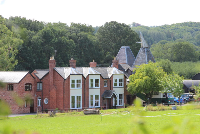
Ashperton is a quaint village located in the county of Herefordshire, England. Situated approximately 14 miles northeast of Hereford, the village is nestled amidst the picturesque countryside of the West Midlands region. With a population of around 500 residents, Ashperton offers a peaceful and idyllic setting for those seeking a rural retreat.

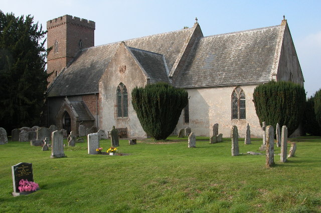
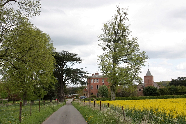
The village is characterized by its charming historic buildings, most notably the St. Bartholomew's Church, a beautiful Grade II listed building dating back to the 12th century. The church features stunning stained glass windows and intricate architectural details, making it a popular attraction for history enthusiasts and visitors alike.

Ashperton boasts a strong sense of community, with various local amenities catering to the needs of its residents. These include a village hall, a primary school, and a traditional pub, providing a gathering place for locals and a warm welcome to visitors.

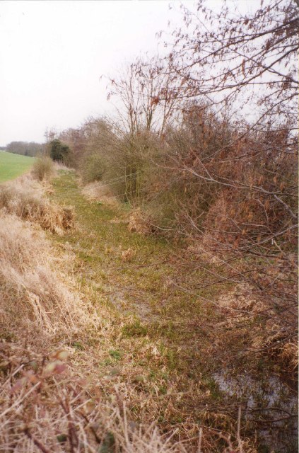
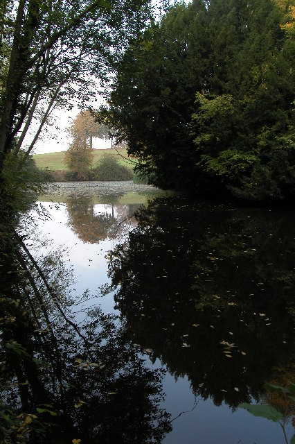
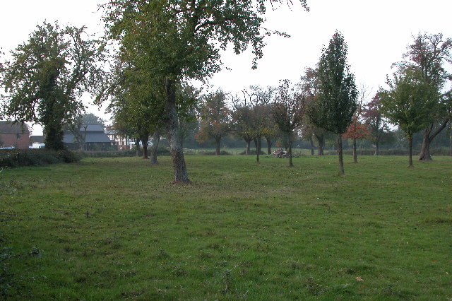
Surrounded by rolling hills and lush farmland, the village offers ample opportunities for outdoor activities and exploration. The surrounding countryside is renowned for its scenic beauty and is ideal for walking, cycling, and horse riding. Additionally, the nearby River Frome provides opportunities for fishing and boating.

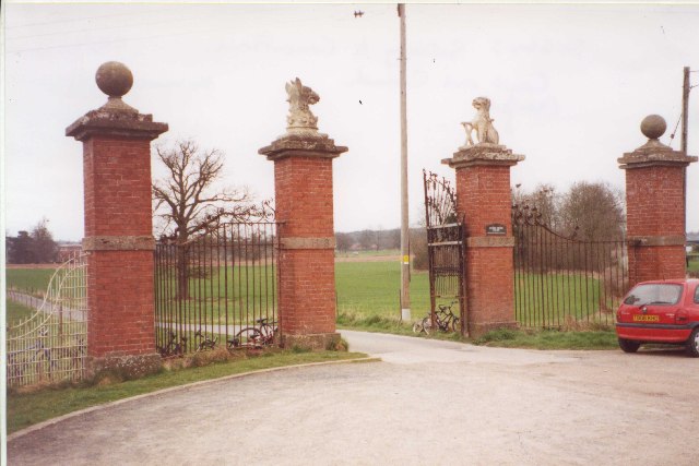
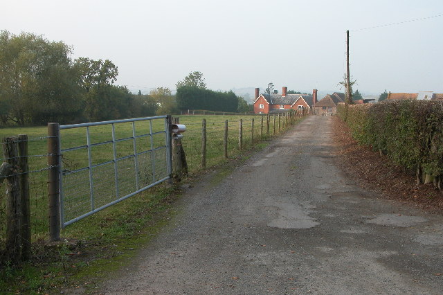
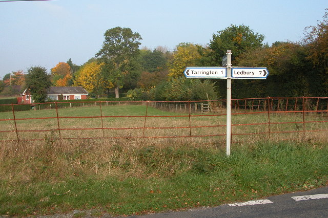
Despite its tranquil setting, Ashperton benefits from its proximity to larger towns such as Hereford and Ledbury, which offer a wider range of amenities and services. The village is also well-connected by road, with the A438 providing easy access to surrounding areas.

Overall, Ashperton is a charming and serene village, offering a quintessential English countryside experience with its historic buildings, natural beauty, and strong community spirit.

If you have any feedback on the listing, please let us know in the comments section below.
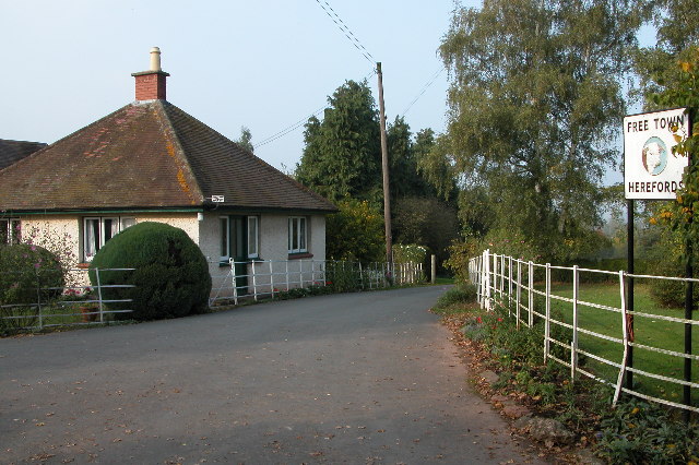
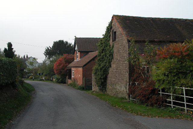
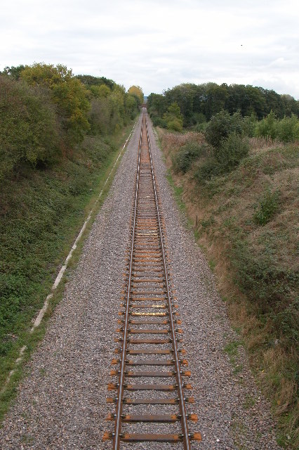
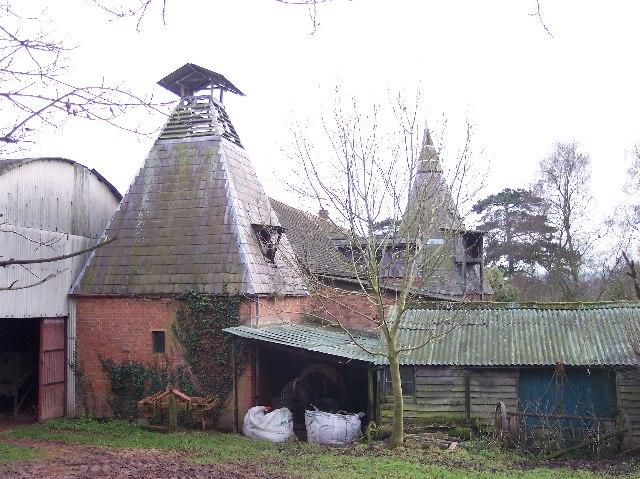
Ashperton Images

Images are sourced within 2km of 52.07234/-2.5212579 or Grid Reference SO6441. Thanks to Geograph Open Source API. All images are credited.

Oast House at Merryvale Farm, Trumpet Two square kiln oast house.
Oast House at Merryvale Farm, Trumpet
Two square kiln oast house.
Gateway to Canon Frome Court This grand entrance leads to the church as well as the Georgian mansion, which has served as a County Secondary School but is now flats.  Note that the car park for the church is a narrow right turn just before the gates leading into the curtilage of the house, beyond which tourists are not welcome!
Gateway to Canon Frome Court
This grand entrance leads to the church as well as the Georgian mansion, which has served as a County Secondary School but is now flats. Note that the car park for the church is a narrow right turn just before the gates leading into the curtilage of the house, beyond which tourists are not welcome!
Disused Canal, Canon Frome This was taken looking SE from the road bridge.
Disused Canal, Canon Frome
This was taken looking SE from the road bridge.
Farm Buildings near Upleadon Court
Bridge over the Hereford and Gloucester Canal This bridge crosses the old Hereford and Gloucester canal near Moorend Farm, between Ashperton and Staplow. This canal was never commercially viable and was abandoned when the railway replaced this earlier form of transport.
Bridge over the Hereford and Gloucester Canal
This bridge crosses the old Hereford and Gloucester canal near Moorend Farm, between Ashperton and Staplow. This canal was never commercially viable and was abandoned when the railway replaced this earlier form of transport.
Ashperton Church Ashperton church is dedicated to St Bartholomew.
Ashperton Church
Ashperton church is dedicated to St Bartholomew.
Moat at Ashperton Site of Ashperton Castle and moat, the motte (on the right) is now completely overgrown with trees. A licence was granted to William de Grandison to crenelate in 1292.
Moat at Ashperton
Site of Ashperton Castle and moat, the motte (on the right) is now completely overgrown with trees. A licence was granted to William de Grandison to crenelate in 1292.
Lower Town, near Ashperton Driveway to farm at Lower Town, near Ashperton.
Lower Town, near Ashperton
Driveway to farm at Lower Town, near Ashperton.
Orchard at Wood End near Ashperton
Road junction near Tarrington Road junction on quiet country lanes between Tarrington and Ashperton.
Road junction near Tarrington
Road junction on quiet country lanes between Tarrington and Ashperton.
Free Town Herefords Entrance to a farm at Free Town in Little Tarrington. Home of one of the very top Hereford cattle breeders.
<span class="nowrap"><a title="http://www.free-town.co.uk/beef/info.html" rel="nofollow ugc noopener" href="http://www.free-town.co.uk/beef/info.html">Link</a><img style="margin-left:2px;" alt="External link" title="External link - shift click to open in new window" src="https://s1.geograph.org.uk/img/external.png" width="10" height="10"/></span>
<span class="nowrap"><a title="http://www.herefordtimes.com/news/features/farming/3598934.Two_famous_herds_triumph_at_National_Hereford_Show/" rel="nofollow ugc noopener" href="http://www.herefordtimes.com/news/features/farming/3598934.Two_famous_herds_triumph_at_National_Hereford_Show/">Link</a><img style="margin-left:2px;" alt="External link" title="External link - shift click to open in new window" src="https://s1.geograph.org.uk/img/external.png" width="10" height="10"/></span>
Free Town Herefords
Entrance to a farm at Free Town in Little Tarrington. Home of one of the very top Hereford cattle breeders. LinkExternal link LinkExternal link
Little Tarrington Road through the small village of Little Tarrington.
Little Tarrington
Road through the small village of Little Tarrington.
The Hereford to Worcester railway This is a view eastwards towards Ledbury from the road bridge near the Trumpet.
The Hereford to Worcester railway
This is a view eastwards towards Ledbury from the road bridge near the Trumpet.
Munsley Church Munsley is dedicated to St Bartholomew and is located in a small village about five miles west of Ledbury. The church is described as early Norman, however, it was restored by the Victorians in 1863.
Munsley Church
Munsley is dedicated to St Bartholomew and is located in a small village about five miles west of Ledbury. The church is described as early Norman, however, it was restored by the Victorians in 1863.
Lower Court, Munsley Lower Court viewed from Munsley church.
Lower Court, Munsley
Lower Court viewed from Munsley church.
Rear entrance to Canon Frome Court
Moat at Freetown Farm Now an ornamental feature, but when built would have provided some security as well as providing the farmstead with high status. Recognized as a historic site on the Herefordshire County's Sites and Monuments Record.
Moat at Freetown Farm
Now an ornamental feature, but when built would have provided some security as well as providing the farmstead with high status. Recognized as a historic site on the Herefordshire County's Sites and Monuments Record.
Two Styles of Oast Houses, Freetown I think the round oast house is earlier, but the square one must be simpler to construct.
Two Styles of Oast Houses, Freetown
I think the round oast house is earlier, but the square one must be simpler to construct.
Show me another place!

Ashperton is located at Grid Ref: SO6441 (Lat: 52.07234, Lng: -2.5212579)

Unitary Authority: County of Herefordshire

Police Authority: West Mercia

What 3 Words

///necklaces.engrossed.addicted. Near Ocle Pychard, Herefordshire

Related Wikis

Ashperton

Ashperton is a small village, parish and former manor about twelve miles east of the City of Hereford, in Herefordshire, England. The village is on the...

Ashperton railway station

Ashperton railway station was a railway station serving the village of Ashperton in Herefordshire, England. It was located on what is now known as the...

Canon Frome

Canon Frome is a hamlet and small rural parish on the River Frome, 5 miles northwest of Ledbury, Herefordshire, England with a population of 139. Its most...

Munsley

Munsley is a village and civil parish 9 miles (14 km) east of Hereford, in the county of Herefordshire, England. In 2001 the parish had a population of...

Stretton Grandison

Stretton Grandison is a hamlet and small civil parish in Herefordshire, England. The population of the civil parish at the 2011 census was 175.It is on...

Upleadon Preceptory

Upleadon Preceptory was a priory in Herefordshire, England at grid reference SO66504270. == References ==

Trumpet, Herefordshire

Trumpet or The Trumpet is a village in Herefordshire, England. The village is named after the timber-framed Trumpet Inn. The inn is located at a major...

Alder's End

Alder's End is a small village in Herefordshire, England. It is about 8 miles (13 km) east of Hereford and is near the A438 road. The village falls within...

Nearby Amenities

Located within 500m of 52.07234,-2.5212579
Ashperton
Place: village
Source: NPE
Wikidata: Q1838521
Lat/Long: 52.0717532/-2.5209943
Bus Stop
Telephone Box
Naptan AtcoCode: 2090A130700
Naptan Bearing: N
Naptan BusStopType: CUS
Naptan CommonName: Telephone Box
Naptan Indicator: adj
Naptan Landmark: Telephone Box- Church Lane
Naptan NaptanCode: heragadg
Naptan Street: A417
Naptan Verified: no
Source: naptan_import
Lat/Long: 52.0727216/-2.5206238
Bus Stop
Telephone Box
Naptan AtcoCode: 2090A18747
Naptan Bearing: SE
Naptan BusStopType: CUS
Naptan CommonName: Telephone Box
Naptan Indicator: opp
Naptan Landmark: Telephone Box- Church Lane
Naptan NaptanCode: herajdaw
Naptan Street: A417
Naptan Verified: no
Source: naptan_import
Lat/Long: 52.0727903/-2.5205373
Historic: memorial
Lat/Long: 52.073761/-2.521054
Telephone
Booth: K6
Covered: booth
Mapillary: 888756728488172
Survey Date: 2021-07-17
Lat/Long: 52.0726795/-2.5206406
Fixme: incomplete
Lat/Long: 52.071832/-2.519887
Generator Method: photovoltaic
Generator Output Electricity: yes
Generator Source: solar
Generator Type: solar_photovoltaic_panel
Location: roof
Power: generator
Lat/Long: 52.0703053/-2.5188893
Generator Method: photovoltaic
Generator Output Electricity: yes
Generator Source: solar
Generator Type: solar_photovoltaic_panel
Location: roof
Power: generator
Lat/Long: 52.0704125/-2.521829
Generator Method: photovoltaic
Generator Output Electricity: yes
Generator Source: solar
Generator Type: solar_photovoltaic_panel
Location: roof
Power: generator
Lat/Long: 52.0714627/-2.5194848
Ashperton School
Power: pole
Source: bing
Transformer: distribution
Voltage Primary: 11000
Lat/Long: 52.0715345/-2.5191032
Power: pole
Source: bing
Lat/Long: 52.0720338/-2.5184602
Power: pole
Source: bing
Lat/Long: 52.0725459/-2.5177567
Power: pole
Source: bing
Lat/Long: 52.0729878/-2.5166886
Power: pole
Source: bing
Lat/Long: 52.0734329/-2.515554
Power: pole
Source: bing
Lat/Long: 52.0745795/-2.515094
Power: pole
Source: bing
Lat/Long: 52.0741583/-2.5159751
Power: pole
Source: bing
Lat/Long: 52.07499/-2.5164673
Power: pole
Source: bing
Lat/Long: 52.0755019/-2.5167677
Power: pole
Source: bing
Lat/Long: 52.0759791/-2.5175147
Power: pole
Source: bing
Lat/Long: 52.0758588/-2.5255882
Power: pole
Source: bing
Lat/Long: 52.0759577/-2.5249283
Power: pole
Source: bing
Lat/Long: 52.0763204/-2.5244509
Generator Method: photovoltaic
Generator Output Electricity: yes
Generator Source: solar
Generator Type: solar_photovoltaic_panel
Location: roof
Power: generator
Lat/Long: 52.0760739/-2.5240445
Generator Method: photovoltaic
Generator Output Electricity: yes
Generator Source: solar
Generator Type: solar_photovoltaic_panel
Location: roof
Power: generator
Lat/Long: 52.0761118/-2.5239855
Generator Method: photovoltaic
Generator Output Electricity: yes
Generator Source: solar
Generator Type: solar_photovoltaic_panel
Location: roof
Power: generator
Lat/Long: 52.073395/-2.5215822
Generator Method: photovoltaic
Generator Output Electricity: yes
Generator Source: solar
Generator Type: solar_photovoltaic_panel
Location: roof
Power: generator
Lat/Long: 52.0734411/-2.5215045
Generator Method: photovoltaic
Generator Output Electricity: yes
Generator Source: solar
Generator Type: solar_photovoltaic_panel
Location: roof
Power: generator
Lat/Long: 52.0734345/-2.5215581
Generator Method: photovoltaic
Generator Output Electricity: yes
Generator Source: solar
Generator Type: solar_photovoltaic_panel
Location: roof
Power: generator
Lat/Long: 52.0733999/-2.5215098
Ashperton
Location Transition: yes
Power: pole
Transformer: distribution
Voltage Primary: 11000
Lat/Long: 52.0730603/-2.5209734
Power: pole
Lat/Long: 52.0734139/-2.5202921
Power: pole
Lat/Long: 52.0730347/-2.5186479
Power: pole
Lat/Long: 52.0711499/-2.5219309
Power: pole
Lat/Long: 52.0713214/-2.5214582
Ashperton Church
Power: pole
Transformer: distribution
Voltage Primary: 11000
Lat/Long: 52.0709764/-2.5224124
Power: pole
Lat/Long: 52.0715242/-2.5209057
Power: pole
Lat/Long: 52.0714825/-2.5200588
Power: pole
Lat/Long: 52.0716643/-2.51935
Power: pole
Lat/Long: 52.0726617/-2.5150651
Jays Cottages
Power: pole
Transformer: distribution
Voltage Primary: 11000
Lat/Long: 52.0719837/-2.5146702
Defibrillator
Defibrillator Location: On wall by door
Emergency: defibrillator
Indoor: no
Lat/Long: 52.0739228/-2.5211364
The data included in this document is from www.openstreetmap.org. The data is made available under ODbL.

Have you been to Ashperton?

Leave your review of Ashperton below (or comments, questions and feedback).