Ashmore Park

Settlement in Staffordshire

England

Ashmore Park

Council Housing - Castlebridge Estate Wednesfield UDC developed the Castlebridge Estate in the early 1950s with a cluster of four storey blocks beside the Wyley & Essington Canal.
Council Housing - Castlebridge Estate Credit: John M

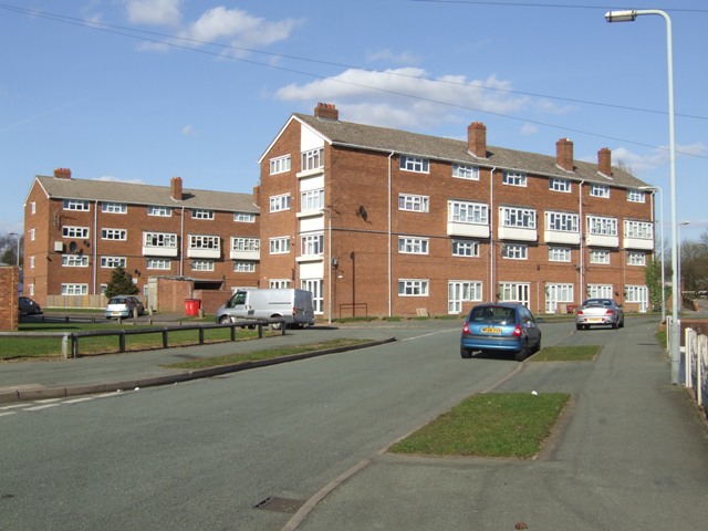
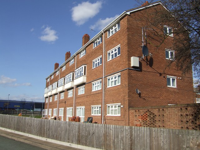
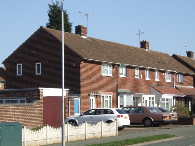
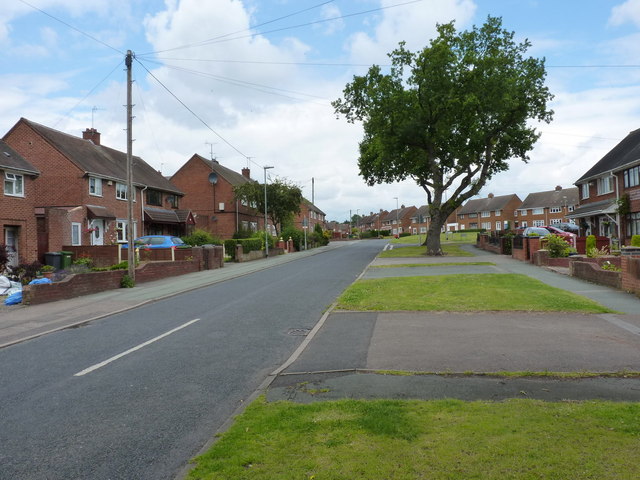
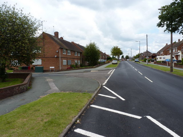
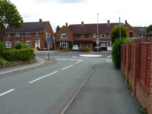
Ashmore Park is a small residential area located in the county of Staffordshire, England. Situated in the city of Wolverhampton, it is part of the district of Wednesfield. The area is predominantly residential, with a mix of housing types including council houses, private homes, and some apartment complexes.

Developed in the 1950s as a post-war housing estate, Ashmore Park was designed to accommodate the growing population and address the housing shortage at the time. The estate was named after a nearby area of land known as Ashmore Farm. Today, it is a well-established community with a population of around 5,000 residents.

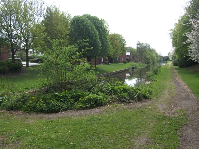
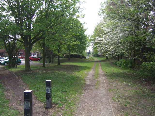
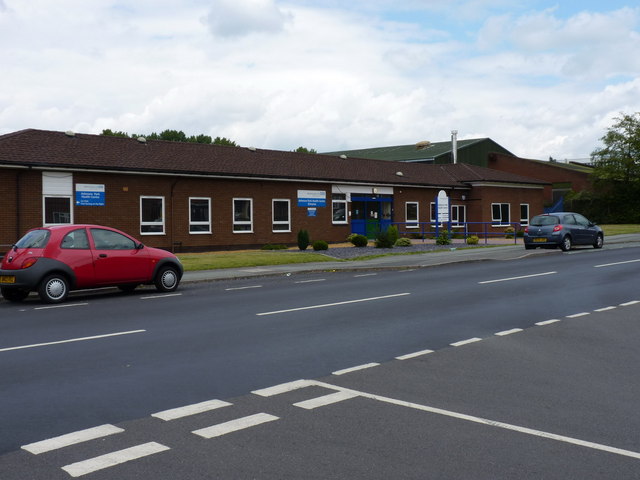
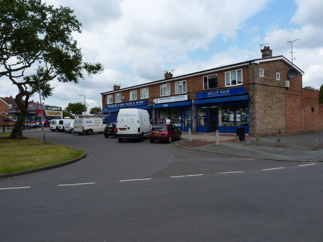
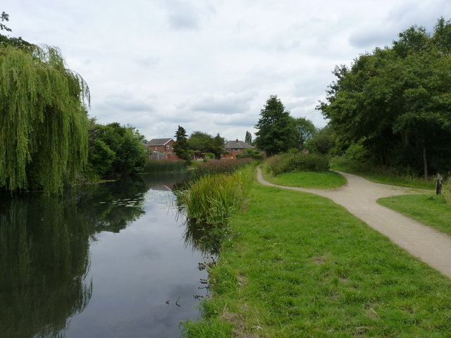
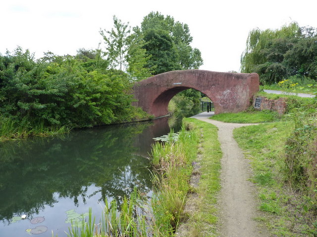
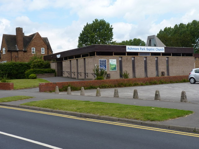
Ashmore Park benefits from its close proximity to a range of amenities. The area has its own shopping center, which includes a supermarket, a post office, and various local businesses. There are also several schools in the vicinity, making it an ideal location for families. The park itself, after which the area is named, provides green spaces for recreation and leisure activities.

Transport links in Ashmore Park are convenient, with regular bus services connecting the area to neighboring towns and cities. The nearby Wolverhampton city center is easily accessible, offering a wider range of amenities and entertainment options.

In summary, Ashmore Park is a well-established residential area in Staffordshire, offering a range of amenities and convenient transport links. With its strong community spirit and proximity to essential services, it provides a comfortable living environment for its residents.

If you have any feedback on the listing, please let us know in the comments section below.

Ashmore Park Images

Images are sourced within 2km of 52.61663/-2.059196 or Grid Reference SJ9602. Thanks to Geograph Open Source API. All images are credited.

Council Housing - Castlebridge Estate Wednesfield UDC developed the Castlebridge Estate in the early 1950s with a cluster of four storey blocks beside the Wyley & Essington Canal.
Council Housing - Castlebridge Estate
Wednesfield UDC developed the Castlebridge Estate in the early 1950s with a cluster of four storey blocks beside the Wyley & Essington Canal.
Council Housing - Castlebridge Estate Wednesfield UDC developed the Castlebridge Estate in the early 1950s. This block comprises sixteen flats.
Council Housing - Castlebridge Estate
Wednesfield UDC developed the Castlebridge Estate in the early 1950s. This block comprises sixteen flats.
Council Housing - Merrick Road Post war housing built for Wednesfield UDC on the early 1950s Castlebridge Estate.
Council Housing - Merrick Road
Post war housing built for Wednesfield UDC on the early 1950s Castlebridge Estate.
Short Heath Basin Built in 1906 by the Hollybank Colliery as a colliery wharf and landsale. A mineral railway was constructed directly from the pit in Essington to eliminate the locks on the Wyrley Branch of the Curly Wyrley. The facility remained in use until the closure of the Hilton Main Colliery in the late 1960s.

A landsale was a site where coal was stockpiled to meet seasonal demand with local sale to coal merchants.
Short Heath Basin
Built in 1906 by the Hollybank Colliery as a colliery wharf and landsale. A mineral railway was constructed directly from the pit in Essington to eliminate the locks on the Wyrley Branch of the Curly Wyrley. The facility remained in use until the closure of the Hilton Main Colliery in the late 1960s. A landsale was a site where coal was stockpiled to meet seasonal demand with local sale to coal merchants.
Short Heath Landsale Following the former colliery railway to the landsale and basin at Short Heath.

A landsale was a site where coal was stockpiled to meet seasonal demand with local sale to coal merchants.
Short Heath Landsale
Following the former colliery railway to the landsale and basin at Short Heath. A landsale was a site where coal was stockpiled to meet seasonal demand with local sale to coal merchants.
Ashmore Park Health Centre
The Corpus Christi Catholic Church, Ashmore Park Located at the southern end of Ashmore Avenue, at the junction with Griffiths Drive
The Corpus Christi Catholic Church, Ashmore Park
Located at the southern end of Ashmore Avenue, at the junction with Griffiths Drive
Ashmore Avenue One of the major roads through the Ashmore Park estate
Ashmore Avenue
One of the major roads through the Ashmore Park estate
Parade of shops - Higgs Road A small shopping development within the Ashmore Park estate.
Parade of shops - Higgs Road
A small shopping development within the Ashmore Park estate.
Griffiths Drive and Acorn Road, Ashmore Park area
Thornley Road joins Griffiths Drive, Ashmore Park
Moathouse Lane bridge over the Essington and Wyrley canal No longer a drivable road; the bridge now carries a cycleway and footpath.
Moathouse Lane bridge over the Essington and Wyrley canal
No longer a drivable road; the bridge now carries a cycleway and footpath.
The Essington and Wyrley canal near Wood End
Devil's Elbow bridge Presumably it takes its name from the sharp (for a canal) bend just this side of the bridge.
Devil's Elbow bridge
Presumably it takes its name from the sharp (for a canal) bend just this side of the bridge.
The church of Jesus Christ of the Latter Day Saints, Linthouse Lane
St Alban's C of E Church, Griffiths Drive, Ashmore Park
Baptist Church, Griffiths Drive, Ashmore Park
Junction of Griffiths Drive and Barnard Road, Ashmore Park
Show me another place!

Ashmore Park is located at Grid Ref: SJ9602 (Lat: 52.61663, Lng: -2.059196)

Unitary Authority: Wolverhampton

Police Authority: West Midlands

What 3 Words

///alert.solve.grace. Near Essington, Staffordshire

Nearby Locations

Ashmore Park

Related Wikis

Wednesfield North (ward)

Wednesfield North is a ward of Wolverhampton City Council, West Midlands. As the name suggests, it covers the northern parts of the town of Wednesfield...

Coppice Performing Arts School

Coppice Performing Arts School is an 11–18 mixed secondary school and sixth form with academy status in Wednesfield, Wolverhampton, West Midlands, England...

Essington

Essington is a village and civil parish in South Staffordshire, England, located near the city of Wolverhampton and towns of Walsall, Bloxwich, Cannock...

New Invention, Willenhall

New Invention is a large estate around three miles (4.8 km) north of the town of Willenhall and four miles (6.4 km) east of the city of Wolverhampton in...

Nearby Amenities

Located within 500m of 52.61663,-2.059196
Bus Stop
Griffiths Dr / Peacock Ave
NaPTANAreaCode: 43000778301
Bus: yes
Naptan AtcoCode: 43000778301
Naptan Bearing: SW
Naptan BusStopType: MKD
Naptan CommonName: Peacock Ave
Naptan Indicator: adj
Naptan NaptanCode: nwmjpgaj
Naptan PlusbusZoneRef: BHAMNWS
Naptan Status: ACT
Naptan StopType: BCT
Naptan Street: GRIFFITHS DR
Naptan Towards: Ashmore Park
Naptan Verified: no
Public Transport: platform
Route Ref: 59
Shelter: yes
Shelter Ref: 102125
Source: WMCA
Lat/Long: 52.613398/-2.0599631
Bus Stop
Griffiths Dr / Peacock Ave
NaPTANAreaCode: 43000778302
Bus: yes
Naptan AtcoCode: 43000778302
Naptan Bearing: SW
Naptan BusStopType: MKD
Naptan CommonName: Peacock Ave
Naptan Indicator: adj
Naptan NaptanCode: nwmjpgam
Naptan PlusbusZoneRef: BHAMNWS
Naptan Status: ACT
Naptan StopType: BCT
Naptan Street: GRIFFITHS DR
Naptan Towards: Wolverhampton
Naptan Verified: no
Public Transport: platform
Route Ref: 28E;57;69
Shelter: yes
Shelter Ref: 102112
Source: WMCA
Lat/Long: 52.613371/-2.0601107
Bus Stop
Griffiths Dr / Peacock Ave
NaPTANAreaCode: 43000778304
Bus: yes
Naptan AtcoCode: 43000778304
Naptan Bearing: NE
Naptan BusStopType: MKD
Naptan CommonName: Peacock Ave
Naptan Indicator: opp
Naptan NaptanCode: nwmjpgap
Naptan PlusbusZoneRef: BHAMNWS
Naptan Status: ACT
Naptan StopType: BCT
Naptan Street: GRIFFITHS DR
Naptan Towards: New Invention
Naptan Verified: no
Public Transport: platform
Route Ref: 28E;57;69
Shelter: yes
Shelter Ref: 102129
Source: WMCA
Lat/Long: 52.6134399/-2.0602493
Bus Stop
Griffiths Dr / Clare Avenue
NaPTANAreaCode: 43000778501
Bus: yes
Naptan AtcoCode: 43000778501
Naptan Bearing: N
Naptan BusStopType: MKD
Naptan CommonName: Clare Avenue
Naptan Indicator: opp
Naptan NaptanCode: nwmjpgaw
Naptan PlusbusZoneRef: BHAMNWS
Naptan Status: ACT
Naptan StopType: BCT
Naptan Street: GRIFFITHS DR
Naptan Towards: Wolverhampton
Naptan Verified: no
Public Transport: platform
Route Ref: 59
Shelter: yes
Shelter Ref: 102115
Source: WMCA
Lat/Long: 52.6166862/-2.0626142
Bus Stop
Griffiths Dr / Barnard Rd
Bus: yes
Naptan AtcoCode: 43000778601
Naptan Bearing: NE
Naptan BusStopType: MKD
Naptan CommonName: Barnard Rd
Naptan Indicator: opp
Naptan NaptanCode: nwmjpgda
Naptan PlusbusZoneRef: BHAMNWS
Naptan Status: ACT
Naptan StopType: BCT
Naptan Street: GRIFFITHS DR
Naptan Towards: Wolverhampton
Naptan Verified: no
Public Transport: platform
Route Ref: 59
Source: WMCA
Lat/Long: 52.6193665/-2.061729
Bus Stop
Griffiths Dr / Ferguson St
NaPTANAreaCode: 43000778701
Bus: yes
Naptan AtcoCode: 43000778701
Naptan Bearing: E
Naptan BusStopType: MKD
Naptan CommonName: Ferguson St
Naptan Indicator: opp
Naptan NaptanCode: nwmjpgdg
Naptan PlusbusZoneRef: BHAMNWS
Naptan Status: ACT
Naptan StopType: BCT
Naptan Street: GRIFFITHS DR
Naptan Towards: Wolverhampton
Naptan Verified: no
Public Transport: platform
Route Ref: 59
Shelter: yes
Shelter Ref: 102127
Source: WMCA
Lat/Long: 52.6199613/-2.0584573
Bus Stop
Griffiths Dr / Higgs Rd
NaPTANAreaCode: 43000778802
Bus: yes
Naptan AtcoCode: 43000778802
Naptan Bearing: SE
Naptan BusStopType: MKD
Naptan CommonName: Higgs Rd
Naptan Indicator: adj
Naptan NaptanCode: nwmjpgdm
Naptan PlusbusZoneRef: BHAMNWS
Naptan Status: ACT
Naptan StopType: BCT
Naptan Street: GRIFFITHS DR
Naptan Towards: Wolverhampton
Naptan Verified: no
Public Transport: platform
Route Ref: 59
Shelter: yes
Shelter Ref: 102114
Source: WMCA
Lat/Long: 52.6190191/-2.0550667
Bus Stop
Griffiths Dr / Ecclestone Rd
NaPTANAreaCode: 43000778901
Naptan AtcoCode: 43000778901
Naptan Bearing: S
Naptan BusStopType: MKD
Naptan CommonName: Ecclestone Rd
Naptan Indicator: after
Naptan NaptanCode: nwmjpgdp
Naptan PlusbusZoneRef: BHAMNWS
Naptan Status: ACT
Naptan StopType: BCT
Naptan Street: GRIFFITHS DR
Naptan Towards: Wolverhampton
Naptan Verified: no
Public Transport: platform
Route Ref: 59
Shelter: yes
Shelter Ref: 102113
Source: WMCA
Lat/Long: 52.6149021/-2.0541606
Bus Stop
Griffiths Dr / Peacock Avenue
NaPTANAreaCode: 43007780003
Bus: yes
Naptan AtcoCode: 43007780003
Naptan Bearing: SW
Naptan BusStopType: MKD
Naptan CommonName: Peacock Avenue
Naptan Indicator: adj
Naptan NaptanCode: nwmpmjdm
Naptan PlusbusZoneRef: BHAMNWS
Naptan Status: ACT
Naptan StopType: BCT
Naptan Street: GRIFFITHS DR
Naptan Towards: Wolverhampton
Naptan Verified: no
Public Transport: platform
Route Ref: 59
Shelter: yes
Shelter Ref: 102111
Source: WMCA
Lat/Long: 52.6135878/-2.0590633
Parking
Lat/Long: 52.6191021/-2.0548662
Hairdresser
Shop: convenience
Lat/Long: 52.6192194/-2.0546623
Newsagent
Shop: convenience
Lat/Long: 52.6192007/-2.0548152
Food & Wine Store
Shop: convenience
Lat/Long: 52.6191982/-2.0549761
Mini Roundabout
Source: bing
Lat/Long: 52.6171098/-2.0544435
Mini Roundabout
Source: bing
Lat/Long: 52.6188176/-2.0622473
Traffic Calming: choker
Lat/Long: 52.6181004/-2.0628088
Mini Roundabout
Lat/Long: 52.6132728/-2.0622218
Direction: backward
Traffic Calming: choked_cushion
Lat/Long: 52.6131423/-2.0615435
Doctors
Healthcare: doctor
Lat/Long: 52.613274/-2.0626946
Post Office
Ashmore Park Post Office
Addr City: Wolverhampton
Addr Housenumber: 50
Addr Postcode: WV11 2JW
Addr Street: Griffiths Drive
Opening Hours: Mo-Fr 07:30-17:30; Sa 08:30-15:00
Ref Pol Id: 3214
Source: OS OpenData StreetView
Lat/Long: 52.6138027/-2.0604485
Ashmore Park
Place: suburb
Source: Ordnance Survey
Lat/Long: 52.6132486/-2.0630935
Bus Stop
Griffiths Dr / Baylis Avenue
NaPTANAreaCode: 43000778401
Bus: yes
Naptan AtcoCode: 43000778401
Naptan Bearing: N
Naptan BusStopType: MKD
Naptan CommonName: Baylis Avenue
Naptan Indicator: adj
Naptan Landmark: Baptist Church
Naptan NaptanCode: nwmjpgat
Naptan PlusbusZoneRef: BHAMNWS
Naptan Status: ACT
Naptan StopType: BCT
Naptan Street: GRIFFITHS DR
Naptan Towards: Wolverhampton
Naptan Verified: no
Public Transport: platform
Route Ref: 59
Shelter: yes
Shelter Ref: 102116
Source: WMCA
Lat/Long: 52.6145611/-2.062343
Crossing
Crossing: uncontrolled
Crossing Island: no
Crossing Markings: zebra
Crossing Ref: zebra
Tactile Paving: yes
Lat/Long: 52.6133546/-2.0604689
Waste Basket
Check Date: 2021-04-05
Lat/Long: 52.6164744/-2.0518458
Source: bing
Traffic Calming: choker
Lat/Long: 52.613753/-2.0584726
Generator Method: photovoltaic
Generator Output Electricity: yes
Generator Source: solar
Generator Type: solar_photovoltaic_panel
Location: roof
Power: generator
Lat/Long: 52.6138798/-2.0547424
Generator Method: photovoltaic
Generator Output Electricity: yes
Generator Source: solar
Generator Type: solar_photovoltaic_panel
Location: roof
Power: generator
Lat/Long: 52.6135232/-2.0549838
Generator Method: photovoltaic
Generator Output Electricity: yes
Generator Source: solar
Generator Type: solar_photovoltaic_panel
Location: roof
Power: generator
Lat/Long: 52.6138464/-2.0548899
Source: bing
Traffic Calming: chicane
Lat/Long: 52.6143814/-2.0553191
Give Way
Source: bing
Lat/Long: 52.6141477/-2.0564738
Source: bing
Traffic Calming: choker
Lat/Long: 52.61412/-2.0566106
Source: bing
Traffic Calming: bump
Lat/Long: 52.6135956/-2.0592821
Generator Method: photovoltaic
Generator Output Electricity: yes
Generator Source: solar
Generator Type: solar_photovoltaic_panel
Location: roof
Power: generator
Lat/Long: 52.6143204/-2.0565006
Generator Method: photovoltaic
Generator Output Electricity: yes
Generator Source: solar
Generator Type: solar_photovoltaic_panel
Location: roof
Power: generator
Lat/Long: 52.6132178/-2.0579463
Generator Method: photovoltaic
Generator Output Electricity: yes
Generator Source: solar
Generator Type: solar_photovoltaic_panel
Location: roof
Power: generator
Lat/Long: 52.6192726/-2.0639062
Generator Method: photovoltaic
Generator Output Electricity: yes
Generator Source: solar
Generator Type: solar_photovoltaic_panel
Location: roof
Power: generator
Lat/Long: 52.6192677/-2.0636246
Generator Method: photovoltaic
Generator Output Electricity: yes
Generator Source: solar
Generator Type: solar_photovoltaic_panel
Location: roof
Power: generator
Lat/Long: 52.6159359/-2.0637506
Generator Method: photovoltaic
Generator Output Electricity: yes
Generator Source: solar
Generator Type: solar_photovoltaic_panel
Location: roof
Power: generator
Lat/Long: 52.6163805/-2.0651212
Generator Method: photovoltaic
Generator Output Electricity: yes
Generator Source: solar
Generator Type: solar_photovoltaic_panel
Location: roof
Power: generator
Lat/Long: 52.6158821/-2.0648208
Generator Method: photovoltaic
Generator Output Electricity: yes
Generator Source: solar
Generator Type: solar_photovoltaic_panel
Location: roof
Power: generator
Lat/Long: 52.612353/-2.05708
Generator Method: photovoltaic
Generator Output Electricity: yes
Generator Source: solar
Generator Type: solar_photovoltaic_panel
Location: roof
Power: generator
Lat/Long: 52.6174178/-2.0528072
Generator Method: photovoltaic
Generator Output Electricity: yes
Generator Source: solar
Generator Type: solar_photovoltaic_panel
Location: roof
Power: generator
Lat/Long: 52.6197432/-2.0603362
Generator Method: photovoltaic
Generator Output Electricity: yes
Generator Source: solar
Generator Type: solar_photovoltaic_panel
Location: roof
Power: generator
Lat/Long: 52.617851/-2.0589629
Generator Method: photovoltaic
Generator Output Electricity: yes
Generator Source: solar
Generator Type: solar_photovoltaic_panel
Location: roof
Power: generator
Lat/Long: 52.6178624/-2.0590299
Generator Method: photovoltaic
Generator Output Electricity: yes
Generator Source: solar
Generator Type: solar_photovoltaic_panel
Location: roof
Power: generator
Lat/Long: 52.6178705/-2.059097
Generator Method: photovoltaic
Generator Output Electricity: yes
Generator Source: solar
Generator Type: solar_photovoltaic_panel
Location: roof
Power: generator
Lat/Long: 52.6178852/-2.0591775
Generator Method: photovoltaic
Generator Output Electricity: yes
Generator Source: solar
Generator Type: solar_photovoltaic_panel
Location: roof
Power: generator
Lat/Long: 52.6181441/-2.0593411
Generator Method: photovoltaic
Generator Output Electricity: yes
Generator Source: solar
Generator Type: solar_photovoltaic_panel
Location: roof
Power: generator
Lat/Long: 52.6181587/-2.0594403
Generator Method: photovoltaic
Generator Output Electricity: yes
Generator Source: solar
Generator Type: solar_photovoltaic_panel
Location: roof
Power: generator
Lat/Long: 52.6183379/-2.0589897
Generator Method: photovoltaic
Generator Output Electricity: yes
Generator Source: solar
Generator Type: solar_photovoltaic_panel
Location: roof
Power: generator
Lat/Long: 52.6186294/-2.0599848
Generator Method: photovoltaic
Generator Output Electricity: yes
Generator Source: solar
Generator Type: solar_photovoltaic_panel
Location: roof
Power: generator
Lat/Long: 52.618561/-2.0602423
Generator Method: photovoltaic
Generator Output Electricity: yes
Generator Source: solar
Generator Type: solar_photovoltaic_panel
Location: roof
Power: generator
Lat/Long: 52.6190316/-2.060599
Generator Method: photovoltaic
Generator Output Electricity: yes
Generator Source: solar
Generator Type: solar_photovoltaic_panel
Location: roof
Power: generator
Lat/Long: 52.6182597/-2.0613179
Generator Method: photovoltaic
Generator Output Electricity: yes
Generator Source: solar
Generator Type: solar_photovoltaic_panel
Location: roof
Power: generator
Lat/Long: 52.6136917/-2.0634368
Crossing
Crossing: unmarked
Crossing Island: no
Crossing Markings: no
Tactile Paving: yes
Lat/Long: 52.6132185/-2.0620631
Give Way
Direction: backward
Lat/Long: 52.6131354/-2.0616997
The data included in this document is from www.openstreetmap.org. The data is made available under ODbL.

Have you been to Ashmore Park?

Leave your review of Ashmore Park below (or comments, questions and feedback).