Ashopton

Settlement in Derbyshire High Peak

England

Ashopton

Ladybower reservoir  Ladybower reservoir seen from the reservoir dam. Built between 1935 and 1943 and opened in 1945, it supplies drinking water to the East Midlands via the Bamford water treatment works operated by Severn Trent.
Ladybower reservoir Credit: Daniel Parks

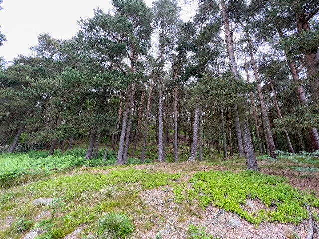
Ashopton is a small village located in the county of Derbyshire, England. Situated in the beautiful Peak District National Park, it is surrounded by stunning natural landscapes and is known for its picturesque views and tranquil atmosphere.

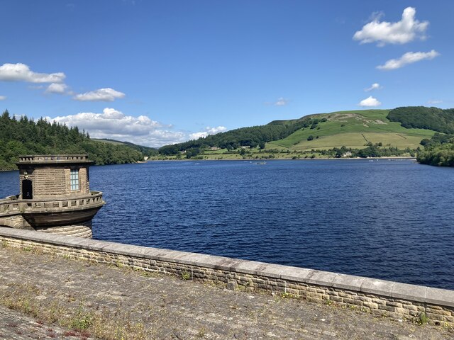
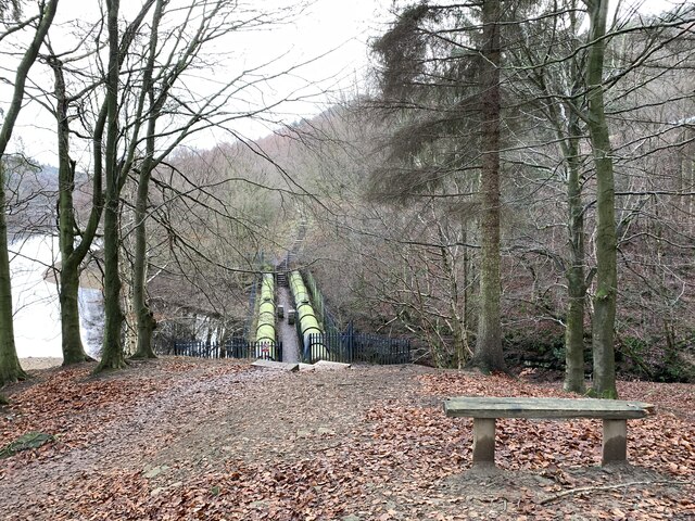
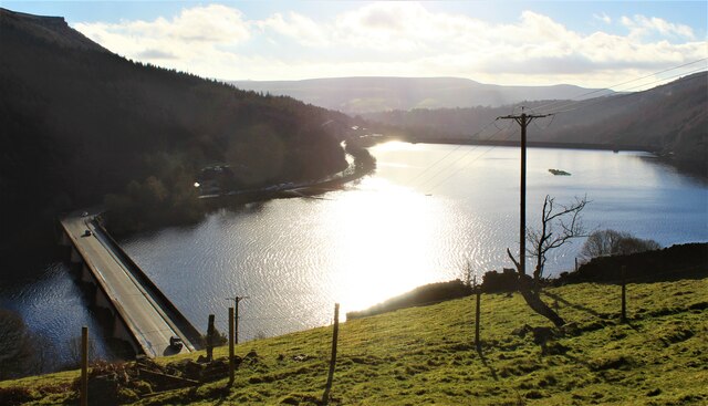
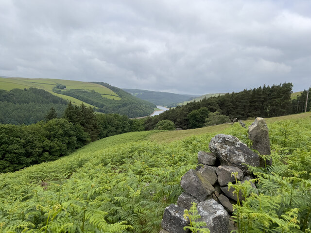
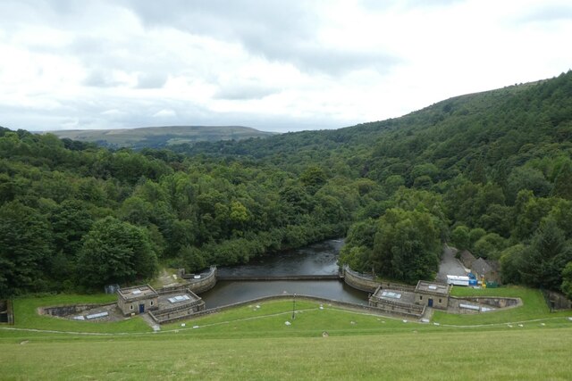
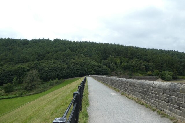
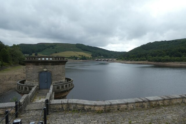
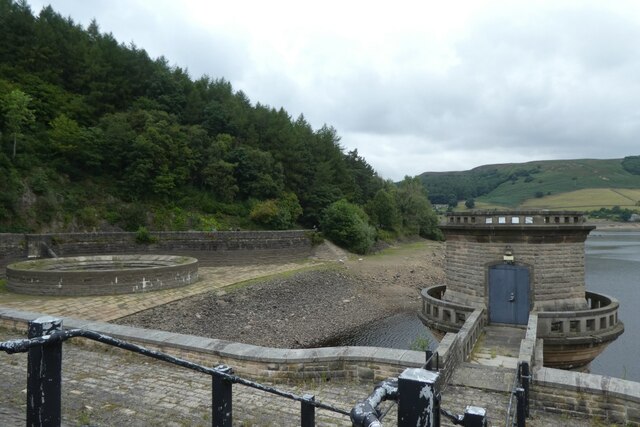
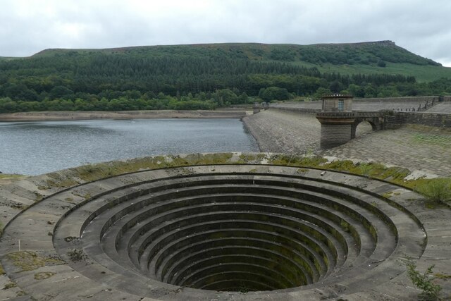
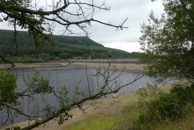
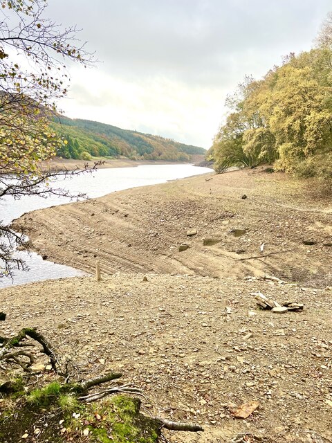
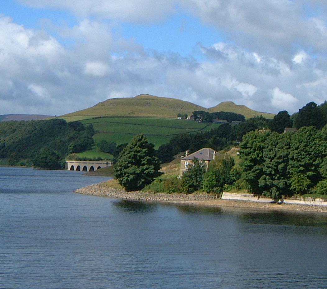
The village is perhaps best known for its reservoir, the Ladybower Reservoir, which was constructed in the 1930s. This reservoir, along with the nearby Derwent Reservoir, serves as a major water storage facility for the city of Sheffield. The creation of the reservoirs resulted in the flooding and subsequent relocation of the original village of Ashopton, with the current village being built on higher ground.

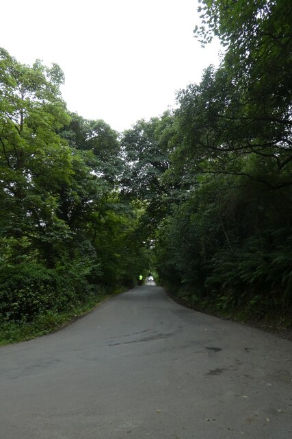
Despite its small size, Ashopton offers some amenities for both residents and visitors. There is a quaint village pub that serves traditional English food and offers a cozy atmosphere for locals and tourists alike. The village is also a popular destination for outdoor enthusiasts, with numerous walking and cycling trails leading to the reservoir and the surrounding countryside.

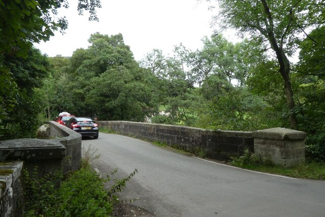
Ashopton is located within close proximity to other notable attractions in the area, such as the historic market town of Bakewell and the popular tourist destination of Chatsworth House. The village is easily accessible by road, with the A57 passing through it, providing convenient links to nearby towns and cities.

Overall, Ashopton offers a tranquil retreat for those seeking a peaceful getaway in the heart of the Peak District National Park, with its stunning scenery and access to outdoor activities making it a popular choice for visitors.

If you have any feedback on the listing, please let us know in the comments section below.

Ashopton Images

Images are sourced within 2km of 53.375342/-1.705201 or Grid Reference SK1986. Thanks to Geograph Open Source API. All images are credited.

Ladybower reservoir  Ladybower reservoir seen from the reservoir dam. Built between 1935 and 1943 and opened in 1945, it supplies drinking water to the East Midlands via the Bamford water treatment works operated by Severn Trent.
Ladybower reservoir
Ladybower reservoir seen from the reservoir dam. Built between 1935 and 1943 and opened in 1945, it supplies drinking water to the East Midlands via the Bamford water treatment works operated by Severn Trent.
Aqueduct alongside Ladybower reservoir On the western bank of the reservoir.
Aqueduct alongside Ladybower reservoir
On the western bank of the reservoir.
Ladybower Reservoir
Ladybower Reservoir
View across to Derwent Reservoir A view from the hillside across to the local reservoir.
View across to Derwent Reservoir
A view from the hillside across to the local reservoir.
Woodland View Just a quick view of the trees here.
Woodland View
Just a quick view of the trees here.
Ladybower outflow Looking down the dam wall of Ladybower Reservoir.
Ladybower outflow
Looking down the dam wall of Ladybower Reservoir.
Across the dam wall Looking along the dam wall of Ladybower Reservoir. The water levels in the reservoir are pretty low following a prolonged period with little rain.
Across the dam wall
Looking along the dam wall of Ladybower Reservoir. The water levels in the reservoir are pretty low following a prolonged period with little rain.
Control tower along the dam wall Looking across Ladybower Reservoir from the dam wall. The water levels are pretty low following a prolonged period with little rain.
Control tower along the dam wall
Looking across Ladybower Reservoir from the dam wall. The water levels are pretty low following a prolonged period with little rain.
Control tower and outflow Looking across Ladybower Reservoir from the dam wall. The water levels are pretty low following a prolonged period with little rain.
Control tower and outflow
Looking across Ladybower Reservoir from the dam wall. The water levels are pretty low following a prolonged period with little rain.
Outflow on the west side of the dam wall Looking across Ladybower Reservoir from the dam wall. The water levels are pretty low following a prolonged period with little rain.
Outflow on the west side of the dam wall
Looking across Ladybower Reservoir from the dam wall. The water levels are pretty low following a prolonged period with little rain.
Ladybower Reservoir Looking across Ladybower Reservoir from the dam wall. The water levels are pretty low following a prolonged period with little rain.
Ladybower Reservoir
Looking across Ladybower Reservoir from the dam wall. The water levels are pretty low following a prolonged period with little rain.
Bridge over the River Derwent Looking along Lydgate Lane.
Bridge over the River Derwent
Looking along Lydgate Lane.
Junction of Carr Lane and Lydgate Lane Looking down Carr Lane below Ladybower reservoir.
Junction of Carr Lane and Lydgate Lane
Looking down Carr Lane below Ladybower reservoir.
Western side of Ladybower Looking along the side of Ladybower Reservoir.
Western side of Ladybower
Looking along the side of Ladybower Reservoir.
Ladybower Reservoir Looking across the reservoir.
Ladybower Reservoir
Looking across the reservoir.
Autumn Woodland Autumn colours near the footpath’s along side the reservoir.
Autumn Woodland
Autumn colours near the footpath’s along side the reservoir.
Slightly Damp Day One of several aqueducts alongside the reservoir, and it started raining.
Slightly Damp Day
One of several aqueducts alongside the reservoir, and it started raining.
Woodland path steps The path and steps  up from the aqueduct.
Woodland path steps
The path and steps up from the aqueduct.
Show me another place!

Ashopton is located at Grid Ref: SK1986 (Lat: 53.375342, Lng: -1.705201)

Administrative County: Derbyshire

District: High Peak

Police Authority: Derbyshire

What 3 Words

///heartless.object.pinks. Near Hope Valley, Derbyshire

Related Wikis

Nearby Amenities

Located within 500m of 53.375342,-1.705201
Post Box
Check Date: 2021-05-13
Collection Times: Mo-Fr 17:00, Sa 10:00
Operator: Royal Mail
Post Box Type: lamp
Ref: S33 431D
Royal Cypher: EIIR
Royal Cypher Wikidata: Q33102113
Lat/Long: 53.37437/-1.7064589
Bench
Backrest: no
Source: GPS
Lat/Long: 53.3758491/-1.7098995
Ashopton
Place: hamlet
Wikidata: Q4570406
Lat/Long: 53.3758477/-1.7043625
Pipeline: valve
Lat/Long: 53.3744925/-1.7082532
Crossing
Bicycle: yes
Crossing: uncontrolled
Kerb: lowered
Tactile Paving: yes
Lat/Long: 53.3745915/-1.7081717
Waste Basket
Waste: trash
Lat/Long: 53.3743784/-1.706532
Colour: green
Communication Mobile Phone: yes
Man Made: mast
Material: metal
Operator: EE
Operator Note: The cabinet next to the mast is marked as "Orange" who have merged into EE
Tower Construction: freestanding
Tower Type: communication
Lat/Long: 53.3743692/-1.7064965
The data included in this document is from www.openstreetmap.org. The data is made available under ODbL.

Have you been to Ashopton?

Leave your review of Ashopton below (or comments, questions and feedback).