Hammer Moor

Wood, Forest in Sussex Chichester

England

Hammer Moor

Line of trees east of Linchmere village I noticed that Linchmere was spelt "Lynchmere" on the road sign to the south of the village. It's "Linchmere" on all the maps.
Line of trees east of Linchmere village Credit: Ian Cunliffe

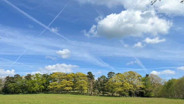
Hammer Moor, located in Sussex, England, is an enchanting wood and forest area that spans over a vast expanse of land. The moor, known for its natural beauty and diverse flora and fauna, attracts nature enthusiasts and hikers alike. It is situated in close proximity to the charming village of Hammer, adding to its allure.

The woodlands of Hammer Moor are characterized by their dense and ancient trees, creating a serene and peaceful atmosphere. Towering oaks, beeches, and chestnuts dominate the landscape, offering a picturesque setting for visitors to explore. The forest floor is adorned with carpets of wildflowers during the spring and summer months, adding bursts of color to the green surroundings.

The moor is also home to a wide range of wildlife, including deer, foxes, rabbits, and various bird species. Birdwatchers will be delighted by the opportunity to spot species such as woodpeckers, owls, and various songbirds. Nature enthusiasts can also discover a variety of insects, amphibians, and small mammals that call Hammer Moor their home.

For those seeking outdoor activities, Hammer Moor offers an extensive network of walking trails and paths, allowing visitors to immerse themselves in the natural beauty of the area. The trails wind through the woodlands, offering breathtaking views of the surrounding countryside. Along the way, hikers may stumble upon hidden streams, tranquil ponds, and even the occasional abandoned stone cottage, adding an air of mystery to the experience.

Overall, Hammer Moor, Sussex is a captivating destination that offers a harmonious blend of natural beauty, diverse wildlife, and outdoor activities. It is a haven for nature lovers and a place where one can truly connect with the tranquility of the forest.

If you have any feedback on the listing, please let us know in the comments section below.
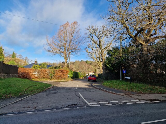
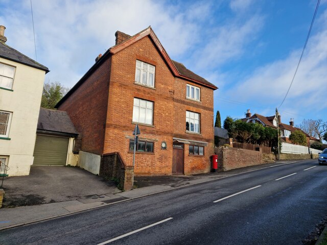
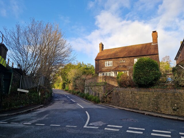
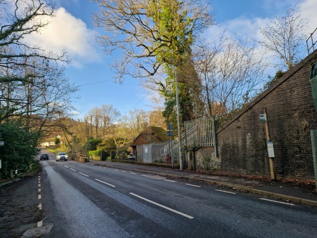
Hammer Moor Images

Images are sourced within 2km of 51.084057/-0.75802369 or Grid Reference SU8732. Thanks to Geograph Open Source API. All images are credited.

Line of trees east of Linchmere village I noticed that Linchmere was spelt "Lynchmere" on the road sign to the south of the village. It's "Linchmere" on all the maps.
Line of trees east of Linchmere village
I noticed that Linchmere was spelt "Lynchmere" on the road sign to the south of the village. It's "Linchmere" on all the maps.
Linchmere House This house is almost opposite the church - on the east side of the lane through Linchmere.
Linchmere House
This house is almost opposite the church - on the east side of the lane through Linchmere.
Bordering on the ridiculous (2) Coming from West Sussex into Surrey, with the junction to Crichmere lane on the left
Bordering on the ridiculous (2)
Coming from West Sussex into Surrey, with the junction to Crichmere lane on the left
Bordering on the ridiculous (3) Coming from Surrey into West Sussex, just past The Mill pub
Bordering on the ridiculous (3)
Coming from Surrey into West Sussex, just past The Mill pub
Looking from Liphook Road into Eliot Drive
Cyclist in Liphook Road
Postbox in Liphook Road This was formerly Harding Stores and sub-postoffice
Postbox in Liphook Road
This was formerly Harding Stores and sub-postoffice
Looking from Liphook Road into Critchmere Lane
Bus stops by the railway bridge in Liphook Road
Haslemere Classic Car Rally Revisited (1)
Haslemere Classic Car Rally Revisited (2)
Haslemere Classic Car Rally Revisited (3)
Haslemere Classic Car Rally Revisited (4)
Haslemere Classic Car Rally Revisited (5)
Haslemere Classic Car Rally Revisited (6)
Haslemere Classic Car Rally Revisited (7)
Hillside, Camelsdale
The Old Quarry, Marley Combe
Show me another place!

Hammer Moor is located at Grid Ref: SU8732 (Lat: 51.084057, Lng: -0.75802369)

Administrative County: West Sussex

District: Chichester

Police Authority: Sussex

What 3 Words

///copying.crumb.seabirds. Near Liphook, Hampshire

Related Wikis

Hammer Bottom

Hammer Bottom or Hammer Vale is a hamlet in the civil parish of Bramshott and Liphook, in the East Hampshire district in the county of Hampshire, England...

Woolmer Hill

Woolmer Hill is an area of high ground in the south-west corner of Surrey, England in the Borough of Waverley abutting Hampshire to the west and West Sussex...

Woolmer Hill School

Woolmer Hill School, formerly Woolmer Hill Technology College, is the main secondary school in the area of Haslemere, Surrey. == Funding == A non-fee paying...

Shottermill & Haslemere F.C.

Shottermill & Haslemere Football Club is a football club based in Haslemere, Surrey, England. The club are currently members of the Surrey Intermediate...

Linchmere

Linchmere, also spelled Lynchmere, is a village and a civil parish, the northernmost parish in the Chichester district of West Sussex, England. It is...

Lynchmere Commons

Lynchmere Commons is a 122-hectare (300-acre) Local Nature Reserve in Lynchmere in West Sussex. It is owned and managed by the Lynchmere Society.This...

Bramshott Common

Bramshott Common is part of a large expanse of heathland, including Ludshott Common, near Bramshott, Hampshire, England.It was the site of Bramshott Camps...

Bramshott Camp

Bramshott Military Camp, often simplified to Camp Bramshott, was a temporary army camp set up on Bramshott Common, Hampshire, England during both the First...

Nearby Amenities

Located within 500m of 51.084057,-0.75802369
Bridge Support: pier
Description: 3 Counties Bridge, the intersection of Surrey, Hampshire and West Sussex
Lat/Long: 51.0866534/-0.7536028
WOOLM H
Railway: crossing
Lat/Long: 51.0849689/-0.7627045
Hammer Vale
Old Name: Hammer Bottom
Place: hamlet
Wikidata: Q5645619
Wikipedia: en:Hammer Bottom
Lat/Long: 51.086033/-0.759718
Post Box
Collection Plate: CP5D
Collection Times: Mo-Fr 09:00; Sa 07:00
Drive Through: no
Last Checked: 2020-03-06
Operator: Royal Mail
Post Box Type: wall
Ref: GU27 29D
Royal Cypher: VR
Royal Cypher Wikidata: Q33102356
Wikimedia Commons: File:Post_Box_GU27_29D_Hammer_Vale,_Hampshire.jpg
Lat/Long: 51.0867956/-0.7576195
Pub
Prince of Wales
Addr City: Haslemere
Addr Postcode: GU27 1QH
Addr Street: Hammer Vale
Brand: Fuller's
Brand Wikidata: Q5253950
Brewery: Fuller's
Fhrs Id: 874995
Website: https://www.princeofwaleshaslemere.co.uk/
Lat/Long: 51.0861409/-0.7617135
Hammer Hill Estate
Naptan AtcoCode: 4400MO0146
Naptan Bearing: N
Naptan BusStopType: CUS
Naptan CommonName: Hammer Hill Estate
Naptan Indicator: opp Hammer Hill
Naptan Landmark: Hammer Hill
Naptan NaptanCode: wsxdjadt
Naptan Street: Linchmere Road
Naptan Verified: no
Source: naptan_import
Lat/Long: 51.0806356/-0.7572316
Bus Stop
Bus: yes
Public Transport: platform
Lat/Long: 51.0867788/-0.7578555
Telephone
Booth: K6
Covered: booth
Lat/Long: 51.086026/-0.7621618
Post Box
Collection Plate: CP5
Collection Times: Mo-Fr 16:30; Sa 12:00
Operator: Royal Mail
Post Box Type: wall
Ref: GU27 129
Royal Cypher: EVIIR
Royal Cypher Wikidata: Q33102324
Wikimedia Commons: File:Post_Box_GU27_129,_Hammer_Lane,_Linchmere,_Haslemere,_West_Sussex.jpg
Lat/Long: 51.0852671/-0.7528223
Defibrillator
Booth: KX300
Covered: booth
Defibrillator Location: In an old (modern style) telephone box on the corner of Linchmere Road and Hammer Lane. The yellow cabinet containing the defibrillator is locked, call 999 ask for an Ambulance then ask for the access code.
Disused Amenity: telephone
Emergency: defibrillator
Indoor: no
Man Made: telephone_box
Lat/Long: 51.0822932/-0.7522369
Post Box
Collection Plate: CP7D
Collection Times: Mo-Fr 09:00; Sa 07:00
Last Checked: 2020-08-20
Note: This postbox is of a brand new (2010s) EIIR lamp design. I am not sure of the official name for this design of postbox.
Operator: Royal Mail
Post Box Type: lamp
Ref: GU27 49D
Royal Cypher: EIIR
Royal Cypher Wikidata: Q33102113
Source: survey
Lat/Long: 51.0805303/-0.7568778
The data included in this document is from www.openstreetmap.org. The data is made available under ODbL.

Have you been to Hammer Moor?

Leave your review of Hammer Moor below (or comments, questions and feedback).