Ashley Moor

Settlement in Herefordshire

England

Ashley Moor

Mortimer Trail at Bircher Common
Mortimer Trail at Bircher Common Credit: Row17

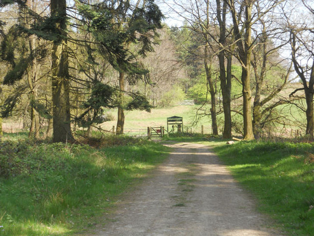
Ashley Moor is a small village located in the county of Herefordshire, in the West Midlands region of England. Situated about 10 miles southwest of Hereford, the village is set amidst picturesque countryside, with rolling hills and meandering streams surrounding it.

The history of Ashley Moor can be traced back to medieval times when it was a farming community. Today, it retains its rural charm with a scattering of traditional cottages and farmhouses, adding to its quaint and peaceful atmosphere. The village is home to a close-knit community, with a population of around 200 residents.

Despite its small size, Ashley Moor offers a range of amenities for its residents and visitors. These include a village hall, a local pub, and a post office. The village hall hosts various events and activities throughout the year, fostering a sense of community spirit among the locals.

Nature enthusiasts will find plenty to explore in and around Ashley Moor. The surrounding countryside provides ample opportunities for walking, cycling, and horse riding, with numerous trails and paths available. The area is also known for its diverse wildlife, with sightings of various bird species, deer, and foxes being common.

For those seeking a taste of history and culture, nearby attractions such as Hereford Cathedral and the Black and White Village Trail offer a glimpse into the region's rich heritage. Ashley Moor's close proximity to Hereford also means that residents have convenient access to a wider range of amenities, including shops, schools, and healthcare facilities.

In summary, Ashley Moor is a charming village in the heart of Herefordshire, offering a peaceful and idyllic setting for its residents. With its rich history, beautiful countryside, and strong sense of community, it is a place that captures the essence of rural England.

If you have any feedback on the listing, please let us know in the comments section below.

Ashley Moor Images

Images are sourced within 2km of 52.301734/-2.7721415 or Grid Reference SO4767. Thanks to Geograph Open Source API. All images are credited.

Mortimer Trail at Bircher Common
The Boot Inn, Orleton Done up for St George's Day.  

To me this pub will always be remembered for the once publican who could not pronounce the name of the village.
The Boot Inn, Orleton
Done up for St George's Day. To me this pub will always be remembered for the once publican who could not pronounce the name of the village.
Orleton Post Office View from outside The Boot.
Orleton Post Office
View from outside The Boot.
The war memorial and village post office, Orleton One of the social centres of the village. The village is properly pronounced 'Orl-ton' rather than Or-let-ton, which I have also heard.
The war memorial and village post office, Orleton
One of the social centres of the village. The village is properly pronounced 'Orl-ton' rather than Or-let-ton, which I have also heard.
The Boot Inn, Orleton I believe that this pub has changed hands, or management, a few times over recent years and months, like all too many pubs. But it seems well run, both wet side and food-wise, so let's hope it operates in profit and gets local support.
The Boot Inn, Orleton
I believe that this pub has changed hands, or management, a few times over recent years and months, like all too many pubs. But it seems well run, both wet side and food-wise, so let's hope it operates in profit and gets local support.
Old building at the rear of The Boot Inn, Orleton This old structure caught my eye to one side of the beer garden of the Boot Inn.
Old building at the rear of The Boot Inn, Orleton
This old structure caught my eye to one side of the beer garden of the Boot Inn.
Lane and footpath near Richard's Castle A waymarker sits between lanes at the junction point.
Lane and footpath near Richard's Castle
A waymarker sits between lanes at the junction point.
April's House, Waterloo Lane, near Richard's Castle A large and impressive house in an isolated spot. Interesting circular saw blade
April's House, Waterloo Lane, near Richard's Castle
A large and impressive house in an isolated spot. Interesting circular saw blade
Orleton Rise Holiday Park A static caravan holiday park within easy reach of many local attractions; Ludlow, Tenbury, Leominster (no, I'm not joking), the Teme valley, Mortimer Forest, the Clee Hills, Richard's Castle, the Mortimer Trail plus numerous small villages with pubs and a wide choice of restaurants. Or visitors could just stay on site drinking their own beer and eating their own barbecue food.
Orleton Rise Holiday Park
A static caravan holiday park within easy reach of many local attractions; Ludlow, Tenbury, Leominster (no, I'm not joking), the Teme valley, Mortimer Forest, the Clee Hills, Richard's Castle, the Mortimer Trail plus numerous small villages with pubs and a wide choice of restaurants. Or visitors could just stay on site drinking their own beer and eating their own barbecue food.
View from a footpath near Orleton The footpath here follows a field edge with lovely views across neighbouring fields to a bungalow and Titterstone Clee behind.
View from a footpath near Orleton
The footpath here follows a field edge with lovely views across neighbouring fields to a bungalow and Titterstone Clee behind.
Footpath through a rape field near Portway The oil seed rape is losing its yellow flowers now as May comes to an end and it is getting hard to struggle through the crop as it grows.
Footpath through a rape field near Portway
The oil seed rape is losing its yellow flowers now as May comes to an end and it is getting hard to struggle through the crop as it grows.
Old building in Orleton I have been watching that tile and waiting for it to fall for, well, maybe five years. This old building could well have been a smithy or a garage, or a coach house for the neighbouring roadside inn. Someone will know.
Old building in Orleton
I have been watching that tile and waiting for it to fall for, well, maybe five years. This old building could well have been a smithy or a garage, or a coach house for the neighbouring roadside inn. Someone will know.
The Maidenhead Inn in Orleton is for sale
St George's Church in Orleton
Tree in a Field
Tree in a Field
Old thatched house in Bircher This house always seems to have at least some remedial building work occurring to its aged thatch or fabric.
Old thatched house in Bircher
This house always seems to have at least some remedial building work occurring to its aged thatch or fabric.
St George, Orleton A splendid village church which the Victorians were fairly kind to.
St George, Orleton
A splendid village church which the Victorians were fairly kind to.
St George, Orleton A broadside shot of the South side of this impressive village church.
St George, Orleton
A broadside shot of the South side of this impressive village church.
Show me another place!

Ashley Moor is located at Grid Ref: SO4767 (Lat: 52.301734, Lng: -2.7721415)

Unitary Authority: County of Herefordshire

Police Authority: West Mercia

What 3 Words

///withdraws.trout.kingpin. Near Orleton, Herefordshire

Nearby Locations

Ashley Moor Ashley Moor

Related Wikis

Bircher Common

Bircher Common is an area of lowland heath in the civil parish of Croft and Yarpole in Herefordshire, England, and 6 miles (10 km) north from Leominster...

Orleton

Orleton is a small village and civil parish in northern Herefordshire, England, at grid reference SO493672. The population of the civil parish at the 2011...

Croft and Yarpole

Croft and Yarpole is a civil parish in the county of Herefordshire, England, and is 17 miles (27 km) north from the city and county town of Hereford....

Yarpole

Yarpole is a village and former civil parish, now in the parish of Croft and Yarpole, Herefordshire, England, about 4.5 miles (7 km) north-west of Leominster...

Nearby Amenities

Located within 500m of 52.301734,-2.7721415
Barrier: stile
Material: wood
Source: survey;gps
Stile: stepover
Lat/Long: 52.305664/-2.7745842
Building: yes
Lat/Long: 52.3003339/-2.7771969
Building: yes
Lat/Long: 52.3009113/-2.7772291
Building: yes
Lat/Long: 52.3014755/-2.7726908
Building: yes
Lat/Long: 52.2986281/-2.7765317
Building: yes
Lat/Long: 52.2991923/-2.7758343
Ashley Moor
Place: locality
Source: OS_OpenData_StreetView
Lat/Long: 52.3027451/-2.7709794
The data included in this document is from www.openstreetmap.org. The data is made available under ODbL.

Have you been to Ashley Moor?

Leave your review of Ashley Moor below (or comments, questions and feedback).