Chapel Copse

Wood, Forest in Sussex Chichester

England

Chapel Copse

Inner Wall, Tuxlith Chapel This image shows the inner face of the west wall of the part of the chapel which was an extension to the original building. My grandparents and many other ancestors are interred around the chapel.
Inner Wall, Tuxlith Chapel Credit: Paul Collins

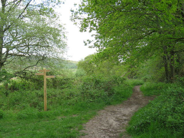
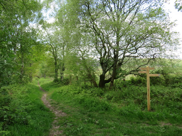
Chapel Copse is a picturesque woodland located in Sussex, England. Situated near the village of Chapel Cross, the copse covers an area of approximately 50 acres and is known for its dense and diverse forest ecosystem.

The copse is primarily composed of broadleaf trees, including oak, beech, and ash, which create a stunning canopy that provides shade and shelter for a variety of wildlife. The forest floor is covered in a rich carpet of mosses, ferns, and wildflowers, adding to the copse's natural beauty.

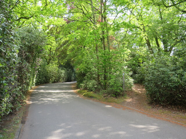
Tranquility and serenity are defining characteristics of Chapel Copse, as it offers a peaceful retreat from the bustling city life. The copse is a popular destination for hikers, nature enthusiasts, and photographers, who are drawn to its idyllic setting and abundant wildlife.

Birdwatchers will be delighted by the copse's avian inhabitants, which include woodland birds such as woodpeckers, owls, and various songbirds. Small mammals such as squirrels and rabbits can also be spotted scurrying through the undergrowth, while deer and foxes occasionally make appearances.

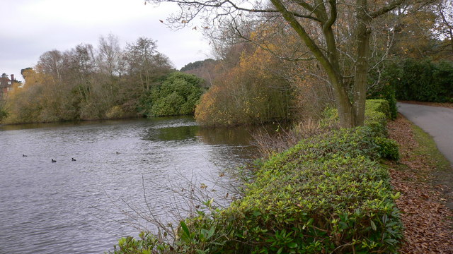
Chapel Copse is well-maintained, with designated walking trails and picnic areas for visitors to enjoy. The copse also boasts a small stream that meanders through its heart, adding to its charm and providing a refreshing spot for visitors to relax.

Overall, Chapel Copse is a hidden gem in Sussex, offering a sanctuary of natural beauty and tranquility. Whether one seeks a leisurely stroll, a picnic, or an opportunity to immerse oneself in nature, Chapel Copse is a must-visit destination for nature enthusiasts and those seeking respite from the noise and stress of everyday life.

If you have any feedback on the listing, please let us know in the comments section below.

Chapel Copse Images

Images are sourced within 2km of 51.050466/-0.82286655 or Grid Reference SU8228. Thanks to Geograph Open Source API. All images are credited.

Inner Wall, Tuxlith Chapel This image shows the inner face of the west wall of the part of the chapel which was an extension to the original building. My grandparents and many other ancestors are interred around the chapel.
Inner Wall, Tuxlith Chapel
This image shows the inner face of the west wall of the part of the chapel which was an extension to the original building. My grandparents and many other ancestors are interred around the chapel.
Tuxlith Chapel This ancient and redundant chapel has recently been re-roofed. Two of my grandparents and many other ancestors lie in the churchyard.
Tuxlith Chapel
This ancient and redundant chapel has recently been re-roofed. Two of my grandparents and many other ancestors lie in the churchyard.
Bordering on the ridiculous (4) Looking from Sussex into Hampshire by Liphook Golf Course
Bordering on the ridiculous (4)
Looking from Sussex into Hampshire by Liphook Golf Course
Bordering on the ridiculous (5) Looking from south-southwest along the B2070 in Hampshire into west Sussex
Bordering on the ridiculous (5)
Looking from south-southwest along the B2070 in Hampshire into west Sussex
Vehicles behind a cyclist on the B2070
Cyclist on the B2070
Horses at Coldharbour Park Farm This year there have been 62,499 photos added to Geograph, of which 414 (0.66%) are mine
Horses at Coldharbour Park Farm
This year there have been 62,499 photos added to Geograph, of which 414 (0.66%) are mine
Langley Farm Road, near Liss Langley Farm Road is a minor lane through countryside in the South Downs National Park.  It is on route 22 of the National Cycle Network and also on the route of the Sussex Border Path.
Langley Farm Road, near Liss
Langley Farm Road is a minor lane through countryside in the South Downs National Park. It is on route 22 of the National Cycle Network and also on the route of the Sussex Border Path.
Minor country lane near Liss A narrow lane in the South Downs National Park.  The blue sign indicates that the lane is a "no through road".

National Cycle Network route 22 passes along this lane, which is also on the route of the Sussex Border Path.
Minor country lane near Liss
A narrow lane in the South Downs National Park. The blue sign indicates that the lane is a "no through road". National Cycle Network route 22 passes along this lane, which is also on the route of the Sussex Border Path.
Bridge over a railway near Liss A bridge carrying a minor lane across a railway line in the South Downs National Park.  The lane is on route 22 of the National Cycle Network and also on the route of the Sussex Border Path.
Bridge over a railway near Liss
A bridge carrying a minor lane across a railway line in the South Downs National Park. The lane is on route 22 of the National Cycle Network and also on the route of the Sussex Border Path.
Railway line near Liss A Class 450 electric multiple unit train crossing the county boundary from Hampshire into West Sussex near Liss, in the South Downs National Park.  The railway is the Portsmouth Direct Line linking Portsmouth with Guildford and London (Waterloo).  It is electrified using the third rail system.
Railway line near Liss
A Class 450 electric multiple unit train crossing the county boundary from Hampshire into West Sussex near Liss, in the South Downs National Park. The railway is the Portsmouth Direct Line linking Portsmouth with Guildford and London (Waterloo). It is electrified using the third rail system.
Private driveway near Liss A private driveway leading to a house in the South Downs National Park.  A public bridleway heads off to the left, part of the route of the Sussex Border Path.
Private driveway near Liss
A private driveway leading to a house in the South Downs National Park. A public bridleway heads off to the left, part of the route of the Sussex Border Path.
Public bridleway near Liss A public bridleway in the South Downs National Park.  Here, the bridleway reaches the end of an access track to some houses, and follows a narrower path into the woodland.  This path forms part of the route of the Sussex Border Path.
Public bridleway near Liss
A public bridleway in the South Downs National Park. Here, the bridleway reaches the end of an access track to some houses, and follows a narrower path into the woodland. This path forms part of the route of the Sussex Border Path.
Bridleways in the South Downs National Park, near Liss A junction of public bridleways in the South Downs National Park.  The Sussex Border Path branches off to the right.
Bridleways in the South Downs National Park, near Liss
A junction of public bridleways in the South Downs National Park. The Sussex Border Path branches off to the right.
Public bridleway near Liss A public bridleway in the South Downs National Park.
Public bridleway near Liss
A public bridleway in the South Downs National Park.
Sussex Border Path near Liss A junction with other bridleways on the Sussex Border Path in the South Downs National Park, near Liss
Sussex Border Path near Liss
A junction with other bridleways on the Sussex Border Path in the South Downs National Park, near Liss
Driveway and path near Liphook A driveway providing access to a house in the South Downs National Park.  The path leading into the woodland to the right is a public bridleway which forms part of the route of the Sussex Border Path.
Driveway and path near Liphook
A driveway providing access to a house in the South Downs National Park. The path leading into the woodland to the right is a public bridleway which forms part of the route of the Sussex Border Path.
Driveway and public bridleway near Liphook A driveway in the grounds of a hotel in the South Downs National Park.  Leading off to the right is a public bridleway.
Driveway and public bridleway near Liphook
A driveway in the grounds of a hotel in the South Downs National Park. Leading off to the right is a public bridleway.
Show me another place!

Chapel Copse is located at Grid Ref: SU8228 (Lat: 51.050466, Lng: -0.82286655)

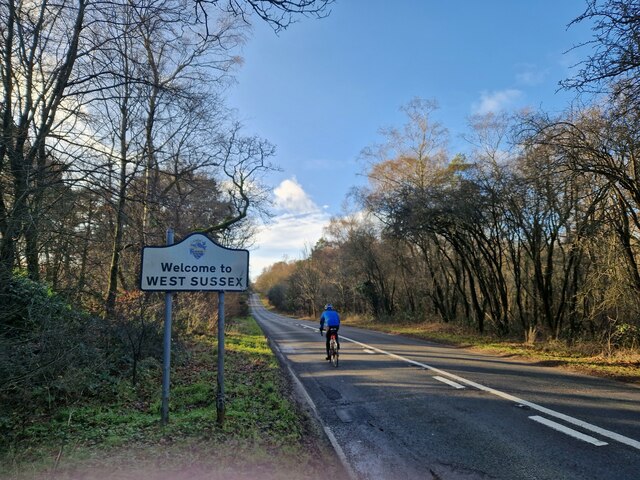
Administrative County: West Sussex

District: Chichester

Police Authority: Sussex

What 3 Words

///allowable.raced.seabirds. Near Liphook, Hampshire

Related Wikis

Nearby Amenities

Located within 500m of 51.050466,-0.82286655
Bus Stop
The Black Fox Inn PH
Naptan AtcoCode: 4400MO0103
Naptan Bearing: NE
Naptan CommonName: The Black Fox Inn PH
Naptan Indicator: o/s pub
Naptan Landmark: The Black Fox Inn P.H.
Naptan NaptanCode: wsxdgwdp
Naptan Street: Portsmouth Road
Naptan Verified: no
Source: naptan_import
Lat/Long: 51.0541627/-0.8189951
Bus Stop
The Black Fox Inn PH
Naptan AtcoCode: 4400MO0104
Naptan Bearing: SW
Naptan BusStopType: CUS
Naptan CommonName: The Black Fox Inn PH
Naptan Indicator: opp pub
Naptan Landmark: The Black Fox Inn P.H.
Naptan NaptanCode: wsxdgwdt
Naptan Street: Portsmouth Road
Naptan Verified: no
Source: naptan_import
Lat/Long: 51.0540886/-0.818783
Bus Stop
Milland Lane
Naptan AtcoCode: 4400MO0451
Naptan Bearing: N
Naptan BusStopType: CUS
Naptan CommonName: Milland Lane
Naptan Indicator: HAR
Naptan Landmark: Hail & Ride
Naptan NaptanCode: wsxgadpg
Naptan Street: Milland Lane
Naptan Verified: no
Source: naptan_import
Lat/Long: 51.0479927/-0.8171262
Bus Stop
Milland Lane
Naptan AtcoCode: 4400MO0452
Naptan Bearing: S
Naptan BusStopType: CUS
Naptan CommonName: Milland Lane
Naptan Indicator: HAR
Naptan Landmark: Hail & Ride
Naptan NaptanCode: wsxgadpj
Naptan Street: Milland Lane
Naptan Verified: no
Source: naptan_import
Lat/Long: 51.0480101/-0.8170687
Power: pole
Lat/Long: 51.0537953/-0.826913
Power: pole
Lat/Long: 51.0536175/-0.8247525
Power: pole
Lat/Long: 51.0535391/-0.8236393
Power: pole
Lat/Long: 51.0537574/-0.8205199
Power: pole
Lat/Long: 51.0526033/-0.8202128
Power: pole
Lat/Long: 51.0514424/-0.8199164
Power: pole
Lat/Long: 51.0513817/-0.8184519
Power: pole
Lat/Long: 51.0513683/-0.817025
Power: pole
Lat/Long: 51.0512772/-0.8170196
Power: pole
Lat/Long: 51.0513059/-0.818511
Power: pole
Lat/Long: 51.0513413/-0.8200505
Power: pole
Lat/Long: 51.0522315/-0.8202624
Power: pole
Lat/Long: 51.0530746/-0.8204904
Power: pole
Lat/Long: 51.0536276/-0.8206514
Power: pole
Lat/Long: 51.0535298/-0.8221319
Power: pole
Lat/Long: 51.0534421/-0.8236501
Power: pole
Lat/Long: 51.0536765/-0.8269411
The data included in this document is from www.openstreetmap.org. The data is made available under ODbL.

Have you been to Chapel Copse?

Leave your review of Chapel Copse below (or comments, questions and feedback).