Pondtail Plantation

Wood, Forest in Sussex Chichester

England

Pondtail Plantation

View from Rival Moor Road The road to the East Hampshire District Council Offices at Penns Place goes along the edge of the housing.  To the south the view is across open farmland towards a solitary house at the southern end of Heath Road East.  I lived within 400 metres of here as a child so this visit, for a meeting, took me back.
View from Rival Moor Road Credit: Graham Horn

Pondtail Plantation, located in Sussex, is a picturesque woodland area renowned for its natural beauty and tranquility. Spanning over a significant expanse of land, this forested region is a haven for nature enthusiasts and outdoor adventurers alike.

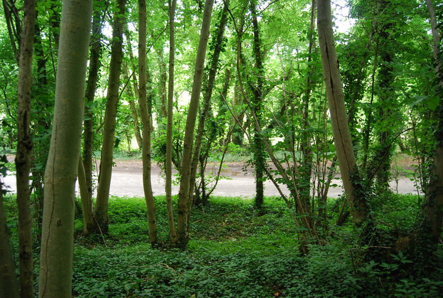
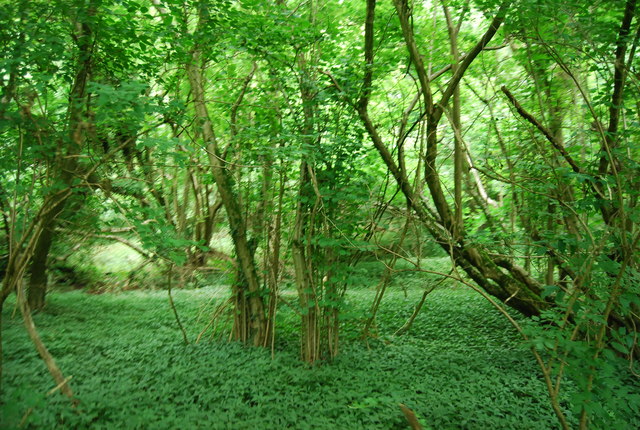
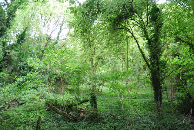
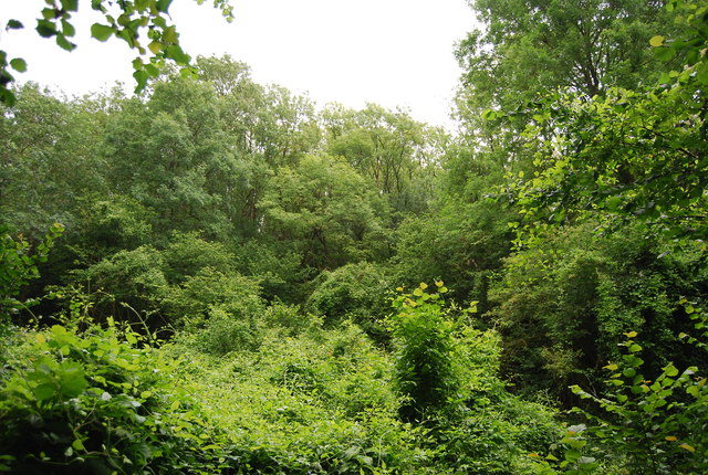
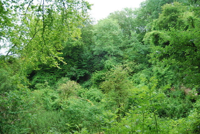
Pondtail Plantation boasts a diverse range of plant and animal species, forming a thriving ecosystem that is closely monitored and protected by local authorities. The woodland is predominantly composed of deciduous trees, such as oak, beech, and ash, which provide a stunning spectacle of colors during the autumn months.

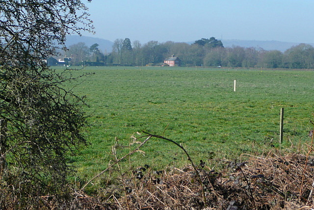
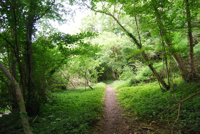
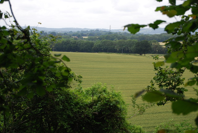
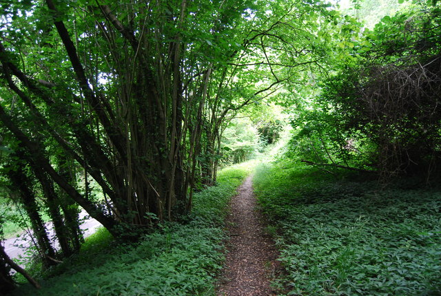
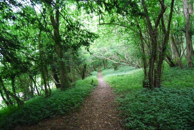
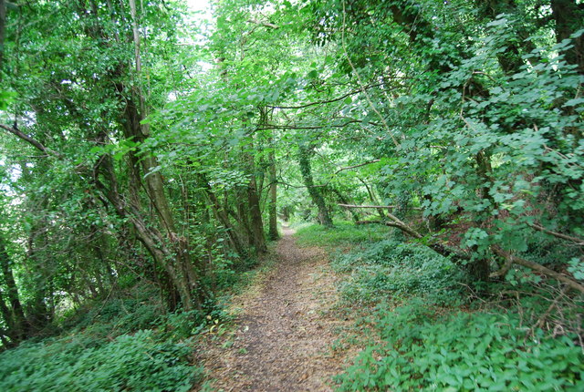
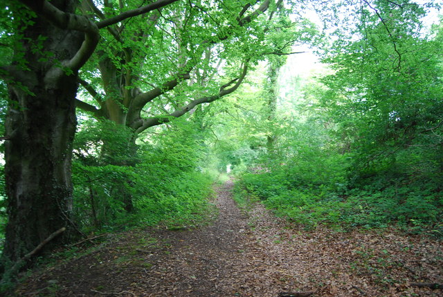
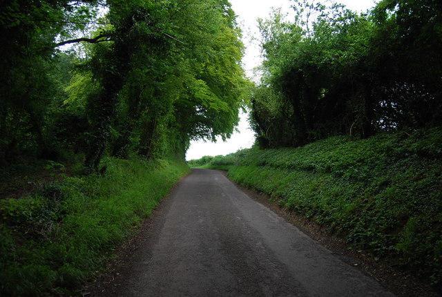
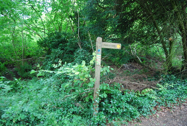
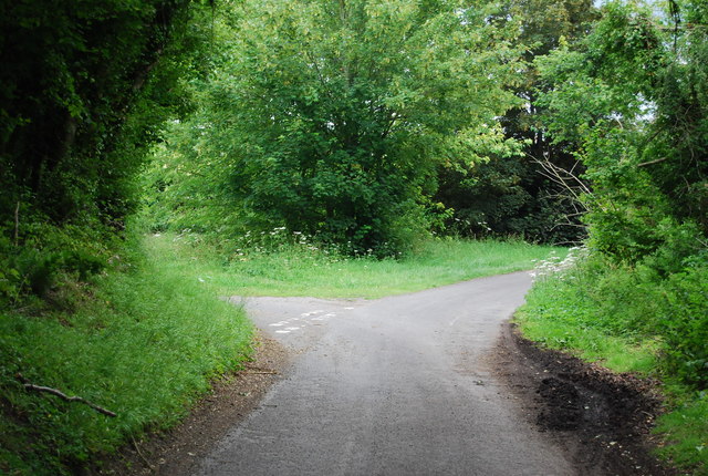
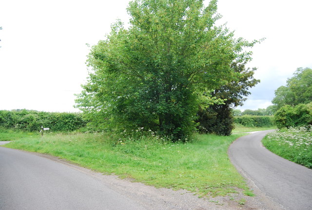
The plantation is intersected by several walking trails, allowing visitors to explore the area at their own pace. These trails offer breathtaking views of the surrounding landscape, including a crystal-clear pond nestled within the heart of the woodland. The pond, from which the plantation derives its name, adds to the enchanting atmosphere of the area and serves as a habitat for various aquatic creatures.

Pondtail Plantation also offers a range of recreational activities for visitors to enjoy. Picnic areas are scattered throughout the woodland, providing an ideal spot for family outings or leisurely lunches amidst nature. Additionally, the plantation offers designated areas for birdwatching, attracting bird enthusiasts keen on spotting a variety of avian species.

Overall, Pondtail Plantation in Sussex is a captivating destination for those seeking a peaceful retreat in the midst of nature. Its stunning landscapes, diverse flora and fauna, and ample recreational opportunities make it a must-visit location in the region.

If you have any feedback on the listing, please let us know in the comments section below.

Pondtail Plantation Images

Images are sourced within 2km of 50.989138/-0.89765313 or Grid Reference SU7721. Thanks to Geograph Open Source API. All images are credited.

View from Rival Moor Road The road to the East Hampshire District Council Offices at Penns Place goes along the edge of the housing.  To the south the view is across open farmland towards a solitary house at the southern end of Heath Road East.  I lived within 400 metres of here as a child so this visit, for a meeting, took me back.
View from Rival Moor Road
The road to the East Hampshire District Council Offices at Penns Place goes along the edge of the housing. To the south the view is across open farmland towards a solitary house at the southern end of Heath Road East. I lived within 400 metres of here as a child so this visit, for a meeting, took me back.
Little Torberry Plantation
Sussex Border Path in Little Torberry Plantation The Sussex Border Path is a footpath route nearly 150 miles long around the inland boundary of the county of Sussex. The county owes its origins to the kingdom of the South Saxons and can claim to have one of the longest inland county boundaries from Emsworth to Rye. The route was devised in 1983 and is well signed along most of the route. Website <span class="nowrap"><a title="http://www.sussexborderpath.co.uk/" rel="nofollow ugc noopener" href="http://www.sussexborderpath.co.uk/">Link</a><img style="margin-left:2px;" alt="External link" title="External link - shift click to open in new window" src="https://s1.geograph.org.uk/img/external.png" width="10" height="10"/></span> 
Map: <a title="https://www.geograph.org.uk/search.php?i=40140109&page=1&displayclass=map#i=40140109&page=1&displayclass=map&zoom=2&lat=51.03263&lon=-0.05427&layers=FTTB00000000000T" href="https://www.geograph.org.uk/search.php?i=40140109&page=1&displayclass=map#i=40140109&page=1&displayclass=map&zoom=2&lat=51.03263&lon=-0.05427&layers=FTTB00000000000T">Link</a>
Sussex Border Path in Little Torberry Plantation
The Sussex Border Path is a footpath route nearly 150 miles long around the inland boundary of the county of Sussex. The county owes its origins to the kingdom of the South Saxons and can claim to have one of the longest inland county boundaries from Emsworth to Rye. The route was devised in 1983 and is well signed along most of the route. Website LinkExternal link Map: Link
Farmland, Torberry Farm
Little Torberry Plantation
Sussex Border Path The Sussex Border Path is a footpath route nearly 150 miles long around the inland boundary of the county of Sussex. The county owes its origins to the kingdom of the South Saxons and can claim to have one of the longest inland county boundaries from Emsworth to Rye. The route was devised in 1983 and is well signed along most of the route. Website <span class="nowrap"><a title="http://www.sussexborderpath.co.uk/" rel="nofollow ugc noopener" href="http://www.sussexborderpath.co.uk/">Link</a><img style="margin-left:2px;" alt="External link" title="External link - shift click to open in new window" src="https://s1.geograph.org.uk/img/external.png" width="10" height="10"/></span> 
Map: <a title="https://www.geograph.org.uk/search.php?i=40140109&page=1&displayclass=map#i=40140109&page=1&displayclass=map&zoom=2&lat=51.03263&lon=-0.05427&layers=FTTB00000000000T" href="https://www.geograph.org.uk/search.php?i=40140109&page=1&displayclass=map#i=40140109&page=1&displayclass=map&zoom=2&lat=51.03263&lon=-0.05427&layers=FTTB00000000000T">Link</a>
Sussex Border Path
The Sussex Border Path is a footpath route nearly 150 miles long around the inland boundary of the county of Sussex. The county owes its origins to the kingdom of the South Saxons and can claim to have one of the longest inland county boundaries from Emsworth to Rye. The route was devised in 1983 and is well signed along most of the route. Website LinkExternal link Map: Link
Sussex Border Path in Torberry Copse
Woodland Torberry Hill
Sussex Border Path The Sussex Border Path is a footpath route nearly 150 miles long around the inland boundary of the county of Sussex. The county owes its origins to the kingdom of the South Saxons and can claim to have one of the longest inland county boundaries from Emsworth to Rye. The route was devised in 1983 and is well signed along most of the route. Website <span class="nowrap"><a title="http://www.sussexborderpath.co.uk/" rel="nofollow ugc noopener" href="http://www.sussexborderpath.co.uk/">Link</a><img style="margin-left:2px;" alt="External link" title="External link - shift click to open in new window" src="https://s1.geograph.org.uk/img/external.png" width="10" height="10"/></span> 
Map: <a title="https://www.geograph.org.uk/search.php?i=40140109&page=1&displayclass=map#i=40140109&page=1&displayclass=map&zoom=2&lat=51.03263&lon=-0.05427&layers=FTTB00000000000T" href="https://www.geograph.org.uk/search.php?i=40140109&page=1&displayclass=map#i=40140109&page=1&displayclass=map&zoom=2&lat=51.03263&lon=-0.05427&layers=FTTB00000000000T">Link</a>
Sussex Border Path
The Sussex Border Path is a footpath route nearly 150 miles long around the inland boundary of the county of Sussex. The county owes its origins to the kingdom of the South Saxons and can claim to have one of the longest inland county boundaries from Emsworth to Rye. The route was devised in 1983 and is well signed along most of the route. Website LinkExternal link Map: Link
Wooded Torberry Hill
Sussex Border Path The Sussex Border Path is a footpath route nearly 150 miles long around the inland boundary of the county of Sussex. The county owes its origins to the kingdom of the South Saxons and can claim to have one of the longest inland county boundaries from Emsworth to Rye. The route was devised in 1983 and is well signed along most of the route. Website <span class="nowrap"><a title="http://www.sussexborderpath.co.uk/" rel="nofollow ugc noopener" href="http://www.sussexborderpath.co.uk/">Link</a><img style="margin-left:2px;" alt="External link" title="External link - shift click to open in new window" src="https://s1.geograph.org.uk/img/external.png" width="10" height="10"/></span> 
Map: <a title="https://www.geograph.org.uk/search.php?i=40140109&page=1&displayclass=map#i=40140109&page=1&displayclass=map&zoom=2&lat=51.03263&lon=-0.05427&layers=FTTB00000000000T" href="https://www.geograph.org.uk/search.php?i=40140109&page=1&displayclass=map#i=40140109&page=1&displayclass=map&zoom=2&lat=51.03263&lon=-0.05427&layers=FTTB00000000000T">Link</a>
Sussex Border Path
The Sussex Border Path is a footpath route nearly 150 miles long around the inland boundary of the county of Sussex. The county owes its origins to the kingdom of the South Saxons and can claim to have one of the longest inland county boundaries from Emsworth to Rye. The route was devised in 1983 and is well signed along most of the route. Website LinkExternal link Map: Link
Woodland on Torberry Hill
Lane south of Canada Corner
Signpost, Sussex Border Path
Approaching Canada Corner
Canada Corner
Canada Corner
Road sign, Canada Corner
Gated track
Gated track
Show me another place!

Pondtail Plantation is located at Grid Ref: SU7721 (Lat: 50.989138, Lng: -0.89765313)

Administrative County: West Sussex

District: Chichester

Police Authority: Sussex

What 3 Words

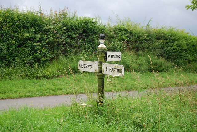
///duck.equivocal.bookcases. Near South Harting, West Sussex

Related Wikis

West Harting

West Harting is a hamlet in the Chichester district of West Sussex, England. At the 2011 Census the population of the hamlet was included in the civil...

Nursted

Nursted is a hamlet in the East Hampshire district of Hampshire, England. It is in the civil parish of Buriton. It is 1.8 miles (2.7 km) southeast of...

Torberry Hill

Torberry Hill (also spelled Tarberry Hill and Torbery Hill) is an Iron Age hillfort in the county of West Sussex, in southern England. It is a Scheduled...

Hurst, West Sussex

Hurst is a hamlet in West Sussex, England. It lies on the Hampshire-Sussex border on the B2146 road. Its nearest town is Petersfield, approximately 2 miles...

Nearby Amenities

Located within 500m of 50.989138,-0.89765313
Quebec
Place: hamlet
Lat/Long: 50.9861782/-0.8924529
Power: tower
Ref: 4VF 41
Source: bing
Source Ref: extrapolation
Lat/Long: 50.9911526/-0.9020909
Power: tower
Ref: 4VF 42
Source: bing
Source Ref: extrapolation
Lat/Long: 50.9915264/-0.8964162
The data included in this document is from www.openstreetmap.org. The data is made available under ODbL.

Have you been to Pondtail Plantation?

Leave your review of Pondtail Plantation below (or comments, questions and feedback).