Goff's Plantation

Wood, Forest in Sussex Chichester

England

Goff's Plantation

The Heath I had a meeting at East Hampshire District Council offices, and as I was early I took the opportunity of revisiting The Heath, my playground when I was a child.  No time for a walk but it looked inviting on a sunny spring day.  I see the cricket pitch is still there in the background.
The Heath Credit: Graham Horn

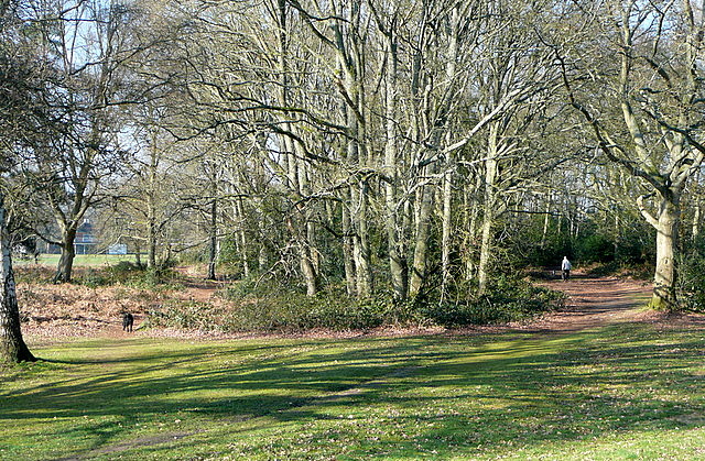
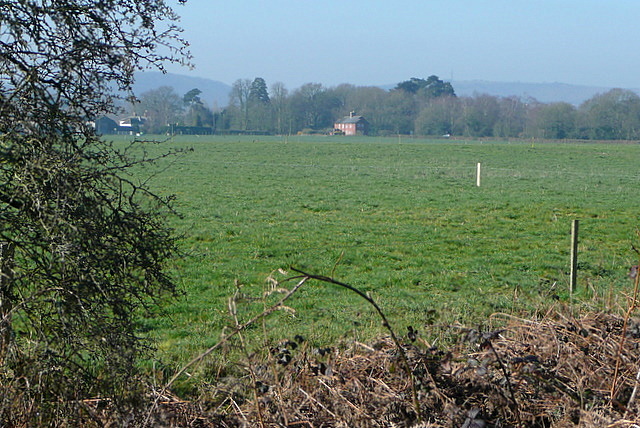
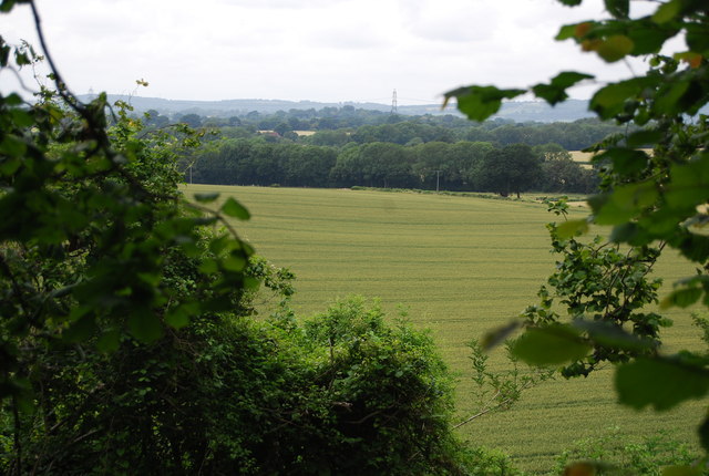
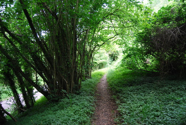
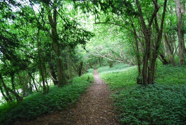
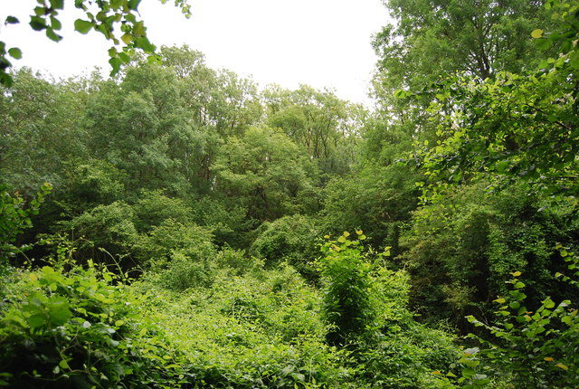
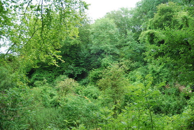
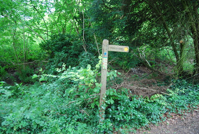
Goff's Plantation is a picturesque woodland located in Sussex, England. Spread over a vast area, it is renowned for its rich biodiversity and stunning natural beauty. The plantation is nestled within the heart of the Sussex countryside and provides a peaceful retreat for nature enthusiasts and walkers alike.

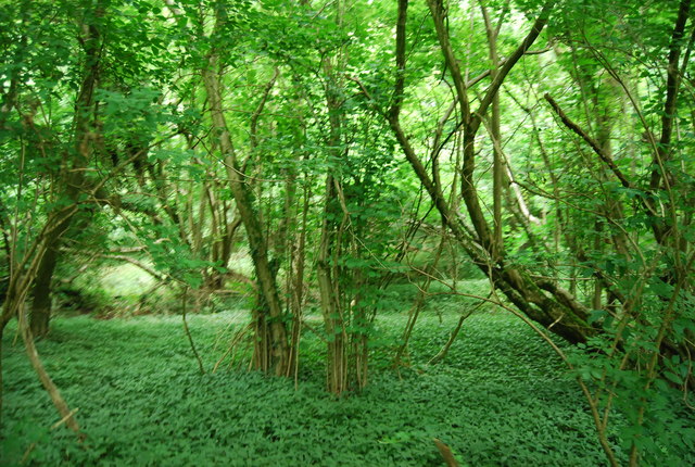
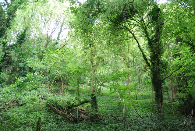
The woodland is predominantly composed of oak, beech, and birch trees, which form a dense canopy overhead, creating a serene and tranquil atmosphere. The towering trees provide shelter to a diverse range of wildlife, including various bird species, squirrels, and small mammals.

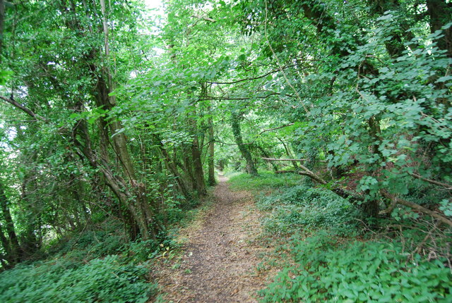
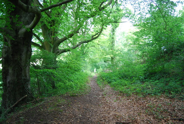
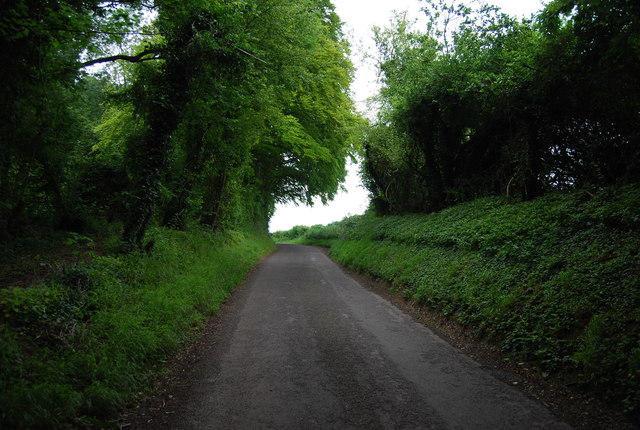
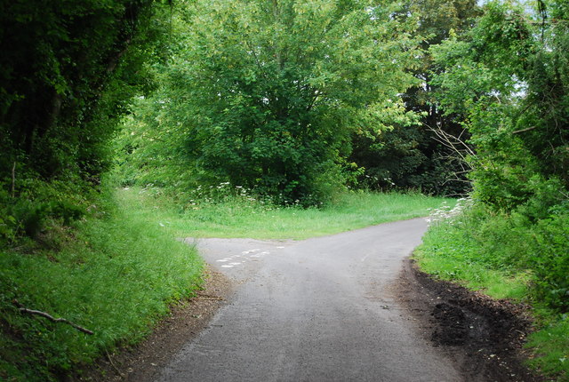
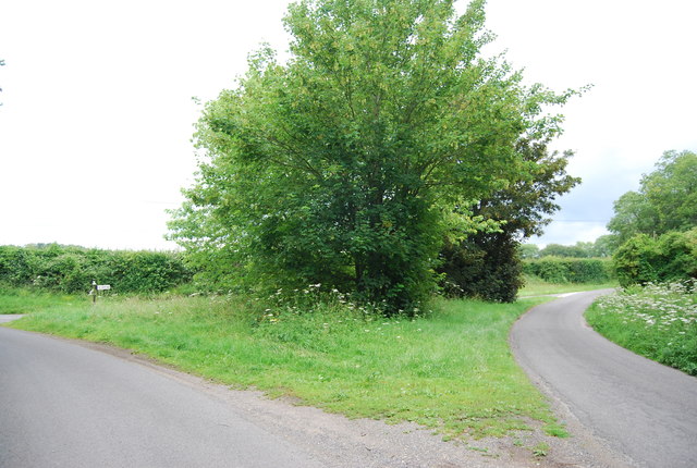
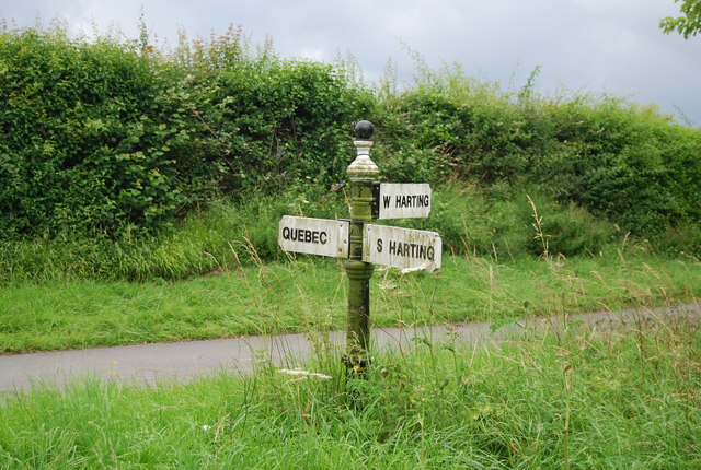
Visitors to Goff's Plantation can explore the numerous walking trails that wind through the dense forest. These trails offer breathtaking views of the surrounding landscape, with glimpses of wildflowers and vibrant ferns lining the paths. The plantation is also home to a small stream that meanders through the woodland, adding to its natural charm.

Goff's Plantation is a popular destination for those seeking to immerse themselves in nature. Its idyllic setting provides opportunities for activities such as birdwatching, photography, and picnicking. The plantation is well-maintained, with designated rest areas and benches strategically placed along the trails.

Managed by local conservation authorities, Goff's Plantation is an important site for environmental preservation and education. It serves as a valuable habitat for native flora and fauna, contributing to the overall biodiversity of the region.

Overall, Goff's Plantation is a hidden gem in Sussex, offering a serene and enchanting experience for nature lovers and providing a valuable sanctuary for the local wildlife.

If you have any feedback on the listing, please let us know in the comments section below.

Goff's Plantation Images

Images are sourced within 2km of 50.992144/-0.90181384 or Grid Reference SU7721. Thanks to Geograph Open Source API. All images are credited.

The Heath I had a meeting at East Hampshire District Council offices, and as I was early I took the opportunity of revisiting The Heath, my playground when I was a child.  No time for a walk but it looked inviting on a sunny spring day.  I see the cricket pitch is still there in the background.
The Heath
I had a meeting at East Hampshire District Council offices, and as I was early I took the opportunity of revisiting The Heath, my playground when I was a child. No time for a walk but it looked inviting on a sunny spring day. I see the cricket pitch is still there in the background.
View from Rival Moor Road The road to the East Hampshire District Council Offices at Penns Place goes along the edge of the housing.  To the south the view is across open farmland towards a solitary house at the southern end of Heath Road East.  I lived within 400 metres of here as a child so this visit, for a meeting, took me back.
View from Rival Moor Road
The road to the East Hampshire District Council Offices at Penns Place goes along the edge of the housing. To the south the view is across open farmland towards a solitary house at the southern end of Heath Road East. I lived within 400 metres of here as a child so this visit, for a meeting, took me back.
Farmland, Torberry Farm
Little Torberry Plantation
Sussex Border Path The Sussex Border Path is a footpath route nearly 150 miles long around the inland boundary of the county of Sussex. The county owes its origins to the kingdom of the South Saxons and can claim to have one of the longest inland county boundaries from Emsworth to Rye. The route was devised in 1983 and is well signed along most of the route. Website <span class="nowrap"><a title="http://www.sussexborderpath.co.uk/" rel="nofollow ugc noopener" href="http://www.sussexborderpath.co.uk/">Link</a><img style="margin-left:2px;" alt="External link" title="External link - shift click to open in new window" src="https://s1.geograph.org.uk/img/external.png" width="10" height="10"/></span> 
Map: <a title="https://www.geograph.org.uk/search.php?i=40140109&page=1&displayclass=map#i=40140109&page=1&displayclass=map&zoom=2&lat=51.03263&lon=-0.05427&layers=FTTB00000000000T" href="https://www.geograph.org.uk/search.php?i=40140109&page=1&displayclass=map#i=40140109&page=1&displayclass=map&zoom=2&lat=51.03263&lon=-0.05427&layers=FTTB00000000000T">Link</a>
Sussex Border Path
The Sussex Border Path is a footpath route nearly 150 miles long around the inland boundary of the county of Sussex. The county owes its origins to the kingdom of the South Saxons and can claim to have one of the longest inland county boundaries from Emsworth to Rye. The route was devised in 1983 and is well signed along most of the route. Website LinkExternal link Map: Link
Sussex Border Path in Torberry Copse
Woodland Torberry Hill
Sussex Border Path The Sussex Border Path is a footpath route nearly 150 miles long around the inland boundary of the county of Sussex. The county owes its origins to the kingdom of the South Saxons and can claim to have one of the longest inland county boundaries from Emsworth to Rye. The route was devised in 1983 and is well signed along most of the route. Website <span class="nowrap"><a title="http://www.sussexborderpath.co.uk/" rel="nofollow ugc noopener" href="http://www.sussexborderpath.co.uk/">Link</a><img style="margin-left:2px;" alt="External link" title="External link - shift click to open in new window" src="https://s1.geograph.org.uk/img/external.png" width="10" height="10"/></span> 
Map: <a title="https://www.geograph.org.uk/search.php?i=40140109&page=1&displayclass=map#i=40140109&page=1&displayclass=map&zoom=2&lat=51.03263&lon=-0.05427&layers=FTTB00000000000T" href="https://www.geograph.org.uk/search.php?i=40140109&page=1&displayclass=map#i=40140109&page=1&displayclass=map&zoom=2&lat=51.03263&lon=-0.05427&layers=FTTB00000000000T">Link</a>
Sussex Border Path
The Sussex Border Path is a footpath route nearly 150 miles long around the inland boundary of the county of Sussex. The county owes its origins to the kingdom of the South Saxons and can claim to have one of the longest inland county boundaries from Emsworth to Rye. The route was devised in 1983 and is well signed along most of the route. Website LinkExternal link Map: Link
Wooded Torberry Hill
Sussex Border Path The Sussex Border Path is a footpath route nearly 150 miles long around the inland boundary of the county of Sussex. The county owes its origins to the kingdom of the South Saxons and can claim to have one of the longest inland county boundaries from Emsworth to Rye. The route was devised in 1983 and is well signed along most of the route. Website <span class="nowrap"><a title="http://www.sussexborderpath.co.uk/" rel="nofollow ugc noopener" href="http://www.sussexborderpath.co.uk/">Link</a><img style="margin-left:2px;" alt="External link" title="External link - shift click to open in new window" src="https://s1.geograph.org.uk/img/external.png" width="10" height="10"/></span> 
Map: <a title="https://www.geograph.org.uk/search.php?i=40140109&page=1&displayclass=map#i=40140109&page=1&displayclass=map&zoom=2&lat=51.03263&lon=-0.05427&layers=FTTB00000000000T" href="https://www.geograph.org.uk/search.php?i=40140109&page=1&displayclass=map#i=40140109&page=1&displayclass=map&zoom=2&lat=51.03263&lon=-0.05427&layers=FTTB00000000000T">Link</a>
Sussex Border Path
The Sussex Border Path is a footpath route nearly 150 miles long around the inland boundary of the county of Sussex. The county owes its origins to the kingdom of the South Saxons and can claim to have one of the longest inland county boundaries from Emsworth to Rye. The route was devised in 1983 and is well signed along most of the route. Website LinkExternal link Map: Link
Woodland on Torberry Hill
Lane south of Canada Corner
Signpost, Sussex Border Path
Approaching Canada Corner
Canada Corner
Canada Corner
Road sign, Canada Corner
Gated track
Gated track
Lane to Quebec
Lane to Quebec
Show me another place!

Goff's Plantation is located at Grid Ref: SU7721 (Lat: 50.992144, Lng: -0.90181384)

Administrative County: West Sussex

District: Chichester

Police Authority: Sussex

What 3 Words

///clots.dish.jolt. Near Petersfield, Hampshire

Related Wikis

Nursted

Nursted is a hamlet in the East Hampshire district of Hampshire, England. It is in the civil parish of Buriton. It is 1.8 miles (2.7 km) southeast of...

West Harting

West Harting is a hamlet in the Chichester district of West Sussex, England. At the 2011 Census the population of the hamlet was included in the civil...

Dureford Abbey

Dureford Abbey, in Sussex, England, was a Premonstratensian monastery. It was founded by Henry Hussey who in 1161 granted land to the abbot of Welbeck...

East Hampshire

East Hampshire is a local government district in Hampshire, England. Its council is based in the town of Petersfield, although the largest town is Alton...

Nearby Amenities

Located within 500m of 50.992144,-0.90181384
Power: tower
Ref: 4VF 41
Source: bing
Source Ref: extrapolation
Lat/Long: 50.9911526/-0.9020909
Power: tower
Ref: 4VF 42
Source: bing
Source Ref: extrapolation
Lat/Long: 50.9915264/-0.8964162
Power: tower
Ref: 4VF 40
Source: bing
Source Ref: extrapolation
Lat/Long: 50.9907131/-0.9076854
Barrier: stile
Lat/Long: 50.9911104/-0.907532
The data included in this document is from www.openstreetmap.org. The data is made available under ODbL.

Have you been to Goff's Plantation?

Leave your review of Goff's Plantation below (or comments, questions and feedback).