Radbrook's Copse

Wood, Forest in Oxfordshire South Oxfordshire

England

Radbrook's Copse

Bottle and Glass pub
Bottle and Glass pub Credit: Matthew Chadwick

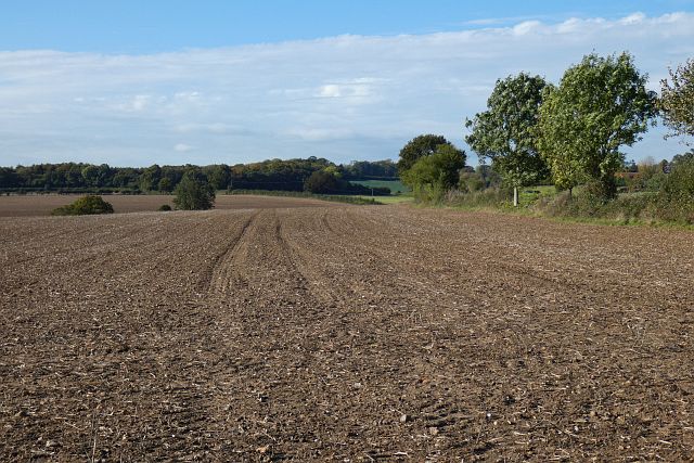
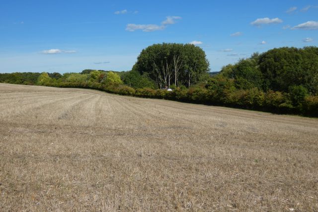
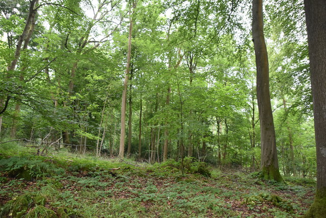
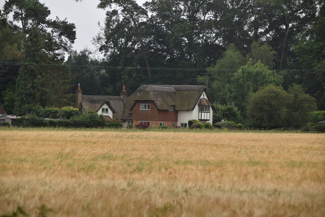
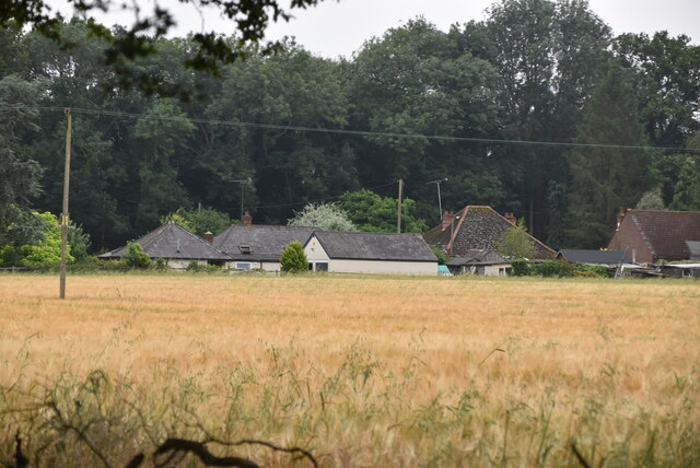
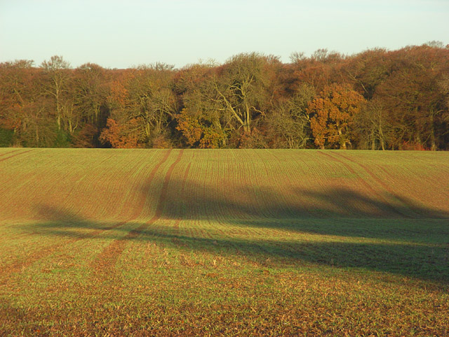
Radbrook's Copse is a beautiful woodland located in Oxfordshire, England. Covering an area of approximately 50 acres, it is nestled in the heart of the county and is a haven for nature enthusiasts and outdoor adventurers alike.

The copse is characterized by its diverse range of tree species, including oak, beech, and birch, creating a rich tapestry of colors throughout the seasons. The woodland floor is carpeted with an array of wildflowers, such as bluebells and primroses, adding to the charm and beauty of the area.

Tranquil walking trails wind their way through Radbrook's Copse, providing visitors with the opportunity to explore and immerse themselves in the natural surroundings. These pathways offer stunning vistas and are lined with benches, allowing visitors to pause and take in the breathtaking scenery.

The copse is home to a variety of wildlife, making it a haven for birdwatchers and nature photographers. Visitors may spot species such as woodpeckers, owls, and deer, adding to the enchantment of the woodland experience.

Radbrook's Copse is not only a place of natural beauty but also a site of historical significance. It is believed to have been an ancient woodland for centuries, with remnants of old boundary ditches and earthworks still visible today.

Managed by local authorities, the copse is carefully maintained to preserve its ecological balance and ensure the protection of its unique flora and fauna. It is open to the public year-round, providing a serene and peaceful retreat for those seeking solace in nature.

If you have any feedback on the listing, please let us know in the comments section below.

Radbrook's Copse Images

Images are sourced within 2km of 51.493766/-0.92606184 or Grid Reference SU7477. Thanks to Geograph Open Source API. All images are credited.

Bottle and Glass pub
Farmland, Shiplake Arable land beside the Henley Road with Ash Copse seen beyond Hampstead Bottom.
Farmland, Shiplake
Arable land beside the Henley Road with Ash Copse seen beyond Hampstead Bottom.
Farmland, Dunsden A large field of barley beside Foxhill Lane and occupying the land between Playhatch to the south and Littlestead and Dunsden Greens to the north.
Farmland, Dunsden
A large field of barley beside Foxhill Lane and occupying the land between Playhatch to the south and Littlestead and Dunsden Greens to the north.
Farmland, Dunsden
Farmland, Dunsden
Farmland, Dunsden
Farmland, Dunsden
Farmland, Dunsden
Farmland, Dunsden
Bones Wood
Bones Wood
Bones Wood
Bones Wood
Chiltern Way Created by the Chiltern Society as its Millennium Project, the Way originally took in all of the Chilterns from north to south across the Chilterns Area of Outstanding Natural Beauty, in a 125-miles circuit extending from Ewelme in the south west, Chorleywood in the south east and Sharpenhoe Clappers and Great Offley in the north east. It was based on an earlier unofficial route, the Chiltern Hundred.
The Way passes through some of the most attractive parts of the Chilterns, including the Bovingdon Plateau, the Chess valley, the Misbourne valley, Penn Country, the Hambleden valley, Stonor Park, Ewelme, Swyncombe Down, Bledlow Ridge, Hampden Country, Bulbourne valley and Dunstable Down.
The original 200km (125 miles) Way took in Hemel via Chalfont St Giles, the edge of Marlow, Hambleden, Bix Bottom, Ewelme, the Ridgeway, Stokenchurch, Great Hampden, Aldbury, the Dunstable Downs, Sharpenhoe Clappers and Harpenden.
Two extensions have been added in 2003: the southern adds a loop of 50km (35 miles) from Bix Bottom via Mapledurham on the Thames and the northern extension 44km (27 miles) from Sharpenhoe Clappers via the Icknield Way and the outskirts of Hitchin. A short cut from Bix Bottom creates a 16km (10 miles) loop via Ewelme.
Although officially starting at Hemel Hempstead Station, the walk can be started at many other places on the route. The Way also has links with other routes including Chiltern Heritage Trail, Ridgeway National Trail, Icknield Way Path, Oxfordshire, Swan's and South Bucks Ways and Grand Union Canal, Lea Valley and Chess Valley Walks.
Chiltern Way
Created by the Chiltern Society as its Millennium Project, the Way originally took in all of the Chilterns from north to south across the Chilterns Area of Outstanding Natural Beauty, in a 125-miles circuit extending from Ewelme in the south west, Chorleywood in the south east and Sharpenhoe Clappers and Great Offley in the north east. It was based on an earlier unofficial route, the Chiltern Hundred. The Way passes through some of the most attractive parts of the Chilterns, including the Bovingdon Plateau, the Chess valley, the Misbourne valley, Penn Country, the Hambleden valley, Stonor Park, Ewelme, Swyncombe Down, Bledlow Ridge, Hampden Country, Bulbourne valley and Dunstable Down. The original 200km (125 miles) Way took in Hemel via Chalfont St Giles, the edge of Marlow, Hambleden, Bix Bottom, Ewelme, the Ridgeway, Stokenchurch, Great Hampden, Aldbury, the Dunstable Downs, Sharpenhoe Clappers and Harpenden. Two extensions have been added in 2003: the southern adds a loop of 50km (35 miles) from Bix Bottom via Mapledurham on the Thames and the northern extension 44km (27 miles) from Sharpenhoe Clappers via the Icknield Way and the outskirts of Hitchin. A short cut from Bix Bottom creates a 16km (10 miles) loop via Ewelme. Although officially starting at Hemel Hempstead Station, the walk can be started at many other places on the route. The Way also has links with other routes including Chiltern Heritage Trail, Ridgeway National Trail, Icknield Way Path, Oxfordshire, Swan's and South Bucks Ways and Grand Union Canal, Lea Valley and Chess Valley Walks.
Bones Wood
Bones Wood
Bones Wood
Bones Wood
Chiltern Way Created by the Chiltern Society as its Millennium Project, the Way originally took in all of the Chilterns from north to south across the Chilterns Area of Outstanding Natural Beauty, in a 125-miles circuit extending from Ewelme in the south west, Chorleywood in the south east and Sharpenhoe Clappers and Great Offley in the north east. It was based on an earlier unofficial route, the Chiltern Hundred.
The Way passes through some of the most attractive parts of the Chilterns, including the Bovingdon Plateau, the Chess valley, the Misbourne valley, Penn Country, the Hambleden valley, Stonor Park, Ewelme, Swyncombe Down, Bledlow Ridge, Hampden Country, Bulbourne valley and Dunstable Down.
The original 200km (125 miles) Way took in Hemel via Chalfont St Giles, the edge of Marlow, Hambleden, Bix Bottom, Ewelme, the Ridgeway, Stokenchurch, Great Hampden, Aldbury, the Dunstable Downs, Sharpenhoe Clappers and Harpenden.
Two extensions have been added in 2003: the southern adds a loop of 50km (35 miles) from Bix Bottom via Mapledurham on the Thames and the northern extension 44km (27 miles) from Sharpenhoe Clappers via the Icknield Way and the outskirts of Hitchin. A short cut from Bix Bottom creates a 16km (10 miles) loop via Ewelme.
Although officially starting at Hemel Hempstead Station, the walk can be started at many other places on the route. The Way also has links with other routes including Chiltern Heritage Trail, Ridgeway National Trail, Icknield Way Path, Oxfordshire, Swan's and South Bucks Ways and Grand Union Canal, Lea Valley and Chess Valley Walks.
Chiltern Way
Created by the Chiltern Society as its Millennium Project, the Way originally took in all of the Chilterns from north to south across the Chilterns Area of Outstanding Natural Beauty, in a 125-miles circuit extending from Ewelme in the south west, Chorleywood in the south east and Sharpenhoe Clappers and Great Offley in the north east. It was based on an earlier unofficial route, the Chiltern Hundred. The Way passes through some of the most attractive parts of the Chilterns, including the Bovingdon Plateau, the Chess valley, the Misbourne valley, Penn Country, the Hambleden valley, Stonor Park, Ewelme, Swyncombe Down, Bledlow Ridge, Hampden Country, Bulbourne valley and Dunstable Down. The original 200km (125 miles) Way took in Hemel via Chalfont St Giles, the edge of Marlow, Hambleden, Bix Bottom, Ewelme, the Ridgeway, Stokenchurch, Great Hampden, Aldbury, the Dunstable Downs, Sharpenhoe Clappers and Harpenden. Two extensions have been added in 2003: the southern adds a loop of 50km (35 miles) from Bix Bottom via Mapledurham on the Thames and the northern extension 44km (27 miles) from Sharpenhoe Clappers via the Icknield Way and the outskirts of Hitchin. A short cut from Bix Bottom creates a 16km (10 miles) loop via Ewelme. Although officially starting at Hemel Hempstead Station, the walk can be started at many other places on the route. The Way also has links with other routes including Chiltern Heritage Trail, Ridgeway National Trail, Icknield Way Path, Oxfordshire, Swan's and South Bucks Ways and Grand Union Canal, Lea Valley and Chess Valley Walks.
Barn Grounds
Barn Grounds
Wheat field
Wheat field
Bones Lane Created by the Chiltern Society as its Millennium Project, the Way originally took in all of the Chilterns from north to south across the Chilterns Area of Outstanding Natural Beauty, in a 125-miles circuit extending from Ewelme in the south west, Chorleywood in the south east and Sharpenhoe Clappers and Great Offley in the north east. It was based on an earlier unofficial route, the Chiltern Hundred.
The Way passes through some of the most attractive parts of the Chilterns, including the Bovingdon Plateau, the Chess valley, the Misbourne valley, Penn Country, the Hambleden valley, Stonor Park, Ewelme, Swyncombe Down, Bledlow Ridge, Hampden Country, Bulbourne valley and Dunstable Down.
The original 200km (125 miles) Way took in Hemel via Chalfont St Giles, the edge of Marlow, Hambleden, Bix Bottom, Ewelme, the Ridgeway, Stokenchurch, Great Hampden, Aldbury, the Dunstable Downs, Sharpenhoe Clappers and Harpenden.
Two extensions have been added in 2003: the southern adds a loop of 50km (35 miles) from Bix Bottom via Mapledurham on the Thames and the northern extension 44km (27 miles) from Sharpenhoe Clappers via the Icknield Way and the outskirts of Hitchin. A short cut from Bix Bottom creates a 16km (10 miles) loop via Ewelme.
Although officially starting at Hemel Hempstead Station, the walk can be started at many other places on the route. The Way also has links with other routes including Chiltern Heritage Trail, Ridgeway National Trail, Icknield Way Path, Oxfordshire, Swan's and South Bucks Ways and Grand Union Canal, Lea Valley and Chess Valley Walks.
Bones Lane
Created by the Chiltern Society as its Millennium Project, the Way originally took in all of the Chilterns from north to south across the Chilterns Area of Outstanding Natural Beauty, in a 125-miles circuit extending from Ewelme in the south west, Chorleywood in the south east and Sharpenhoe Clappers and Great Offley in the north east. It was based on an earlier unofficial route, the Chiltern Hundred. The Way passes through some of the most attractive parts of the Chilterns, including the Bovingdon Plateau, the Chess valley, the Misbourne valley, Penn Country, the Hambleden valley, Stonor Park, Ewelme, Swyncombe Down, Bledlow Ridge, Hampden Country, Bulbourne valley and Dunstable Down. The original 200km (125 miles) Way took in Hemel via Chalfont St Giles, the edge of Marlow, Hambleden, Bix Bottom, Ewelme, the Ridgeway, Stokenchurch, Great Hampden, Aldbury, the Dunstable Downs, Sharpenhoe Clappers and Harpenden. Two extensions have been added in 2003: the southern adds a loop of 50km (35 miles) from Bix Bottom via Mapledurham on the Thames and the northern extension 44km (27 miles) from Sharpenhoe Clappers via the Icknield Way and the outskirts of Hitchin. A short cut from Bix Bottom creates a 16km (10 miles) loop via Ewelme. Although officially starting at Hemel Hempstead Station, the walk can be started at many other places on the route. The Way also has links with other routes including Chiltern Heritage Trail, Ridgeway National Trail, Icknield Way Path, Oxfordshire, Swan's and South Bucks Ways and Grand Union Canal, Lea Valley and Chess Valley Walks.
Barley
Barley
Fir Tree Cottage
Fir Tree Cottage
Ripening crops
Ripening crops
Show me another place!

Radbrook's Copse is located at Grid Ref: SU7477 (Lat: 51.493766, Lng: -0.92606184)

Administrative County: Oxfordshire

District: South Oxfordshire

Police Authority: Thames Valley

What 3 Words

///expose.ducks.impact. Near Sonning, Berkshire

Related Wikis

Holmwood, Binfield Heath

Holmwood is a country house in the village of Binfield Heath in Oxfordshire, England. It is situated on Shiplake Row in the village of Binfield Heath near...

Dunsden Green

Dunsden Green or Dunsden is a village in the civil parish of Eye & Dunsden in the South Oxfordshire ward of Sonning Common, about 3 miles (5 km) northeast...

Eye and Dunsden

Eye and Dunsden is a largely rural civil parish in the most southern part of the English county of Oxfordshire. It includes the villages of Sonning Eye...

Berry Brook

The Berry Brook is a stream close to Sonning Eye in the flood plain of the River Thames, in southern Oxfordshire, England.The stream flows northeast from...

Playhatch

Playhatch (or Play Hatch) is a hamlet in the civil parish of Eye & Dunsden in South Oxfordshire, England, about 2 miles (3.2 km) northeast of Reading,...
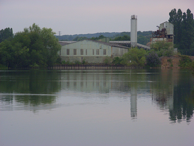
Sonning Works

The Sonning Works are a gravel works owned by Lafarge, located near Sonning Eye, Oxfordshire, England. == Overview == The gravel works is positioned on...

Binfield Heath

Binfield Heath is a village and civil parish in South Oxfordshire, England, 2+1⁄2 miles (4 km) south-southwest of Henley-on-Thames and 3+1⁄2 miles (6 km...

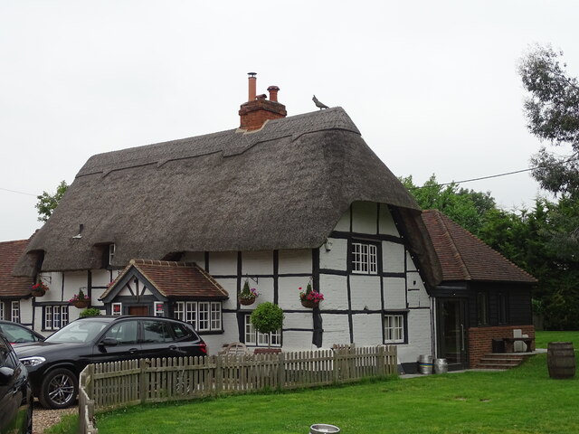
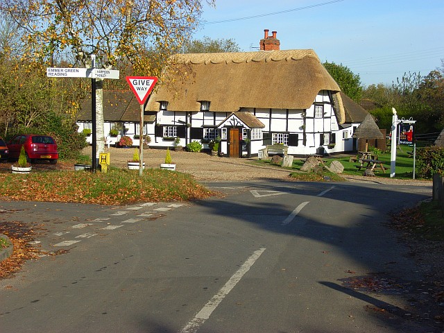
French Horn, Sonning Eye

The French Horn at Sonning is a hotel and restaurant on the banks of the River Thames next to the Sonning Backwater Bridges, at Sonning Eye, Oxfordshire...

Nearby Amenities

Located within 500m of 51.493766,-0.92606184
Bus Stop
Gravel Road
Naptan AtcoCode: 340000094INN
Naptan Bearing: N
Naptan CommonName: Gravel Road
Naptan Indicator: Corner
Naptan Landmark: Opp Bus Shelter
Naptan NaptanCode: oxfamtaj
Naptan Street: Village Road
Naptan Verified: no
Source: naptan_import
Lat/Long: 51.4955631/-0.9310224
Bus Stop
Gravel Road
Naptan AtcoCode: 340000094OPP
Naptan Bearing: S
Naptan CommonName: Gravel Road
Naptan Indicator: Opposite
Naptan Landmark: Bus Shelter
Naptan NaptanCode: oxfawmpg
Naptan Street: Village Road
Naptan Verified: no
Shelter: yes
Source: naptan_import
Lat/Long: 51.4957235/-0.9308602
Post Box
Operator: Royal Mail
Ref: RG9 23
Lat/Long: 51.4967693/-0.9305613
The data included in this document is from www.openstreetmap.org. The data is made available under ODbL.

Have you been to Radbrook's Copse?

Leave your review of Radbrook's Copse below (or comments, questions and feedback).