St John's Copse

Wood, Forest in Berkshire

England

St John's Copse

A327 Bridge, M4 The M4 is 190 miles long and runs from London to South Wales. Major centres close to the motorway include Reading, Swindon, Bristol, Newport, Cardiff and Swansea. The motorway was constructed between 1961 and 1996. The M4 originally crossed the first Severn Road Bridge. It has now been diverted to use the Second Severn Crossing and the motorway over the older bridge has been renumbered as M48.
Wikipedia: <span class="nowrap"><a title="http://en.wikipedia.org/wiki/M4_motorway" rel="nofollow ugc noopener" href="http://en.wikipedia.org/wiki/M4_motorway">Link</a><img style="margin-left:2px;" alt="External link" title="External link - shift click to open in new window" src="https://s1.geograph.org.uk/img/external.png" width="10" height="10"/></span>
A327 Bridge, M4 Credit: N Chadwick

St John's Copse, located in Berkshire, is a picturesque woodland area that offers a tranquil escape from the bustling city life. Covering an area of approximately 50 acres, this beautiful copse is a haven for nature enthusiasts and those seeking solace amidst nature's embrace.

The copse is predominantly composed of native deciduous trees, including oak, beech, and birch, which create a stunning tapestry of colors during the autumn months. The forest floor is adorned with a rich diversity of flora, including bluebells, wild garlic, and wood sorrel, adding to the copse's natural charm.

A network of well-maintained footpaths winds through St John's Copse, allowing visitors to explore the woodlands at their own pace. The trails meander through sun-dappled glades, alongside babbling brooks, and up gentle inclines, offering breathtaking views of the surrounding countryside. Birdsong fills the air, and lucky visitors may catch a glimpse of red kites soaring overhead or deer grazing among the trees.

St John's Copse is not only a natural sanctuary but also a site of historical significance. The copse is believed to have been used as a hiding place for Catholic priests during the religious persecutions of the 16th and 17th centuries, hence its name. Remnants of a small chapel can still be found within the copse, serving as a reminder of its past.

With its idyllic scenery and rich history, St John's Copse is a cherished gem in Berkshire. Whether visitors seek a peaceful walk, a picnic spot, or a glimpse into the region's past, this woodland sanctuary offers an escape into the beauty of nature.

If you have any feedback on the listing, please let us know in the comments section below.

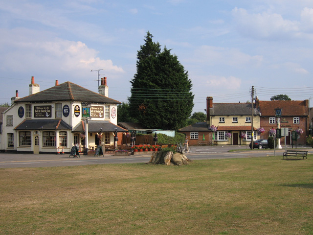
St John's Copse Images

Images are sourced within 2km of 51.416067/-0.92903364 or Grid Reference SU7469. Thanks to Geograph Open Source API. All images are credited.

A327 Bridge, M4 The M4 is 190 miles long and runs from London to South Wales. Major centres close to the motorway include Reading, Swindon, Bristol, Newport, Cardiff and Swansea. The motorway was constructed between 1961 and 1996. The M4 originally crossed the first Severn Road Bridge. It has now been diverted to use the Second Severn Crossing and the motorway over the older bridge has been renumbered as M48.
Wikipedia: <span class="nowrap"><a title="http://en.wikipedia.org/wiki/M4_motorway" rel="nofollow ugc noopener" href="http://en.wikipedia.org/wiki/M4_motorway">Link</a><img style="margin-left:2px;" alt="External link" title="External link - shift click to open in new window" src="https://s1.geograph.org.uk/img/external.png" width="10" height="10"/></span>
A327 Bridge, M4
The M4 is 190 miles long and runs from London to South Wales. Major centres close to the motorway include Reading, Swindon, Bristol, Newport, Cardiff and Swansea. The motorway was constructed between 1961 and 1996. The M4 originally crossed the first Severn Road Bridge. It has now been diverted to use the Second Severn Crossing and the motorway over the older bridge has been renumbered as M48. Wikipedia: LinkExternal link
Deer for 41 miles! The M4 is 190 miles long and runs from London to South Wales. Major centres close to the motorway include Reading, Swindon, Bristol, Newport, Cardiff and Swansea. The motorway was constructed between 1961 and 1996. The M4 originally crossed the first Severn Road Bridge. It has now been diverted to use the Second Severn Crossing and the motorway over the older bridge has been renumbered as M48.
Wikipedia: <span class="nowrap"><a title="http://en.wikipedia.org/wiki/M4_motorway" rel="nofollow ugc noopener" href="http://en.wikipedia.org/wiki/M4_motorway">Link</a><img style="margin-left:2px;" alt="External link" title="External link - shift click to open in new window" src="https://s1.geograph.org.uk/img/external.png" width="10" height="10"/></span>
Deer for 41 miles!
The M4 is 190 miles long and runs from London to South Wales. Major centres close to the motorway include Reading, Swindon, Bristol, Newport, Cardiff and Swansea. The motorway was constructed between 1961 and 1996. The M4 originally crossed the first Severn Road Bridge. It has now been diverted to use the Second Severn Crossing and the motorway over the older bridge has been renumbered as M48. Wikipedia: LinkExternal link
Bridge over the M4 The M4 is 190 miles long and runs from London to South Wales. Major centres close to the motorway include Reading, Swindon, Bristol, Newport, Cardiff and Swansea. The motorway was constructed between 1961 and 1996. The M4 originally crossed the first Severn Road Bridge. It has now been diverted to use the Second Severn Crossing and the motorway over the older bridge has been renumbered as M48.
Wikipedia: <span class="nowrap"><a title="http://en.wikipedia.org/wiki/M4_motorway" rel="nofollow ugc noopener" href="http://en.wikipedia.org/wiki/M4_motorway">Link</a><img style="margin-left:2px;" alt="External link" title="External link - shift click to open in new window" src="https://s1.geograph.org.uk/img/external.png" width="10" height="10"/></span>
Bridge over the M4
The M4 is 190 miles long and runs from London to South Wales. Major centres close to the motorway include Reading, Swindon, Bristol, Newport, Cardiff and Swansea. The motorway was constructed between 1961 and 1996. The M4 originally crossed the first Severn Road Bridge. It has now been diverted to use the Second Severn Crossing and the motorway over the older bridge has been renumbered as M48. Wikipedia: LinkExternal link
A327 Bridge, M4 The M4 is 190 miles long and runs from London to South Wales. Major centres close to the motorway include Reading, Swindon, Bristol, Newport, Cardiff and Swansea. The motorway was constructed between 1961 and 1996. The M4 originally crossed the first Severn Road Bridge. It has now been diverted to use the Second Severn Crossing and the motorway over the older bridge has been renumbered as M48.
Wikipedia: <span class="nowrap"><a title="http://en.wikipedia.org/wiki/M4_motorway" rel="nofollow ugc noopener" href="http://en.wikipedia.org/wiki/M4_motorway">Link</a><img style="margin-left:2px;" alt="External link" title="External link - shift click to open in new window" src="https://s1.geograph.org.uk/img/external.png" width="10" height="10"/></span>
A327 Bridge, M4
The M4 is 190 miles long and runs from London to South Wales. Major centres close to the motorway include Reading, Swindon, Bristol, Newport, Cardiff and Swansea. The motorway was constructed between 1961 and 1996. The M4 originally crossed the first Severn Road Bridge. It has now been diverted to use the Second Severn Crossing and the motorway over the older bridge has been renumbered as M48. Wikipedia: LinkExternal link
Roundabout on Reading Road, Shinfield At the B3270 junction just beyond the M4 crossing.
Roundabout on Reading Road, Shinfield
At the B3270 junction just beyond the M4 crossing.
Houses on Reading Road, Shinfield
The A327 Arborfield Road
Reading Road, Arborfield
Layby on Reading Road, Arborfield
St Bartholomew, Arborfield: early June 2016
Shinfield Baptist Church: early June 2016 Baptists form a major branch of Evangelical Christianity distinguished by baptizing professing  believers only, as opposed to infant baptism; and doing so by complete immersion.  Their history dates back to the early 17th century.  
In the 18th and 19th centuries, the First and Second Great Awakenings increased church membership in the United States. Baptist missionaries have spread their faith to every continent. Today there are a 100 million Baptists worldwide.
Shinfield Baptist Church: early June 2016
Baptists form a major branch of Evangelical Christianity distinguished by baptizing professing believers only, as opposed to infant baptism; and doing so by complete immersion. Their history dates back to the early 17th century. In the 18th and 19th centuries, the First and Second Great Awakenings increased church membership in the United States. Baptist missionaries have spread their faith to every continent. Today there are a 100 million Baptists worldwide.
St Mary the Virgin, Shinfield: early June 2016
St Mary the Virgin, Shinfield: seat
St Mary the Virgin, Shinfield: gravestones
Path from Church Lane to Deardon Way, Shinfield
Church Lane, Shinfield
St Mary's Church Hall, Shinfield
Path from Church Lane to Deardon Way, Shinfield
Show me another place!

St John's Copse is located at Grid Ref: SU7469 (Lat: 51.416067, Lng: -0.92903364)

Unitary Authority: Wokingham

Police Authority: Thames Valley

What 3 Words

///horns.became.honest. Near Lower Earley, Berkshire

Related Wikis

Lower Earley

Lower Earley is the southern portion of Earley civil parish and a large suburb of Reading, within the English county of Berkshire. It forms part of (along...

International Cocoa Quarantine Centre

The International Cocoa Quarantine Centre (ICQC), located in Arborfield, a suburb of Reading, Berkshire, United Kingdom, is an organization aiming to reduce...
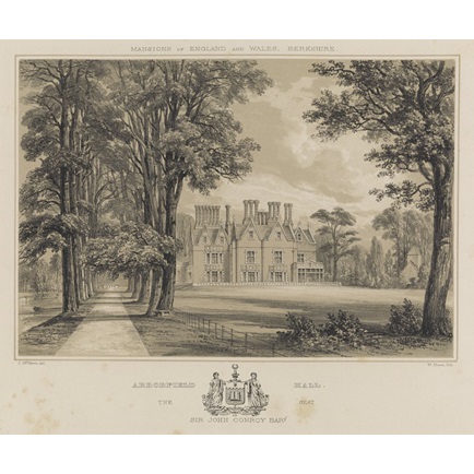
Arborfield Hall

Arborfield Hall was a large country house on the banks of the River Loddon near the village of Arborfield in Berkshire. == History == The site originally...

Arborfield and Newland

Arborfield and Newland is a civil parish in the Wokingham district of Berkshire, England. It had a population of 2,228 according to the 2001 census, increasing...

RAF Shinfield Park

RAF Shinfield Park was a Royal Air Force administrative site in the south of Reading, Berkshire. It served as the Met Office residential training college...

Shinfield

Shinfield is a village and civil parish in the English county of Berkshire, just south of Reading. It contains 4,313 acres (17.45 km2) and is administered...

European Centre for Medium-Range Weather Forecasts

The European Centre for Medium-Range Weather Forecasts (ECMWF) is an independent intergovernmental organisation supported by most of the nations of Europe...

Shire Hall, Shinfield Park

The Shire Hall is a former municipal building at Shinfield Park just south of Reading, Berkshire. It was the headquarters of Berkshire County Council from...

Nearby Amenities

Located within 500m of 51.416067,-0.92903364
Barrier: bollard
Bicycle: yes
Bollard: fixed
Foot: yes
Lat/Long: 51.4197394/-0.9320401
Power: tower
Source: bing;NPE
Lat/Long: 51.4127452/-0.9265115
Power: tower
Source: bing;NPE
Lat/Long: 51.4143178/-0.9249715
Power: tower
Source: bing;NPE
Lat/Long: 51.4155711/-0.9237541
Power: tower
Source: bing;NPE
Lat/Long: 51.4167658/-0.9225906
Barrier: bollard
Bicycle: yes
Bollard: fixed
Foot: yes
Lat/Long: 51.4176569/-0.9334053
Street Lamp
Lamp Model: Philips BGP627
Lamp Type: LED
Light Count: 1
Source: Personal memory
Lat/Long: 51.4202359/-0.9297341
Street Lamp
Lamp Model: Philips BGP627
Lamp Type: LED
Light Count: 1
Source: Personal memory
Lat/Long: 51.4201091/-0.9308612
Street Lamp
Lamp Model: Philips BGP627
Lamp Type: LED
Light Count: 1
Source: Personal memory
Lat/Long: 51.4201801/-0.9302931
Street Lamp
Lamp Model: Philips BGP627
Lamp Type: LED
Light Count: 1
Source: Personal memory
Lat/Long: 51.4200381/-0.9314294
Street Lamp
Lamp Model: Philips BGP627
Lamp Type: LED
Light Count: 1
Source: Personal memory
Lat/Long: 51.4199595/-0.9320087
Street Lamp
Lamp Model: Philips BGP627
Lamp Type: LED
Light Count: 2
Source: Personal memory
Lat/Long: 51.4205076/-0.9284213
Street Lamp
Lamp Model: Philips BGP627
Lamp Type: LED
Light Count: 2
Source: Personal memory
Lat/Long: 51.4204455/-0.9292466
Access: private
Barrier: lift_gate
Maxspeed: 10 mph
Lat/Long: 51.4165943/-0.9339458
Barrier: bollard
Material: concrete
Motor Vehicle: no
Lat/Long: 51.4151763/-0.9359264
Noexit: yes
Lat/Long: 51.4134792/-0.9339854
Barrier: block
Bicycle: designated
Foot: yes
Lat/Long: 51.4175857/-0.9334588
Parking
Lat/Long: 51.4169353/-0.9334375
Generator Method: photovoltaic
Generator Output Electricity: yes
Generator Source: solar
Generator Type: solar_photovoltaic_panel
Power: generator
Lat/Long: 51.4166549/-0.9320013
Parking
Lat/Long: 51.4159874/-0.9358996
The data included in this document is from www.openstreetmap.org. The data is made available under ODbL.

Have you been to St John's Copse?

Leave your review of St John's Copse below (or comments, questions and feedback).