Brown's Green

Downs, Moorland in Berkshire

England

Brown's Green

A327 Bridge, M4 The M4 is 190 miles long and runs from London to South Wales. Major centres close to the motorway include Reading, Swindon, Bristol, Newport, Cardiff and Swansea. The motorway was constructed between 1961 and 1996. The M4 originally crossed the first Severn Road Bridge. It has now been diverted to use the Second Severn Crossing and the motorway over the older bridge has been renumbered as M48.
Wikipedia: <span class="nowrap"><a title="http://en.wikipedia.org/wiki/M4_motorway" rel="nofollow ugc noopener" href="http://en.wikipedia.org/wiki/M4_motorway">Link</a><img style="margin-left:2px;" alt="External link" title="External link - shift click to open in new window" src="https://s1.geograph.org.uk/img/external.png" width="10" height="10"/></span>
A327 Bridge, M4 Credit: N Chadwick

Brown's Green is a picturesque village located in the county of Berkshire, England. Situated amidst the stunning landscape of the Downs and Moorland, this small community offers a tranquil and idyllic setting for residents and visitors alike.

The village is characterized by its charming traditional cottages, which are surrounded by lush green fields and rolling hills. The Downs, with their gently sloping terrain, provide a stunning backdrop to the village, offering breathtaking views of the surrounding countryside.

Nature enthusiasts are drawn to Brown's Green due to its proximity to the Moorland. This vast expanse of open heathland is home to a rich diversity of wildlife, including rare species such as Dartford warblers and sand lizards. Visitors can enjoy leisurely walks or hikes along the well-maintained trails that crisscross the Moorland, providing an opportunity to immerse themselves in the natural beauty of the area.

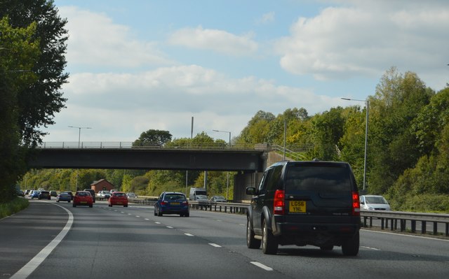
Despite its rural location, Brown's Green benefits from excellent transport links. The village is well-connected to nearby towns and cities, making it an attractive place to live for those who value the peace and tranquility of the countryside but still require easy access to urban amenities.

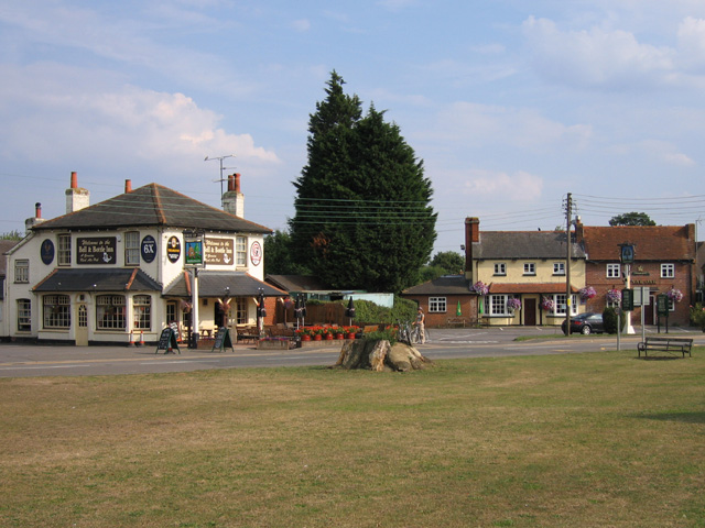
The community spirit in Brown's Green is strong, with regular events and gatherings organized by local residents. The village also boasts a quaint country pub, where locals and visitors can socialize and enjoy traditional British cuisine.

In summary, Brown's Green, Berkshire, is a charming village nestled in the heart of the Downs and Moorland. Its picturesque surroundings, abundant wildlife, and strong community make it a delightful place to live or visit for those seeking respite from the hustle and bustle of city life.

If you have any feedback on the listing, please let us know in the comments section below.

Brown's Green Images

Images are sourced within 2km of 51.416357/-0.93519606 or Grid Reference SU7469. Thanks to Geograph Open Source API. All images are credited.

A327 Bridge, M4 The M4 is 190 miles long and runs from London to South Wales. Major centres close to the motorway include Reading, Swindon, Bristol, Newport, Cardiff and Swansea. The motorway was constructed between 1961 and 1996. The M4 originally crossed the first Severn Road Bridge. It has now been diverted to use the Second Severn Crossing and the motorway over the older bridge has been renumbered as M48.
Wikipedia: <span class="nowrap"><a title="http://en.wikipedia.org/wiki/M4_motorway" rel="nofollow ugc noopener" href="http://en.wikipedia.org/wiki/M4_motorway">Link</a><img style="margin-left:2px;" alt="External link" title="External link - shift click to open in new window" src="https://s1.geograph.org.uk/img/external.png" width="10" height="10"/></span>
A327 Bridge, M4
The M4 is 190 miles long and runs from London to South Wales. Major centres close to the motorway include Reading, Swindon, Bristol, Newport, Cardiff and Swansea. The motorway was constructed between 1961 and 1996. The M4 originally crossed the first Severn Road Bridge. It has now been diverted to use the Second Severn Crossing and the motorway over the older bridge has been renumbered as M48. Wikipedia: LinkExternal link
Footbridge over the M4 The M4 is 190 miles long and runs from London to South Wales. Major centres close to the motorway include Reading, Swindon, Bristol, Newport, Cardiff and Swansea. The motorway was constructed between 1961 and 1996. The M4 originally crossed the first Severn Road Bridge. It has now been diverted to use the Second Severn Crossing and the motorway over the older bridge has been renumbered as M48.
Wikipedia: <span class="nowrap"><a title="http://en.wikipedia.org/wiki/M4_motorway" rel="nofollow ugc noopener" href="http://en.wikipedia.org/wiki/M4_motorway">Link</a><img style="margin-left:2px;" alt="External link" title="External link - shift click to open in new window" src="https://s1.geograph.org.uk/img/external.png" width="10" height="10"/></span>
Footbridge over the M4
The M4 is 190 miles long and runs from London to South Wales. Major centres close to the motorway include Reading, Swindon, Bristol, Newport, Cardiff and Swansea. The motorway was constructed between 1961 and 1996. The M4 originally crossed the first Severn Road Bridge. It has now been diverted to use the Second Severn Crossing and the motorway over the older bridge has been renumbered as M48. Wikipedia: LinkExternal link
Deer for 41 miles! The M4 is 190 miles long and runs from London to South Wales. Major centres close to the motorway include Reading, Swindon, Bristol, Newport, Cardiff and Swansea. The motorway was constructed between 1961 and 1996. The M4 originally crossed the first Severn Road Bridge. It has now been diverted to use the Second Severn Crossing and the motorway over the older bridge has been renumbered as M48.
Wikipedia: <span class="nowrap"><a title="http://en.wikipedia.org/wiki/M4_motorway" rel="nofollow ugc noopener" href="http://en.wikipedia.org/wiki/M4_motorway">Link</a><img style="margin-left:2px;" alt="External link" title="External link - shift click to open in new window" src="https://s1.geograph.org.uk/img/external.png" width="10" height="10"/></span>
Deer for 41 miles!
The M4 is 190 miles long and runs from London to South Wales. Major centres close to the motorway include Reading, Swindon, Bristol, Newport, Cardiff and Swansea. The motorway was constructed between 1961 and 1996. The M4 originally crossed the first Severn Road Bridge. It has now been diverted to use the Second Severn Crossing and the motorway over the older bridge has been renumbered as M48. Wikipedia: LinkExternal link
Bridge over the M4 The M4 is 190 miles long and runs from London to South Wales. Major centres close to the motorway include Reading, Swindon, Bristol, Newport, Cardiff and Swansea. The motorway was constructed between 1961 and 1996. The M4 originally crossed the first Severn Road Bridge. It has now been diverted to use the Second Severn Crossing and the motorway over the older bridge has been renumbered as M48.
Wikipedia: <span class="nowrap"><a title="http://en.wikipedia.org/wiki/M4_motorway" rel="nofollow ugc noopener" href="http://en.wikipedia.org/wiki/M4_motorway">Link</a><img style="margin-left:2px;" alt="External link" title="External link - shift click to open in new window" src="https://s1.geograph.org.uk/img/external.png" width="10" height="10"/></span>
Bridge over the M4
The M4 is 190 miles long and runs from London to South Wales. Major centres close to the motorway include Reading, Swindon, Bristol, Newport, Cardiff and Swansea. The motorway was constructed between 1961 and 1996. The M4 originally crossed the first Severn Road Bridge. It has now been diverted to use the Second Severn Crossing and the motorway over the older bridge has been renumbered as M48. Wikipedia: LinkExternal link
A327 Bridge, M4 The M4 is 190 miles long and runs from London to South Wales. Major centres close to the motorway include Reading, Swindon, Bristol, Newport, Cardiff and Swansea. The motorway was constructed between 1961 and 1996. The M4 originally crossed the first Severn Road Bridge. It has now been diverted to use the Second Severn Crossing and the motorway over the older bridge has been renumbered as M48.
Wikipedia: <span class="nowrap"><a title="http://en.wikipedia.org/wiki/M4_motorway" rel="nofollow ugc noopener" href="http://en.wikipedia.org/wiki/M4_motorway">Link</a><img style="margin-left:2px;" alt="External link" title="External link - shift click to open in new window" src="https://s1.geograph.org.uk/img/external.png" width="10" height="10"/></span>
A327 Bridge, M4
The M4 is 190 miles long and runs from London to South Wales. Major centres close to the motorway include Reading, Swindon, Bristol, Newport, Cardiff and Swansea. The motorway was constructed between 1961 and 1996. The M4 originally crossed the first Severn Road Bridge. It has now been diverted to use the Second Severn Crossing and the motorway over the older bridge has been renumbered as M48. Wikipedia: LinkExternal link
Footbridge over the M4 The M4 is 190 miles long and runs from London to South Wales. Major centres close to the motorway include Reading, Swindon, Bristol, Newport, Cardiff and Swansea. The motorway was constructed between 1961 and 1996. The M4 originally crossed the first Severn Road Bridge. It has now been diverted to use the Second Severn Crossing and the motorway over the older bridge has been renumbered as M48.
Wikipedia: <span class="nowrap"><a title="http://en.wikipedia.org/wiki/M4_motorway" rel="nofollow ugc noopener" href="http://en.wikipedia.org/wiki/M4_motorway">Link</a><img style="margin-left:2px;" alt="External link" title="External link - shift click to open in new window" src="https://s1.geograph.org.uk/img/external.png" width="10" height="10"/></span>
Footbridge over the M4
The M4 is 190 miles long and runs from London to South Wales. Major centres close to the motorway include Reading, Swindon, Bristol, Newport, Cardiff and Swansea. The motorway was constructed between 1961 and 1996. The M4 originally crossed the first Severn Road Bridge. It has now been diverted to use the Second Severn Crossing and the motorway over the older bridge has been renumbered as M48. Wikipedia: LinkExternal link
Roundabout on Reading Road, Shinfield At the B3270 junction just beyond the M4 crossing.
Roundabout on Reading Road, Shinfield
At the B3270 junction just beyond the M4 crossing.
Houses on Reading Road, Shinfield
The A327 Arborfield Road
Reading Road, Arborfield
Layby on Reading Road, Arborfield
Shinfield Baptist Church: early June 2016 Baptists form a major branch of Evangelical Christianity distinguished by baptizing professing  believers only, as opposed to infant baptism; and doing so by complete immersion.  Their history dates back to the early 17th century.  
In the 18th and 19th centuries, the First and Second Great Awakenings increased church membership in the United States. Baptist missionaries have spread their faith to every continent. Today there are a 100 million Baptists worldwide.
Shinfield Baptist Church: early June 2016
Baptists form a major branch of Evangelical Christianity distinguished by baptizing professing believers only, as opposed to infant baptism; and doing so by complete immersion. Their history dates back to the early 17th century. In the 18th and 19th centuries, the First and Second Great Awakenings increased church membership in the United States. Baptist missionaries have spread their faith to every continent. Today there are a 100 million Baptists worldwide.
St Mary the Virgin, Shinfield: early June 2016
St Mary the Virgin, Shinfield: seat
St Mary the Virgin, Shinfield: gravestones
Church Lane, Shinfield
Path from Church Lane to Deardon Way, Shinfield
Church Lane, Shinfield
Show me another place!

Brown's Green is located at Grid Ref: SU7469 (Lat: 51.416357, Lng: -0.93519606)

Unitary Authority: Wokingham

Police Authority: Thames Valley

What 3 Words

///lions.held.sake. Near Shinfield, Berkshire

Related Wikis

Lower Earley

Lower Earley is the southern portion of Earley civil parish and a large suburb of Reading, within the English county of Berkshire. It forms part of (along...
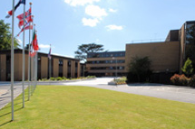
RAF Shinfield Park

RAF Shinfield Park was a Royal Air Force administrative site in the south of Reading, Berkshire. It served as the Met Office residential training college...

European Centre for Medium-Range Weather Forecasts

The European Centre for Medium-Range Weather Forecasts (ECMWF) is an independent intergovernmental organisation supported by most of the nations of Europe...

Shinfield

Shinfield is a village and civil parish in the English county of Berkshire, just south of Reading. It contains 4,313 acres (17.45 km2) and is administered...

International Cocoa Quarantine Centre

The International Cocoa Quarantine Centre (ICQC), located in Arborfield, a suburb of Reading, Berkshire, United Kingdom, is an organization aiming to reduce...
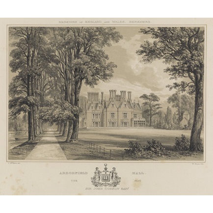
Arborfield Hall

Arborfield Hall was a large country house on the banks of the River Loddon near the village of Arborfield in Berkshire. == History == The site originally...

Shire Hall, Shinfield Park

The Shire Hall is a former municipal building at Shinfield Park just south of Reading, Berkshire. It was the headquarters of Berkshire County Council from...

L'Ortolan

L'Ortolan is a gourmet restaurant in the village of Shinfield, 6 km (4 mi) south of the centre of Reading, Berkshire, England. It is located in the village...

Nearby Amenities

Located within 500m of 51.416357,-0.93519606
Barrier: bollard
Bicycle: yes
Bollard: fixed
Foot: yes
Lat/Long: 51.4197394/-0.9320401
Barrier: kissing_gate
Bicycle: yes
Foot: yes
Lat/Long: 51.4127832/-0.9375883
Barrier: bollard
Bicycle: yes
Bollard: fixed
Foot: yes
Lat/Long: 51.4176569/-0.9334053
Crossing
Bicycle: yes
Crossing: uncontrolled
Crossing Island: yes
Source: survey
Lat/Long: 51.4127635/-0.9394733
Crossing
Bicycle: yes
Crossing: uncontrolled
Crossing Island: yes
Source: survey
Tactile Paving: yes
Lat/Long: 51.4140969/-0.9408996
Crossing
Bicycle: yes
Crossing: uncontrolled
Crossing Island: yes
Source: survey
Tactile Paving: yes
Lat/Long: 51.4140679/-0.9413203
Crossing
Bicycle: yes
Crossing: uncontrolled
Crossing Island: yes
Source: survey
Tactile Paving: yes
Lat/Long: 51.4140588/-0.940812
Crossing
Bicycle: yes
Crossing: uncontrolled
Crossing Island: yes
Source: survey
Tactile Paving: yes
Lat/Long: 51.4137697/-0.9407287
Crossing
Bicycle: yes
Crossing: uncontrolled
Crossing Island: yes
Source: survey
Tactile Paving: yes
Lat/Long: 51.4137151/-0.9408048
Barrier: lift_gate
Locked: no
Lat/Long: 51.4155755/-0.9400147
Street Lamp
Lamp Model: Philips BGP627
Lamp Type: LED
Light Count: 2
Source: Personal memory
Lat/Long: 51.4171247/-0.9422525
Street Lamp
Lamp Model: Philips BGP627
Lamp Type: LED
Light Count: 2
Source: Personal memory
Lat/Long: 51.4173675/-0.9416863
Street Lamp
Lamp Model: Philips BGP627
Lamp Type: LED
Light Count: 2
Source: Personal memory
Lat/Long: 51.4176335/-0.9410563
Street Lamp
Lamp Model: Philips BGP627
Lamp Type: LED
Light Count: 2
Source: Personal memory
Lat/Long: 51.4178711/-0.9404767
Street Lamp
Lamp Model: Philips BGP627
Lamp Type: LED
Light Count: 2
Source: Personal memory
Lat/Long: 51.4181172/-0.9398369
Street Lamp
Lamp Model: Philips BGP627
Lamp Type: LED
Light Count: 2
Source: Personal memory
Lat/Long: 51.4183356/-0.9392368
Street Lamp
Lamp Model: Philips BGP627
Lamp Type: LED
Light Count: 2
Source: Personal memory
Lat/Long: 51.41857/-0.9385807
Street Lamp
Lamp Model: Philips BGP627
Lamp Type: LED
Light Count: 2
Source: Personal memory
Lat/Long: 51.4187666/-0.9379643
Street Lamp
Lamp Model: Philips BGP627
Lamp Type: LED
Light Count: 2
Source: Personal memory
Lat/Long: 51.4189748/-0.9372871
Street Lamp
Lamp Model: Philips BGP627
Lamp Type: LED
Light Count: 2
Source: Personal memory
Lat/Long: 51.4191554/-0.9366637
Street Lamp
Lamp Model: Philips BGP627
Lamp Type: LED
Light Count: 2
Source: Personal memory
Lat/Long: 51.4193185/-0.9360332
Street Lamp
Lamp Model: Philips BGP627
Lamp Type: LED
Light Count: 2
Source: Personal memory
Lat/Long: 51.4194961/-0.9353187
Street Lamp
Lamp Model: Philips BGP627
Lamp Type: LED
Light Count: 2
Source: Personal memory
Lat/Long: 51.4196432/-0.9346742
Street Lamp
Lamp Model: Philips BGP627
Lamp Type: LED
Light Count: 2
Source: Personal memory
Lat/Long: 51.4197801/-0.9340134
Street Lamp
Lamp Model: Philips BGP627
Lamp Type: LED
Light Count: 2
Source: Personal memory
Lat/Long: 51.4202448/-0.9324071
Street Lamp
Lamp Model: Philips BGP627
Lamp Type: LED
Light Count: 1
Source: Personal memory
Lat/Long: 51.420331/-0.9318379
Street Lamp
Lamp Model: Philips BGP627
Lamp Type: LED
Light Count: 1
Source: Personal memory
Lat/Long: 51.4200381/-0.9314294
Street Lamp
Lamp Model: Philips BGP627
Lamp Type: LED
Light Count: 1
Source: Personal memory
Lat/Long: 51.4199595/-0.9320087
Street Lamp
Lamp Model: Philips BGP627
Lamp Type: LED
Light Count: 2
Source: Personal memory
Lat/Long: 51.4200255/-0.9326287
Bus Stop
Bench: no
Bin: no
Bus: yes
Image: https://storage13.openstreetcam.org/files/photo/2021/4/16/lth/3511201_716a6_6079871a1cb3d.jpg
Public Transport: platform
Shelter: no
Survey Date: 2021-04-16
Lat/Long: 51.414591/-0.9402166
Access: private
Barrier: lift_gate
Maxspeed: 10 mph
Lat/Long: 51.4165943/-0.9339458
Direction: SW
Generator Method: photovoltaic
Generator Output Electricity: yes
Generator Solar Modules: 10
Generator Source: solar
Generator Type: solar_photovoltaic_panel
Location: roof
Power: generator
Lat/Long: 51.4201382/-0.9387809
Barrier: bollard
Material: concrete
Motor Vehicle: no
Lat/Long: 51.4151763/-0.9359264
Barrier: kerb
Kerb: lowered
Source: Bing
Tactile Paving: yes
Lat/Long: 51.4140968/-0.9413
Barrier: kerb
Kerb: lowered
Source: Bing
Tactile Paving: yes
Lat/Long: 51.4140452/-0.9413364
Barrier: kerb
Kerb: lowered
Source: Bing
Tactile Paving: yes
Lat/Long: 51.4137891/-0.9406772
Barrier: kerb
Kerb: lowered
Source: Bing
Tactile Paving: yes
Lat/Long: 51.4137364/-0.9407841
Barrier: kerb
Kerb: lowered
Source: Bing
Tactile Paving: yes
Lat/Long: 51.414084/-0.940881
Barrier: kerb
Kerb: lowered
Source: Bing
Tactile Paving: yes
Lat/Long: 51.4137614/-0.9407492
Barrier: kerb
Kerb: lowered
Source: Bing
Tactile Paving: yes
Lat/Long: 51.4141171/-0.9409286
Barrier: kerb
Kerb: lowered
Source: Bing
Tactile Paving: yes
Lat/Long: 51.4140482/-0.9407683
Barrier: kerb
Kerb: lowered
Source: Bing
Tactile Paving: yes
Lat/Long: 51.4140693/-0.9408548
Barrier: kerb
Kerb: lowered
Source: Bing
Tactile Paving: yes
Lat/Long: 51.4136893/-0.9408301
Barrier: kerb
Kerb: lowered
Source: Bing
Tactile Paving: yes
Lat/Long: 51.4127858/-0.9391592
Barrier: kerb
Kerb: lowered
Source: Bing
Tactile Paving: yes
Lat/Long: 51.412789/-0.9394198
Barrier: kerb
Kerb: lowered
Tactile Paving: yes
Lat/Long: 51.4206184/-0.9329079
Post Box
Drive Through: no
Mapillary: 681224693288500
Operator: Royal Mail
Post Box Mounting: pier
Post Box Type: lamp
Ref: RG2 387D
Royal Cypher: EIIR
Royal Cypher Wikidata: Q33102113
Survey Date: 2022-02-05
Lat/Long: 51.4132021/-0.9383373
Cafe
Cafe No. 1
Lat/Long: 51.4147322/-0.9410986
Traffic Calming: bump
Lat/Long: 51.415353/-0.9398963
Traffic Calming: bump
Lat/Long: 51.4153605/-0.9395203
Noexit: yes
Lat/Long: 51.4134792/-0.9339854
Entrance: yes
Lat/Long: 51.4159637/-0.9397713
Entrance: yes
Lat/Long: 51.4163844/-0.9406975
Entrance: yes
Lat/Long: 51.416828/-0.9395356
Parking Entrance
Lat/Long: 51.4166732/-0.9418297
Barrier: block
Bicycle: designated
Foot: yes
Lat/Long: 51.4175857/-0.9334588
Parking
Lat/Long: 51.4169353/-0.9334375
Generator Method: photovoltaic
Generator Output Electricity: yes
Generator Source: solar
Generator Type: solar_photovoltaic_panel
Power: generator
Lat/Long: 51.4166549/-0.9320013
Entrance: yes
Lat/Long: 51.4145674/-0.9407269
Parking
Lat/Long: 51.4159874/-0.9358996
The data included in this document is from www.openstreetmap.org. The data is made available under ODbL.

Have you been to Brown's Green?

Leave your review of Brown's Green below (or comments, questions and feedback).