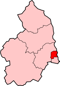
Ashington

Settlement in Northumberland

England

Ashington

Ashington War Memorial In Kenilworth Road, Ashington.
The memorial honours over 1000 people from the town who gave their lives in the two World Wars.
Ashington War Memorial Credit: Russel Wills

Ashington is a town located in the county of Northumberland, in the northeastern region of England. It lies approximately 15 miles north of Newcastle upon Tyne and 3 miles west of the North Sea coast. With a population of around 27,000, it is the largest town in the county.

Historically, Ashington was a coal mining town, and its development and growth were closely tied to the mining industry. The first coal mine in the area was opened in the 1860s, and by the early 20th century, Ashington was known as the "world's largest coal mining village." However, following the decline of the coal industry in the latter half of the 20th century, the town has undergone significant transformation.

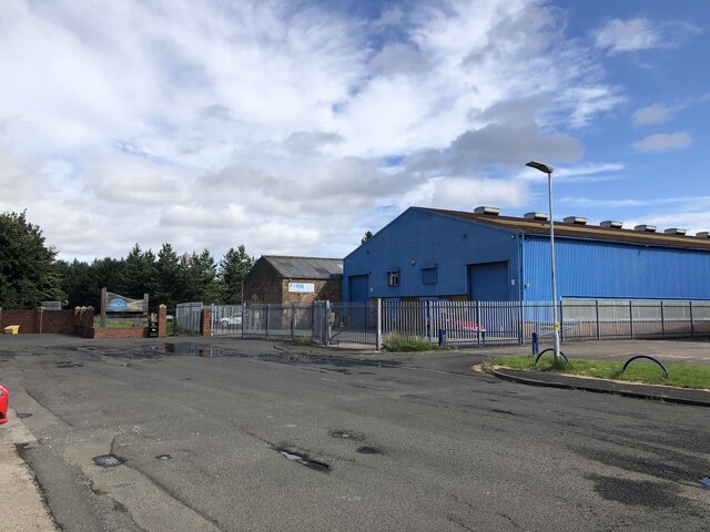
Today, Ashington is known for its strong sense of community and its efforts to diversify its economy. The town has seen investment in various sectors, including retail, education, and leisure. The Ashington Community Development Trust has played a key role in revitalizing the town, supporting local businesses and community projects.

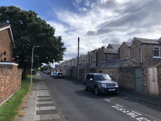
In terms of amenities, Ashington offers a range of facilities, including shops, supermarkets, restaurants, and pubs. The town is also home to several schools, a leisure center, a library, and a hospital. Additionally, Ashington benefits from good transport links, with easy access to the A189 road and regular bus services.

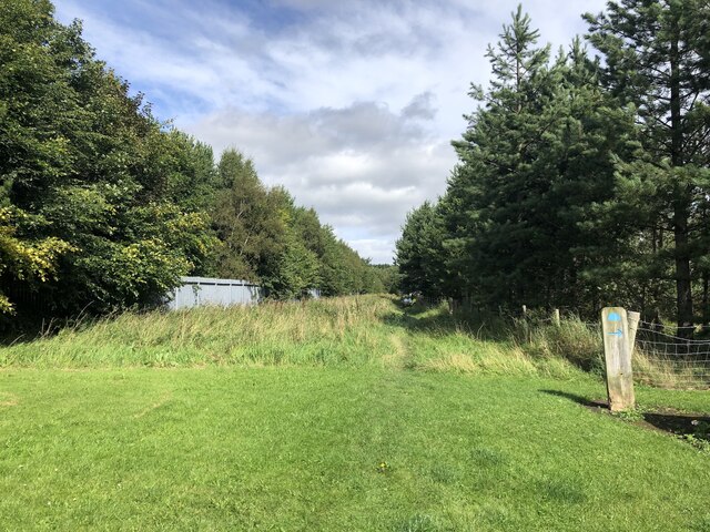
The surrounding area of Ashington boasts natural beauty, with nearby attractions including the Northumberland coastline, Northumberland National Park, and the picturesque market town of Morpeth. Overall, Ashington offers a blend of industrial heritage, community spirit, and access to the stunning Northumberland countryside.

If you have any feedback on the listing, please let us know in the comments section below.
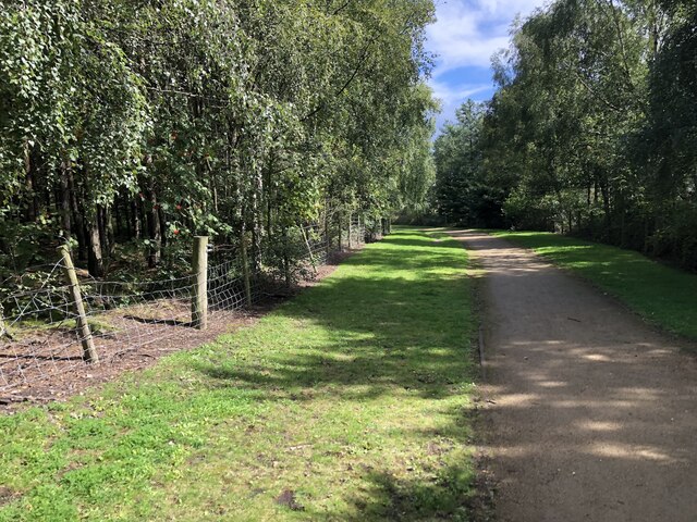
Ashington Images

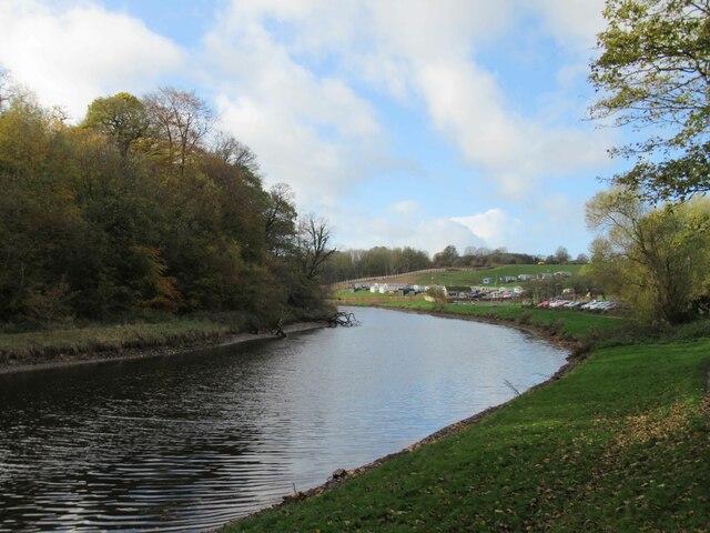
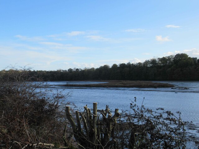
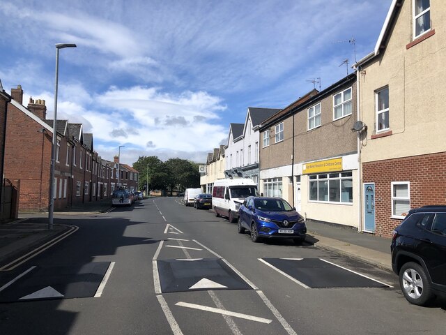
Images are sourced within 2km of 55.173429/-1.57213 or Grid Reference NZ2786. Thanks to Geograph Open Source API. All images are credited.

Ashington War Memorial In Kenilworth Road, Ashington.
The memorial honours over 1000 people from the town who gave their lives in the two World Wars.
Ashington War Memorial
In Kenilworth Road, Ashington. The memorial honours over 1000 people from the town who gave their lives in the two World Wars.
Wilco - Goods Inwards The back of wilco Ashington, Wansbeck Square.
<span class="nowrap"><a title="https://stores.wilko.com/gb/ashington/wansbeck-square" rel="nofollow ugc noopener" href="https://stores.wilko.com/gb/ashington/wansbeck-square">Link</a><img style="margin-left:2px;" alt="External link" title="External link - shift click to open in new window" src="https://s1.geograph.org.uk/img/external.png" width="10" height="10"/></span>
Wilco - Goods Inwards
The back of wilco Ashington, Wansbeck Square. LinkExternal link
Richard Hardie Ashington  'Richard Hardie is a well-established family run business, and this year we are celebrating our 50th year in the motor trade.'  <span class="nowrap"><a title="https://www.autotrader.co.uk/dealers/northumberland/ashington/richard-hardie-ashington-24423" rel="nofollow ugc noopener" href="https://www.autotrader.co.uk/dealers/northumberland/ashington/richard-hardie-ashington-24423">Link</a><img style="margin-left:2px;" alt="External link" title="External link - shift click to open in new window" src="https://s1.geograph.org.uk/img/external.png" width="10" height="10"/></span>
Richard Hardie Ashington
'Richard Hardie is a well-established family run business, and this year we are celebrating our 50th year in the motor trade.' LinkExternal link
River Wansbeck Country Park Caravan site and cafe beyond car park.
River Wansbeck Country Park
Caravan site and cafe beyond car park.
River Wansbeck Country Park
Canoeists on the River Wansbeck I'm taking a photo of two canoeist one videoing the other.
Canoeists on the River Wansbeck
I'm taking a photo of two canoeist one videoing the other.
A196 Road Bridge over the River Wansbeck
Railway Bridge over the River Wansbeck
Flock of feral pigeons over railway bridge over the River Wansbeck
Castle Island Nature Reserve on the River Wansbeck
Cambois Rowing Club
Cambois Rowing Club
High Market, Ashington Parallel to where the miner's rows were at Ashington Colliery. There are still scattered retail outlets here but the main shopping action is in the tin sheds to the north on the site of the colliery.
High Market, Ashington
Parallel to where the miner's rows were at Ashington Colliery. There are still scattered retail outlets here but the main shopping action is in the tin sheds to the north on the site of the colliery.
Back of First Row Surviving miners' row in Ashington. The lines of houses to the north, where the colliery was, have since been replaced by modern housing.
Back of First Row
Surviving miners' row in Ashington. The lines of houses to the north, where the colliery was, have since been replaced by modern housing.
Forge Leisure, Ashington They make pool covers. The far building looks like a survivor from the Ashington Colliery which had a rail yard on this site.

This was taken in this area during the lifetime of the colliery: <a href="https://www.geograph.org.uk/photo/6441345">NZ2688 : Ashington Colliery, 1967</a>
Forge Leisure, Ashington
They make pool covers. The far building looks like a survivor from the Ashington Colliery which had a rail yard on this site. This was taken in this area during the lifetime of the colliery: NZ2688 : Ashington Colliery, 1967
Site of Ashington Colliery The woodland ride runs between a fenced off area of sports pitches (Rugby?) and the Wansbeck Industrial Park. To the north the site of the colliery bings is now a woodland. There are laid out paths with interpretation boards showing the site when it was a very productive colliery. <a href="https://www.geograph.org.uk/photo/6441345">NZ2688 : Ashington Colliery, 1967</a>
Site of Ashington Colliery
The woodland ride runs between a fenced off area of sports pitches (Rugby?) and the Wansbeck Industrial Park. To the north the site of the colliery bings is now a woodland. There are laid out paths with interpretation boards showing the site when it was a very productive colliery. NZ2688 : Ashington Colliery, 1967
Pithead site, Ashington Colliery Now woodland and a business park. <a href="https://www.geograph.org.uk/photo/6441345">NZ2688 : Ashington Colliery, 1967</a>
Pithead site, Ashington Colliery
Now woodland and a business park. NZ2688 : Ashington Colliery, 1967
Community Woodland, Ashington Passing Wansbeck Business Park. This was the site of the Ashington Colliery pit head.
Community Woodland, Ashington
Passing Wansbeck Business Park. This was the site of the Ashington Colliery pit head.
Empty car showroom, Morpeth Road, Ashington
Show me another place!

Ashington is located at Grid Ref: NZ2786 (Lat: 55.173429, Lng: -1.57213)

Unitary Authority: Northumberland

Police Authority: Northumbria

What 3 Words

///shadowing.unless.handwriting. Near Ashington, Northumberland

Nearby Locations

Ashington

Related Wikis

Wansbeck District

Wansbeck was a local government district in south-east Northumberland, England. Its main population centres were Ashington, Bedlington and Newbiggin-by...

North Seaton railway station

North Seaton railway station served the town of Ashington, Northumberland, England from 1859 to 1964 on the Blyth and Tyne Railway. == History == The station...

Ashington Academy

Ashington Academy is a secondary school and sixth form located in Ashington in the English county of Northumberland. == History == It was established...
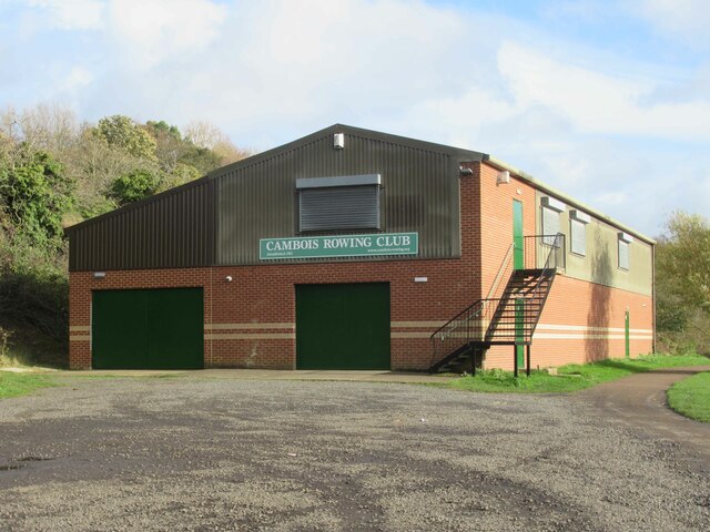
Cambois Rowing Club

Cambois Rowing Club is a rowing club on the River Wansbeck, based at Blackclose Bank, Riverside Park, Ashington, Northumberland and is affiliated to British...

Ashington

Ashington is a town and civil parish in Northumberland, England, with a population of 27,864 at the 2011 Census. It was once a centre of the coal mining...

Northumberland College

Northumberland College is a further education college based in Ashington, Northumberland, England. The present site opened in 1957, and became the County...

Ashington railway station

Ashington railway station was a station on the Newbiggin-by-the-Sea branch of the Blyth and Tyne Railway network which served the town of Ashington in...

Ashington Town Hall

Ashington Town Hall is a municipal building in Station Road in Ashington, Northumberland, England. The town hall, which was the headquarters of Ashington...

Nearby Amenities

Located within 500m of 55.173429,-1.57213
Traffic Signals
Lat/Long: 55.1765834/-1.5675088
Power: pole
Lat/Long: 55.1715623/-1.574035
Power: pole
Lat/Long: 55.1720342/-1.5713696
Power: pole
Lat/Long: 55.1714689/-1.5750372
Power: pole
Lat/Long: 55.1720288/-1.569575
Power: pole
Lat/Long: 55.17158/-1.5754434
Noexit: yes
Lat/Long: 55.1739842/-1.5798403
Noexit: yes
Lat/Long: 55.1739007/-1.5779873
Crossing Barrier: double_half
Crossing Light: yes
Railway: level_crossing
Lat/Long: 55.1769323/-1.5692311
Noexit: yes
Lat/Long: 55.1740276/-1.5790081
Give Way
Direction: forward
Lat/Long: 55.1733392/-1.5771646
Traffic Calming: cushion
Lat/Long: 55.1711522/-1.5788295
Traffic Calming: cushion
Lat/Long: 55.1709853/-1.5766572
Traffic Calming: cushion
Lat/Long: 55.1694087/-1.5746234
Noexit: yes
Lat/Long: 55.1715699/-1.5759717
Noexit: yes
Lat/Long: 55.1706941/-1.5748644
Noexit: yes
Lat/Long: 55.1728799/-1.5779303
Post Box
Collection Times: Mo-Fr 16:00; Sa 11:30
Post Box Type: pillar
Ref: NE63 171
Royal Cypher: EIIR
Royal Cypher Wikidata: Q33102113
Source: survey
Lat/Long: 55.1732228/-1.5772746
Noexit: yes
Lat/Long: 55.1723628/-1.5770969
Traffic Calming: cushion
Lat/Long: 55.1711387/-1.5769154
Noexit: yes
Lat/Long: 55.1719649/-1.5793656
Noexit: yes
Lat/Long: 55.1703529/-1.5755912
Noexit: yes
Lat/Long: 55.1721006/-1.5761937
Noexit: yes
Lat/Long: 55.1704616/-1.5759915
Noexit: yes
Lat/Long: 55.1703674/-1.576105
Traffic Calming: cushion
Lat/Long: 55.1726128/-1.5775925
Noexit: yes
Lat/Long: 55.1725408/-1.5771979
Noexit: yes
Lat/Long: 55.1710368/-1.5764288
Noexit: yes
Lat/Long: 55.1710699/-1.5779488
Noexit: yes
Lat/Long: 55.1715877/-1.5775667
Traffic Calming: cushion
Lat/Long: 55.1708967/-1.5753308
Noexit: yes
Lat/Long: 55.1726347/-1.57929
Noexit: yes
Lat/Long: 55.1724789/-1.5794277
Noexit: yes
Lat/Long: 55.1709794/-1.5761846
Traffic Calming: cushion
Lat/Long: 55.1705688/-1.5767188
Noexit: yes
Lat/Long: 55.1720634/-1.5764037
Power: pole
Lat/Long: 55.1716797/-1.5743597
Power: pole
Lat/Long: 55.1716834/-1.5728331
Power: pole
Lat/Long: 55.1719082/-1.5713501
Entrance: main
Lat/Long: 55.172106/-1.5716159
Power: pole
Lat/Long: 55.1721734/-1.5693793
Man Made: tower
Tower Type: communication
Lat/Long: 55.1690974/-1.5709271
Access: customers
Barrier: lift_gate
Bicycle: no
Foot: no
Motorcar: yes
Lat/Long: 55.1721109/-1.5717432
Post Box
Collection Times: Mo-Fr 06:00
Operator: Royal Mail
Operator Wikidata: Q638098
Post Box Type: meter
Ref: NE63 670
Royal Cypher: EIIR
Royal Cypher Wikidata: Q33102113
Source: survey
Lat/Long: 55.1695753/-1.5704017
Bus Stop
Tactile Paving: yes
Lat/Long: 55.1694888/-1.5703333
Atm
Opening Hours: 24/7
Lat/Long: 55.1725149/-1.572172
Entrance: main
Lat/Long: 55.1725288/-1.5721209
Post Box
Collection Times: Mo-Fr 09:00; Sa 07:00
Post Box Type: lamp
Ref: NE63 230D
Royal Cypher: EIIR
Royal Cypher Wikidata: Q33102113
Source: survey
Lat/Long: 55.1761528/-1.5775506
Street Lamp
Lat/Long: 55.1735913/-1.5766942
Street Lamp
Lat/Long: 55.172999/-1.572091
Bus Stop
Bus: yes
Naptan AtcoCode: 3100Z270867
Naptan NaptanCode: nldgajtw
Public Transport: platform
Shelter: yes
Lat/Long: 55.173975/-1.5771943
Noexit: yes
Lat/Long: 55.1722889/-1.5665042
Noexit: yes
Lat/Long: 55.1721503/-1.5663975
Noexit: yes
Lat/Long: 55.1726712/-1.569083
Crossing Barrier: double_half
Crossing Light: yes
Railway: level_crossing
Lat/Long: 55.1769199/-1.569169
Bus Stop
Bus: yes
Naptan AtcoCode: 3100Z269869
Naptan NaptanCode: nldgajtj
Public Transport: platform
Lat/Long: 55.1759713/-1.5776605
Bus Stop
Bus: yes
Public Transport: platform
Shelter: yes
Lat/Long: 55.1729477/-1.5736466
Noexit: yes
Lat/Long: 55.1716808/-1.5685595
Generator Method: photovoltaic
Generator Output Electricity: yes
Generator Source: solar
Generator Type: solar_photovoltaic_panel
Power: generator
Lat/Long: 55.1723993/-1.5735115
Generator Method: photovoltaic
Generator Output Electricity: yes
Generator Source: solar
Generator Type: solar_photovoltaic_panel
Power: generator
Lat/Long: 55.1713148/-1.5753987
Generator Method: photovoltaic
Generator Output Electricity: yes
Generator Source: solar
Generator Type: solar_photovoltaic_panel
Power: generator
Lat/Long: 55.1712858/-1.5756365
Generator Method: photovoltaic
Generator Output Electricity: yes
Generator Source: solar
Generator Type: solar_photovoltaic_panel
Power: generator
Lat/Long: 55.1705788/-1.5764709
Generator Method: photovoltaic
Generator Output Electricity: yes
Generator Source: solar
Generator Type: solar_photovoltaic_panel
Power: generator
Lat/Long: 55.1707002/-1.5757866
Generator Method: photovoltaic
Generator Output Electricity: yes
Generator Source: solar
Generator Type: solar_photovoltaic_panel
Power: generator
Lat/Long: 55.1699341/-1.5739248
Generator Method: photovoltaic
Generator Output Electricity: yes
Generator Source: solar
Generator Type: solar_photovoltaic_panel
Power: generator
Lat/Long: 55.1710058/-1.5777101
Generator Method: photovoltaic
Generator Output Electricity: yes
Generator Source: solar
Generator Type: solar_photovoltaic_panel
Power: generator
Lat/Long: 55.171418/-1.5775017
Generator Method: photovoltaic
Generator Output Electricity: yes
Generator Source: solar
Generator Type: solar_photovoltaic_panel
Power: generator
Lat/Long: 55.171431/-1.5777685
Generator Method: photovoltaic
Generator Output Electricity: yes
Generator Source: solar
Generator Type: solar_photovoltaic_panel
Power: generator
Lat/Long: 55.172058/-1.578142
Generator Method: photovoltaic
Generator Output Electricity: yes
Generator Source: solar
Generator Type: solar_photovoltaic_panel
Power: generator
Lat/Long: 55.1721944/-1.5784876
Generator Method: photovoltaic
Generator Output Electricity: yes
Generator Source: solar
Generator Type: solar_photovoltaic_panel
Power: generator
Lat/Long: 55.1721813/-1.5781192
Noexit: yes
Lat/Long: 55.1729137/-1.5691755
Noexit: yes
Lat/Long: 55.1740015/-1.5781112
Traffic Calming: cushion
Lat/Long: 55.1698014/-1.5766293
Noexit: yes
Lat/Long: 55.1720791/-1.5783955
Traffic Calming: cushion
Lat/Long: 55.1710155/-1.5783003
Traffic Calming: cushion
Lat/Long: 55.1716509/-1.5786878
Generator Method: photovoltaic
Generator Output Electricity: yes
Generator Source: solar
Generator Type: solar_photovoltaic_panel
Power: generator
Lat/Long: 55.1715253/-1.5787362
Give Way
Direction: forward
Lat/Long: 55.1724932/-1.5783166
Give Way
Direction: forward
Lat/Long: 55.1726752/-1.5776965
Give Way
Direction: forward
Lat/Long: 55.172299/-1.5788377
Give Way
Direction: forward
Lat/Long: 55.1699204/-1.5765675
Generator Method: photovoltaic
Generator Output Electricity: yes
Generator Source: solar
Generator Type: solar_photovoltaic_panel
Power: generator
Lat/Long: 55.1714801/-1.5773508
Noexit: yes
Lat/Long: 55.1705082/-1.5739846
Noexit: yes
Lat/Long: 55.1702807/-1.5743762
Traffic Calming: cushion
Lat/Long: 55.1695865/-1.5756797
Generator Method: photovoltaic
Generator Output Electricity: yes
Generator Source: solar
Generator Type: solar_photovoltaic_panel
Power: generator
Lat/Long: 55.1701995/-1.5755725
Noexit: yes
Lat/Long: 55.1707257/-1.5776861
Traffic Calming: cushion
Lat/Long: 55.1722694/-1.5771967
Traffic Calming: cushion
Lat/Long: 55.1717022/-1.5773308
Traffic Calming: cushion
Lat/Long: 55.1715528/-1.576794
Traffic Calming: cushion
Lat/Long: 55.1716269/-1.5770245
Noexit: yes
Lat/Long: 55.1710374/-1.5756463
Generator Method: photovoltaic
Generator Output Electricity: yes
Generator Source: solar
Generator Type: solar_photovoltaic_panel
Power: generator
Lat/Long: 55.1732785/-1.5789038
Generator Method: photovoltaic
Generator Output Electricity: yes
Generator Source: solar
Generator Type: solar_photovoltaic_panel
Power: generator
Lat/Long: 55.173277/-1.5781635
The data included in this document is from www.openstreetmap.org. The data is made available under ODbL.

Have you been to Ashington?

Leave your review of Ashington below (or comments, questions and feedback).