Ashingdon

Settlement in Essex Rochford

England

Ashingdon

Footpath near Lowlands Farm, Ashingdon
Footpath near Lowlands Farm, Ashingdon Credit: Roger Jones

Ashingdon is a small village located in the county of Essex, England. Situated approximately 40 miles east of London, it falls within the Rochford district. The village is nestled in a rural setting, surrounded by picturesque countryside and farmland.

Ashingdon has a rich historical background, with evidence of human habitation dating back to the Iron Age. The village is perhaps best known for its connection to the historic Battle of Ashingdon, which took place in 1016 between the Anglo-Saxons and the Vikings. This battle is believed to have been a significant event in the struggle for control of the English throne.

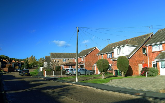
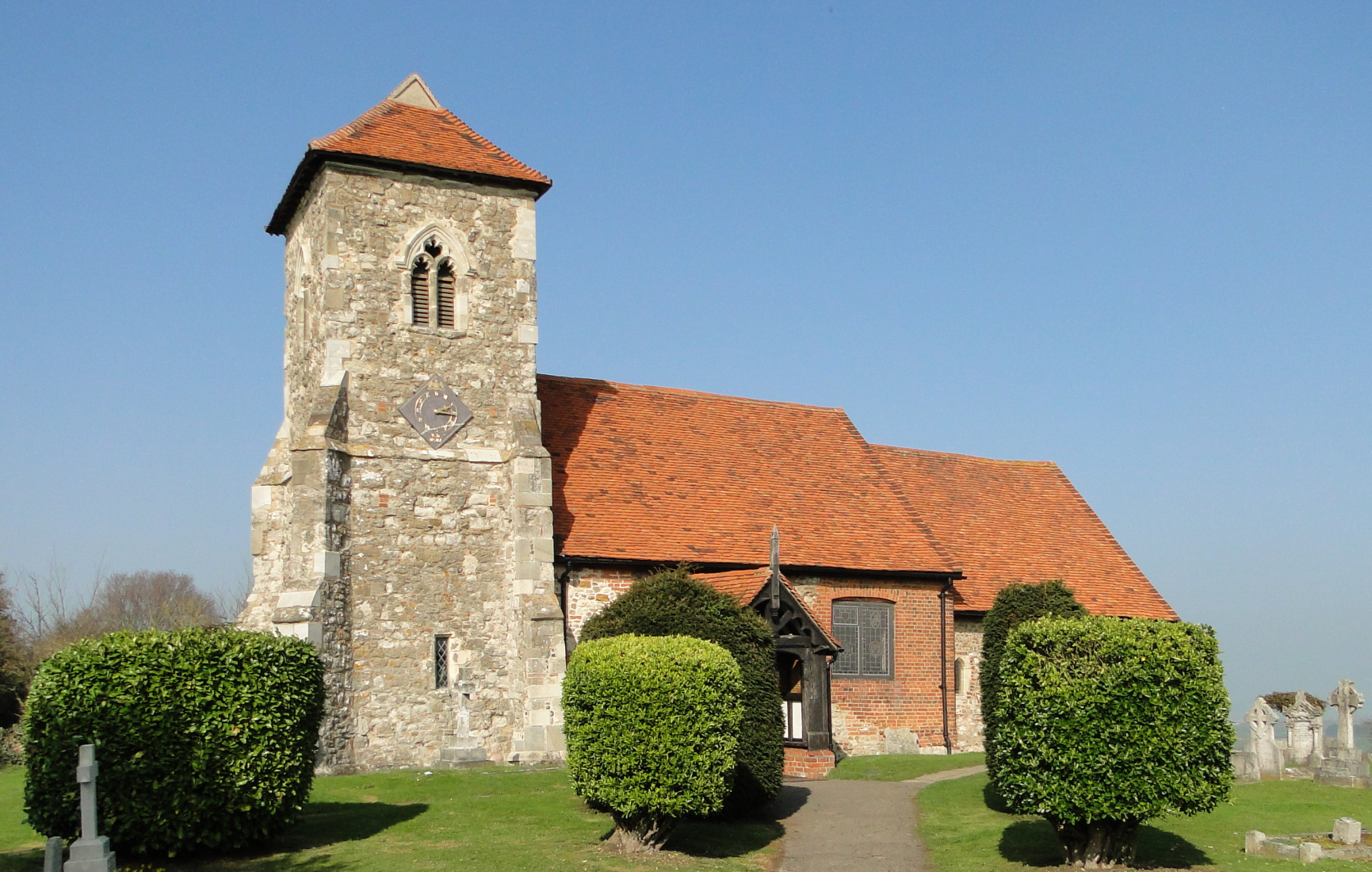
Today, Ashingdon maintains its rural charm with a small population. The village is characterized by quaint cottages, a traditional parish church, and a handful of local amenities such as a village hall, a primary school, and a pub. The surrounding countryside offers opportunities for outdoor activities and scenic walks.

Despite its small size, Ashingdon benefits from its proximity to larger towns and cities. The nearby town of Rochford provides additional amenities and transport links, including a railway station with regular services to London and Southend-on-Sea. The village is also conveniently located near the A127 road, facilitating easy access to other parts of Essex and beyond.

Overall, Ashingdon offers a tranquil and idyllic setting for those seeking a quieter lifestyle while still enjoying the convenience of nearby urban areas.

If you have any feedback on the listing, please let us know in the comments section below.

Ashingdon Images

Images are sourced within 2km of 51.60742/0.691447 or Grid Reference TQ8693. Thanks to Geograph Open Source API. All images are credited.

Footpath near Lowlands Farm, Ashingdon
View from church car park, Ashingdon
Trees on edge of field, Ashingdon
Pond on Ashingdon Public Footpath No. 10 It's 15 plus years since I last photographed this pond <a href="https://www.geograph.org.uk/photo/219838">TQ8594 : Green Pond</a> - it looks a bit fresher now
Pond on Ashingdon Public Footpath No. 10
It's 15 plus years since I last photographed this pond TQ8594 : Green Pond - it looks a bit fresher now
Stained glass window war memorial, St Mary's Church, Hawkwell WWI memorial located on the eastern flank wall. The central panel contains the inscription:
I ASCEND UNTO MY FATHER AND YOUR FATHER 
IN MEMORY OF THE FALLEN IN THE GREAT WAR 1914-18 
BY THE PARISHIONERS
Stained glass window war memorial, St Mary's Church, Hawkwell
WWI memorial located on the eastern flank wall. The central panel contains the inscription: I ASCEND UNTO MY FATHER AND YOUR FATHER IN MEMORY OF THE FALLEN IN THE GREAT WAR 1914-18 BY THE PARISHIONERS
WWI memorial tablet, St Mary's Church, Hawkwell Marble tablet commemorating the service of Thomas Wright Flavell, who was killed at Gallipoli. The rector who showed me the memorial told me that Mr Flavell was killed two days after arriving at Gallipoli.
WWI memorial tablet, St Mary's Church, Hawkwell
Marble tablet commemorating the service of Thomas Wright Flavell, who was killed at Gallipoli. The rector who showed me the memorial told me that Mr Flavell was killed two days after arriving at Gallipoli.
WWI memorial tablet, St Mary's Church, Hawkwell Commemorates the men of the parish who fell in WWI.
Located on the southern wall.
WWI memorial tablet, St Mary's Church, Hawkwell
Commemorates the men of the parish who fell in WWI. Located on the southern wall.
Hyde Wood Lane: boundary of Ashingdon & Canewdon This road is part of the boundary between the civil parishes of Ashingdon & Canewdon.
Hyde Wood Lane: boundary of Ashingdon & Canewdon
This road is part of the boundary between the civil parishes of Ashingdon & Canewdon.
Path in Magnolia Fields Local Nature Reserve, Hawkwell Sometimes known as Magnolia Park, this Nature Reserve is managed by Hawkwell Parish Council. The reserve was former brickworks.
Rochford district: <span class="nowrap"><a title="https://www.rochford.gov.uk/leisure-and-tourism/woodlands-parks-and-open-spaces/magnolia-nature-reserve" rel="nofollow ugc noopener" href="https://www.rochford.gov.uk/leisure-and-tourism/woodlands-parks-and-open-spaces/magnolia-nature-reserve">Link</a><img style="margin-left:2px;" alt="External link" title="External link - shift click to open in new window" src="https://s1.geograph.org.uk/img/external.png" width="10" height="10"/></span>
Wild Essex: <span class="nowrap"><a title="https://www.wildessex.net/sites/Magnolia%20Nature%20Reserve.htm" rel="nofollow ugc noopener" href="https://www.wildessex.net/sites/Magnolia%20Nature%20Reserve.htm">Link</a><img style="margin-left:2px;" alt="External link" title="External link - shift click to open in new window" src="https://s1.geograph.org.uk/img/external.png" width="10" height="10"/></span>
Path in Magnolia Fields Local Nature Reserve, Hawkwell
Sometimes known as Magnolia Park, this Nature Reserve is managed by Hawkwell Parish Council. The reserve was former brickworks. Rochford district: LinkExternal link Wild Essex: LinkExternal link
Clearing in Magnolia Fields Local Nature Reserve, Hawkwell Sometimes known as Magnolia Park, this Nature Reserve is managed by Hawkwell Parish Council. The reserve was former brickworks.
Rochford district: <span class="nowrap"><a title="https://www.rochford.gov.uk/leisure-and-tourism/woodlands-parks-and-open-spaces/magnolia-nature-reserve" rel="nofollow ugc noopener" href="https://www.rochford.gov.uk/leisure-and-tourism/woodlands-parks-and-open-spaces/magnolia-nature-reserve">Link</a><img style="margin-left:2px;" alt="External link" title="External link - shift click to open in new window" src="https://s1.geograph.org.uk/img/external.png" width="10" height="10"/></span>
Wild Essex: <span class="nowrap"><a title="https://www.wildessex.net/sites/Magnolia%20Nature%20Reserve.htm" rel="nofollow ugc noopener" href="https://www.wildessex.net/sites/Magnolia%20Nature%20Reserve.htm">Link</a><img style="margin-left:2px;" alt="External link" title="External link - shift click to open in new window" src="https://s1.geograph.org.uk/img/external.png" width="10" height="10"/></span>
Clearing in Magnolia Fields Local Nature Reserve, Hawkwell
Sometimes known as Magnolia Park, this Nature Reserve is managed by Hawkwell Parish Council. The reserve was former brickworks. Rochford district: LinkExternal link Wild Essex: LinkExternal link
Path to Beckney Wood, Ashingdon
Glencroft Open Space, Hawkwell Glencroft Open Space is managed by Hawkwell Parish Council.
Glencroft Open Space, Hawkwell
Glencroft Open Space is managed by Hawkwell Parish Council.
Tipping hopper, Magnolia Fields Local Nature Reserve, Hawkwell This is a typical narrow-gauge contractor's tipping hopper built in the thousands and used for the transport of materials around a site. In this instance, probably used to carry brick clay from the fields to the works/kilns.

Sometimes known as Magnolia Park, this wagon is a reminder that this area was once industrial, much of this area was originally a brickworks, where both sand and clay were extracted.
Tipping hopper, Magnolia Fields Local Nature Reserve, Hawkwell
This is a typical narrow-gauge contractor's tipping hopper built in the thousands and used for the transport of materials around a site. In this instance, probably used to carry brick clay from the fields to the works/kilns. Sometimes known as Magnolia Park, this wagon is a reminder that this area was once industrial, much of this area was originally a brickworks, where both sand and clay were extracted.
Track near Doggetts Chase, Rochford
Rural Housing, Doggetts Chase, Rochford Most likely built for those working on Doggetts farm.
Rural Housing, Doggetts Chase, Rochford
Most likely built for those working on Doggetts farm.
Grazing, Magnolia Farm
Rectory Avenue, Hawkwell Taken looking north towards Wedgwood Way.
Rectory Avenue, Hawkwell
Taken looking north towards Wedgwood Way.
Wedgwood Way & Rectory Avenue, Hawkwell
Show me another place!

Ashingdon is located at Grid Ref: TQ8693 (Lat: 51.60742, Lng: 0.691447)

Administrative County: Essex

District: Rochford

Police Authority: Essex

What 3 Words

///suits.healthier.shuttle. Near Rochford, Essex

Nearby Locations

Ashingdon

Related Wikis

Ashingdon

Ashingdon is a village and civil parish in Essex, England. It is located about 2.5 miles (4 km) north of Rochford and is 13 miles (21 km) southeast from...

Magnolia Fields

Magnolia Fields or Magnolia Park is a 9.7 hectare Local Nature Reserve in Hawkwell in Essex. It is owned by Rochford District Council and managed by Hawkwell...

Rayleigh and Wickford (UK Parliament constituency)

Rayleigh and Wickford is a constituency represented in the House of Commons of the UK Parliament since its 2010 creation by Mark Francois, a Conservative...
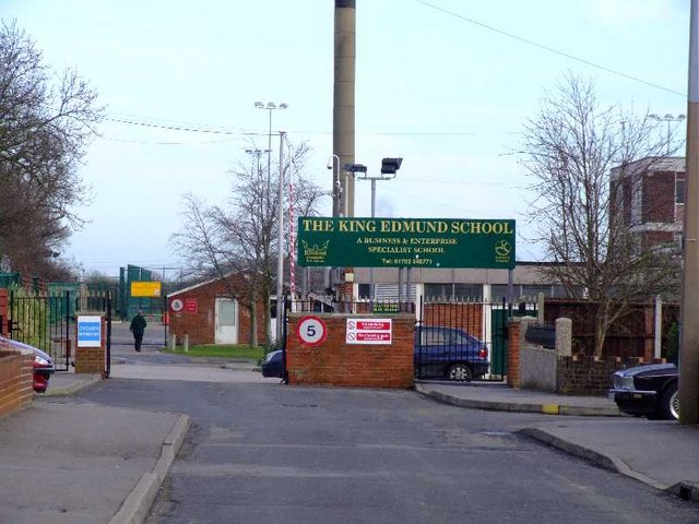
King Edmund School

The King Edmund School is a coeducational secondary school and sixth form located in Rochford, Essex, England. It is a specialist BEC and applied learning...

Greensward Academy

Greensward Academy is a comprehensive school and academy for 11- to 18-year-olds, located in Hockley, Essex.Greensward has approximately 200 staff and...

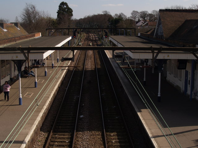
Hockley railway station (Essex)

Hockley railway station is on the Shenfield to Southend Line in the East of England, serving the village of Hockley, Essex. It is 36 miles 1 chain (57...
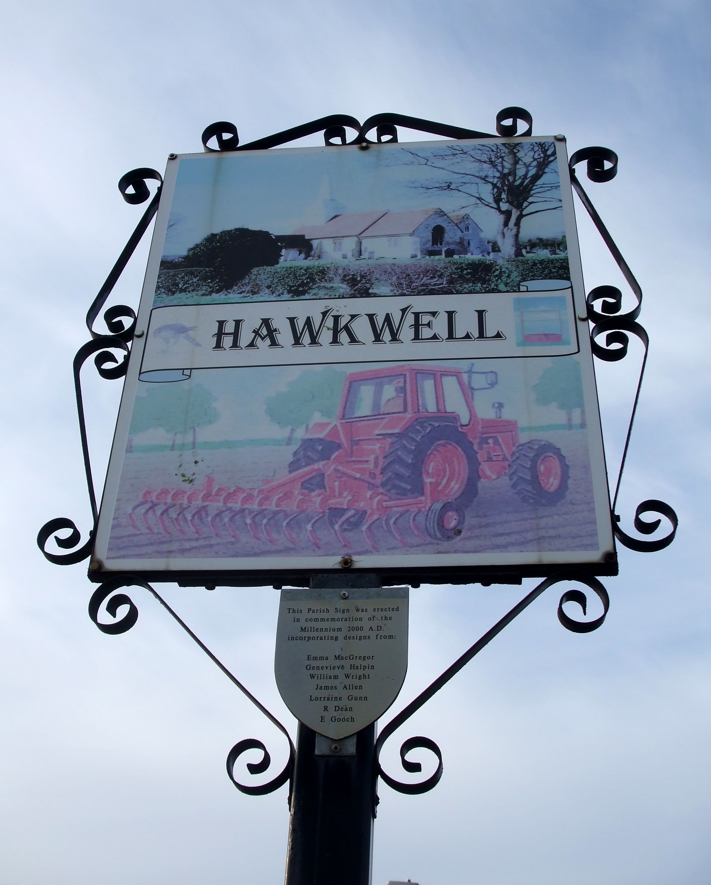
Hawkwell

Hawkwell is a village and civil parish in the district of Rochford in Essex, England. It is the second largest village after Rayleigh. The 2001 census...

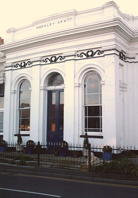
Spa Pump Room, Hockley

The Spa Pump Room is a Grade II listed, early Victorian building in Hockley, Essex. It was built to the designs of James Lockyer in 1842 after a medicinal...

Nearby Amenities

Located within 500m of 51.60742,0.691447
Bus Stop
Wedgwood Way
Naptan AtcoCode: 15001101513
Naptan Bearing: N
Naptan CommonName: Wedgewood Way
Naptan Crossing: Wedgewood Way
Naptan Indicator: Opp
Naptan Landmark: Wedgewood Way
Naptan NaptanCode: esxagdtg
Naptan PlusbusZoneRef: STHCENT
Naptan Street: Ashingdon Road
Naptan Verified: no
Public Transport: platform
Source: naptan_import
Lat/Long: 51.6036019/0.6935203
Bus Stop
The Victory
Naptan AtcoCode: 15001101514
Naptan Bearing: S
Naptan CommonName: The Victory
Naptan Indicator: o/s
Naptan Landmark: The Victory
Naptan NaptanCode: esxagapd
Naptan PlusbusZoneRef: STHCENT
Naptan Street: Ashingdon Road
Naptan Verified: no
Public Transport: platform
Source: naptan_import
Lat/Long: 51.6058123/0.6924379
Bus Stop
The Victory
Naptan AtcoCode: 15001101515
Naptan Bearing: N
Naptan CommonName: The Victory
Naptan Indicator: Opp
Naptan Landmark: The Victory
Naptan NaptanCode: esxagapg
Naptan PlusbusZoneRef: STHCENT
Naptan Street: Ashingdon Road
Naptan Verified: no
Public Transport: platform
Source: naptan_import
Lat/Long: 51.6062603/0.6921178
Bus Stop
Ashingdon Hill Top
Naptan AtcoCode: 15001101516
Naptan Bearing: SE
Naptan CommonName: Ashingdon Hill Top
Naptan Crossing: Church Road
Naptan Indicator: SE-bound
Naptan Landmark: Ashingdon Hill Top
Naptan NaptanCode: esxagdtj
Naptan PlusbusZoneRef: STHCENT
Naptan Street: Ashingdon Road
Naptan Verified: no
Public Transport: platform
Source: naptan_import
Lat/Long: 51.6087008/0.6908034
Bus Stop
Ashingdon Hill Top
Naptan AtcoCode: 15001101517
Naptan Bearing: NW
Naptan CommonName: Ashingdon Hill Top
Naptan Crossing: Church Road
Naptan Indicator: NW-bound
Naptan Landmark: Ashingdon Hill Top
Naptan NaptanCode: esxagapj
Naptan PlusbusZoneRef: STHCENT
Naptan Street: Ashingdon Road
Naptan Verified: no
Public Transport: platform
Source: naptan_import
Lat/Long: 51.6090178/0.6903166
Recycling
Recycling Cans: yes
Recycling Clothes: yes
Recycling Glass: yes
Recycling Paper: yes
Lat/Long: 51.6076216/0.6915296
Crossing
Crossing: uncontrolled
Crossing Ref: zebra
Lat/Long: 51.6069255/0.6917293
Crossing
Crossing: uncontrolled
Crossing Ref: zebra
Lat/Long: 51.6032426/0.6937497
Toucan Heating and Plumbing
Craft: plumber
Lat/Long: 51.608178/0.6871148
The data included in this document is from www.openstreetmap.org. The data is made available under ODbL.

Have you been to Ashingdon?

Leave your review of Ashingdon below (or comments, questions and feedback).