Ashill

Settlement in Norfolk Breckland

England

Ashill

Post Box at Ashill IP25 3201. Royal Mail list this box as 'The Green'.
My shadow is also in the photograph!
Post Box at Ashill Credit: David Bremner

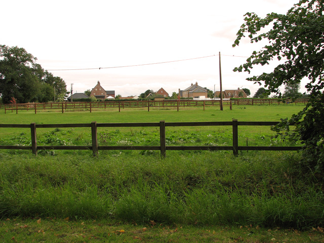
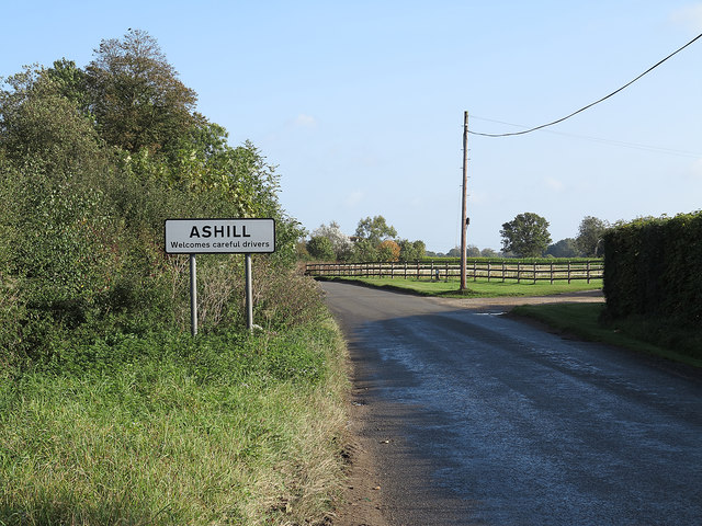
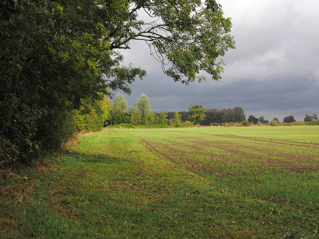
Ashill is a small village located in the Breckland district of Norfolk, England. Situated about 12 miles southwest of the town of Dereham, Ashill has a population of around 800 residents. The village is set amidst picturesque countryside, characterized by rolling fields and woodlands, making it an appealing location for nature enthusiasts and those seeking a tranquil rural retreat.

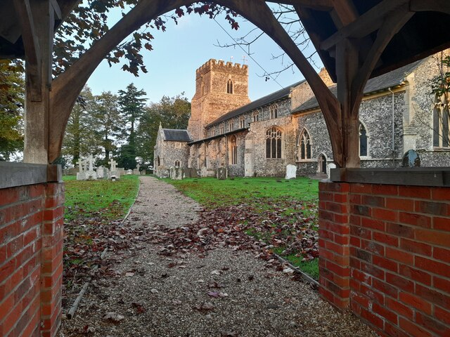
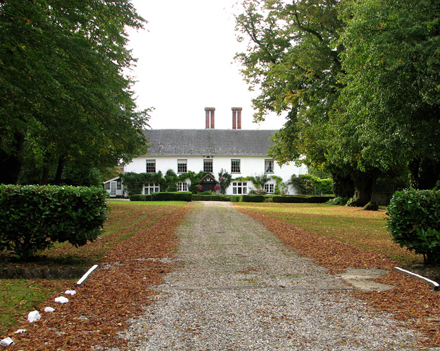
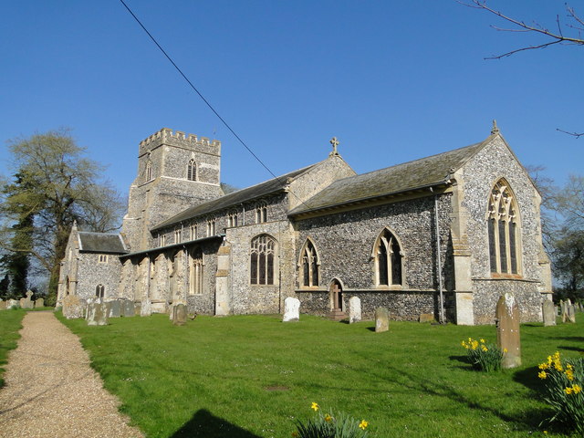
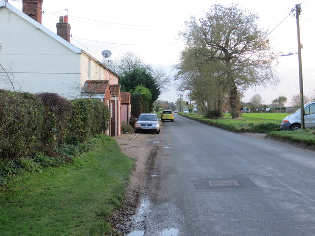
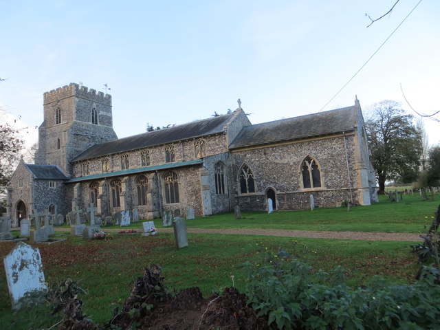
Ashill has a rich history dating back to the medieval period, with several historic buildings and landmarks still standing today. The village church, St. Nicholas, is a notable example, featuring magnificent stained glass windows and intricate stonework. The village also boasts a number of charming thatched cottages and traditional houses, lending it a quintessentially English ambiance.

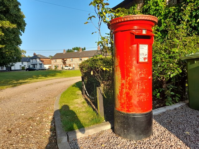
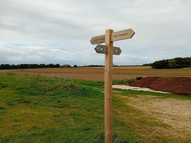
Despite its small size, Ashill offers a range of amenities for its residents and visitors. These include a primary school, a village hall, a post office, and a pub, providing essential services and a sense of community. The surrounding area provides ample opportunities for outdoor activities such as cycling, walking, and horse riding, with numerous footpaths and bridleways crisscrossing the countryside.

Ashill's location provides convenient access to nearby towns and cities, with good transport links to Dereham, Norwich, and King's Lynn. The village is also within easy reach of the beautiful North Norfolk coast, offering stunning beaches and nature reserves for those seeking a day trip or a weekend getaway.

Overall, Ashill is a charming and idyllic village that offers a peaceful and picturesque setting, along with a strong sense of community and access to nearby amenities and attractions.

If you have any feedback on the listing, please let us know in the comments section below.
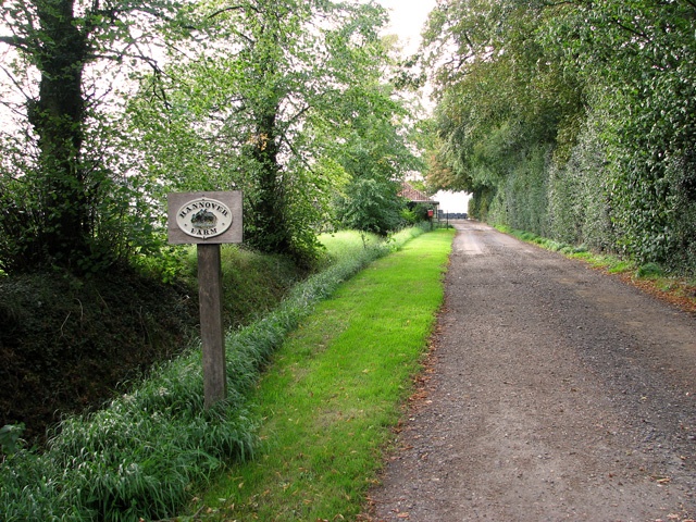
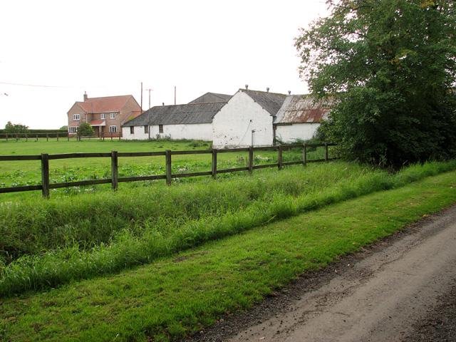
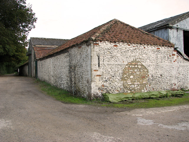
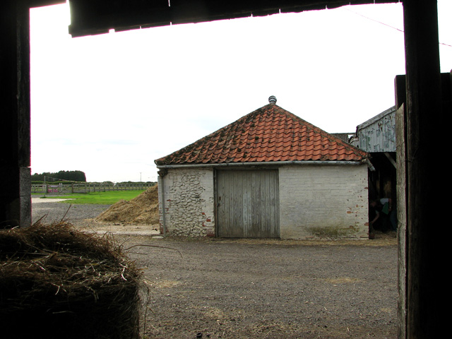
Ashill Images

Images are sourced within 2km of 52.606089/0.78586898 or Grid Reference TF8804. Thanks to Geograph Open Source API. All images are credited.

Post Box at Ashill IP25 3201. Royal Mail list this box as 'The Green'.
My shadow is also in the photograph!
Post Box at Ashill
IP25 3201. Royal Mail list this box as 'The Green'. My shadow is also in the photograph!
St Nicholas Church, Ashill Early morning sunlight touches the fine church at Ashill.
St Nicholas Church, Ashill
Early morning sunlight touches the fine church at Ashill.
Footpath Sign Typical scenery of the area.
Footpath Sign
Typical scenery of the area.
Bury's Hall, Ashill
Bury's Hall, Ashill
Driveway to Hannover Farm, Ashill
Farm buildings, Ashill
Farm sheds, Ashill
Farm sheds, Ashill
Old farm building, Ashill
Paddocks beside Hale Road, Ashill
St. Nicholas' church, Ashill A lovely 14th c. tower with an first rate unusual ogee arch around the west doorway and a good three-light reticulated window above. Just below the parapet are two fine gargoyles. The 15th c. font has geometric decoration and faces beneath the bowl. The arcade and screen are all from in the same period. The chancel which weeps slightly is the oldest part of the church, dating from the 13th c. it still has the original corner piscina and sedilia. Each of the many wall posts which support the roof are themselves supported on corbels of various design, some faces, a grotesque and others floriated. The complex roof was put up in 1618 but some major timbers had to be replaced 1867. Much of the window glass has been removed from its original window and re-set elsewhere. All furnishings are Victorian.
St. Nicholas' church, Ashill
A lovely 14th c. tower with an first rate unusual ogee arch around the west doorway and a good three-light reticulated window above. Just below the parapet are two fine gargoyles. The 15th c. font has geometric decoration and faces beneath the bowl. The arcade and screen are all from in the same period. The chancel which weeps slightly is the oldest part of the church, dating from the 13th c. it still has the original corner piscina and sedilia. Each of the many wall posts which support the roof are themselves supported on corbels of various design, some faces, a grotesque and others floriated. The complex roof was put up in 1618 but some major timbers had to be replaced 1867. Much of the window glass has been removed from its original window and re-set elsewhere. All furnishings are Victorian.
Ordnance Survey Cut Mark This OS cut mark can be found on the NE face of the Church of St Nicholas. It marks a point 72.4228m above mean sea level.
Ordnance Survey Cut Mark
This OS cut mark can be found on the NE face of the Church of St Nicholas. It marks a point 72.4228m above mean sea level.
Watton Road entering Ashill Watton Road heading north into the village of Ashill.
Watton Road entering Ashill
Watton Road heading north into the village of Ashill.
Wheat emerging from field at Ashill The field is at the north end of the village on the east side of Hale Road.
Wheat emerging from field at Ashill
The field is at the north end of the village on the east side of Hale Road.
Hale Road at Ashill near Reeves Farm Looking southward.
Hale Road at Ashill near Reeves Farm
Looking southward.
The Church of St Nicholas at Ashill Viewed from the south-east.
The Church of St Nicholas at Ashill
Viewed from the south-east.
Ordnance Survey Flush Bracket G1545 This can be found on the wall of a house - a private dwelling - at Reeve's farm, Ashill.
For more detail see : <span class="nowrap"><a title="http://www.bench-marks.org.uk/bm10733" rel="nofollow ugc noopener" href="http://www.bench-marks.org.uk/bm10733">Link</a><img style="margin-left:2px;" alt="External link" title="External link - shift click to open in new window" src="https://s1.geograph.org.uk/img/external.png" width="10" height="10"/></span>
Ordnance Survey Flush Bracket G1545
This can be found on the wall of a house - a private dwelling - at Reeve's farm, Ashill. For more detail see : LinkExternal link
Ordnance Survey Cut Mark This can be found on the wall of St Nicholas Church at Ashill.
For more detail see : <span class="nowrap"><a title="http://www.bench-marks.org.uk/bm46562" rel="nofollow ugc noopener" href="http://www.bench-marks.org.uk/bm46562">Link</a><img style="margin-left:2px;" alt="External link" title="External link - shift click to open in new window" src="https://s1.geograph.org.uk/img/external.png" width="10" height="10"/></span>
Ordnance Survey Cut Mark
This can be found on the wall of St Nicholas Church at Ashill. For more detail see : LinkExternal link
Dolphin Crescent On the outskirts of Saham Hills.
Dolphin Crescent
On the outskirts of Saham Hills.
Show me another place!

Ashill is located at Grid Ref: TF8804 (Lat: 52.606089, Lng: 0.78586898)

Administrative County: Norfolk

District: Breckland

Police Authority: Norfolk

What 3 Words

///clustered.duplicity.named. Near Ashill, Norfolk

Nearby Locations

Ashill Holmere Ashill

Related Wikis

Nearby Amenities

Located within 500m of 52.606089,0.78586898
Ashill
Place: village
Postal Code: IP25
Website: http://www.origins.org.uk/genuki/NFK/places/a/ashill/
Wikidata: Q943542
Wikipedia: en:Ashill, Norfolk
Lat/Long: 52.6057274/0.7879246
Bus Stop
Goose Green, adj
Naptan AtcoCode: 2900A141
Naptan Bearing: S
Naptan CommonName: Goose Green
Naptan Indicator: adj
Naptan Landmark: The Old Bakery
Naptan Locality: Ashill
Naptan NaptanCode: nfoadgma
Naptan ShortCommonName: Goose Green
Naptan Street: Hale Road
Naptan Verified: no
Source: naptan_import
Lat/Long: 52.6072035/0.7853293
Dunnetts Close, adj
Naptan AtcoCode: 2900A1416
Naptan Bearing: S
Naptan BusStopType: CUS
Naptan CommonName: Dunnetts Close
Naptan Indicator: adj
Naptan Landmark: Dunnetts Close
Naptan Locality: Ashill
Naptan NaptanCode: nfoadgpa
Naptan Street: Hale Road
Naptan Verified: no
Source: naptan_import
Lat/Long: 52.6088326/0.7850449
Dunnetts Close, opp
Naptan AtcoCode: 2900A1417
Naptan Bearing: N
Naptan BusStopType: CUS
Naptan CommonName: Dunnetts Close
Naptan Indicator: opp
Naptan Landmark: Dunnetts Close
Naptan Locality: Ashill
Naptan NaptanCode: nfoadgpd
Naptan Street: Hale Road
Naptan Verified: no
Source: naptan_import
Lat/Long: 52.6087408/0.7849661
Church Street, opp
Naptan AtcoCode: 2900A1418
Naptan Bearing: S
Naptan BusStopType: CUS
Naptan CommonName: Church Street
Naptan Indicator: opp
Naptan Landmark: Church Street
Naptan Locality: Ashill
Naptan NaptanCode: nfoadgpg
Naptan Street: Hale Road
Naptan Verified: no
Source: naptan_import
Lat/Long: 52.6039301/0.785487
Watton Road, adj
Naptan AtcoCode: 2900A1419
Naptan Bearing: NW
Naptan BusStopType: CUS
Naptan CommonName: Watton Road
Naptan Indicator: adj
Naptan Landmark: The Woodlands
Naptan Locality: Ashill
Naptan NaptanCode: nfoadgpj
Naptan ShortCommonName: Watton Road
Naptan Street: Watton Road
Naptan Verified: no
Source: naptan_import
Lat/Long: 52.6025745/0.7857702
Bus Stop
no 6, os
Naptan AtcoCode: 2900A147
Naptan Bearing: E
Naptan BusStopType: CUS
Naptan CommonName: no 6
Naptan Indicator: os
Naptan Locality: Ashill
Naptan NaptanCode: nfoadgpw
Naptan Street: Church Street
Naptan Verified: no
Source: naptan_import
Lat/Long: 52.602844/0.7815778
Bus Stop
Goose Green, opp
Naptan AtcoCode: 2900A148
Naptan Bearing: N
Naptan CommonName: Goose Green
Naptan Indicator: opp
Naptan Landmark: The Green
Naptan Locality: Ashill
Naptan NaptanCode: nfoadgta
Naptan Street: Hale Road
Naptan Verified: no
Source: naptan_import
Lat/Long: 52.6078331/0.7850996
Turning Circle
Source: Bing
Lat/Long: 52.6018909/0.7878662
Turning Circle
Lat/Long: 52.6082651/0.7881704
Turning Circle
Lat/Long: 52.6092955/0.7887902
Power: pole
Source: Bing
Lat/Long: 52.6089742/0.7912712
Power: pole
Source: Bing
Lat/Long: 52.6079734/0.7923084
Barrier: lych_gate
Colour: black
Foot: yes
Material: wood
Lat/Long: 52.6026807/0.7812236
Post Box
Collection Times: Mo-Fr 15:30; Sa 11:00
Post Box Design: type_a
Post Box Type: pillar
Ref: IP25 3201
Royal Cypher: EIIR
Royal Cypher Wikidata: Q33102113
Lat/Long: 52.6064927/0.7856191
Disused Amenity: post_box
Inscription: This wall box is no longer in use. By courtesy of Royal Mail is will remain here as part of the history of Ashill.
Man Made: post_box
Post Box Mounting: brick_pillar
Post Box Type: wall
Royal Cypher: GR
Sealed: yes
Lat/Long: 52.6028064/0.7821858
Public Bookcase
Book Swap
Booth: K6
Disused Amenity: telephone
Man Made: telephone_box
Public Bookcase Type: phone_box
Lat/Long: 52.6026392/0.7815439
Ashill
Inscription: WI
Man Made: village_sign
Material: metal
Lat/Long: 52.6066932/0.7854001
Man Made: beacon
Lat/Long: 52.6071263/0.7867511
Post Box
Collection Times: Mo-Fr 09:30; Sa 09:30
Post Box Mounting: pier
Post Box Type: lamp
Ref: IP25 3313
Royal Cypher: EIIR
Royal Cypher Wikidata: Q33102113
Lat/Long: 52.6034356/0.7847655
Ashill Food & Wine
Addr Housenumber: 1
Addr Postcode: IP25 7AX
Addr Street: Hale Road
Addr Village: Ashill
Fhrs Id: 832977
Shop: convenience;newsagent
Source Addr: FHRS Open Data
Lat/Long: 52.6074284/0.7854957
Waste Basket
Waste: dog_excrement
Lat/Long: 52.6067062/0.7864301
Bench
Backrest: yes
Material: wood
Seats: 3
Lat/Long: 52.6069857/0.7860395
Board Type: notice
Information: board
Tourism: information
Lat/Long: 52.6071608/0.7853877
Bench
Backrest: yes
Material: wood
Seats: 3
Lat/Long: 52.6072671/0.7855856
Defibrillator
Addr City: Thetford
Addr Postcode: IP25 7AT
Addr Street: The Green
Addr Village: Ashill
Emergency: defibrillator
Location: On outside wall of the AVA Call in Centre south of the pond, facing the road called "The Green".
Ref GB The Circuit: E94E89DD-5644-4B0A-BF16-AD5800B48B16
Lat/Long: 52.6057842/0.7852015
Entrance: yes
Lat/Long: 52.6028465/0.7809468
Give Way
Direction: backward
Lat/Long: 52.6025917/0.7813171
Post Office
Ashill Mobile Post Office Service
Addr City: Thetford
Addr Housename: Ashill Community Centre
Addr Postcode: IP25 7AX
Addr Street: Hale Road
Addr Village: Ashill
Brand: Post Office
Brand Wikidata: Q1783168
Fixme: verify by survey
Opening Hours: Tu 09:00-10:00
Ref Pol Id: 136598
Source: pol_branch_list_2018-01
Website: https://www.postoffice.co.uk/branch-finder/708112x/ashill-mobile-service
Lat/Long: 52.6088536/0.783802
Give Way
Direction: forward
Lat/Long: 52.6034857/0.7854771
Give Way
Direction: backward
Lat/Long: 52.6035385/0.7852539
Power: pole
Lat/Long: 52.6103106/0.7844067
Power: pole
Lat/Long: 52.6099108/0.7845441
Power: pole
Lat/Long: 52.6095134/0.7846769
Power: pole
Transformer: distribution
Lat/Long: 52.6091579/0.7846273
Power: pole
Lat/Long: 52.6091966/0.784748
Power: pole
Lat/Long: 52.6089742/0.7831809
Power: pole
Lat/Long: 52.6087886/0.7816467
Power: pole
Lat/Long: 52.6086216/0.7802271
The data included in this document is from www.openstreetmap.org. The data is made available under ODbL.

Have you been to Ashill?

Leave your review of Ashill below (or comments, questions and feedback).