Vinalls Copse

Wood, Forest in Hampshire Hart

England

Vinalls Copse

B3349 The B3349 runs 27 miles from Alton <a href="https://www.geograph.org.uk/photo/5212600">SU7038 : Junction of A339 & B3349</a> to Wokingham.
<span class="nowrap"><a title="http://www.sabre-roads.org.uk/wiki/index.php?title=B3349" rel="nofollow ugc noopener" href="http://www.sabre-roads.org.uk/wiki/index.php?title=B3349">Link</a><img style="margin-left:2px;" alt="External link" title="External link - shift click to open in new window" src="https://s1.geograph.org.uk/img/external.png" width="10" height="10"/></span>
B3349 Credit: N Chadwick

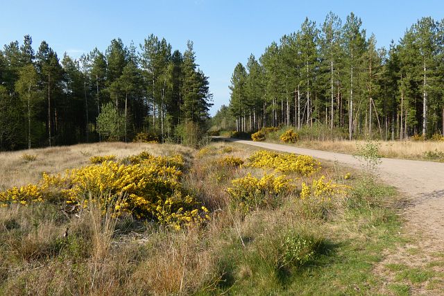
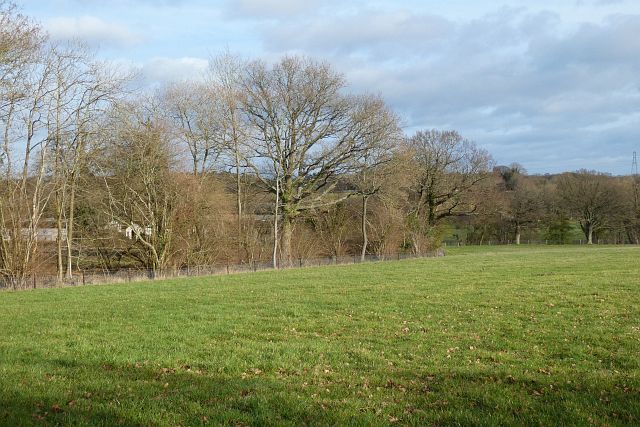
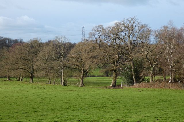
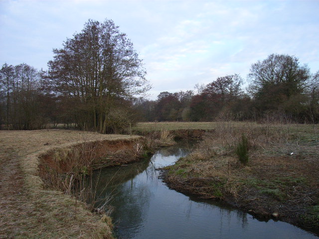
Vinalls Copse is a picturesque woodland located in Hampshire, England. Covering an area of approximately 20 acres, it is a well-preserved natural haven that offers a peaceful escape from the hustle and bustle of everyday life.

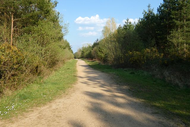
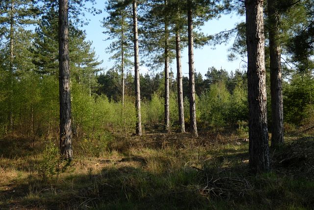
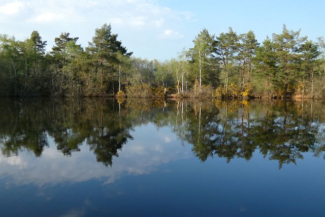
The copse is primarily composed of deciduous trees, including oak, beech, and ash, which create a stunning display of color throughout the seasons. In spring, the forest floor is carpeted with bluebells, creating a breathtaking sight. In summer, the canopy provides shade and a cool atmosphere, while in autumn, the trees transform into a vibrant palette of reds, yellows, and oranges. Even in winter, the copse retains its charm, with the bare branches creating an ethereal atmosphere.

The woodland is crisscrossed by a network of well-maintained footpaths, allowing visitors to explore its beauty at their own pace. The paths wind through the trees, occasionally opening up to reveal small clearings and glades. The sound of birdsong fills the air, adding to the tranquility of the setting.

Vinalls Copse is also home to a diverse range of wildlife. Squirrels can be spotted scampering through the branches, while deer occasionally make an appearance, adding a touch of enchantment to the woodland experience. Birdwatchers will delight in the numerous species that call the copse their home, including woodpeckers, thrushes, and owls.

Overall, Vinalls Copse is a hidden gem in Hampshire, offering visitors a chance to connect with nature and enjoy the beauty of a well-preserved woodland. Whether it's a leisurely stroll, a picnic, or an opportunity to observe wildlife, this charming copse has something to offer for everyone.

If you have any feedback on the listing, please let us know in the comments section below.

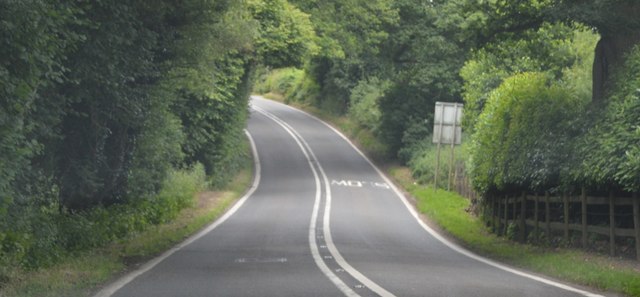
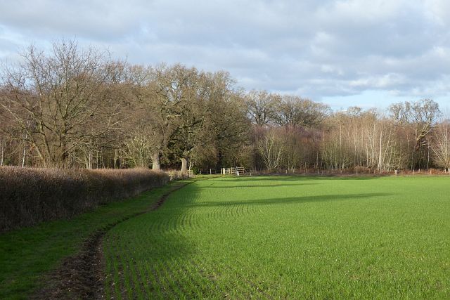
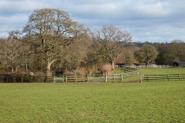
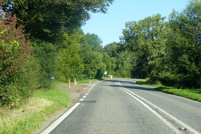
Vinalls Copse Images

Images are sourced within 2km of 51.338504/-0.93312439 or Grid Reference SU7460. Thanks to Geograph Open Source API. All images are credited.

B3349 The B3349 runs 27 miles from Alton <a href="https://www.geograph.org.uk/photo/5212600">SU7038 : Junction of A339 & B3349</a> to Wokingham.
<span class="nowrap"><a title="http://www.sabre-roads.org.uk/wiki/index.php?title=B3349" rel="nofollow ugc noopener" href="http://www.sabre-roads.org.uk/wiki/index.php?title=B3349">Link</a><img style="margin-left:2px;" alt="External link" title="External link - shift click to open in new window" src="https://s1.geograph.org.uk/img/external.png" width="10" height="10"/></span>
B3349
The B3349 runs 27 miles from Alton SU7038 : Junction of A339 & B3349 to Wokingham. LinkExternal link
Wood and farmland, Mattingley A footpath follows the edge of this arable field to the east of Alder Moor Farm.
Wood and farmland, Mattingley
A footpath follows the edge of this arable field to the east of Alder Moor Farm.
Pasture, Mattingley Fields at Steven's Farm in Hazeley. A public footpath passes through the smaller gate.
Pasture, Mattingley
Fields at Steven's Farm in Hazeley. A public footpath passes through the smaller gate.
B3349 Reading Road, Hound Green Towards Reading.
B3349 Reading Road, Hound Green
Towards Reading.
B3349 Reading Road Towards Reading.
B3349 Reading Road
Towards Reading.
B3349 passing The New Inn The B3349 runs 27 miles from Alton <a href="https://www.geograph.org.uk/photo/5212600">SU7038 : Junction of A339 & B3349</a> to Wokingham.
<span class="nowrap"><a title="http://www.sabre-roads.org.uk/wiki/index.php?title=B3349" rel="nofollow ugc noopener" href="http://www.sabre-roads.org.uk/wiki/index.php?title=B3349">Link</a><img style="margin-left:2px;" alt="External link" title="External link - shift click to open in new window" src="https://s1.geograph.org.uk/img/external.png" width="10" height="10"/></span>
B3349 passing The New Inn
The B3349 runs 27 miles from Alton SU7038 : Junction of A339 & B3349 to Wokingham. LinkExternal link
B3349 The B3349 runs 27 miles from Alton <a href="https://www.geograph.org.uk/photo/5212600">SU7038 : Junction of A339 & B3349</a> to Wokingham.
<span class="nowrap"><a title="http://www.sabre-roads.org.uk/wiki/index.php?title=B3349" rel="nofollow ugc noopener" href="http://www.sabre-roads.org.uk/wiki/index.php?title=B3349">Link</a><img style="margin-left:2px;" alt="External link" title="External link - shift click to open in new window" src="https://s1.geograph.org.uk/img/external.png" width="10" height="10"/></span>
B3349
The B3349 runs 27 miles from Alton SU7038 : Junction of A339 & B3349 to Wokingham. LinkExternal link
Old Milestone by the B3349, Heckfield Carved stone post by the B3349, in parish of HECKFIELD (HART District), Heckfield, by junction with road to Heckfield Memorial Hall, on wide grass verge, on West side of road. Hook pillar, erected by the Basingstoke, Hartfordbridge & Blackwater (and Odiham) turnpike trust in the 19th century. Mileage defaced.

Inscription reads:-
: READING / (8) / Miles : : ODIHAM / (7) / Miles :  

Milestone Society National ID: HA_REOD08.
Old Milestone by the B3349, Heckfield
Carved stone post by the B3349, in parish of HECKFIELD (HART District), Heckfield, by junction with road to Heckfield Memorial Hall, on wide grass verge, on West side of road. Hook pillar, erected by the Basingstoke, Hartfordbridge & Blackwater (and Odiham) turnpike trust in the 19th century. Mileage defaced. Inscription reads:- : READING / (8) / Miles : : ODIHAM / (7) / Miles : Milestone Society National ID: HA_REOD08.
Track and forestry, Bramshill A track headed north in the western part of Bramshill Plantation.
Track and forestry, Bramshill
A track headed north in the western part of Bramshill Plantation.
Track and forestry, Bramshill A track headed due east in the southern part of Bramshill Plantation.
Track and forestry, Bramshill
A track headed due east in the southern part of Bramshill Plantation.
Forestry, Bramshill Mature pines towards the south of Bramshill Plantation.
Forestry, Bramshill
Mature pines towards the south of Bramshill Plantation.
Forestry, Bramshill Mature pines in the western part of Heath Warren Wood.
Forestry, Bramshill
Mature pines in the western part of Heath Warren Wood.
Pond and woodland, Bramshill One of the pools passed by a bridleway to the west of Heath Warren.
Pond and woodland, Bramshill
One of the pools passed by a bridleway to the west of Heath Warren.
Farmland, Heckfield The sheep had just been relocated to this field from a neighbouring riverside field.
Farmland, Heckfield
The sheep had just been relocated to this field from a neighbouring riverside field.
Pasture, Heckfield A field descending towards the River Whitewater.
Pasture, Heckfield
A field descending towards the River Whitewater.
Pastures, Bramshill The southwestern corner of Netherclifts Copse and fields descending to the River Hart.
Pastures, Bramshill
The southwestern corner of Netherclifts Copse and fields descending to the River Hart.
B3349 Reading Road, Heckfield Towards Reading. Morris Mini Cooper S MRD 222 F (1968) is approaching.
B3349 Reading Road, Heckfield
Towards Reading. Morris Mini Cooper S MRD 222 F (1968) is approaching.
B3349 towards Reading Approaching a four way roundabout, the B3011 goes right.
B3349 towards Reading
Approaching a four way roundabout, the B3011 goes right.
Show me another place!

Vinalls Copse is located at Grid Ref: SU7460 (Lat: 51.338504, Lng: -0.93312439)

Administrative County: Hampshire

District: Hart

Police Authority: Hampshire

What 3 Words

///panic.prancing.pacemaker. Near Eversley, Hampshire

Related Wikis

River Hart

The River Hart is a tributary of the River Whitewater in north Hampshire, England. It rises at Ashley Head spring in Crondall and flows north to meet the...

Bramshill

Bramshill is a civil parish in the English county of Hampshire. Its name has become synonymous with the Police Staff College, Bramshill located in Bramshill...

Hazeley

Hazeley is a village in the Hart District in Hampshire, England. It is 2.5 miles (3 km) away from Hartley Wintney and comes under the parish of Mattingley...
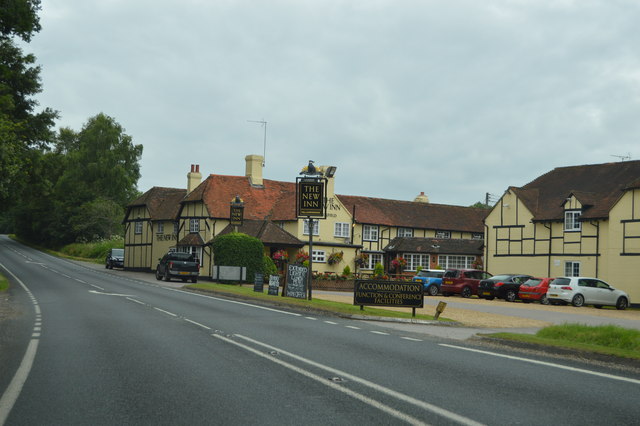
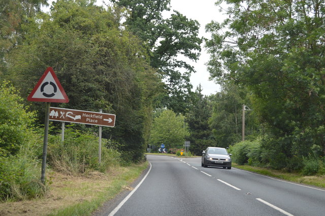
Heckfield Place

A country estate of 438 acres, the heart of Heckfield Place is a Georgian Grade II listed manor house, located in Hampshire, United Kingdom. It was built...

Nearby Amenities

Located within 500m of 51.338504,-0.93312439
Power: tower
Source: bing
Lat/Long: 51.3391182/-0.9392018
Power: tower
Source: bing
Lat/Long: 51.3412319/-0.9349472
Power: tower
Source: bing
Lat/Long: 51.342212/-0.9299543
Power: tower
Lat/Long: 51.336782/-0.9312256
Power: tower
Lat/Long: 51.341423/-0.9296231
Power: tower
Lat/Long: 51.3392744/-0.9277205
Power: tower
Source: Bing
Lat/Long: 51.3348888/-0.9339089
The data included in this document is from www.openstreetmap.org. The data is made available under ODbL.

Have you been to Vinalls Copse?

Leave your review of Vinalls Copse below (or comments, questions and feedback).