Eastfield Plantation

Wood, Forest in Hampshire East Hampshire

England

Eastfield Plantation

A31 - Near Chawton
A31 - Near Chawton Credit: James Emmans

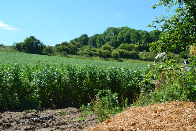
Eastfield Plantation is a picturesque woodland estate located in Hampshire, England. Situated in the heart of the county, this enchanting forest, also known as Eastfield Wood, spans an area of approximately 500 acres. It is nestled amidst the rolling hills and verdant landscapes that Hampshire is renowned for.

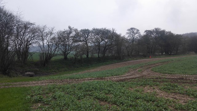
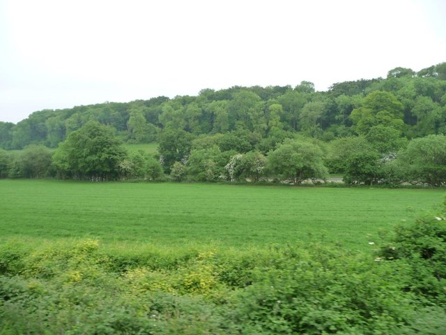
The plantation boasts a diverse range of tree species, including ancient oaks, beech, birch, and ash trees. These majestic giants dominate the woodland, forming a dense canopy that provides shade and shelter to a variety of flora and fauna. The forest floor is carpeted with a lush undergrowth of wildflowers, ferns, and mosses, creating a vibrant and picturesque scene.

Eastfield Plantation is a haven for wildlife enthusiasts and nature lovers, with numerous species of birds, mammals, and insects calling it home. Visitors may spot deer grazing in the meadows or catch a glimpse of elusive woodland creatures like foxes and badgers. The melodious songs of woodland birds, such as thrushes and warblers, add to the symphony of nature that permeates the air.

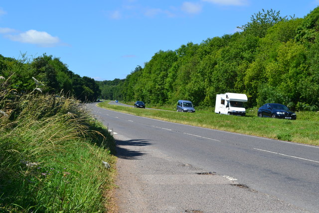
The plantation offers a network of well-maintained walking trails, allowing visitors to explore the woodlands at their leisure. These paths wind through the forest, offering stunning views of the surrounding countryside and opportunities to observe the rich biodiversity up close.

Eastfield Plantation is a cherished natural gem in Hampshire, providing a tranquil retreat for those seeking solace in nature's embrace. Its beauty, biodiversity, and serene atmosphere make it a must-visit destination for nature enthusiasts and a valuable asset for the local community.

If you have any feedback on the listing, please let us know in the comments section below.

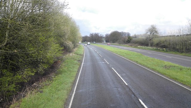
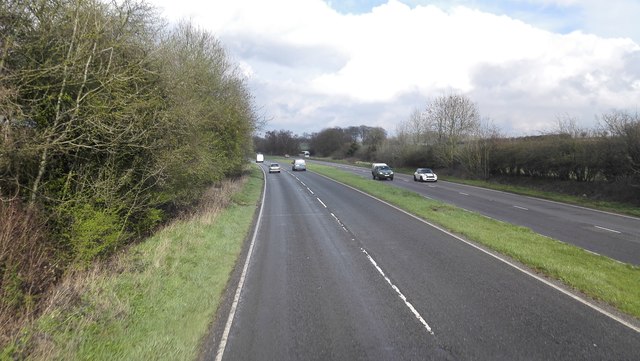
Eastfield Plantation Images

Images are sourced within 2km of 51.131776/-0.98289891 or Grid Reference SU7137. Thanks to Geograph Open Source API. All images are credited.

A31 - Near Chawton
A31 - Near Chawton
A31 - Near Chawton Dual carriageway heading north east, that soon becomes the Alton bypass.
A31 - Near Chawton
Dual carriageway heading north east, that soon becomes the Alton bypass.
Field Boundary near Lower Farringdon
Farmland south-east of Beigent's Copse Between the railway line and the A31. The woodland on the hillside is Imbook Copse.
Farmland south-east of Beigent's Copse
Between the railway line and the A31. The woodland on the hillside is Imbook Copse.
Field beside lay-by on the A31
A31 west of Chawton
A31 west of Chawton
Market Day in Alton (a) Markets have been in the existence for many centuries. 
Most Settlements in England at least one outlet for local artisans, tradesmen and farmers. The market often gained a royal charter that gave  sole rights to an area six and two thirds miles as the crow flies from the designated market place. Many famous brands began their commercial ventures in markets. We are often told how much has changed in the last 25 years but some really important things have not. The market is an enduring symbol of the sense of community that communal shopping generates, and the internet cannot.
Market Day in Alton (a)
Markets have been in the existence for many centuries. Most Settlements in England at least one outlet for local artisans, tradesmen and farmers. The market often gained a royal charter that gave sole rights to an area six and two thirds miles as the crow flies from the designated market place. Many famous brands began their commercial ventures in markets. We are often told how much has changed in the last 25 years but some really important things have not. The market is an enduring symbol of the sense of community that communal shopping generates, and the internet cannot.
Market Day in Alton (b)
Alton- can you bear to visit? (taken in Westbrook Walk)
Alton- can you bear to visit?
(taken in Westbrook Walk)
Spring forward, fall back (13) Alton Flood Meadow
Spring forward, fall back (13)
Alton Flood Meadow
Spring forward, fall back (14) The Flood Meadows
Spring forward, fall back (14)
The Flood Meadows
Spring forward, fall back (15) Stream that becomes the River Wey
Spring forward, fall back (15)
Stream that becomes the River Wey
Spring forward, fall back (16) Entrance to the Flood Meadows
Spring forward, fall back (16)
Entrance to the Flood Meadows
Spring forward, fall back (17) Footpath from The Flood Meadows to the Basingstoke Road
Spring forward, fall back (17)
Footpath from The Flood Meadows to the Basingstoke Road
Spring forward, fall back (18) Footpath from Basingstoke Road to the Flood Meadows
Spring forward, fall back (18)
Footpath from Basingstoke Road to the Flood Meadows
Spring forward, fall back (19) The Flood Meadows as seen from Basingstoke Road
Spring forward, fall back (19)
The Flood Meadows as seen from Basingstoke Road
Spring forward, fall back (20) Looking westwards along the Basingstoke Road
Spring forward, fall back (20)
Looking westwards along the Basingstoke Road
Spring forward, fall back (21) Junction of Basingstoke Road and Lenten Street
Spring forward, fall back (21)
Junction of Basingstoke Road and Lenten Street
Show me another place!

Eastfield Plantation is located at Grid Ref: SU7137 (Lat: 51.131776, Lng: -0.98289891)

Administrative County: Hampshire

District: East Hampshire

Police Authority: Hampshire

What 3 Words

///comet.trucks.snug. Near Alton, Hampshire

Related Wikis

Chawton

Chawton is a village and civil parish in the East Hampshire district of Hampshire, England. The village lies within the South Downs National Park and is...

Jane Austen's House Museum

Jane Austen's House Museum is a small independent museum in the village of Chawton near Alton in Hampshire. It is a writer's house museum occupying the...

Butts Junction

Butts Junction was a railway junction located in Alton in Hampshire, England. The junction was the location at which the Basingstoke and Alton Light Railway...

Treloar's Hospital Platform railway station

Treloar's Hospital Platform (also known as Alton Park and Cripples' Home Siding) was a railway station which served Lord Mayor Treloar's hospital in Alton...

All Saints' Church, Alton

All Saints' Church is an Anglican church in Alton, Hampshire, England. It is a Grade II listed building by English Heritage.
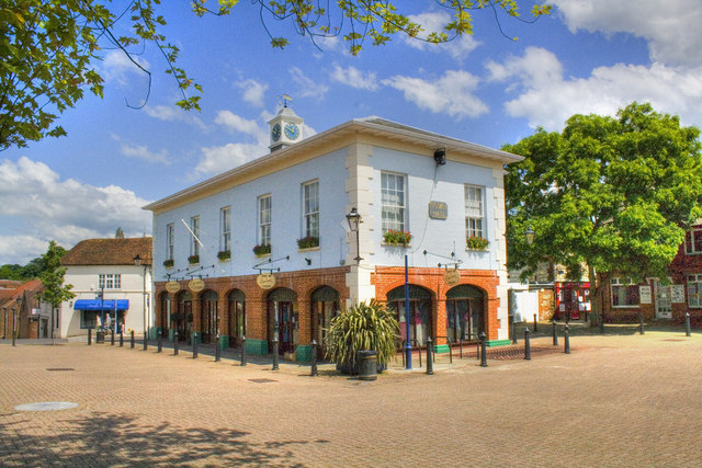
Alton Town Hall

Alton Town Hall is a municipal building in the Market Square in Alton, Hampshire, England. The structure, which is the meeting place of Alton Town Council...

Alton, Hampshire

Alton ( AWL-tən) is a market town and civil parish in the East Hampshire district of Hampshire, England, near the source of the River Wey. It had a population...

Massey's Folly

Massey's Folly was built by Thomas Hacket Massey who served as rector in Farringdon village in Hampshire for 62 years. The folly took thirty years to build...

Nearby Amenities

Located within 500m of 51.131776,-0.98289891
Chawton
Is In: Hampshire, England, UK
Place: village
Source: npe
Lat/Long: 51.133963/-0.9885059
Barrier: stile
Lat/Long: 51.1322674/-0.9768355
Barrier: stile
Lat/Long: 51.1325797/-0.9790673
Barrier: stile
Lat/Long: 51.1329288/-0.9803376
Barrier: stile
Lat/Long: 51.1335963/-0.981706
Bus Stop
Chawton (the Greyfriar Ph)
Naptan AtcoCode: 1900HA020305
Naptan Bearing: N
Naptan CommonName: Chawton (the Greyfriar Ph)
Naptan Landmark: Jane Austen's House
Naptan NaptanCode: hamgmamj
Naptan Street: Winchester Road
Naptan Verified: no
Source: naptan_import
Lat/Long: 51.1331727/-0.9887785
Bus Stop
Chawton (the Greyfriar Ph)
Naptan AtcoCode: 1900HA020306
Naptan Bearing: S
Naptan CommonName: Chawton (the Greyfriar Ph)
Naptan Landmark: Jane Austen's House
Naptan NaptanCode: hamgmamw
Naptan Street: Winchester Road
Naptan Verified: no
Source: naptan_import
Lat/Long: 51.133136/-0.9886936
Bus Stop
Eastfields Estate
Naptan AtcoCode: 1900HA020309
Naptan Bearing: W
Naptan CommonName: Eastfields Estate
Naptan NaptanCode: hamgmdjm
Naptan Street: Wolf's Lane
Naptan Verified: no
Source: naptan_import
Lat/Long: 51.135487/-0.9849974
Bus Stop
Eastfields Estate
Naptan AtcoCode: 1900HA020310
Naptan Bearing: E
Naptan CommonName: Eastfields Estate
Naptan NaptanCode: hamgmdjp
Naptan Street: Wolf's Lane
Naptan Verified: no
Source: naptan_import
Lat/Long: 51.1355409/-0.9849962
Post Box
Collection Plate: CP7
Collection Times: Mo-Fr 17:00; Sa 10:30
Last Checked: 2021-08-08
Operator: Royal Mail
Operator Wikidata: Q638098
Post Box Type: lamp
Ref: GU34 9
Royal Cypher: EIIR
Royal Cypher Wikidata: Q33102113
Source: survey
Lat/Long: 51.1330134/-0.9888216
Parking
Lat/Long: 51.1326735/-0.9884797
Leisure: playground
Lat/Long: 51.1325013/-0.9887789
Bench
Lat/Long: 51.1327709/-0.9890022
Bench
Lat/Long: 51.1329763/-0.9892233
Barrier: stile
Lat/Long: 51.1340114/-0.9823986
Toilets
Check Date: 2023-04-08
Lat/Long: 51.1333418/-0.9892598
Bicycle Parking
Capacity: 4
Covered: no
Lat/Long: 51.1330377/-0.9885059
Bench
Lat/Long: 51.1327459/-0.9892672
Eastfield Farm
Place: farm
Source: Bing
Lat/Long: 51.133347/-0.9825307
The Oast House
Place: isolated_dwelling
Source: Bing
Lat/Long: 51.1275633/-0.9832956
The data included in this document is from www.openstreetmap.org. The data is made available under ODbL.

Have you been to Eastfield Plantation?

Leave your review of Eastfield Plantation below (or comments, questions and feedback).