Old Mally Plantation

Wood, Forest in Yorkshire Scarborough

England

Old Mally Plantation

Raven Lodge retaining walls
Raven Lodge retaining walls Credit: Mick Garratt

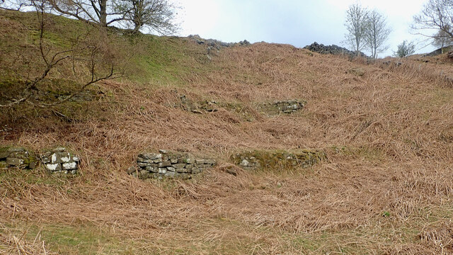
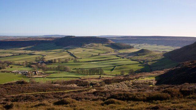
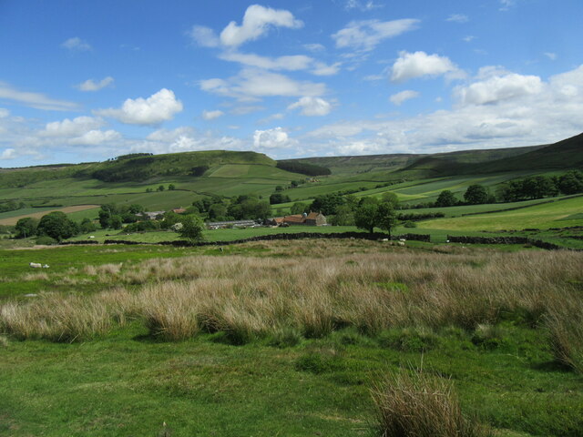
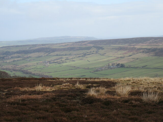
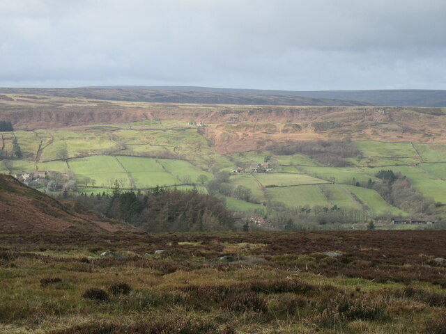
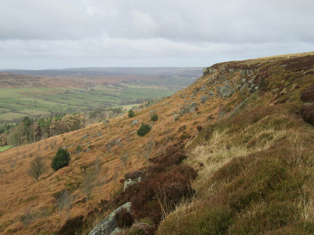
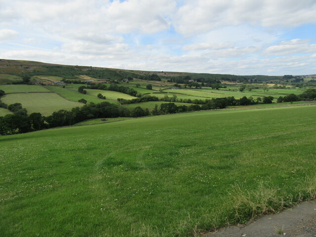
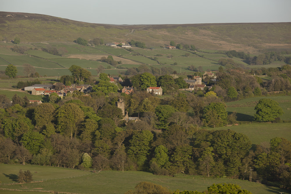
Old Mally Plantation, located in the picturesque county of Yorkshire, England, is a historic woodland nestled within a sprawling forest. Covering an area of approximately 50 acres, this enchanting plantation is renowned for its ancient trees and diverse flora and fauna.

The plantation, dating back several centuries, has retained its original charm and remains largely untouched by modern development. It boasts a magnificent collection of towering oak, beech, and ash trees, some of which are believed to be over 300 years old. These majestic giants create a dense canopy, providing a tranquil and sheltered environment for a myriad of wildlife species.

The woodland floor is carpeted with a rich tapestry of wildflowers, such as bluebells, primroses, and wood anemones, which burst into vibrant colors during the spring months. The plantation is also home to an abundance of wildlife, including deer, foxes, badgers, and a myriad of bird species, making it a haven for nature enthusiasts and birdwatchers alike.

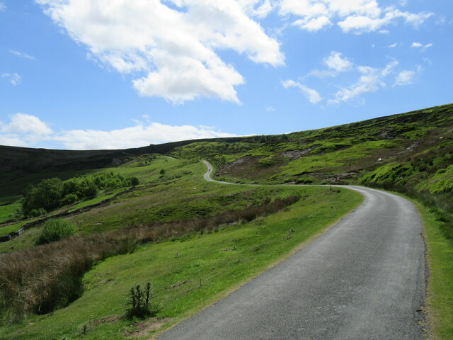
The plantation is crisscrossed by a network of well-maintained footpaths, allowing visitors to explore its captivating beauty at their own pace. These paths lead to charming clearings, babbling brooks, and hidden ponds, further enhancing the plantation's allure.

Old Mally Plantation offers a sanctuary away from the hustle and bustle of city life, inviting visitors to immerse themselves in the tranquility of nature. Whether one seeks a leisurely stroll, a picnic amidst the trees, or a chance to reconnect with the natural world, this woodland paradise promises an unforgettable experience for all.

If you have any feedback on the listing, please let us know in the comments section below.

Old Mally Plantation Images

Images are sourced within 2km of 54.427437/-0.92334289 or Grid Reference NZ6904. Thanks to Geograph Open Source API. All images are credited.

Raven Lodge retaining walls
Little Fryup Dale The Rev. J.C. Atkinson, writing in the late 19th-century, had a fascination for Little Fryup Dale, or rather the folklore associated with the area around the little knoll on the right, Fairy Cross Plain.

It might seem odd that a man of the cloth should be so preoccupied with fairies, elves and hobs but belief in the supernatural would still have been within living memory of many of his parishioners. In 1866 he wrote:

There was a singularly fine fairy-ring, at Fairy-cross Plain, in this parish — a place which will be mentioned again before long, in connection with the Elfin race — round which children, in the time of my parish clerk’s childhood, (and he is not fifty yet,) would run any number of times short of nine, himself among the number. Nothing would induce them to run the ninth, for if they did it would ‘raise the fairies,’ who were held to have great power to harm, and a willingness too, if treated neglectingly or despitefully.

Atkinson compares similar lore from Northumberland, Scotland and across the North Sea, from Sweden and Denmark.

Fairy Cross Plain now is just two or three cottages. In Atkinson’s day, one of these was a public house called the “Ship Inn”. Job Bonas lived in another. He was a farmer, blacksmith and horse breeder, and used to drive to Helmsley by pony and trap to shoe the oxen on Lord Feversham’s estate.

For sources and references see my blog <span class="nowrap"><a title="http://www.fhithich.uk/?p=27356" rel="nofollow ugc noopener" href="http://www.fhithich.uk/?p=27356">Link</a><img style="margin-left:2px;" alt="External link" title="External link - shift click to open in new window" src="https://s1.geograph.org.uk/img/external.png" width="10" height="10"/></span>
Little Fryup Dale
The Rev. J.C. Atkinson, writing in the late 19th-century, had a fascination for Little Fryup Dale, or rather the folklore associated with the area around the little knoll on the right, Fairy Cross Plain. It might seem odd that a man of the cloth should be so preoccupied with fairies, elves and hobs but belief in the supernatural would still have been within living memory of many of his parishioners. In 1866 he wrote: There was a singularly fine fairy-ring, at Fairy-cross Plain, in this parish — a place which will be mentioned again before long, in connection with the Elfin race — round which children, in the time of my parish clerk’s childhood, (and he is not fifty yet,) would run any number of times short of nine, himself among the number. Nothing would induce them to run the ninth, for if they did it would ‘raise the fairies,’ who were held to have great power to harm, and a willingness too, if treated neglectingly or despitefully. Atkinson compares similar lore from Northumberland, Scotland and across the North Sea, from Sweden and Denmark. Fairy Cross Plain now is just two or three cottages. In Atkinson’s day, one of these was a public house called the “Ship Inn”. Job Bonas lived in another. He was a farmer, blacksmith and horse breeder, and used to drive to Helmsley by pony and trap to shoe the oxen on Lord Feversham’s estate. For sources and references see my blog LinkExternal link
New Way The steep hill out of Little Fryup Dale.
New Way
The steep hill out of Little Fryup Dale.
Little Fryup Dale Looking east at the bottom of New Way.
Little Fryup Dale
Looking east at the bottom of New Way.
Great Fryup Dale Looking NE from the road.
Great Fryup Dale
Looking NE from the road.
On Danby Rigg Looking west towards Danby Dale.
On Danby Rigg
Looking west towards Danby Dale.
Danby Rigg The rocky escarpment on the west side of Danby Rigg.
Danby Rigg
The rocky escarpment on the west side of Danby Rigg.
Road junction at Slate Hill The road along Little Fryup Dale has a branch here which ascends the moorside. A roadside sign warns that this is a single track road with no passing places and is unsuitable for lorries. It fails to mention the numerous potholes though.
Road junction at Slate Hill
The road along Little Fryup Dale has a branch here which ascends the moorside. A roadside sign warns that this is a single track road with no passing places and is unsuitable for lorries. It fails to mention the numerous potholes though.
The steep descent into Little Fryup Dale A single track road that drops steeply off the moor into Little Fryup Dale. A sign at the bottom warns of a lack of passing places, but there are several smooth grassy areas where vehicles may pass.
The steep descent into Little Fryup Dale
A single track road that drops steeply off the moor into Little Fryup Dale. A sign at the bottom warns of a lack of passing places, but there are several smooth grassy areas where vehicles may pass.
Bridleway into the dale This is bridleway number 30.31/114 which drops down off the moor for a 140m descent to the road at the minor watershed between Little and Great Fryup Dale. The prominent 'island' of high ground in the distance is simply shown as 'Heads' on OS maps old and new.
Bridleway into the dale
This is bridleway number 30.31/114 which drops down off the moor for a 140m descent to the road at the minor watershed between Little and Great Fryup Dale. The prominent 'island' of high ground in the distance is simply shown as 'Heads' on OS maps old and new.
Moorland sheep Sheep on the moor above Great Fryup Dale. They appear to exist quite happily up here through the winter months, their grassy diet no doubt supplemented with sheep nuts and hay by the farmer. Beyond Great Fryup Dale is a thin blue line on the horizon, that being the North Sea out from Whitby.
Moorland sheep
Sheep on the moor above Great Fryup Dale. They appear to exist quite happily up here through the winter months, their grassy diet no doubt supplemented with sheep nuts and hay by the farmer. Beyond Great Fryup Dale is a thin blue line on the horizon, that being the North Sea out from Whitby.
Across the moor towards disturbed ground Gently sloping moorland above the head of Great Fryup Dale. In the middle distance an area of highly disturbed ground which suggests an area of landslips rather than human activity, as there's no indication on old maps of any quarrying or mining. What old maps do show is a line of springs, probably emerging where sandstone overlies shales, a combination which often causes landslips.
Across the moor towards disturbed ground
Gently sloping moorland above the head of Great Fryup Dale. In the middle distance an area of highly disturbed ground which suggests an area of landslips rather than human activity, as there's no indication on old maps of any quarrying or mining. What old maps do show is a line of springs, probably emerging where sandstone overlies shales, a combination which often causes landslips.
Moorland road Road across Danby High Moor at around the 400m contour. Users of this road need to be aware of the numerous potholes.
Moorland road
Road across Danby High Moor at around the 400m contour. Users of this road need to be aware of the numerous potholes.
Darkening skies above Danby High Moor A passing shower to the north west blots out the sunshine on the moor top.
Darkening skies above Danby High Moor
A passing shower to the north west blots out the sunshine on the moor top.
Danby Dale Looking NW from Gate Way.
Danby Dale
Looking NW from Gate Way.
Near Stormy Hall Looking NE from Blackmires Lane.
Near Stormy Hall
Looking NE from Blackmires Lane.
Peacock A Peacock at West Cliff Farm.
Peacock
A Peacock at West Cliff Farm.
Red Admiral A Red Admiral at West Green Farm.
Red Admiral
A Red Admiral at West Green Farm.
Show me another place!

Old Mally Plantation is located at Grid Ref: NZ6904 (Lat: 54.427437, Lng: -0.92334289)

Division: North Riding

Administrative County: North Yorkshire

District: Scarborough

Police Authority: North Yorkshire

What 3 Words

///camp.weekends.motivator. Near Danby, North Yorkshire

Related Wikis

Botton, North Yorkshire

Botton is a small village within the North York Moors National Park in North Yorkshire, England which is mainly a Camphill Community for people with learning...

Fryup

Fryup (grid reference NZ720046) is a hamlet in the North York Moors National Park in North Yorkshire, England. It is within the civil parish of Danby,...

Westerdale

Westerdale is a village, civil parish and dale within the Scarborough district of North Yorkshire, England. The Esk Valley Walk runs through part of the...

Ainthorpe

Ainthorpe is a village in the civil parish of Danby and the Scarborough district of the county of North Yorkshire, England. It is situated within the...

Nearby Amenities

Located within 500m of 54.427437,-0.92334289
Traffic Calming: bump
Lat/Long: 54.428615/-0.9291585
Botton
Is In Valley: Danby Dale
Place: village
Source Name: OS_OpenData_StreetView
Wikidata: Q9178188
Lat/Long: 54.4275049/-0.9288366
Addr City: Whitby
Addr Housename: Old Botton Farm
Addr Postcode: YO21 2NJ
Addr Suburb: Botton
Lat/Long: 54.4308999/-0.9260529
Addr City: Whitby
Addr Postcode: YO21 2NJ
Addr Suburb: Botton
Lat/Long: 54.4274487/-0.928629
Toilets
Lat/Long: 54.4282506/-0.9276645
Traffic Calming: bump
Lat/Long: 54.4291888/-0.9298107
Botton Bookshop
Shop: books
Lat/Long: 54.4278211/-0.9280836
Botton Glassworks
Shop: houseware
Lat/Long: 54.4278055/-0.9283038
Shop: gift
Lat/Long: 54.4279706/-0.9281154
Cafe
Coffee Bar
Lat/Long: 54.4280291/-0.9281476
Botton Creamery
Shop: dairy
Lat/Long: 54.4280479/-0.9276205
Ford: yes
Lat/Long: 54.4258312/-0.9254875
Falcon Farm
Place: farm
Lat/Long: 54.4259715/-0.9262781
Botton Farm
Place: farm
Lat/Long: 54.4311409/-0.9263295
Ford: yes
Lat/Long: 54.426548/-0.9186526
The data included in this document is from www.openstreetmap.org. The data is made available under ODbL.

Have you been to Old Mally Plantation?

Leave your review of Old Mally Plantation below (or comments, questions and feedback).