Swan Wood South
Wood, Forest in Oxfordshire South Oxfordshire
England
Swan Wood South
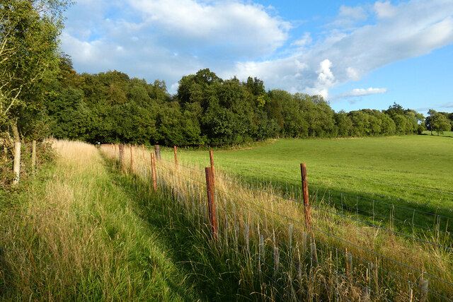
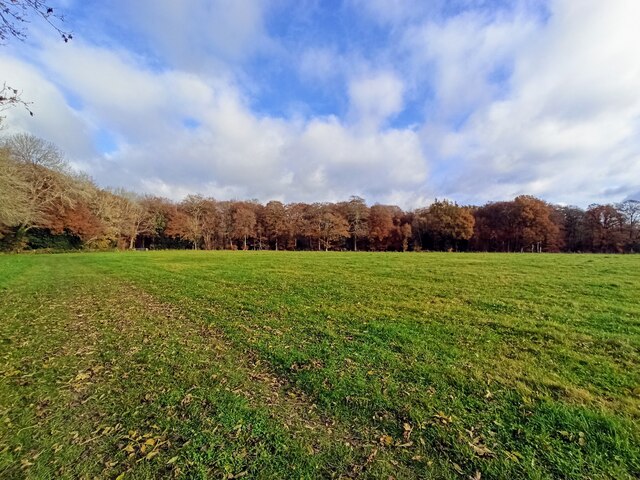
Swan Wood South is a picturesque woodland located in Oxfordshire, England. Situated in the southern region of the county, the wood spans an area of approximately 50 hectares. It is known for its dense canopy of trees, primarily consisting of oak, beech, and birch. The wood is abundant in wildlife, attracting nature enthusiasts and birdwatchers from all around.
The woodland is intersected by several footpaths, making it easily accessible for visitors. These paths weave through the enchanting forest, leading to secluded clearings and tranquil ponds. The wood is a haven for various bird species, including swans, which are often spotted gracefully gliding across the surface of the ponds. Additionally, the wood is home to a diverse range of mammals, such as deer, foxes, and badgers.
Swan Wood South is a popular spot for nature walks, picnics, and photography. The changing seasons bring a different charm to the wood, with vibrant autumn foliage and delicate spring blossoms. The wood is particularly stunning in the early morning or late afternoon, when sunlight filters through the dense foliage, casting a warm glow on the forest floor.
The wood is managed by a local conservation organization, ensuring its preservation and protection for future generations. Swan Wood South offers a peaceful retreat from the hustle and bustle of urban life, providing visitors with an opportunity to immerse themselves in the beauty of nature. Whether it's a leisurely stroll or a moment of solitude, Swan Wood South offers a truly enchanting experience for all who venture within its borders.
If you have any feedback on the listing, please let us know in the comments section below.
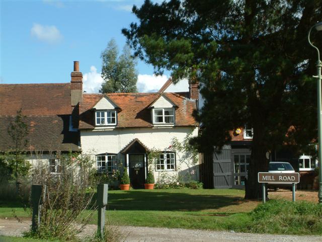
Swan Wood South Images
Images are sourced within 2km of 51.55997/-0.99272226 or Grid Reference SU6985. Thanks to Geograph Open Source API. All images are credited.


Swan Wood South is located at Grid Ref: SU6985 (Lat: 51.55997, Lng: -0.99272226)
Administrative County: Oxfordshire
District: South Oxfordshire
Police Authority: Thames Valley
What 3 Words
///menswear.guardian.grass. Near Rotherfield Peppard, Oxfordshire
Nearby Locations
Related Wikis

Highmoor, Oxfordshire
Highmoor is a village and civil parish in the Chiltern Hills in Oxfordshire, about 4 miles (6.4 km) west of Henley-on-Thames. The parish includes the hamlet...

Bear, Oveys and Great Bottom Woods
Bear, Oveys and Great Bottom Woods is a 64.1-hectare (158-acre) biological Site of Special Scientific Interest west of Henley-on-Thames in Oxfordshire...

Stoke Row
Stoke Row is a village and civil parish in the Chiltern Hills, about 5 miles (8 km) west of Henley-on-Thames in South Oxfordshire and about 9 miles (14...

Nettlebed
Nettlebed is a village and civil parish in Oxfordshire in the Chiltern Hills about 4+1⁄2 miles (7 km) northwest of Henley-on-Thames and 6 miles (10 km...

Crocker End House
Crocker End House in Nettlebed in Henley-on-Thames, Oxfordshire, England is a spacious Victorian home built to replace Nettlebed's prosperous rectory in...
Henley Rural District
Henley was a rural district in Oxfordshire, England from 1894 to 1974.It was named after the borough of Henley-on-Thames, which it surrounded on the west...

Bix, Oxfordshire
Bix is a village in the civil parish of Bix and Assendon in South Oxfordshire, about 2.5 miles (4 km) northwest of Henley-on-Thames. The village is about...

Greys Court
Greys Court is a Tudor country house and gardens in the southern Chiltern Hills at Rotherfield Greys, near Henley-on-Thames in the county of Oxfordshire...
Nearby Amenities
Located within 500m of 51.55997,-0.99272226Have you been to Swan Wood South?
Leave your review of Swan Wood South below (or comments, questions and feedback).