Burnt Platt

Wood, Forest in Oxfordshire South Oxfordshire

England

Burnt Platt

Pasture and woodland, Highmoor With a footpath approaching Highmoor from the north-west.
Pasture and woodland, Highmoor Credit: Andrew Smith

Burnt Platt is a small village located in Oxfordshire, England. Situated within a vast expanse of wood and forest, the village is known for its picturesque surroundings and serene atmosphere. It is nestled amidst the beautiful landscapes of the Cotswolds, a popular tourist destination renowned for its rolling hills and charming villages.

The village itself is characterized by its quaint and traditional architecture, with many buildings dating back centuries. The houses are mostly made of local stone, adding to the rustic charm of Burnt Platt. The streets are lined with trees, providing shade during the summer months and creating a picturesque setting for residents and visitors alike.

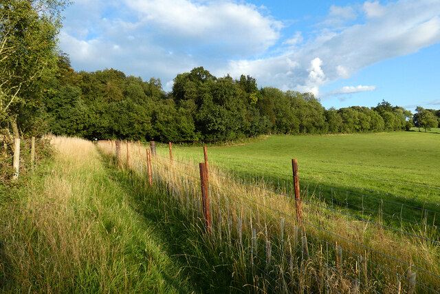
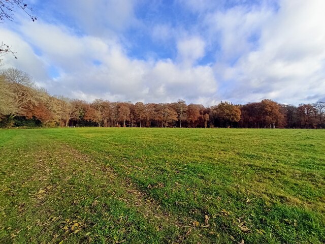
Nature enthusiasts are drawn to Burnt Platt for its proximity to the wood and forest areas that surround the village. These natural areas offer numerous walking and hiking trails, allowing visitors to explore and immerse themselves in the beauty of the countryside. The woodlands are home to a variety of flora and fauna, making it a haven for wildlife enthusiasts and birdwatchers.

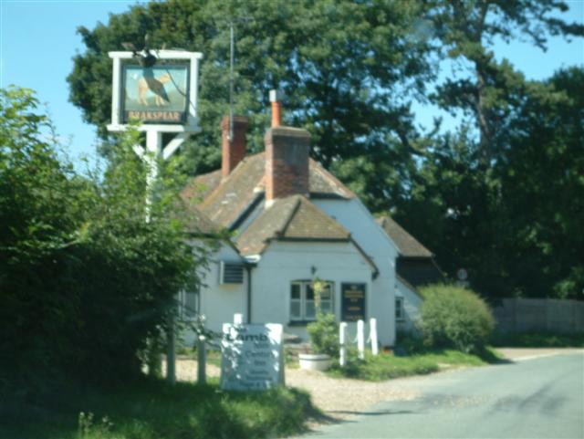
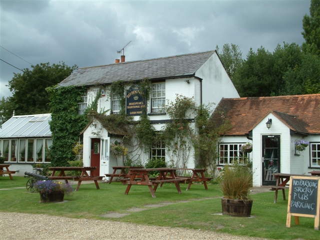
Despite its small size, Burnt Platt boasts a close-knit community. The village has a local pub where residents gather to socialize and enjoy a refreshing drink. There is also a village hall that hosts various events and activities throughout the year, fostering a sense of community spirit.

Overall, Burnt Platt, Oxfordshire is a charming village that offers a peaceful retreat for those seeking to escape the hustle and bustle of city life. With its natural beauty and strong sense of community, it is a hidden gem within the idyllic countryside of Oxfordshire.

If you have any feedback on the listing, please let us know in the comments section below.

Burnt Platt Images

Images are sourced within 2km of 51.54396/-1.0038046 or Grid Reference SU6983. Thanks to Geograph Open Source API. All images are credited.

Pasture and woodland, Highmoor With a footpath approaching Highmoor from the north-west.
Pasture and woodland, Highmoor
With a footpath approaching Highmoor from the north-west.
Fingerposts at Highmoor Cross
The road to Stoke Row Going through Bear Wood
The road to Stoke Row
Going through Bear Wood
Bear Wood, Stoke Row
Stoke Row The road becomes Kit Lane but the maps don't give a name till beyond the end of the village.
Stoke Row
The road becomes Kit Lane but the maps don't give a name till beyond the end of the village.
Stoke Row Green
Stoke Row Green
Stoke Row
Stoke Row
Houses in Stoke Row Looking towards Church View.
Houses in Stoke Row
Looking towards Church View.
Church View, Stoke Row
Basset Wood
Basset Wood
Woods north east of Stoke Row
Nott Wood
Nott Wood
The Maharajah's Well, Stoke Row This is an unlikely looking structure to find in an Oxfordshire village. Its origins lie in the friendship that developed between Edward Anderton Reade, the son of a local squire who spent his working life in India, and the Maharajah of Benares. In Victorian times the villages of this part of Oxfordshire had only limited access to clean water bringing considerable hardship to the poor of the area. Learning of these difficulties, the Maharajah - who had remained loyal to the British during the Indian Mutiny of 1857 - determined that a charity should be set up to relieve the problem. The result was a well dug to a depth of 368 feet, a considerable engineering achievement. To honour the Maharajah, who never visited Britain, a splendid well canopy was built incorporating a gold elephant representing the Hindu god Ganesh. The well was used until the beginning of the Second World War although by that time most houses in the village had a mains connection. Today the well has been renovated and preserved and is maintained by the Maharajah's Well Trust.

The octagonal cottage to the right was built to house the well warden. The last warden died in 1979 since when it has been rented out to supplement the charity's income.
The Maharajah's Well, Stoke Row
This is an unlikely looking structure to find in an Oxfordshire village. Its origins lie in the friendship that developed between Edward Anderton Reade, the son of a local squire who spent his working life in India, and the Maharajah of Benares. In Victorian times the villages of this part of Oxfordshire had only limited access to clean water bringing considerable hardship to the poor of the area. Learning of these difficulties, the Maharajah - who had remained loyal to the British during the Indian Mutiny of 1857 - determined that a charity should be set up to relieve the problem. The result was a well dug to a depth of 368 feet, a considerable engineering achievement. To honour the Maharajah, who never visited Britain, a splendid well canopy was built incorporating a gold elephant representing the Hindu god Ganesh. The well was used until the beginning of the Second World War although by that time most houses in the village had a mains connection. Today the well has been renovated and preserved and is maintained by the Maharajah's Well Trust. The octagonal cottage to the right was built to house the well warden. The last warden died in 1979 since when it has been rented out to supplement the charity's income.
The Maharajah's Well, Stoke Row This is looking under the canopy of the well where the gold elephant takes pride of place. See <a href="https://www.geograph.org.uk/photo/7620533">SU6784 : The Maharajah's Well, Stoke Row</a> for a wider view and some historical notes.
The Maharajah's Well, Stoke Row
This is looking under the canopy of the well where the gold elephant takes pride of place. See SU6784 : The Maharajah's Well, Stoke Row for a wider view and some historical notes.
The Lamb, Satwell The Lamb at Satwell
The Lamb, Satwell
The Lamb at Satwell
Satwell Close, Shepherd's green Satwell Close, Shepherd's green
Satwell Close, Shepherd's green
The Dog & Duck, Highmoor The Dog & Duck, Public House, Highmoor
The Dog & Duck, Highmoor
The Dog & Duck, Public House, Highmoor
St Pauls Church, Highmoor St Pauls Church in the south-western corner of the gridsquare
St Pauls Church, Highmoor
St Pauls Church in the south-western corner of the gridsquare
Show me another place!

Burnt Platt is located at Grid Ref: SU6983 (Lat: 51.54396, Lng: -1.0038046)

Administrative County: Oxfordshire

District: South Oxfordshire

Police Authority: Thames Valley

What 3 Words

///lectured.shaver.delays. Near Rotherfield Peppard, Oxfordshire

Related Wikis

Bear, Oveys and Great Bottom Woods

Bear, Oveys and Great Bottom Woods is a 64.1-hectare (158-acre) biological Site of Special Scientific Interest west of Henley-on-Thames in Oxfordshire...

Stoke Row

Stoke Row is a village and civil parish in the Chiltern Hills, about 5 miles (8 km) west of Henley-on-Thames in South Oxfordshire and about 9 miles (14...

Wyfold Court

Wyfold Court is a country house at Rotherfield Peppard in south Oxfordshire. It is a Grade II* listed building. By the year 2000, the estate had been converted...

Highmoor, Oxfordshire

Highmoor is a village and civil parish in the Chiltern Hills in Oxfordshire, about 4 miles (6.4 km) west of Henley-on-Thames. The parish includes the hamlet...

Gallowstree Common

Gallowstree Common is a hamlet in South Oxfordshire, England, about 4.5 miles (7.2 km) north of Reading, Berkshire. The village had a public house, the...

St Peter and St Paul, Checkendon

St Peter and St Paul is the Church of England parish church of Checkendon, a village in Oxfordshire, England. Its parish is part of the Deanery of Henley...

Hook End Recording Studios

Hook End Recording Studios was a recording studio located in Hook End Manor, a 16th-century Elizabethan house near Checkendon, Oxfordshire, England. Its...

Checkendon

Checkendon is a village and civil parish about 6 miles (10 km) west of Henley-on-Thames in South Oxfordshire and about 9 miles (14 km) north west of Reading...

Nearby Amenities

Located within 500m of 51.54396,-1.0038046
Barrier: stile
Foot: yes
Material: wood
Stile: squeezer
Lat/Long: 51.545721/-0.9978868
The data included in this document is from www.openstreetmap.org. The data is made available under ODbL.

Have you been to Burnt Platt?

Leave your review of Burnt Platt below (or comments, questions and feedback).