Ashfold Side

Settlement in Yorkshire Harrogate

England

Ashfold Side

Greenhow Village Named after the hill it sits under. Green - because this is a limestone area, the alkaline soil seems to produce very green grass.
Greenhow Village Credit: Malcolm Street

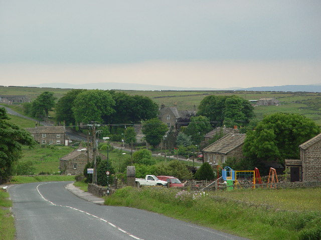
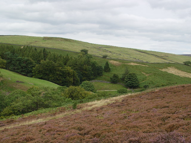
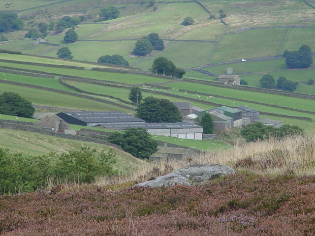
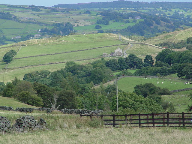
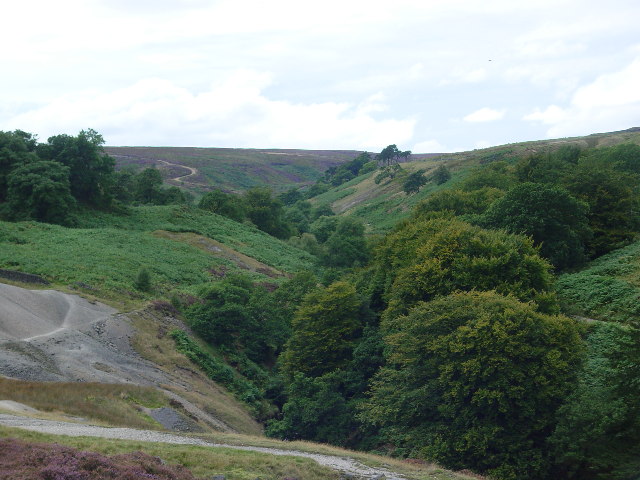
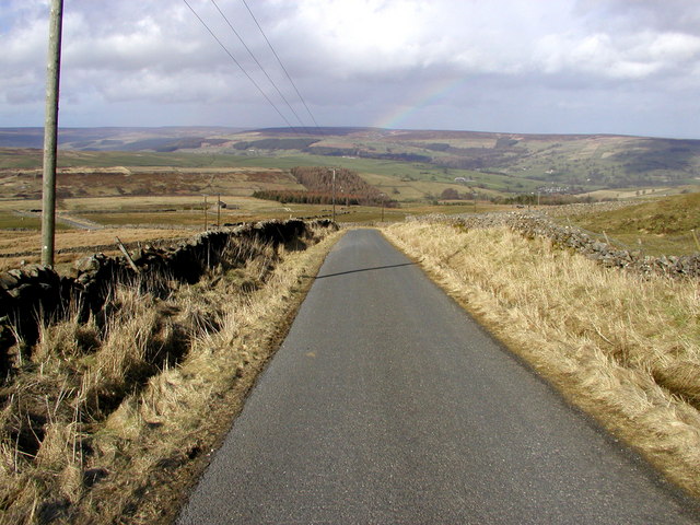
Ashfold Side is a small village located in the rural countryside of Yorkshire, England. Situated amidst rolling hills and picturesque landscapes, this charming settlement offers a peaceful and idyllic escape from the hustle and bustle of city life.

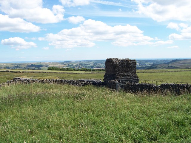
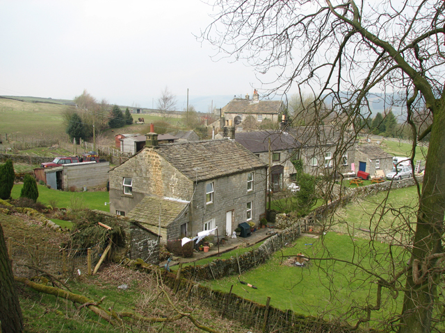
The village is characterized by its quaint and traditional English architecture, with rows of charming cottages and stone houses lining the narrow streets. These buildings date back several centuries, giving Ashfold Side a sense of history and heritage.

Despite its small size, Ashfold Side boasts a close-knit community that takes pride in maintaining the village's natural beauty. Well-tended gardens and floral displays add color and vibrancy to the surroundings, creating a pleasing aesthetic for residents and visitors alike.

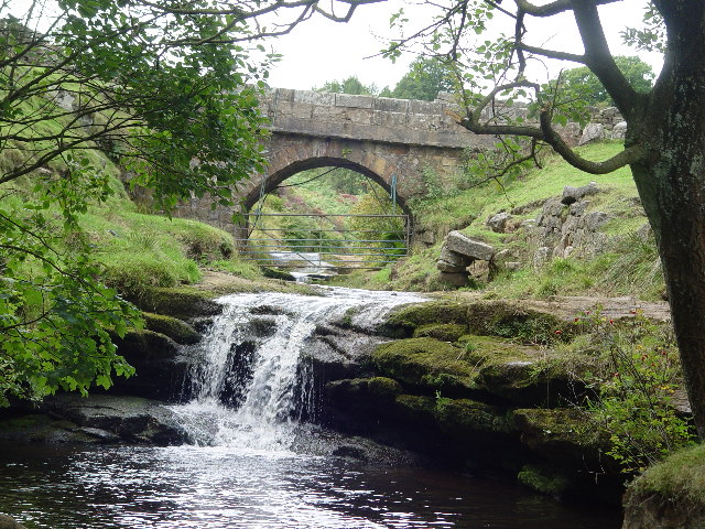
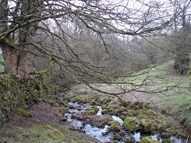
The village is surrounded by stunning natural features, including sprawling meadows, ancient woodlands, and babbling brooks. This makes it an ideal destination for nature enthusiasts and outdoor adventurers. Numerous walking and hiking trails crisscross the area, offering opportunities to explore the breathtaking beauty of the Yorkshire countryside.

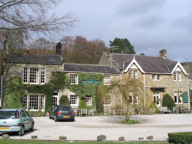
Although Ashfold Side is primarily a residential area, it is within close proximity to larger towns and cities, providing residents with convenient access to amenities and services. The village is also home to a cozy pub, where locals and tourists can gather for a pint and a hearty meal.

In summary, Ashfold Side offers a serene and picturesque setting, steeped in history and surrounded by natural beauty. It is a place where residents can enjoy a peaceful and rural lifestyle, while still having easy access to nearby urban centers.

If you have any feedback on the listing, please let us know in the comments section below.
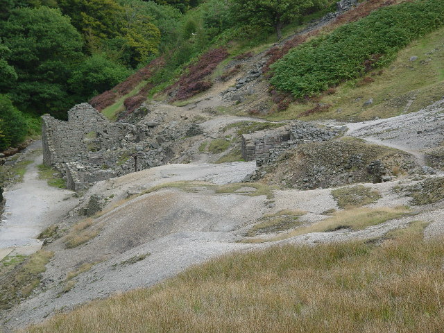
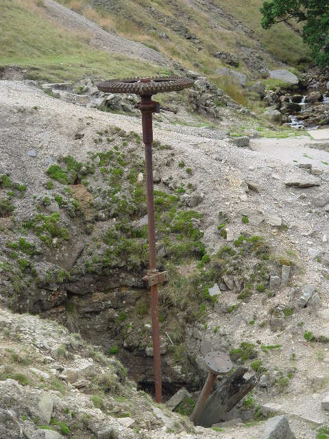
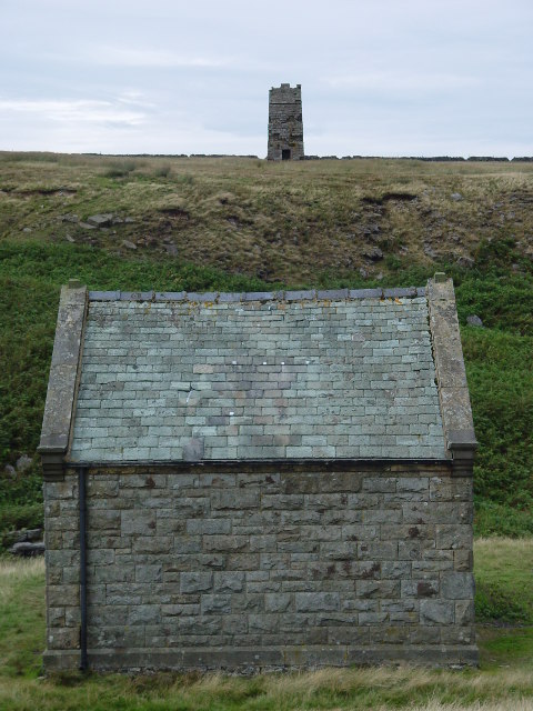
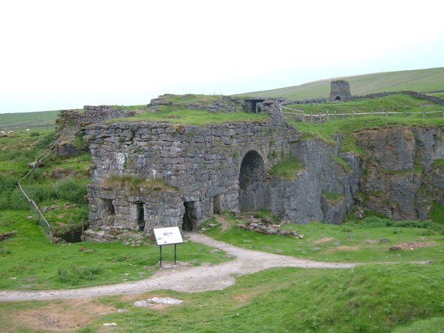
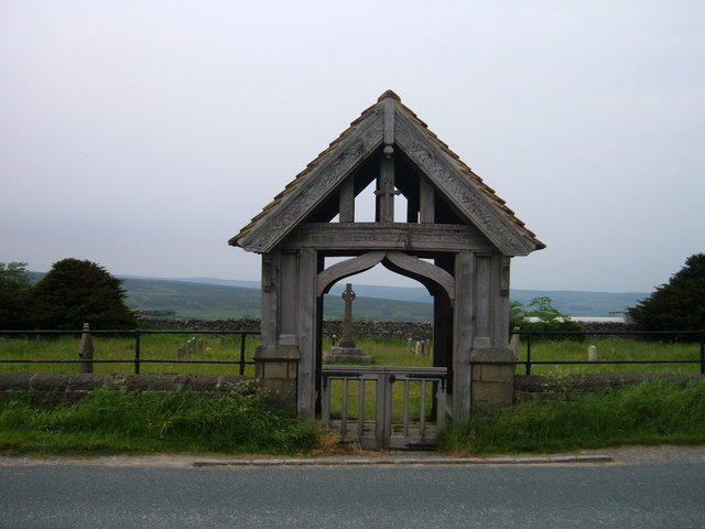
Ashfold Side Images

Images are sourced within 2km of 54.08977/-1.8180362 or Grid Reference SE1266. Thanks to Geograph Open Source API. All images are credited.

Greenhow Village Named after the hill it sits under. Green - because this is a limestone area, the alkaline soil seems to produce very green grass.
Greenhow Village
Named after the hill it sits under. Green - because this is a limestone area, the alkaline soil seems to produce very green grass.
Greenhow Hill at Toft Gate Greenhow Hill rises 900 feet from Pateley Bridge to the hill top village of Greenhow 3 miles away. This difference in altitude can mean feet of snow on the hill and sunshine in Pateley.
Greenhow Hill at Toft Gate
Greenhow Hill rises 900 feet from Pateley Bridge to the hill top village of Greenhow 3 miles away. This difference in altitude can mean feet of snow on the hill and sunshine in Pateley.
Coldstones Quarry, Greenhow Hill Large open limestone quarry.
Coldstones Quarry, Greenhow Hill
Large open limestone quarry.
Brandstone Dub and Bridge Brandstone Dub and Bridge, on Brandstone Beck, Sunside, just below the old, long abandoned village of Hardcastle. The term Dub refers to a pool, here deep enough to bathe in, although not very big - may be it was the local washing hole at sometime?
Brandstone Dub and Bridge
Brandstone Dub and Bridge, on Brandstone Beck, Sunside, just below the old, long abandoned village of Hardcastle. The term Dub refers to a pool, here deep enough to bathe in, although not very big - may be it was the local washing hole at sometime?
Prosperous Smelt Mill, Merryfield Built around 1800 the mill smelted the lead ore produced from the Prosperous and Providence Mines. The crown cog wheel standing proud in front of the mill rises up from Smelt Mill Shaft where an underground 20 foot diameter waterwheel supplied power to the mill. The pinion shaft lies in the now blocked shaft.
Prosperous Smelt Mill, Merryfield
Built around 1800 the mill smelted the lead ore produced from the Prosperous and Providence Mines. The crown cog wheel standing proud in front of the mill rises up from Smelt Mill Shaft where an underground 20 foot diameter waterwheel supplied power to the mill. The pinion shaft lies in the now blocked shaft.
Smelt Mill Shaft, Merryfield The crown cog on the drive shaft can here be clearly seen, along with the pinion shaft lying in the mine shaft. These transferred the power from the underground waterwheel to the mill.
Smelt Mill Shaft, Merryfield
The crown cog on the drive shaft can here be clearly seen, along with the pinion shaft lying in the mine shaft. These transferred the power from the underground waterwheel to the mill.
Surveying Tower, Hardcastle Moor The surveying tower was used in the driving of the aqueduct tunnel under Greenhow Hill abt 1900. The tunnel is part of a long aqueduct from Scar House Reservoir to Bradford. In the foreground is No1 Well Shaft, one of 3 access points in the tunnel which is 3.5 miles long and reaches its greatest depth below the ground surface at No2 Shaft, Craven Cross, Greenhow, where it is 600 feet down. This is deeper than any of the mines reached. For further information see <span class="nowrap"><a title="http://www.greenhow-hill.org.uk/mining/bcww.html" rel="nofollow ugc noopener" href="http://www.greenhow-hill.org.uk/mining/bcww.html">Link</a><img style="margin-left:2px;" alt="External link" title="External link - shift click to open in new window" src="https://s1.geograph.org.uk/img/external.png" width="10" height="10"/></span>
Surveying Tower, Hardcastle Moor
The surveying tower was used in the driving of the aqueduct tunnel under Greenhow Hill abt 1900. The tunnel is part of a long aqueduct from Scar House Reservoir to Bradford. In the foreground is No1 Well Shaft, one of 3 access points in the tunnel which is 3.5 miles long and reaches its greatest depth below the ground surface at No2 Shaft, Craven Cross, Greenhow, where it is 600 feet down. This is deeper than any of the mines reached. For further information see LinkExternal link
Ashfoldside Ashfoldside Beck, which runs from above the Prosperous Mine workings at High Stonet Grooves to where it joins the River Nidd  above Pateley Bridge. Opposite the wooded valley in the photograph is the Wonderful Level, driven by Sir Thomas White's company abt 1800. This connects with the Smelt Mill Shaft shown in SE1166
Ashfoldside
Ashfoldside Beck, which runs from above the Prosperous Mine workings at High Stonet Grooves to where it joins the River Nidd above Pateley Bridge. Opposite the wooded valley in the photograph is the Wonderful Level, driven by Sir Thomas White's company abt 1800. This connects with the Smelt Mill Shaft shown in SE1166
Westfield House Westfield House, a farm set above Ashfoldside Beck.
Westfield House
Westfield House, a farm set above Ashfoldside Beck.
House on Ladies Riggs Road The house is near Bale Bank Farm. In the distance the ground falls away over Ladies' Riggs into Pateley Bridge, Nidderdale.
House on Ladies Riggs Road
The house is near Bale Bank Farm. In the distance the ground falls away over Ladies' Riggs into Pateley Bridge, Nidderdale.
The valley of Ashfoldside Beck Looking up from Prosperous Smelt Mill.
The valley of Ashfoldside Beck
Looking up from Prosperous Smelt Mill.
New Shaft Engine House at Merryfield Hole This housed a steam engine which was used to pump water out of the mine shaft surrounded by a fence to the left of it.
New Shaft Engine House at Merryfield Hole
This housed a steam engine which was used to pump water out of the mine shaft surrounded by a fence to the left of it.
Looking towards Upper Nidderdale Taken from the minor road just off the Grassington to Pately Bridge road.
Looking towards Upper Nidderdale
Taken from the minor road just off the Grassington to Pately Bridge road.
Hillend. Stream at Hillend on the Nidderdale Way.
Hillend.
Stream at Hillend on the Nidderdale Way.
Toft Gate Lime Kiln,  Greenhow The kiln in the foreground was loaded with limestone through the top and with coal through the rectangular openings in the end and side walls.  A stone lined flue runs from the kiln up a gentle slope to the chimney base in the distance.  
The hill behind the chimney is the west flank of the modern day limestone quarry.
Toft Gate Lime Kiln, Greenhow
The kiln in the foreground was loaded with limestone through the top and with coal through the rectangular openings in the end and side walls. A stone lined flue runs from the kiln up a gentle slope to the chimney base in the distance. The hill behind the chimney is the west flank of the modern day limestone quarry.
Mouseman lychgate at Greenhow Covered entry in carved oak to a small roadside cemetery about 1/2 mile outside of the village of Greenhow.  There are two carved "mice" in the curved trusses and following Biblical quotes on the outer and inner lintels:-
"I will lift up mine eyes unto the hills, from whence cometh my help."

"The sun shall not burn you by day, neither the moon by night"
Mouseman lychgate at Greenhow
Covered entry in carved oak to a small roadside cemetery about 1/2 mile outside of the village of Greenhow. There are two carved "mice" in the curved trusses and following Biblical quotes on the outer and inner lintels:- "I will lift up mine eyes unto the hills, from whence cometh my help." "The sun shall not burn you by day, neither the moon by night"
Mouseman mouse Detail of carving on Greenhow cemetery lychgate.
Mouseman mouse
Detail of carving on Greenhow cemetery lychgate.
View from Toft Gate Lime Kilns
Show me another place!

Ashfold Side is located at Grid Ref: SE1266 (Lat: 54.08977, Lng: -1.8180362)

Division: West Riding

Administrative County: North Yorkshire

District: Harrogate

Police Authority: North Yorkshire

What 3 Words

///encourage.footsteps.nightlife. Near Pateley Bridge, North Yorkshire

Related Wikis

Heathfield, North Yorkshire

Heathfield is a hamlet in the civil parish of Stonebeck Down in upper Nidderdale, in North Yorkshire, England. It lies on a broad terrace on the west...
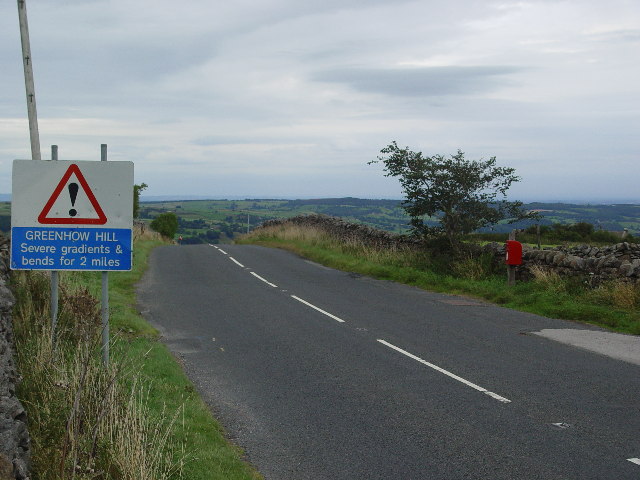
Greenhow

Greenhow is a village in North Yorkshire, England, often referred to as Greenhow Hill. The term how derives from the Old Norse word haugr meaning a hill...

Nidderdale High School

Nidderdale High School is a coeducational secondary school located in Pateley Bridge, North Yorkshire, England. The school is named after Nidderdale, one...

Gouthwaite Reservoir

Gouthwaite Reservoir is in Nidderdale, North Yorkshire, England. It is one of many reservoirs in the area, others include Roundhill Reservoir and Angram...

Wath-in-Nidderdale railway station

Wath-in-Nidderdale railway station, was one of two intermediate stations on the Nidd Valley Light Railway, in Wath-in-Nidderdale, Yorkshire, England. The...

Wath-in-Nidderdale

Wath, sometimes known as Wath-in-Nidderdale to distinguish it from other places named Wath, is a village in the Harrogate district of North Yorkshire,...

Six Dales Trail

The Six Dales Trail is a long distance footpath in North Yorkshire, England, with a short section in West Yorkshire. It is 38 miles (61 km) long and connects...

Pateley Bridge railway station (Nidd Valley Light Railway)

Pateley Bridge railway station (NVLR) was a railway station serving the southern terminus of the Nidd Valley Light Railway, in Pateley Bridge, North Yorkshire...

Nearby Amenities

Located within 500m of 54.08977,-1.8180362
Nabs Sun Side
Place: locality
Source: NPE
Lat/Long: 54.0881439/-1.8120143
Providence Mine
Historic: ruins
Lat/Long: 54.0908357/-1.8191802
Sun Side Shaft
Abandoned: yes
Historic: mine_shaft
Is In Country: UK
Is In County: North Yorkshire
Is In Historical County: Yorkshire
Man Made: mineshaft
Mineral: lead
Note: position approximate
Source: OS OpenData StreetView
Lat/Long: 54.0868553/-1.8144048
Pinnacle Hill
Ele: 294
Is In Country: UK
Is In County: North Yorkshire
Is In Historical County: Yorkshire
Natural: peak
Source: OS OpenData StreetView
Lat/Long: 54.0897534/-1.8228494
Abandoned: yes
Historic: mine_shaft
Is In Country: UK
Is In County: North Yorkshire
Is In Historical County: Yorkshire
Man Made: mineshaft
Mineral: lead
Source: OS OpenData StreetView
Lat/Long: 54.0908848/-1.8236331
Providence Lead Mine
Archaeological Site: mineral_extraction
Historic: mine
Is In Country: UK
Is In County: North Yorkshire
Is In Historical County: Yorkshire
Mineral: lead
Source: OS OpenData StreetView
Lat/Long: 54.0900894/-1.8192922
Prosperous Lead Mine
Historic: mine
Is In Country: UK
Is In County: North Yorkshire
Is In Historical County: Yorkshire
Mineral: lead
Source: OS OpenData StreetView
Lat/Long: 54.0894721/-1.8179783
flue
Historic: industrial
Is In Country: UK
Is In County: North Yorkshire
Is In Historical County: Yorkshire
Mineral: lead
Source: OS OpenData StreetView
Lat/Long: 54.0908282/-1.8166915
Ford: yes
Lat/Long: 54.0904332/-1.8198556
York Level
Archaeological Site: mineral_extraction
Fixme: which side of stream?
Historic: mine_adit
Is In County: North Yorkshire
Is In Historical County: Yorkshire
Mineral: lead
Lat/Long: 54.0908359/-1.8204279
Lords Hall
Archaeological Site: building
Historic: archaeological_site
Source: NLS-OS-1st_Series
Lat/Long: 54.0868463/-1.8227668
Dunn Shaft
Archaeological Site: mineral_extraction
Fixme: which side of trrack?
Historic: mine_shaft
Is In County: North Yorkshire
Is In Historical County: Yorkshire
Mineral: lead
Lat/Long: 54.0911764/-1.824934
Natural: spring
Source: NLS-OS-1st_Series
Lat/Long: 54.0885202/-1.8209858
Nabs
Ele: 315
Natural: peak
Lat/Long: 54.0885123/-1.8133891
Abandoned: yes
Historic: mine_shaft
Man Made: mineshaft
Lat/Long: 54.0891492/-1.8152823
Abandoned: yes
Historic: mine_shaft
Man Made: mineshaft
Lat/Long: 54.0888834/-1.8166835
Abandoned: yes
Historic: mine_shaft
Man Made: mineshaft
Lat/Long: 54.0887853/-1.8173946
Vipoints Hill
Ele: 280
Natural: peak
Lat/Long: 54.0857948/-1.814662
Bental Head
Place: locality
Lat/Long: 54.0863234/-1.8176545
Barrier: stile
Lat/Long: 54.0873802/-1.8168453
Information: guidepost
Tourism: information
Lat/Long: 54.0873815/-1.8168057
Power: pole
Lat/Long: 54.0858332/-1.8181488
Power: pole
Lat/Long: 54.0865613/-1.8183767
Power: pole
Lat/Long: 54.0870959/-1.8191073
Power: pole
Lat/Long: 54.0877104/-1.8199008
Power: pole
Lat/Long: 54.0882664/-1.8206603
Power: pole
Lat/Long: 54.088973/-1.8215717
Power: pole
Lat/Long: 54.0892541/-1.8226271
Power: pole
Lat/Long: 54.0896181/-1.8239863
Power: pole
Lat/Long: 54.0855244/-1.8162894
The data included in this document is from www.openstreetmap.org. The data is made available under ODbL.

Have you been to Ashfold Side?

Leave your review of Ashfold Side below (or comments, questions and feedback).