Ashfold Side Plantation

Wood, Forest in Yorkshire Harrogate

England

Ashfold Side Plantation

Prosperous Smelt Mill ruins, Merryfield
Prosperous Smelt Mill ruins, Merryfield Credit: habiloid

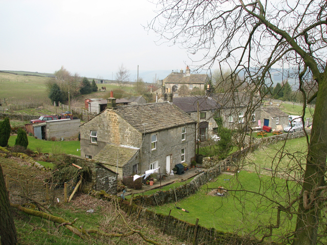
Ashfold Side Plantation is a picturesque woodland located in the county of Yorkshire, England. Spread over a vast area, the plantation is nestled within the scenic countryside, offering visitors a tranquil and serene escape from the hustle and bustle of urban life.

The plantation primarily consists of deciduous trees, such as oak, beech, and birch, which form a dense canopy, providing shelter and habitat for a diverse range of wildlife. The trees create a stunning spectacle throughout the year, with vibrant green leaves in the spring and summer, followed by a riot of colors in autumn as the foliage turns various shades of red, orange, and gold.

Walking through the plantation, visitors are treated to a rich tapestry of flora and fauna. Bluebells carpet the forest floor in spring, creating a breathtaking display, while a variety of ferns, mosses, and wildflowers add a touch of beauty to the landscape. The plantation is also home to a plethora of bird species, including woodpeckers, owls, and thrushes, filling the air with their melodious songs.

To enhance the visitor experience, well-maintained walking trails wind their way through the plantation, offering opportunities for leisurely strolls and peaceful picnics. These trails provide access to various viewpoints, allowing visitors to enjoy stunning vistas of the surrounding countryside and nearby rolling hills.

Overall, Ashfold Side Plantation is a true gem of Yorkshire, offering a haven of natural beauty and tranquility for all who visit. Whether exploring the woodland, admiring the vibrant flora, or simply enjoying the peaceful ambiance, this plantation is a must-visit destination for nature enthusiasts and those seeking a respite in the heart of Yorkshire.

If you have any feedback on the listing, please let us know in the comments section below.

Ashfold Side Plantation Images

Images are sourced within 2km of 54.093912/-1.817009 or Grid Reference SE1266. Thanks to Geograph Open Source API. All images are credited.
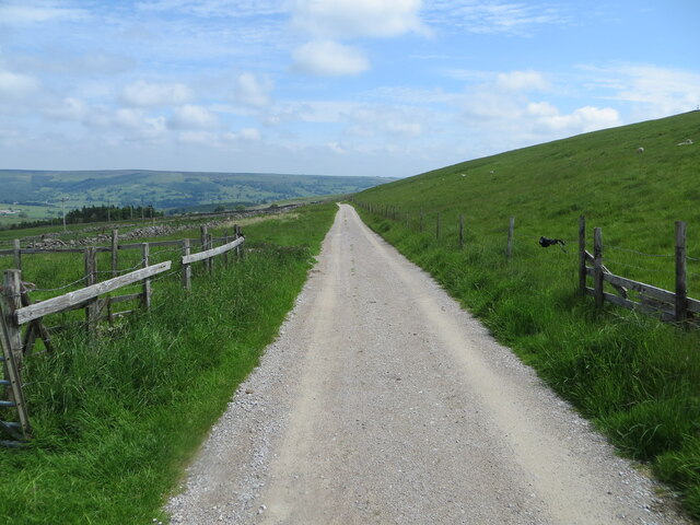
Prosperous Smelt Mill ruins, Merryfield
Track, Bridleway and Path heading towards Coldstones Fold Farm Looking north-eastward.
Track, Bridleway and Path heading towards Coldstones Fold Farm
Looking north-eastward.
Greenhow Hill, Bewerley Moor The pivot benchmark is cut into the top of a boulder on the east side of the track.
Greenhow Hill, Bewerley Moor
The pivot benchmark is cut into the top of a boulder on the east side of the track.
Greenhow Hill, Bewerley Moor There is a pivot benchmark cut into the top of the boulder in the foreground of the picture. It is on the east side of the track.
Greenhow Hill, Bewerley Moor
There is a pivot benchmark cut into the top of the boulder in the foreground of the picture. It is on the east side of the track.
Greenhow Hill, Bewerley Moor According to the OS benchmark database in this location there is a boulder on the east side of the track with a pivot benchmark. Nothing was found.
Greenhow Hill, Bewerley Moor
According to the OS benchmark database in this location there is a boulder on the east side of the track with a pivot benchmark. Nothing was found.
Greenhow Hill, Bewerley Moor The benchmark is cut into a large boulder in the centre of the track.
Greenhow Hill, Bewerley Moor
The benchmark is cut into a large boulder in the centre of the track.
Greenhow Hill, Bewerley Moor There is a benchmark cut into the large boulder in the centre of the track.
Greenhow Hill, Bewerley Moor
There is a benchmark cut into the large boulder in the centre of the track.
Greenhow Hill, Bewerley Moor According to the OS benchmark database there is a rock with a benchmark located south of the wall and east of the track. Nothing was found.
Greenhow Hill, Bewerley Moor
According to the OS benchmark database there is a rock with a benchmark located south of the wall and east of the track. Nothing was found.
Greenhow, Near Hardcastle, Lord's Hall According to the OS benchmark database there was a stone built house/barn in this location called Lord's Hall; there was a benchmark cut into the north-west face. The structure has been completely demolished and it is very difficult to make out any footprint. The benchmark has been destroyed.
Greenhow, Near Hardcastle, Lord's Hall
According to the OS benchmark database there was a stone built house/barn in this location called Lord's Hall; there was a benchmark cut into the north-west face. The structure has been completely demolished and it is very difficult to make out any footprint. The benchmark has been destroyed.
Greenhow, old mine workings According to the OS benchmark database there was a rivet benchmark cut into a stone north of the ruins and on the west side of the track. Nothing was found.
Greenhow, old mine workings
According to the OS benchmark database there was a rivet benchmark cut into a stone north of the ruins and on the west side of the track. Nothing was found.
Recent tree planting at Blazefield Hundreds of tree saplings cover the hillside below Blazefield farm, not to be confused with the hamlet of Blazefield, some 3-4 miles away on the hillside above Glasshouses.
Recent tree planting at Blazefield
Hundreds of tree saplings cover the hillside below Blazefield farm, not to be confused with the hamlet of Blazefield, some 3-4 miles away on the hillside above Glasshouses.
Valley of Brandstone Beck Low January sun lights up the background whilst the shaded foreground is still frost covered. The beck tumbles down a side valley to join forces with Foster Beck before reaching the River Nidd.
Valley of Brandstone Beck
Low January sun lights up the background whilst the shaded foreground is still frost covered. The beck tumbles down a side valley to join forces with Foster Beck before reaching the River Nidd.
Marshy col between valleys A low point on the moor between the valleys of Ashfold Side Beck and Brandstone Beck. The col itself is ill-drained but a well used track follows the eastern margin. This view is in a corner of the grid square and encompasses some of the adjoining square and also another to the north where the abandoned farmstead of Merryfield can be seen on a patch of improved land.
Marshy col between valleys
A low point on the moor between the valleys of Ashfold Side Beck and Brandstone Beck. The col itself is ill-drained but a well used track follows the eastern margin. This view is in a corner of the grid square and encompasses some of the adjoining square and also another to the north where the abandoned farmstead of Merryfield can be seen on a patch of improved land.
Disturbed ground above Ashfold Side Beck High on the hillside above the beck is an extensive area of disturbed ground from the time when both Prosperous and Providence lead mines were being worked. Some care is advisable here as one or two of the circular hollows may have a thin covering of vegetation over a deep shaft.
Disturbed ground above Ashfold Side Beck
High on the hillside above the beck is an extensive area of disturbed ground from the time when both Prosperous and Providence lead mines were being worked. Some care is advisable here as one or two of the circular hollows may have a thin covering of vegetation over a deep shaft.
Bridleway in Ashfold Side Gill Well used track and bridleway [number 15.125/14] that ascends the gill alongside Ashfold Side Beck.
Bridleway in Ashfold Side Gill
Well used track and bridleway [number 15.125/14] that ascends the gill alongside Ashfold Side Beck.
Track at Ashfold Side Part of a popular walking route alongside Ashfold Side Beck, seen here a short way up valley from the caravan and mobile home sites.
Track at Ashfold Side
Part of a popular walking route alongside Ashfold Side Beck, seen here a short way up valley from the caravan and mobile home sites.
Mobile homes above the beck I would guess that these are 'mobile homes' rather than caravans, being a little more upmarket than the type seen out on the road. There's a good half mile and more of holiday mobile homes along the valley here, which is obviously a popular spot for weekenders and holdaymakers.
Mobile homes above the beck
I would guess that these are 'mobile homes' rather than caravans, being a little more upmarket than the type seen out on the road. There's a good half mile and more of holiday mobile homes along the valley here, which is obviously a popular spot for weekenders and holdaymakers.
Greenhow Hill, Minakin Row According to the 1909 OS map for this location there was a benchmark cut into the property called Minakin Row. Today there is a heap of rubble and nothing was found.
Greenhow Hill, Minakin Row
According to the 1909 OS map for this location there was a benchmark cut into the property called Minakin Row. Today there is a heap of rubble and nothing was found.
Show me another place!

Ashfold Side Plantation is located at Grid Ref: SE1266 (Lat: 54.093912, Lng: -1.817009)

Division: West Riding

Administrative County: North Yorkshire

District: Harrogate

Police Authority: North Yorkshire

What 3 Words

///motivations.bearable.gangs. Near Pateley Bridge, North Yorkshire

Related Wikis

Heathfield, North Yorkshire

Heathfield is a hamlet in the civil parish of Stonebeck Down in upper Nidderdale, in North Yorkshire, England. It lies on a broad terrace on the west...

Gouthwaite Reservoir

Gouthwaite Reservoir is in Nidderdale, North Yorkshire, England. It is one of many reservoirs in the area, others include Roundhill Reservoir and Angram...

Greenhow

Greenhow is a village in North Yorkshire, England, often referred to as Greenhow Hill. The term how derives from the Old Norse word haugr meaning a hill...

Wath-in-Nidderdale railway station

Wath-in-Nidderdale railway station, was one of two intermediate stations on the Nidd Valley Light Railway, in Wath-in-Nidderdale, Yorkshire, England. The...

Nidderdale High School

Nidderdale High School is a coeducational secondary school located in Pateley Bridge, North Yorkshire, England. The school is named after Nidderdale, one...

Six Dales Trail

The Six Dales Trail is a long distance footpath in North Yorkshire, England, with a short section in West Yorkshire. It is 38 miles (61 km) long and connects...

Wath-in-Nidderdale

Wath, sometimes known as Wath-in-Nidderdale to distinguish it from other places named Wath, is a village in the Harrogate district of North Yorkshire,...

Pateley Bridge railway station (Nidd Valley Light Railway)

Pateley Bridge railway station (NVLR) was a railway station serving the southern terminus of the Nidd Valley Light Railway, in Pateley Bridge, North Yorkshire...

Nearby Amenities

Located within 500m of 54.093912,-1.817009
Providence Mine
Historic: ruins
Lat/Long: 54.0908357/-1.8191802
Providence Lead Mine
Archaeological Site: mineral_extraction
Historic: mine
Is In Country: UK
Is In County: North Yorkshire
Is In Historical County: Yorkshire
Mineral: lead
Source: OS OpenData StreetView
Lat/Long: 54.0900894/-1.8192922
Prosperous Lead Mine
Historic: mine
Is In Country: UK
Is In County: North Yorkshire
Is In Historical County: Yorkshire
Mineral: lead
Source: OS OpenData StreetView
Lat/Long: 54.0894721/-1.8179783
flue
Historic: industrial
Is In Country: UK
Is In County: North Yorkshire
Is In Historical County: Yorkshire
Mineral: lead
Source: OS OpenData StreetView
Lat/Long: 54.0908282/-1.8166915
Ford: yes
Lat/Long: 54.0904332/-1.8198556
York Level
Archaeological Site: mineral_extraction
Fixme: which side of stream?
Historic: mine_adit
Is In County: North Yorkshire
Is In Historical County: Yorkshire
Mineral: lead
Lat/Long: 54.0908359/-1.8204279
The data included in this document is from www.openstreetmap.org. The data is made available under ODbL.

Have you been to Ashfold Side Plantation?

Leave your review of Ashfold Side Plantation below (or comments, questions and feedback).