Guttridge's Wood

Wood, Forest in Oxfordshire South Oxfordshire

England

Guttridge's Wood

Direction Sign – Signpost on Hardwick Road, Whitchurch-on-Thames Located on the southwest side of the junction of Hardwick Road, Sheepwash Lane and a bridleway to Mapledurham, in Whitchurch-on-Thames parish. 3 arms and pawn finial. See also <a title="https://www.geograph.org.uk/photo/2182449" href="https://www.geograph.org.uk/photo/2182449">Link</a>.

Milestone Society National ID: OX_SU6577
Direction Sign – Signpost on Hardwick Road, Whitchurch-on-Thames Credit: John V Nicholls

Guttridge's Wood is a charming woodland located in Oxfordshire, England. Covering an area of approximately 50 acres, this forest is a haven for nature enthusiasts and outdoor lovers alike. The wood is situated near the village of East Hanney and is easily accessible by both car and foot.

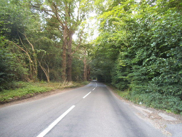
Once inside the wood, visitors are greeted by a diverse range of flora and fauna. The forest is home to a variety of tree species, including oak, birch, and beech, which form a lush canopy above. The forest floor is adorned with a carpet of bluebells in the spring, creating a stunning display of color.

The wood boasts a network of well-maintained trails that wind through its enchanting landscape. These pathways offer opportunities for leisurely strolls, invigorating hikes, or peaceful picnics amidst nature. Along the trails, visitors may spot a myriad of wildlife, such as deer, squirrels, and a variety of bird species.

Guttridge's Wood is also a site of historical significance. The remains of an ancient Iron Age hillfort can be found within the wood, adding an extra layer of intrigue for history enthusiasts.

For those looking to explore beyond the confines of the wood, there are several nearby attractions worth visiting. The picturesque village of East Hanney offers quaint cottages and a charming church, while the bustling city of Oxford is just a short drive away.

Overall, Guttridge's Wood is a picturesque and tranquil forest that offers a serene escape from the hustle and bustle of everyday life. With its natural beauty and rich history, it is a must-visit destination for nature enthusiasts and history buffs alike.

If you have any feedback on the listing, please let us know in the comments section below.

Guttridge's Wood Images

Images are sourced within 2km of 51.505341/-1.0416041 or Grid Reference SU6678. Thanks to Geograph Open Source API. All images are credited.

Direction Sign – Signpost on Hardwick Road, Whitchurch-on-Thames Located on the southwest side of the junction of Hardwick Road, Sheepwash Lane and a bridleway to Mapledurham, in Whitchurch-on-Thames parish. 3 arms and pawn finial. See also <a title="https://www.geograph.org.uk/photo/2182449" href="https://www.geograph.org.uk/photo/2182449">Link</a>.

Milestone Society National ID: OX_SU6577
Direction Sign – Signpost on Hardwick Road, Whitchurch-on-Thames
Located on the southwest side of the junction of Hardwick Road, Sheepwash Lane and a bridleway to Mapledurham, in Whitchurch-on-Thames parish. 3 arms and pawn finial. See also Link. Milestone Society National ID: OX_SU6577
No Trace of The Fox This place now has no resemblance to earlier photos here.
Graham Horn's picture from 15 years ago shows the building which used to be on this site until a few years ago. Then it was a large pub "The Fox" <a href="https://www.geograph.org.uk/photo/348561">SU6779 : The Fox at Cane End</a>
A later picture of mine <a href="https://www.geograph.org.uk/photo/2083210">SU6779 : Palm Tree  (Ex Fox)</a> shows it as an Indian restaurant "The Palm Tree."  
In my caption at the time I wished them luck in this tricky out of town location.
Not to be. After yet another spell as a Thai restaurant the place finally closed its doors.
Now demolished and replaced by these new houses. The only clues are the pub style sign post which now carries the developer's name board and the new cul de sac which is called Fox Heath Gardens..
No Trace of The Fox
This place now has no resemblance to earlier photos here. Graham Horn's picture from 15 years ago shows the building which used to be on this site until a few years ago. Then it was a large pub "The Fox" SU6779 : The Fox at Cane End A later picture of mine SU6779 : Palm Tree (Ex Fox) shows it as an Indian restaurant "The Palm Tree." In my caption at the time I wished them luck in this tricky out of town location. Not to be. After yet another spell as a Thai restaurant the place finally closed its doors. Now demolished and replaced by these new houses. The only clues are the pub style sign post which now carries the developer's name board and the new cul de sac which is called Fox Heath Gardens..
Pumpkins by the Greenhouse Back after a couple of years off due to covid, the Tolhurst Organic Farm Squash & Pumpkin Festival was back this year. 
So many pumpkins.
This lot is by one of the old greenhouses which were once part of the Hardwick Hall kitchen garden.
The OS map still marks it with the crosshatch Greenhouse symbol.
Pumpkins by the Greenhouse
Back after a couple of years off due to covid, the Tolhurst Organic Farm Squash & Pumpkin Festival was back this year. So many pumpkins. This lot is by one of the old greenhouses which were once part of the Hardwick Hall kitchen garden. The OS map still marks it with the crosshatch Greenhouse symbol.
Squash & Pumpkin Festival, 2022 After a couple of years off due to covid, the Tolhurst Organic Farm Squash & Pumpkin Festival was back this year. 
We are in the old kitchen garden next to Hardwick Hall for the festival, but the farm covers several nearby fields.
Not just for Halloween, all these varieties are good to eat. Some better than others, but that's vegetables for you.
Squash & Pumpkin Festival, 2022
After a couple of years off due to covid, the Tolhurst Organic Farm Squash & Pumpkin Festival was back this year. We are in the old kitchen garden next to Hardwick Hall for the festival, but the farm covers several nearby fields. Not just for Halloween, all these varieties are good to eat. Some better than others, but that's vegetables for you.
The A4074 at the junction of Deadman's Lane
Long Toll at the junction of the B4256
Woodland by the A4074, Cane End
Long Toll at the junction of the B4256
Reading Road, Cane End
Deadman's Lane, Cane End
Reading Road in Green Dean Wood
Horsepond Road, Cane End
Long Toll at the junction of Goring Road
The King Charles Head, Goring Heath, Oxfordshire The history of this building from pub to private house can be seen here <a href="https://www.geograph.org.uk/photo/26752">SU6678 : Gutteridge Wood and The King Charles Head between Nunney Wood and Collins End</a>and here <a href="https://www.geograph.org.uk/photo/1166729">SU6678 : The King Charles Head</a>.
The King Charles Head, Goring Heath, Oxfordshire
The history of this building from pub to private house can be seen here SU6678 : Gutteridge Wood and The King Charles Head between Nunney Wood and Collins Endand here SU6678 : The King Charles Head.
Jetty on the Bank Looks quite new and no doubt for some boat for private functions that moors up on a regular basis at Mapledurham
Jetty on the Bank
Looks quite new and no doubt for some boat for private functions that moors up on a regular basis at Mapledurham
View Upstream View upstream of Mapledurham in the Pangbourne direction
View Upstream
View upstream of Mapledurham in the Pangbourne direction
Geese under the tree The whole field seemed full of these Canada gees but they mostly under the shade of this tree at Mapledurham
Geese under the tree
The whole field seemed full of these Canada gees but they mostly under the shade of this tree at Mapledurham
Field near Mapledurham Looking from the riverbank at Mapledurham to the surrounding fields nearby
Field near Mapledurham
Looking from the riverbank at Mapledurham to the surrounding fields nearby
Show me another place!

Guttridge's Wood is located at Grid Ref: SU6678 (Lat: 51.505341, Lng: -1.0416041)

Administrative County: Oxfordshire

District: South Oxfordshire

Police Authority: Thames Valley

What 3 Words

///lofts.munch.cyber. Near Pangbourne, Berkshire

Related Wikis

Hardwick House, Oxfordshire

Hardwick House is a Tudor house on the banks of the River Thames on a slight rise at Whitchurch-on-Thames in the English county of Oxfordshire. It is reputed...

Mapledurham Lock

Mapledurham Lock is a lock and weir situated on the River Thames in England, about 4 miles upstream of Reading. The lock was first built in 1777 by the...

Trench Green

Trench Green is a hamlet in Oxfordshire about 1 mile (1.6 km) northeast of the village of Mapledurham and about 4 miles (6.4 km) northwest of Reading in...

Mapledurham Watermill

Mapledurham Watermill is a historic watermill in the civil parish of Mapledurham in the English county of Oxfordshire. It is driven by the head of water...

Mapledurham

Mapledurham is a small village, civil parish and country estate beside the River Thames in southern Oxfordshire, England. The large parish borders Caversham...

Mapledurham House

Mapledurham House is an Elizabethan stately home located in the civil parish of Mapledurham in the English county of Oxfordshire. It is a Grade I listed...

Whitchurch Hill

Whitchurch Hill is a village in the Chiltern Hills in Oxfordshire, about 5.5 miles (9 km) northwest of Reading, Berkshire, near Whitchurch-on-Thames. The...

Hook End Recording Studios

Hook End Recording Studios was a recording studio located in Hook End Manor, a 16th-century Elizabethan house near Checkendon, Oxfordshire, England. Its...

Nearby Amenities

Located within 500m of 51.505341,-1.0416041
Barrier: kissing_gate
Foot: yes
Lat/Long: 51.5051818/-1.0464643
Barrier: kissing_gate
Foot: yes
Lat/Long: 51.5046889/-1.0449605
Barrier: kissing_gate
Foot: yes
Lat/Long: 51.5037956/-1.047487
Barrier: kissing_gate
Foot: yes
Lat/Long: 51.5036071/-1.0481677
Barrier: kissing_gate
Foot: yes
Lat/Long: 51.5044059/-1.0484184
Barrier: kissing_gate
Foot: yes
Lat/Long: 51.5044423/-1.0482542
The data included in this document is from www.openstreetmap.org. The data is made available under ODbL.

Have you been to Guttridge's Wood?

Leave your review of Guttridge's Wood below (or comments, questions and feedback).