Bottom Wood
Wood, Forest in Oxfordshire South Oxfordshire
England
Bottom Wood

Bottom Wood is a picturesque forest located in Oxfordshire, England. The wood is situated near the village of Wood and covers an area of approximately 50 acres. It is known for its diverse flora and fauna, making it a popular destination for nature enthusiasts and wildlife lovers.
The wood is predominantly made up of native broadleaf trees, including oak, beech, and ash. These towering trees create a dense canopy that provides a sheltered habitat for a wide range of wildlife. Visitors to Bottom Wood may encounter various bird species such as woodpeckers, owls, and thrushes, as well as small mammals like squirrels and hedgehogs.
The forest floor is covered with a rich carpet of bluebells, wild garlic, and other wildflowers during the spring season, creating a vibrant and colorful display. There are several well-maintained footpaths and trails that wind through the wood, allowing visitors to explore its beauty at their own pace.
Bottom Wood offers a tranquil and peaceful setting, perfect for those seeking a break from the hustle and bustle of city life. Its secluded location and natural beauty make it an ideal spot for picnics, photography, and nature walks. The wood is also managed and conserved by local conservation groups, ensuring its preservation for future generations to enjoy.
In conclusion, Bottom Wood in Oxfordshire is a captivating forest that showcases the natural beauty of the region. With its diverse wildlife, stunning flora, and serene atmosphere, it provides a welcoming escape into nature for visitors of all ages.
If you have any feedback on the listing, please let us know in the comments section below.
Bottom Wood Images
Images are sourced within 2km of 51.497786/-1.0490519 or Grid Reference SU6678. Thanks to Geograph Open Source API. All images are credited.


Bottom Wood is located at Grid Ref: SU6678 (Lat: 51.497786, Lng: -1.0490519)
Administrative County: Oxfordshire
District: South Oxfordshire
Police Authority: Thames Valley
What 3 Words
///crisis.gosh.agenda. Near Pangbourne, Berkshire
Related Wikis

Hardwick House, Oxfordshire
Hardwick House is a Tudor house on the banks of the River Thames on a slight rise at Whitchurch-on-Thames in the English county of Oxfordshire. It is reputed...

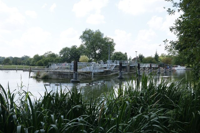
Mapledurham Lock
Mapledurham Lock is a lock and weir situated on the River Thames in England, about 4 miles upstream of Reading. The lock was first built in 1777 by the...

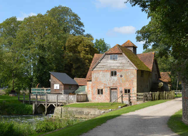
Mapledurham Watermill
Mapledurham Watermill is a historic watermill in the civil parish of Mapledurham in the English county of Oxfordshire. It is driven by the head of water...

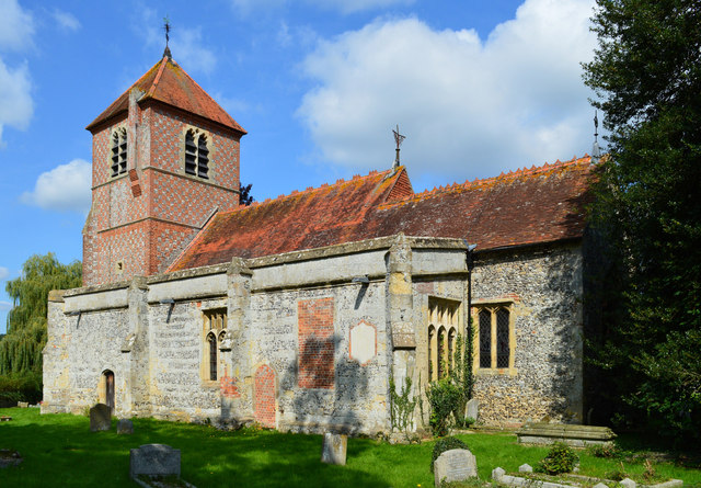
Mapledurham
Mapledurham is a small village, civil parish and country estate beside the River Thames in southern Oxfordshire, England. The large parish borders Caversham...

Mapledurham House
Mapledurham House is an Elizabethan stately home located in the civil parish of Mapledurham in the English county of Oxfordshire. It is a Grade I listed...
Purley on Thames
Purley on Thames (known locally as Purley) is a village and civil parish in Berkshire, England. Purley is centred 3 miles (4.8 km) north-west of Reading...

Whitchurch Hill
Whitchurch Hill is a village in the Chiltern Hills in Oxfordshire, about 5.5 miles (9 km) northwest of Reading, Berkshire, near Whitchurch-on-Thames. The...

Trench Green
Trench Green is a hamlet in Oxfordshire about 1 mile (1.6 km) northeast of the village of Mapledurham and about 4 miles (6.4 km) northwest of Reading in...
Nearby Amenities
Located within 500m of 51.497786,-1.0490519Have you been to Bottom Wood?
Leave your review of Bottom Wood below (or comments, questions and feedback).