Guinea Copse

Wood, Forest in Hampshire Basingstoke and Deane

England

Guinea Copse

Chineham car park
Chineham car park Credit: Mr Ignavy

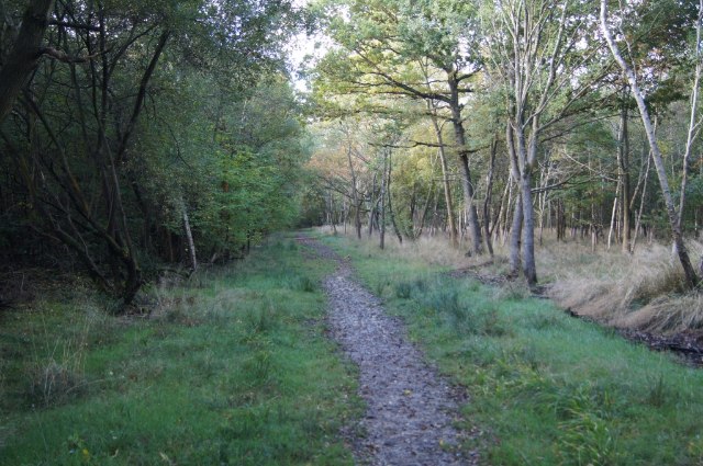
Guinea Copse is a picturesque woodland located in Hampshire, England. Covering an area of approximately 20 acres, it is a well-preserved and diverse forest that offers a tranquil retreat for nature enthusiasts and outdoor enthusiasts alike.

The copse is predominantly composed of native broadleaf trees, such as oak, beech, and ash, which provide a rich canopy that filters sunlight and creates a cool and shady environment. These trees have been growing undisturbed for many years, resulting in a dense and mature woodland with a thriving ecosystem.

There are several winding footpaths that meander through the copse, allowing visitors to explore its beauty and discover its hidden treasures. These paths are well-maintained and marked, ensuring a safe and enjoyable experience for hikers and walkers. Along the way, visitors can admire the vibrant wildflowers that carpet the forest floor during spring and summer, attracting a variety of insects and birds.

Guinea Copse is also home to a diverse range of wildlife. Visitors may spot squirrels darting amongst the trees, and if lucky, catch a glimpse of deer grazing in the undergrowth. The copse provides a habitat for various bird species, including woodpeckers, thrushes, and owls, making it a haven for birdwatchers.

Due to its natural beauty and tranquility, Guinea Copse is a popular destination for nature lovers seeking a peaceful refuge from the bustling city life. It offers a unique opportunity to reconnect with nature and appreciate the wonders of Hampshire's woodlands.

If you have any feedback on the listing, please let us know in the comments section below.

Guinea Copse Images

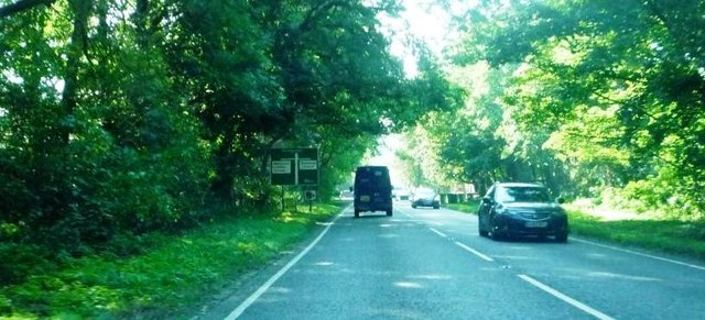
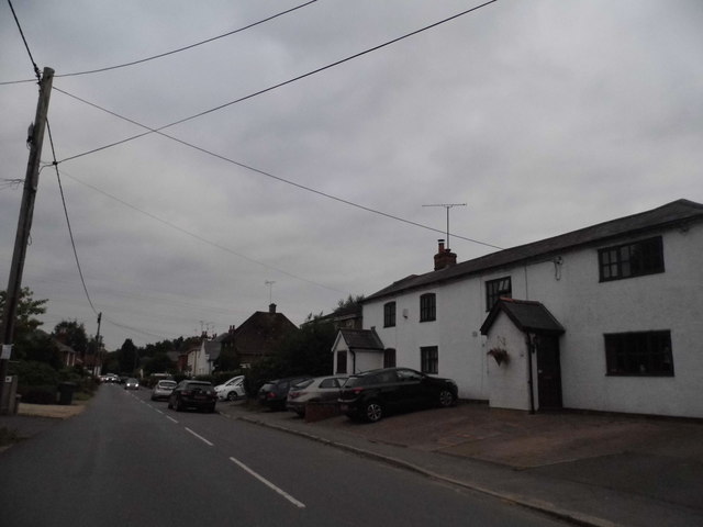
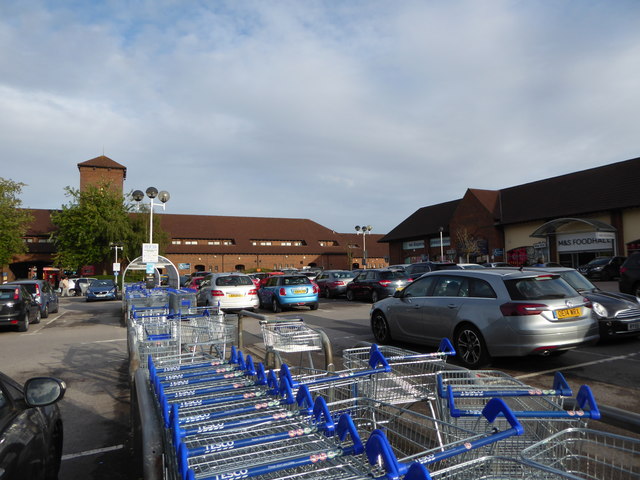
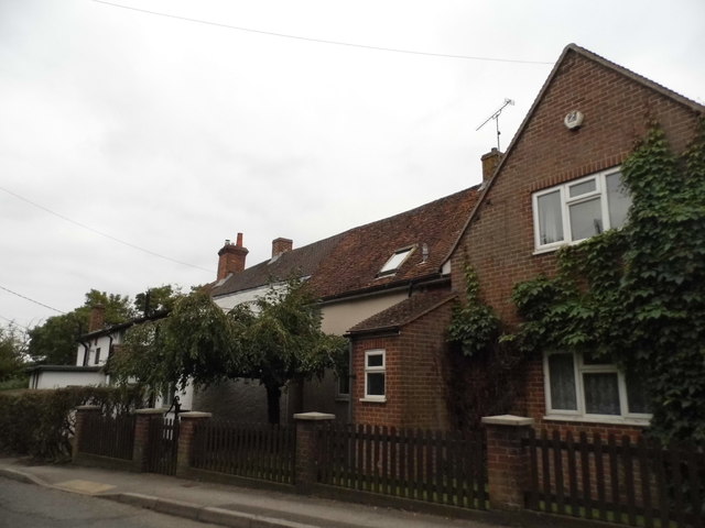
Images are sourced within 2km of 51.295787/-1.0506915 or Grid Reference SU6655. Thanks to Geograph Open Source API. All images are credited.

Chineham car park
Chineham car park
Approaching junction on A33 Travelling south towards Basingstoke, near junction with roads to Wildmoor Loddon School and Sherfield Church
Approaching junction on A33
Travelling south towards Basingstoke, near junction with roads to Wildmoor Loddon School and Sherfield Church
Traffic lights and junction on A33 Taken travelling towards Basingstoke at junction with Lillymill Chine.
Traffic lights and junction on A33
Taken travelling towards Basingstoke at junction with Lillymill Chine.
Pyotts Hill, Old Basing This is one of the original villages surrounding Basingstoke before it became built up.
Pyotts Hill, Old Basing
This is one of the original villages surrounding Basingstoke before it became built up.
Pyotts Hill, Chineham
Great Binfields Road, Lychpit
Binfields Close, Lychpit
2016: a year on Geograph (Day 270) Car park, Chineham Park
2016: a year on Geograph (Day 270)
Car park, Chineham Park
Houses on Bartons Lane, Old Basing
Selection of shops - Chineham
Chineham car park
Chineham car park
Access to Chineham District Centre
Corner of Wade Road
Corner of Wade Road
Parking at Chineham District Centre
Clocktower - Chineham District Centre
Parking at Chineham District Centre
Show me another place!

Guinea Copse is located at Grid Ref: SU6655 (Lat: 51.295787, Lng: -1.0506915)

Administrative County: Hampshire

District: Basingstoke and Deane

Police Authority: Hampshire

What 3 Words

///drumbeat.sung.clarifies. Near Chineham, Hampshire

Nearby Locations

Guinea Copse

Related Wikis

Chineham

Chineham ( CHIN-əm) is a civil parish on the outskirts of Basingstoke, Hampshire, England. It is situated about 3 miles (5 km) northeast of central Basingstoke...

Sherfield Park

Sherfield Park, also known as Taylor's Farm, is a civil parish in the Basingstoke and Deane district of Hampshire, England. It is situated about 4 miles...

The Loddon School

The Loddon School is a British private school for children who have severe and complex learning difficulties. Children catered for have problems associated...

Basing Wood

Basing Wood is a 120-hectare (300-acre) woodland near Basingstoke, England. == Wildlife == The wood consists of broadleaf and conifer trees, particularly...

Nearby Amenities

Located within 500m of 51.295787,-1.0506915
Crossing
Bicycle: yes
Crossing: uncontrolled
Crossing Island: no
Kerb: lowered
Sloped Curb: yes
Lat/Long: 51.2985856/-1.0560496
Crossing
Crossing: unmarked
Kerb: lowered
Sloped Curb: yes
Lat/Long: 51.2985244/-1.0550901
Crossing
Bicycle: yes
Crossing Island: yes
Kerb: lowered
Lat/Long: 51.2922155/-1.0537832
Barrier: cycle_barrier
Bicycle: yes
Foot: yes
Lat/Long: 51.2986623/-1.0560582
Barrier: cycle_barrier
Lat/Long: 51.2963064/-1.0555443
Barrier: bollard
Lat/Long: 51.2920655/-1.0537404
Crossing
Crossing: unmarked
Kerb: lowered
Sloped Curb: yes
Lat/Long: 51.2953591/-1.057774
Bench
Lat/Long: 51.3000564/-1.0490035
Bench
Lat/Long: 51.2995775/-1.0491609
Leisure: playground
Lat/Long: 51.2985471/-1.049919
Crossing
Bicycle: yes
Crossing: uncontrolled
Crossing Island: no
Kerb: lowered
Sloped Curb: yes
Tactile Paving: yes
Lat/Long: 51.2964827/-1.055581
Public Building
Chineham Village Hall
Lat/Long: 51.2919566/-1.0533818
Post Box
Postal Code: RG24
Ref: RG24 319
Lat/Long: 51.2925717/-1.0532507
Dentist
Guinea Court Dental Surgery
Lat/Long: 51.2946009/-1.0520876
Willow House
Building: yes
Lat/Long: 51.2945951/-1.0524515
Sycamore House
Building: yes
Lat/Long: 51.2947671/-1.0525604
Beech House
Building: yes
Lat/Long: 51.2949256/-1.052632
Bus Stop
Bowman Road
Bus: yes
Naptan AtcoCode: 1900HA010393
Naptan Bearing: N
Naptan CommonName: Chineham Arms
Naptan Crossing: Renown Way
Naptan NaptanCode: hamgdmpm
Naptan PlusbusZoneRef: BSNGSTK
Naptan Street: Hanmore Road
Naptan Verified: no
Public Transport: platform
Source: naptan_import
Lat/Long: 51.2968793/-1.0563816
Pub
The Chineham Arms
Brand: Fuller's
Brand Wikidata: Q5253950
Website: https://www.chinehamarms.co.uk/
Lat/Long: 51.2976268/-1.0565457
Crossing
Crossing: unmarked
Kerb: lowered
Sloped Curb: yes
Lat/Long: 51.2970645/-1.0562671
Bench
Lat/Long: 51.2956649/-1.0478246
Post Box
Operator: Royal Mail
Postal Code: RG24
Ref: RG24 340
Lat/Long: 51.2973493/-1.0502054
Bench
Check Date: 2021-03-13
Lat/Long: 51.2985463/-1.0561052
Barrier: bollard
Lat/Long: 51.2980386/-1.0446167
Leisure: playground
Lat/Long: 51.2972803/-1.0439503
Bench
Lat/Long: 51.298655/-1.0498878
Cufaude Village
Place: neighbourhood
Source Name: Inscription at start of Thornhill Way
Lat/Long: 51.2988208/-1.0531306
Bench
Lat/Long: 51.2941576/-1.0465424
Barrier: bollard
Lat/Long: 51.292029/-1.0473996
Barrier: bollard
Lat/Long: 51.2936325/-1.0498798
Barrier: bollard
Lat/Long: 51.293478/-1.0494355
Bus Stop
Toll House
Naptan AtcoCode: 1900HA010403
Naptan Bearing: NE
Naptan CommonName: Toll House
Naptan NaptanCode: hamgdpta
Naptan PlusbusZoneRef: BSNGSTK
Naptan Street: A33
Naptan Verified: no
Source: naptan_import
Lat/Long: 51.2924562/-1.046667
Man Made: mast
Lat/Long: 51.2928343/-1.0455974
Man Made: mast
Lat/Long: 51.2930988/-1.0454525
Traffic Signals
Source: Bing
Traffic Signals Direction: forward
Lat/Long: 51.2931583/-1.0456723
Sherfield Park
Place: locality
Source Name: Plaque
Lat/Long: 51.2921076/-1.0490994
Recycling
Lat/Long: 51.2924415/-1.0532662
Bench
Lat/Long: 51.2927451/-1.0533429
Bench
Lat/Long: 51.29239/-1.0535538
Barrier: bollard
Lat/Long: 51.292713/-1.0515919
Tollhouse Copse
Landuse: forest
Lat/Long: 51.2936197/-1.0481183
Crossing
Crossing: unmarked
Kerb: lowered
Sloped Curb: yes
Lat/Long: 51.2948511/-1.0574963
Barrier: bollard
Lat/Long: 51.2939816/-1.0552666
Crossing
Crossing: uncontrolled
Crossing Island: yes
Crossing Markings: no
Tactile Paving: yes
Lat/Long: 51.2947942/-1.0523299
Pharmacy
Lloyds Pharmacy
Dispensing: yes
Lat/Long: 51.2949822/-1.0518296
One Stop
Brand: One Stop
Brand Wikidata: Q65954217
Contact Website: https://www.onestop.co.uk/store?store=fac73df4-10f5-42ed-9b67-de70c27b2b6a
Shop: convenience
Source: local_knowledge
Lat/Long: 51.2947282/-1.0519969
Maple Lodge
Building: yes
Lat/Long: 51.2948012/-1.0529426
Bench
Lat/Long: 51.2967257/-1.0534323
Bench
Lat/Long: 51.2967422/-1.053275
Turning Circle
Lat/Long: 51.2988041/-1.0538253
Barrier: bollard
Lat/Long: 51.2945051/-1.0555106
Barrier: bollard
Lat/Long: 51.295469/-1.0577661
Bench
Lat/Long: 51.2967399/-1.0536156
Bench
Lat/Long: 51.2956656/-1.0478777
Bench
Lat/Long: 51.2952838/-1.0478323
Bench
Lat/Long: 51.2949583/-1.047248
Bench
Lat/Long: 51.2949526/-1.0471767
Bicycle Parking
Lat/Long: 51.2919438/-1.0529497
Bus Stop
Thyme Close
Bus: yes
Naptan AtcoCode: 1900HA010394
Naptan Bearing: E
Naptan CommonName: Thyme Close
Naptan Crossing: Thyme Close
Naptan NaptanCode: hamgdmta
Naptan PlusbusZoneRef: BSNGSTK
Naptan Street: Thornhill Way
Naptan Verified: no
Public Transport: platform
Source: naptan_import
Lat/Long: 51.2985871/-1.0553184
Bus Stop
Fennel Close
Bus: yes
Naptan AtcoCode: 1900HA010395
Naptan Bearing: E
Naptan CommonName: Fennel Close
Naptan Crossing: Fennel Close
Naptan NaptanCode: hamgdmwt
Naptan PlusbusZoneRef: BSNGSTK
Naptan Street: Thornhill Way
Naptan Verified: no
Public Transport: platform
Source: naptan_import
Lat/Long: 51.2981776/-1.0524868
Bus Stop
Woodlands
Bus: yes
Naptan AtcoCode: 1900HA010396
Naptan Bearing: E
Naptan CommonName: Woodlands
Naptan Crossing: Juniper Close
Naptan NaptanCode: hamgdpga
Naptan PlusbusZoneRef: BSNGSTK
Naptan Street: Thornhill Way
Naptan Verified: no
Public Transport: platform
Source: naptan_import
Lat/Long: 51.2972669/-1.0498772
Bus Stop
Longstock Close
Bus: yes
Naptan AtcoCode: 1900HA010397
Naptan Bearing: S
Naptan CommonName: Longstock Close
Naptan Crossing: Longstock Close
Naptan NaptanCode: hamgdptd
Naptan PlusbusZoneRef: BSNGSTK
Naptan Street: Thornhill Way
Naptan Verified: no
Public Transport: platform
Source: naptan_import
Lat/Long: 51.2949195/-1.046236
Bus Stop
Bowman Road
Bus: yes
Naptan AtcoCode: 1900HA010398
Naptan Bearing: W
Naptan CommonName: Bowman Road
Naptan Crossing: Bowman Road
Naptan NaptanCode: hamgdpaw
Naptan PlusbusZoneRef: BSNGSTK
Naptan Street: Thornhill Way
Naptan Verified: no
Public Transport: platform
Source: naptan_import
Lat/Long: 51.2942706/-1.0509226
Bus Stop
Village Hall
Bus: yes
Naptan AtcoCode: 1900HA010401
Naptan Bearing: SW
Naptan CommonName: Chineham Village Hall
Naptan Crossing: Warbleton Road
Naptan NaptanCode: hamgdmwp
Naptan PlusbusZoneRef: BSNGSTK
Naptan Street: Thornhill Way
Naptan Verified: no
Public Transport: platform
Source: naptan_import
Lat/Long: 51.2922968/-1.0536261
Bus Stop
Toll House
Naptan AtcoCode: 1900HA010402
Naptan Bearing: SW
Naptan CommonName: Toll House
Naptan NaptanCode: hamgdpmg
Naptan PlusbusZoneRef: BSNGSTK
Naptan Street: A33
Naptan Verified: no
Source: naptan_import
Lat/Long: 51.2919645/-1.0470214
Bus Stop
Belvedere Gardens
Bus: yes
Naptan AtcoCode: 1900HAA13411
Naptan Bearing: SE
Naptan CommonName: Belvedere Gardens
Naptan Crossing: Fox's Furlong
Naptan NaptanCode: hamgdpmj
Naptan PlusbusZoneRef: BSNGSTK
Naptan Street: Thornhill Way
Naptan Verified: no
Public Transport: platform
Source: naptan_import
Lat/Long: 51.2969309/-1.0475497
Barrier: cycle_barrier
Bicycle: yes
Foot: yes
Lat/Long: 51.2985034/-1.056039
Barrier: bollard
Lat/Long: 51.2963936/-1.0555653
Barrier: cycle_barrier
Lat/Long: 51.2966146/-1.0556184
Traffic Signals
Source: Bing
Traffic Signals Direction: forward
Lat/Long: 51.293224/-1.0454068
Traffic Signals
Source: Bing
Traffic Signals Direction: backward
Lat/Long: 51.293438/-1.0454353
Crossing
Crossing: unmarked
Kerb: lowered
Sloped Curb: yes
Lat/Long: 51.2971897/-1.0564099
Crossing
Crossing: uncontrolled
Crossing Island: yes
Kerb: lowered
Lat/Long: 51.2925362/-1.0534684
Crossing
Crossing: unmarked
Kerb: lowered
Sloped Curb: yes
Lat/Long: 51.2924043/-1.0534953
Crossing
Crossing: unmarked
Kerb: lowered
Sloped Curb: yes
Source: Mapbox
Lat/Long: 51.2993173/-1.0467996
Crossing
Crossing: unmarked
Kerb: lowered
Sloped Curb: yes
Source: Mapbox
Lat/Long: 51.2994447/-1.0477952
Give Way
Direction: backward
Lat/Long: 51.2957245/-1.0533045
Barrier: cycle_barrier
Lat/Long: 51.2942614/-1.0547705
Barrier: bollard
Lat/Long: 51.2926424/-1.0538368
Bus Stop
Bowman Road
Bus: yes
Public Transport: platform
Lat/Long: 51.2964514/-1.0549316
Bus Stop
Guinea Court
Bus: yes
Naptan AtcoCode: 1900HAA19551
Naptan NaptanCode: hamjgapd
Public Transport: platform
Lat/Long: 51.2951809/-1.05248
Bus Stop
Guinea Court
Bus: yes
Public Transport: platform
Lat/Long: 51.2949847/-1.0525337
Bus Stop
Village Hall
Bus: yes
Public Transport: platform
Lat/Long: 51.2927925/-1.0532552
Generator Method: photovoltaic
Generator Output Electricity: yes
Generator Source: solar
Generator Type: solar_photovoltaic_panel
Location: roof
Power: generator
Lat/Long: 51.2994492/-1.0534805
Generator Method: photovoltaic
Generator Output Electricity: yes
Generator Source: solar
Generator Type: solar_photovoltaic_panel
Location: roof
Power: generator
Lat/Long: 51.2989628/-1.0535476
Generator Method: photovoltaic
Generator Output Electricity: yes
Generator Source: solar
Generator Type: solar_photovoltaic_panel
Location: roof
Power: generator
Lat/Long: 51.2977084/-1.0546955
Generator Method: photovoltaic
Generator Output Electricity: yes
Generator Source: solar
Generator Type: solar_photovoltaic_panel
Location: roof
Power: generator
Lat/Long: 51.2974769/-1.052354
Generator Method: photovoltaic
Generator Output Electricity: yes
Generator Source: solar
Generator Type: solar_photovoltaic_panel
Location: roof
Power: generator
Lat/Long: 51.2968161/-1.0508761
Generator Method: photovoltaic
Generator Output Electricity: yes
Generator Source: solar
Generator Type: solar_photovoltaic_panel
Location: roof
Power: generator
Lat/Long: 51.296786/-1.0507017
Generator Method: photovoltaic
Generator Output Electricity: yes
Generator Source: solar
Generator Type: solar_photovoltaic_panel
Location: roof
Power: generator
Lat/Long: 51.2963281/-1.0493606
Generator Method: photovoltaic
Generator Output Electricity: yes
Generator Source: solar
Generator Type: solar_photovoltaic_panel
Location: roof
Power: generator
Lat/Long: 51.2992178/-1.047416
Barrier: kerb
Kerb: raised
Lat/Long: 51.2924899/-1.0465873
Give Way
Direction: backward
Lat/Long: 51.2965327/-1.0562742
Waste Basket
Lat/Long: 51.2937313/-1.052286
Parking
Capacity: 2
Parking: street_side
Lat/Long: 51.2948295/-1.0524308
Fire Hydrant
Emergency: fire_hydrant
Lat/Long: 51.2957409/-1.0533957
Generator Method: photovoltaic
Generator Output Electricity: yes
Generator Source: solar
Generator Type: solar_photovoltaic_panel
Location: roof
Power: generator
Lat/Long: 51.2944016/-1.0545576
Parking
Capacity: 2
Parking: street_side
Lat/Long: 51.2946837/-1.0521679
Entrance: yes
Lat/Long: 51.2951574/-1.0542788
The data included in this document is from www.openstreetmap.org. The data is made available under ODbL.

Have you been to Guinea Copse?

Leave your review of Guinea Copse below (or comments, questions and feedback).