Bensgrove Wood

Wood, Forest in Oxfordshire South Oxfordshire

England

Bensgrove Wood

Pasture and farm buildings, Checkendon Corker's Farm viewed from the footpath passing to its west.
Pasture and farm buildings, Checkendon Credit: Andrew Smith

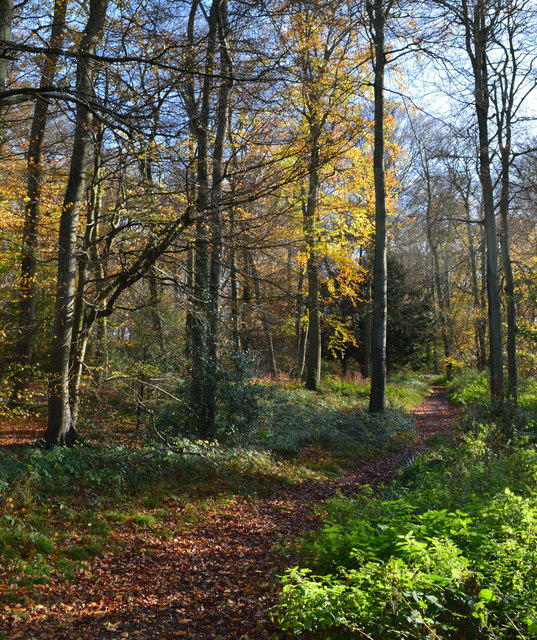
Bensgrove Wood is a picturesque woodland located in Oxfordshire, England. Nestled in the heart of the county, this enchanting forest covers an area of approximately 100 acres. It is renowned for its diverse range of plant and animal species, making it a popular destination for nature enthusiasts and hikers alike.

The wood is predominantly composed of deciduous trees, such as oak, ash, and beech, which create a stunning canopy during the summer months. The forest floor is adorned with a rich carpet of wildflowers, including bluebells, primroses, and wood anemones, adding to the natural beauty of the wood.

Bensgrove Wood is also home to a variety of wildlife, offering visitors a chance to spot animals in their natural habitat. Red deer, badgers, and foxes roam the forest, while a plethora of bird species, including woodpeckers and tawny owls, can be heard and seen throughout the year.

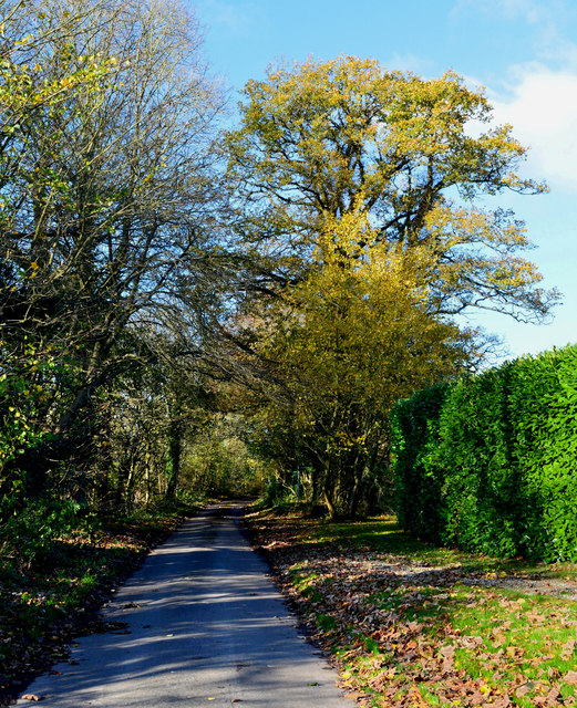
There are several well-maintained walking trails that wind through the wood, allowing visitors to explore its hidden treasures. These trails cater to different levels of difficulty, making it accessible for families and individuals of all ages. Along the way, there are benches and picnic spots where visitors can take a break and enjoy the tranquil surroundings.

Bensgrove Wood is managed by a local conservation organization, ensuring the preservation and protection of its unique ecosystem. The wood is open to the public year-round, with no admission fees, making it an ideal destination for those seeking a peaceful retreat in nature.

If you have any feedback on the listing, please let us know in the comments section below.

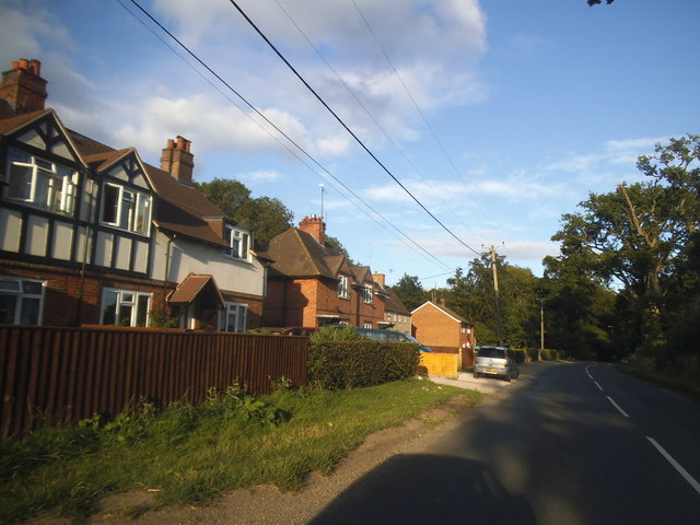
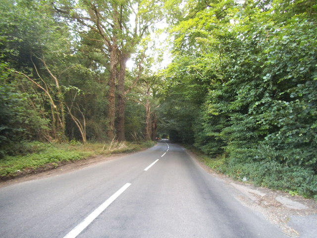
Bensgrove Wood Images

Images are sourced within 2km of 51.517299/-1.0492366 or Grid Reference SU6680. Thanks to Geograph Open Source API. All images are credited.

Pasture and farm buildings, Checkendon Corker's Farm viewed from the footpath passing to its west.
Pasture and farm buildings, Checkendon
Corker's Farm viewed from the footpath passing to its west.
Greenmoor hill views
No Trace of The Fox This place now has no resemblance to earlier photos here.
Graham Horn's picture from 15 years ago shows the building which used to be on this site until a few years ago. Then it was a large pub "The Fox" <a href="https://www.geograph.org.uk/photo/348561">SU6779 : The Fox at Cane End</a>
A later picture of mine <a href="https://www.geograph.org.uk/photo/2083210">SU6779 : Palm Tree  (Ex Fox)</a> shows it as an Indian restaurant "The Palm Tree."  
In my caption at the time I wished them luck in this tricky out of town location.
Not to be. After yet another spell as a Thai restaurant the place finally closed its doors.
Now demolished and replaced by these new houses. The only clues are the pub style sign post which now carries the developer's name board and the new cul de sac which is called Fox Heath Gardens..
No Trace of The Fox
This place now has no resemblance to earlier photos here. Graham Horn's picture from 15 years ago shows the building which used to be on this site until a few years ago. Then it was a large pub "The Fox" SU6779 : The Fox at Cane End A later picture of mine SU6779 : Palm Tree (Ex Fox) shows it as an Indian restaurant "The Palm Tree." In my caption at the time I wished them luck in this tricky out of town location. Not to be. After yet another spell as a Thai restaurant the place finally closed its doors. Now demolished and replaced by these new houses. The only clues are the pub style sign post which now carries the developer's name board and the new cul de sac which is called Fox Heath Gardens..
The A4074 at the junction of Deadman's Lane
Long Toll at the junction of the B4256
Woodland by the A4074, Cane End
Long Toll at the junction of the B4256
The B4526, Goring Heath
Reading Road, Cane End
Deadman's Lane, Cane End
Horsepond Road, Cane End
Long Toll at the junction of Goring Road
The King Charles Head, Goring Heath, Oxfordshire The history of this building from pub to private house can be seen here <a href="https://www.geograph.org.uk/photo/26752">SU6678 : Gutteridge Wood and The King Charles Head between Nunney Wood and Collins End</a>and here <a href="https://www.geograph.org.uk/photo/1166729">SU6678 : The King Charles Head</a>.
The King Charles Head, Goring Heath, Oxfordshire
The history of this building from pub to private house can be seen here SU6678 : Gutteridge Wood and The King Charles Head between Nunney Wood and Collins Endand here SU6678 : The King Charles Head.
Woodland path, Goring Heath, Oxfordshire
Handsome beech trees, Hook End, Oxfordshire
Country lane, Hook End, Oxfordshire
The Sun, Whitchurch Hill, Oxfordshire
Frosty morning, Goring Heath, Oxfordshire
Show me another place!

Bensgrove Wood is located at Grid Ref: SU6680 (Lat: 51.517299, Lng: -1.0492366)

Administrative County: Oxfordshire

District: South Oxfordshire

Police Authority: Thames Valley

What 3 Words

///forum.guarded.regulator. Near Pangbourne, Berkshire

Related Wikis

Hook End Recording Studios

Hook End Recording Studios was a recording studio located in Hook End Manor, a 16th-century Elizabethan house near Checkendon, Oxfordshire, England. Its...

Exlade Street

Exlade Street is a hamlet in Checkendon civil parish in Oxfordshire, about 6 miles (9.7 km) northwest of Reading, in the Chiltern Hills. The hamlet is...

The Oratory School

The Oratory School () is an HMC co-educational private Roman Catholic boarding and day school for pupils aged 11–18 located in Woodcote, 6 miles (9.7 km...

Whitchurch Hill

Whitchurch Hill is a village in the Chiltern Hills in Oxfordshire, about 5.5 miles (9 km) northwest of Reading, Berkshire, near Whitchurch-on-Thames. The...

The Oratory Preparatory School

The Oratory Prep School is a Roman Catholic day and boarding school for some 330 boys and girls aged from two to thirteen, founded in 1925. The school...

Langtree School

Langtree School is a coeducational secondary school located in the village of Woodcote in South Oxfordshire, England. The school has approximately 624...

Crays Pond

Crays Pond is a hamlet situated in the parish of Goring Heath in South Oxfordshire. Crays Pond is about 2.4 miles (3.9 km) northeast of Goring-on-Thames...

Woodcote

Woodcote is a village and civil parish in South Oxfordshire, about 5 miles (8 km) southeast of Wallingford and about 7 miles (11 km) northwest of Reading...

Nearby Amenities

Located within 500m of 51.517299,-1.0492366
Barrier: kissing_gate
Foot: yes
Lat/Long: 51.5200327/-1.0512489
Barrier: kissing_gate
Foot: yes
Lat/Long: 51.5173876/-1.044107
Barrier: kissing_gate
Foot: yes
Lat/Long: 51.5187261/-1.0466212
The data included in this document is from www.openstreetmap.org. The data is made available under ODbL.

Have you been to Bensgrove Wood?

Leave your review of Bensgrove Wood below (or comments, questions and feedback).