Earlham

Settlement in Norfolk Norwich

England

Earlham

Paddocks by River Wensum
Paddocks by River Wensum Credit: Hugh Venables

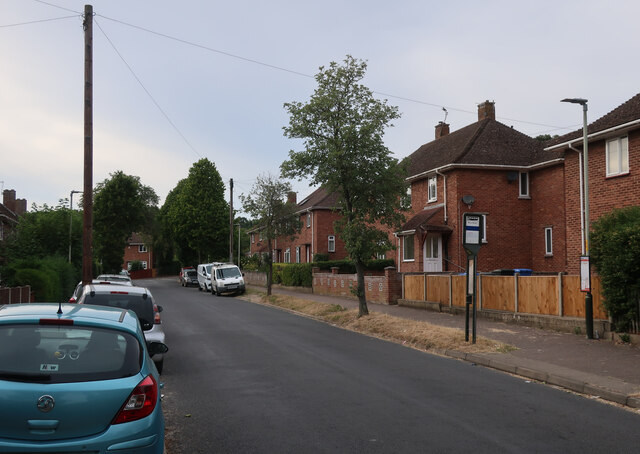
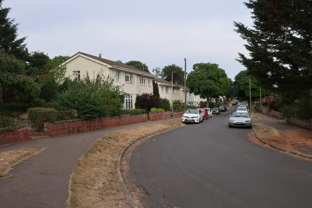
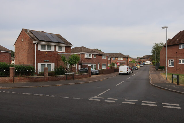
Earlham is a suburb located in the western part of Norwich, Norfolk, England. It is situated approximately 3 miles from the city center and is bordered by Costessey to the west and Bowthorpe to the south. With a population of around 10,000 residents, Earlham is a vibrant and diverse community.

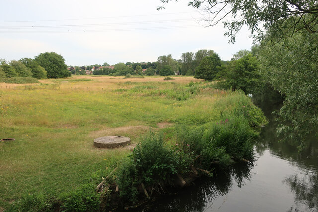
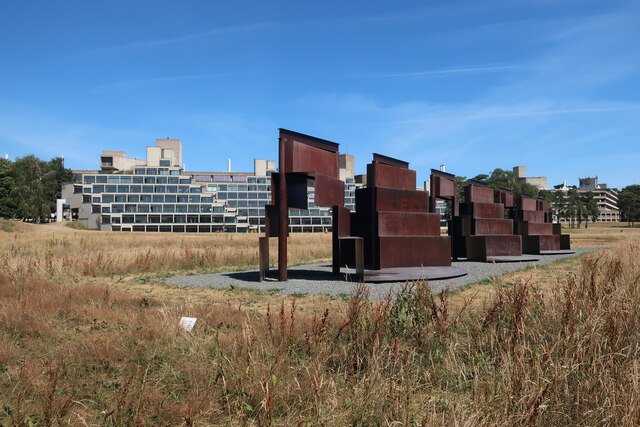
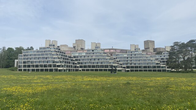
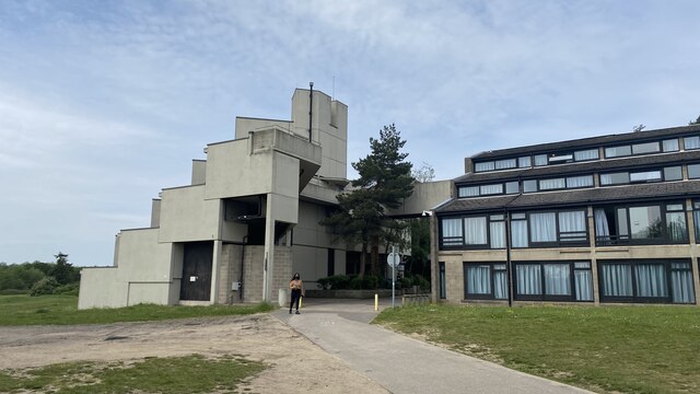
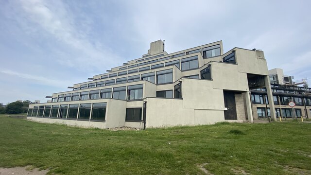
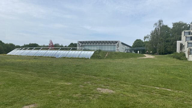
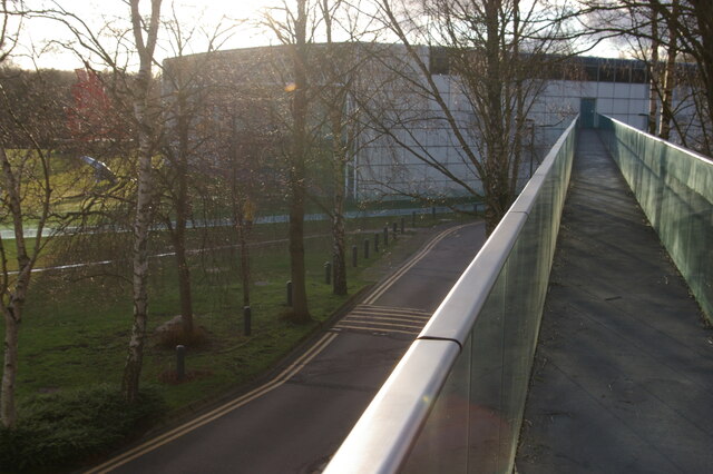
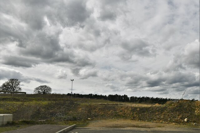
The area is known for its picturesque landscapes, with Earlham Park being one of its main attractions. The park spans over 88 acres and offers beautiful green spaces, woodlands, and a lake, making it perfect for leisurely walks, picnics, and outdoor activities. It is also home to the University of East Anglia, which contributes to the area's lively and intellectual atmosphere.

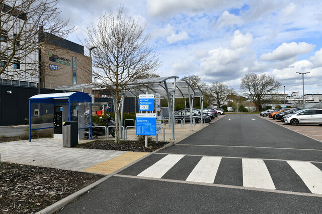
Earlham has a range of amenities and facilities to cater to its residents. The area is well-served by several schools, including Earlham Primary School and City Academy Norwich. There are also various shopping options available, with the Earlham Shopping Center offering a variety of stores, supermarkets, and eateries.

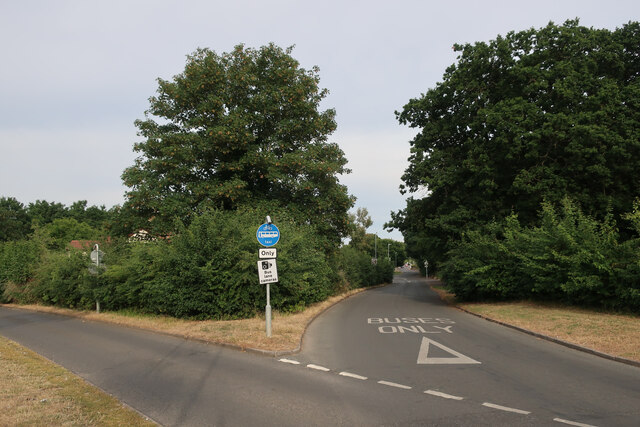
Transportation in Earlham is convenient, with regular bus services connecting the suburb to Norwich city center and other nearby areas. The A47 road, which runs through Earlham, provides easy access to neighboring towns and cities.

Overall, Earlham offers a peaceful and picturesque setting, combined with a thriving community atmosphere and convenient amenities, making it an attractive place to live for families, students, and professionals alike.

If you have any feedback on the listing, please let us know in the comments section below.

Earlham Images

Images are sourced within 2km of 52.626851/1.235173 or Grid Reference TG1908. Thanks to Geograph Open Source API. All images are credited.

Paddocks by River Wensum
Wilberforce Road, West Earlham
Garages on St Mildreds Road
St Mildreds Road, West Earlham
Earlham Green Lane
Earlham Green Lane
Bus link to Earlham Green Lane
Holworthy Road
Holworthy Road
Goodwood Steps, UEA campus Anthony Caro sculpture which sits well with the stepped nature of the campus buildings behind.
Goodwood Steps, UEA campus
Anthony Caro sculpture which sits well with the stepped nature of the campus buildings behind.
Suffolk Terrace (ziggurats), University of East Anglia
Sainsbury Centre, University of East Anglia
Footbridge leading into the Sainsbury Centre, University of East Anglia The Sainsbury Centre at the University of East Anglia is a renowned art gallery, housed in a pioneering example by Norman Foster of high-tech architecture.
Footbridge leading into the Sainsbury Centre, University of East Anglia
The Sainsbury Centre at the University of East Anglia is a renowned art gallery, housed in a pioneering example by Norman Foster of high-tech architecture.
Colney, Norfolk and Norwich University Hospitals: The Quadram Institute
Colney, Norfolk and Norwich University Hospitals: The Quadram Institute car park
Colney, Norfolk and Norwich University Hospitals: The Quadram Institute car park payment area
Colney, Norfolk and Norwich University Hospitals: Where development of this site ends
Show me another place!

Earlham is located at Grid Ref: TG1908 (Lat: 52.626851, Lng: 1.235173)

Administrative County: Norfolk

District: Norwich

Police Authority: Norfolk

What 3 Words

///rocks.than.tree. Near Bowthorpe, Norfolk

Related Wikis

Earlham Hall

Earlham Hall is a country house in Norfolk, England. It is located just to the west of the city of Norwich, on Earlham Road, on the outskirts of the village...

Earlham Park Woods

Earlham Park Woods is a 8.1-hectare (20-acre) Local Nature Reserve on the western outskirts of Norwich in Norfolk. It is owned and managed by Norwich...

Climatic Research Unit

The Climatic Research Unit (CRU) is a component of the University of East Anglia and is one of the leading institutions concerned with the study of natural...

University of East Anglia

The University of East Anglia (UEA) is a public research university in Norwich, England. Established in 1963 on a 320-acre (130-hectare) campus west of...

Nearby Amenities

Located within 500m of 52.626851,1.235173
Traffic Calming: cushion
Lat/Long: 52.630459/1.2365623
Access: private
Barrier: lift_gate
Lat/Long: 52.6262927/1.239435
Traffic Calming: bump
Lat/Long: 52.6258747/1.2405302
Traffic Signals
Lat/Long: 52.6273113/1.2297135
Traffic Signals
Lat/Long: 52.6271638/1.2297633
Give Way
Lat/Long: 52.6271909/1.2292218
Traffic Signals
Lat/Long: 52.627283/1.2295193
Crossing
Check Date Crossing: 2020-11-19
Crossing: uncontrolled
Crossing Ref: zebra
Tactile Paving: yes
Lat/Long: 52.62405/1.2405142
Crossing
Crossing: unmarked
Tactile Paving: no
Lat/Long: 52.626905/1.2396634
Crossing
Crossing: uncontrolled
Lat/Long: 52.6262693/1.236457
Traffic Calming: bump
Lat/Long: 52.6264499/1.2376102
Crossing
Crossing: uncontrolled
Lat/Long: 52.6263849/1.237542
Crossing
Bicycle: yes
Crossing: unmarked
Crossing Island: no
Crossing Markings: no
Tactile Paving: no
Lat/Long: 52.6279819/1.2385629
Power: tower
Ref: PO36
Lat/Long: 52.6260001/1.2295409
Power: tower
Ref: PO37
Lat/Long: 52.6285812/1.2295371
Barrier: lift_gate
Bicycle: yes
Foot: yes
Lat/Long: 52.6286815/1.2377965
Post Box
Collection Times: Mo-Fr 18:30; Sa 13:00
Operator: Royal Mail
Postal Code: NR5
Ref: NR5 512
Lat/Long: 52.6287733/1.2379293
Crossing
Crossing Island: yes
Tactile Paving: yes
Lat/Long: 52.6278372/1.2349495
Entrance: main
Lat/Long: 52.6280565/1.2350376
Crossing
Crossing: unmarked
Crossing Markings: no
Tactile Paving: yes
Lat/Long: 52.6279044/1.2349517
Power: pole
Ref: 115
Lat/Long: 52.625154/1.2295
Power: pole
Ref: 3
Lat/Long: 52.62518/1.22938
Power: pole
Ref: 2
Lat/Long: 52.626197/1.23004
Power: pole
Ref: 116
Lat/Long: 52.626165/1.230171
Power: pole
Ref: 1
Lat/Long: 52.627215/1.230716
Power: pole
Ref: 117
Lat/Long: 52.627182/1.23085
Power: pole
Lat/Long: 52.6275404/1.2288917
Power: pole
Lat/Long: 52.6275754/1.2283883
Power: pole
Lat/Long: 52.6275551/1.2286379
Bus Stop
West Earlham / Rockingham Road
Naptan AtcoCode: 2900N12327
Naptan Bearing: E
Naptan CommonName: Rockingham Road
Naptan Indicator: adj
Naptan Landmark: Wordsworth Road
Naptan Locality: Norwich
Naptan NaptanCode: nfodjmgw
Naptan PlusbusZoneRef: NRCH
Naptan ShortCommonName: Rockingham Road
Naptan Street: Rockingham Road
Operator: First Eastern Counties
Route Ref: 21;22
Shelter: no
Source: naptan_import;survey
Lat/Long: 52.6308027/1.237931
Bus Stop
Bowthorpe / Wilberforce Road
Naptan AtcoCode: 2900N12329
Naptan Bearing: SE
Naptan CommonName: Robson Road
Naptan Indicator: opp
Naptan Landmark: Robson Road
Naptan Locality: Norwich
Naptan NaptanCode: nfodjmjd
Naptan PlusbusZoneRef: NRCH
Naptan Street: Wilberforce Road
Operator: First Eastern Counties
Route Ref: 21;22
Shelter: no
Source: naptan_import;survey
Lat/Long: 52.6312233/1.2358981
Bus Stop
Earlham Park Gates / Serving N&N Hospital
Bench: no
Check Date Shelter: 2020-11-19
Naptan AtcoCode: 2900N12390
Naptan Bearing: W
Naptan CommonName: Earlham Park Gates
Naptan Indicator: adj
Naptan Landmark: University Drive
Naptan Latitude: 52.6279964
Naptan Locality: Norwich
Naptan Longitude: 1.2411613
Naptan NaptanCode: nfodjptj
Naptan PlusbusZoneRef: NRCH
Naptan Street: Earlham Road
Operator: First Eastern Counties;H. Semmence & Co;Konectbus
Shelter: no
Source: naptan_import;survey
Lat/Long: 52.6280052/1.2413617
Bus Stop
Bowthorpe / Wilberforce Road
Naptan AtcoCode: 2900N12711
Naptan Bearing: NW
Naptan CommonName: Robson Road
Naptan Indicator: adj
Naptan Landmark: Robson Road
Naptan Locality: Norwich
Naptan NaptanCode: nfodmpma
Naptan PlusbusZoneRef: NRCH
Naptan Street: Wilberforce Road
Operator: First Eastern Counties
Route Ref: 21;22
Shelter: no
Source: naptan_import;survey
Lat/Long: 52.6310098/1.2359961
University Village
Naptan AtcoCode: 2900N1300
Naptan Bearing: S
Naptan BusStopType: MKD
Naptan CommonName: University Village
Naptan Indicator: opp
Naptan Locality: Earlham
Naptan NaptanCode: nfogmjpw
Naptan PlusbusZoneRef: NRCH
Naptan Street: Wilberforce Road
Physically Present: no
Shelter: no
Source: naptan_import;survey
Lat/Long: 52.6287711/1.238159
Bus Stop
Earlham Road / opp UEA
Bench: no
Check Date Shelter: 2020-11-19
Naptan AtcoCode: 2900N1302
Naptan Bearing: E
Naptan CommonName: Earlham Park Gates
Naptan Indicator: opp
Naptan Landmark: Earlham Gates
Naptan Latitude: 52.6281354
Naptan Locality: Norwich
Naptan Longitude: 1.2406838
Naptan NaptanCode: nfogmjtd
Naptan PlusbusZoneRef: NRCH
Naptan Street: Earlham Road
Operator: Konectbus;H. Semmence & Co
Shelter: no
Source: naptan_import;survey
Lat/Long: 52.6281037/1.2408778
Bus Stop
Earlham Park Gates
Bench: no
Naptan AtcoCode: 2900N129100
Naptan Bearing: S
Naptan BusStopType: MKD
Naptan CommonName: Enterprise Centre
Naptan Indicator: opp
Naptan NaptanCode: nfogtmwt
Naptan PlusbusZoneRef: NRCH
Naptan Street: University Drive
Naptan Verified: yes
Operator: First
Shelter: no
Source: naptan_import;survey;photo
Lat/Long: 52.6264064/1.2401108
Bus Stop
Bus Shelter
Bench: yes
Public Transport: platform
Shelter: yes
Lat/Long: 52.6276535/1.240522
Traffic Calming: cushion
Lat/Long: 52.6273914/1.2280145
Bicycle Parking
Bicycle Parking: stands
Capacity: 34
Check Date Capacity: 2020-11-20
Covered: yes
Operator: Sports Park
Lat/Long: 52.6244959/1.2406017
Waste Basket
Colour: green
Material: plastic
Waste: dog_excrement
Lat/Long: 52.6261993/1.2344669
Bench
Backrest: yes
Material: wood
Lat/Long: 52.6261812/1.2343295
Bench
Backrest: yes
Colour: brown
Inscription: Norfolk Dog Training Society / 50th Anniversary / 2005
Material: wood
Lat/Long: 52.6259251/1.2351923
Waste Basket
Colour: green
Material: plastic
Operator: Norwich City Council
Waste: dog_excrement
Lat/Long: 52.6237892/1.2319004
Traffic Calming: cushion
Lat/Long: 52.6292119/1.2377233
Traffic Calming: cushion
Lat/Long: 52.6286916/1.238065
Traffic Calming: cushion
Lat/Long: 52.6298034/1.2371925
Crossing
Bicycle: yes
Button Operated: yes
Crossing: traffic_signals
Crossing Island: no
Crossing Ref: toucan
Tactile Paving: yes
Lat/Long: 52.6279041/1.2393568
Waste Basket
Colour: green
Material: plastic
Lat/Long: 52.6310078/1.2359997
Bus Stop
Watton Rd / Old Watton Rd
Naptan AtcoCode: 2900C2362
Naptan Bearing: SW
Naptan CommonName: Old Watton Road
Naptan Indicator: opp
Naptan Locality: Colney
Naptan NaptanCode: nfogtdmj
Naptan Street: Watton Road
Operator: Konectbus
Physically Present: no
Shelter: no
Source: naptan_import;survey
Lat/Long: 52.6266534/1.2278611
Motorcycle Parking
Capacity: 10
Check Date Capacity: 2020-11-19
Covered: no
Fee: no
Parking: surface
Lat/Long: 52.6250596/1.2406297
Bench
Backrest: no
Lat/Long: 52.62426/1.2405967
Bench
Backrest: no
Lat/Long: 52.624223/1.2406045
Bench
Backrest: yes
Lat/Long: 52.6243983/1.2406455
Bicycle Parking
Operator: Sportspark
Lat/Long: 52.624883/1.240621
Bench
Backrest: yes
Lat/Long: 52.624339/1.2406545
Bench
Backrest: yes
Lat/Long: 52.6243687/1.24065
Bench
Backrest: yes
Lat/Long: 52.624428/1.240641
Bench
Backrest: no
Lat/Long: 52.624299/1.2405907
Barrier: lift_gate
Foot: yes
Lat/Long: 52.6249985/1.2404782
Access: no
Barrier: lift_gate
Bicycle: yes
Foot: yes
Motor Vehicle: yes
Motorcycle: yes
Lat/Long: 52.6257642/1.2403444
Man Made: surveillance
Surveillance: public
Lat/Long: 52.6272459/1.2398006
Traffic Calming: hump
Lat/Long: 52.6244464/1.2404517
Traffic Calming: hump
Lat/Long: 52.6252501/1.2403219
Entrance: yes
Lat/Long: 52.6241081/1.2407643
Bicycle Parking
Village - Courtyard
Access: private
Capacity: 80
Covered: yes
Locked: yes
Operator: University of East Anglia
Lat/Long: 52.628062/1.237636
Bicycle Parking
Village - Hawthorn
Capacity: 12
Covered: no
Operator: University of East Anglia
Lat/Long: 52.62884/1.235206
Bicycle Parking
Village - Ash
Capacity: 10
Covered: no
Operator: University of East Anglia
Lat/Long: 52.628094/1.236488
Bicycle Parking
Village - Willow
Capacity: 12
Covered: no
Operator: University of East Anglia
Lat/Long: 52.629081/1.235055
Bicycle Parking
Village - Beech
Capacity: 10
Covered: no
Operator: University of East Anglia
Lat/Long: 52.628501/1.236654
Bicycle Parking
Village - Elm
Capacity: 12
Covered: no
Operator: University of East Anglia
Lat/Long: 52.628811/1.237459
Bicycle Parking
Village - Oak
Capacity: 11
Covered: no
Operator: University of East Anglia
Lat/Long: 52.628124/1.23616
Bicycle Parking
Earlham Hall
Bicycle Parking: stands
Capacity: 10
Covered: no
Lat/Long: 52.625626/1.236992
Bicycle Parking
Village - Larch
Capacity: 10
Covered: no
Operator: University of East Anglia
Lat/Long: 52.628163/1.236681
Bicycle Parking
Village - Pine
Capacity: 12
Covered: no
Operator: University of East Anglia
Lat/Long: 52.629192/1.235114
Bicycle Parking
Village - Yew
Capacity: 11
Covered: no
Operator: University of East Anglia
Lat/Long: 52.628641/1.236772
Street Lamp
Operator: Norfolk County Council
Ref: 1820
Lat/Long: 52.6277166/1.2368607
Street Lamp
Operator: Norfolk County Council
Ref: 85
Lat/Long: 52.6270536/1.2296353
Street Lamp
Operator: Norfolk County Council
Ref: 1821
Lat/Long: 52.6278308/1.2363623
Barrier: bollard
Lat/Long: 52.6280623/1.2401467
Waste Basket
Waste: general
Lat/Long: 52.6279419/1.23484
Barrier: bollard
Lat/Long: 52.6281439/1.2401213
Street Lamp
Lat/Long: 52.6274079/1.2285604
Street Lamp
Lat/Long: 52.6274067/1.2290433
Street Lamp
Lat/Long: 52.6273705/1.2295712
Street Lamp
Operator: Norfolk County Council
Ref: 99
Lat/Long: 52.6274208/1.2281469
Crossing
Crossing: uncontrolled
Lat/Long: 52.6283334/1.2372861
Street Lamp
Operator: Norfolk County Council
Ref: 1811
Lat/Long: 52.6279006/1.2404159
Man Made: surveillance
Surveillance: public
Lat/Long: 52.6262802/1.2399502
Traffic Signals
Lat/Long: 52.6271432/1.2293418
Street Lamp
Lit: no
Operator: Norfolk County Council
Lat/Long: 52.6271172/1.229935
Welcome to Norwich / A Fine City
Colour: white
Inscription: UNESCO World City of Literature / Twinned with Rouen, Koblenz, Novi Sad and El Viejo
Material: metal
Traffic Sign: city_limit
Lat/Long: 52.627848/1.2345317
Street Lamp
Lit: no
Operator: University of Eash Anglia
Ref: U03
Lat/Long: 52.6275937/1.2399048
Street Lamp
Lit: no
Operator: Norfolk County Council
Ref: 1812
Lat/Long: 52.6279907/1.2399968
Earlham
Place: suburb
Wikidata: Q21476525
Lat/Long: 52.6271083/1.2357203
Bus Stop
University Drive / Enterprise Centre
Bench: no
Naptan AtcoCode: 2900N129101
Naptan Bearing: N
Naptan BusStopType: MKD
Naptan CommonName: Enterprise Centre
Naptan Indicator: o/s
Naptan NaptanCode: nfogtpad
Naptan PlusbusZoneRef: NRCH
Naptan Street: University Drive
Shelter: no
Source: naptan_import
Lat/Long: 52.6247979/1.240329
Waste Basket
Operator: Norwich City Council
Waste: general
Lat/Long: 52.6246228/1.2356584
Entrance: yes
Lat/Long: 52.624991/1.2396867
Entrance: main
Lat/Long: 52.6254101/1.2396674
Entrance: yes
Lat/Long: 52.6256346/1.2395695
Cafe
Sportscafe
Addr City: Norwich
Addr Housename: Sportspark
Addr Place: University of East Anglia
Addr Postcode: NR4 7TJ
Addr Street: University Drive
Fhrs Id: 724480
Opening Hours: Mo-Th 08:00-22:00; Fr-Su 08:00-21:30
Opening Hours Kitchen: Mo-Th 08:00-21:30; Fr-Su 08:00-21:00
Source Addr: FHRS Open Data
Website: https://portal.uea.ac.uk/campus-kitchen/cafes-and-restaurants/sports-park-cafe
Wheelchair: yes
Lat/Long: 52.6242167/1.2409994
Crossing
Crossing: unmarked
Crossing Island: no
Note: Though grooved/ridged, directional road crossing surface
Tactile Paving: no
Lat/Long: 52.6274609/1.2399721
Barrier: kissing_gate
Bicycle: yes
Colour: green
Foot: yes
Material: metal
Lat/Long: 52.6279373/1.2347373
Bench
Backrest: no
Material: wood
Lat/Long: 52.6295549/1.2345237
Bench
Backrest: no
Material: wood
Lat/Long: 52.6290395/1.2345857
Waste Basket
Waste: general
Lat/Long: 52.6269642/1.2336425
Waste Basket
Note: import;Dog excrement must be wrapped
Waste: general
Lat/Long: 52.6273443/1.2342272
Covered: no
Leisure: picnic_table
Lat/Long: 52.6273862/1.2342507
Waste Basket
Waste: general
Lat/Long: 52.6252748/1.2356052
Barrier: kissing_gate
Bicycle: yes
Foot: yes
Lat/Long: 52.6302375/1.2346018
Barrier: kissing_gate
Colour: grey
Foot: yes
Material: metal
Lat/Long: 52.6307435/1.234041
Barrier: stile
Colour: grey
Foot: yes
Material: metal
Step Count: 2
Lat/Long: 52.6307613/1.2340261
Barrier: kissing_gate
Foot: yes
Material: wood
Lat/Long: 52.6301774/1.2324931
Entrance: yes
Lat/Long: 52.6281932/1.2351285
Entrance: yes
Lat/Long: 52.6281174/1.2352521
Give Way
Lat/Long: 52.6305879/1.2364886
Give Way
Lat/Long: 52.6305646/1.2363994
Crossing
Crossing: uncontrolled
Crossing Ref: zebra
Tactile Paving: yes
Lat/Long: 52.625862/1.2402176
Charging Station
Amperage: 32
Authentication Membership Card: yes
Capacity: 2
Car: yes
Fee: no
Note: One bay in Zone A, the other in Zone B beyond lift gate
Opening Hours: Mo-Su 06:00-02:00
Operator: ChargeMaster
Ref: CM2076
Serial Number: 3196
Socket Type2: 2
Voltage: 230
Website: https://chargemasterplc.com/
Lat/Long: 52.6262906/1.2393731
Give Way
Lat/Long: 52.6261266/1.2394891
Give Way
Lat/Long: 52.6260844/1.2394446
Vending Machine
Vending: parking_tickets
Lat/Long: 52.6261406/1.2393294
Traffic Calming: bump
Lat/Long: 52.6267803/1.2385919
Traffic Calming: bump
Lat/Long: 52.6268255/1.2389446
Give Way
Lat/Long: 52.6269227/1.2398164
Traffic Calming: hump
Lat/Long: 52.6267482/1.2391853
Give Way
Lat/Long: 52.6268179/1.2391792
Traffic Calming: hump
Lat/Long: 52.6265191/1.2391989
Description: WW2 Spigot mortar base (only the base remains visible by inside the park by the fence). Presumably to defend the river crossing.
Historic: ruins
Military: spigot_mortar_base
Website: http://www.heritage.norfolk.gov.uk/record-details?MNF32484-World-War-Two-spigot-mortar-emplacement&Index=29713&RecordCount=57339&SessionID=39cdfa3e-68ac-4444-960c-0e4da53e0884
Lat/Long: 52.6277309/1.235223
Give Way
Lat/Long: 52.6294021/1.2380383
Crossing
Crossing: unmarked
Lat/Long: 52.6283848/1.2410842
Cafe
Grain
Addr City: Norwich
Addr Housename: The Enterprise Centre
Addr Place: University of East Anglia
Addr Postcode: NR4 7TJ
Cuisine: coffee_shop
Fhrs Id: 1160011
Opening Hours: Mo-Fr 08:30-15:30
Operator: UEA Catering
Url: https://www.uea.ac.uk/adapt/the-enterprise-centre/namaste-hut-cafe
Lat/Long: 52.6255858/1.2395215
Bicycle Parking
Bicycle Parking: stands
Capacity: 64
Covered: yes
Lat/Long: 52.6259343/1.2398827
Entrance: main
Lat/Long: 52.6255743/1.237016
Entrance: main
Lat/Long: 52.6256493/1.237163
Camera Mount: pole
Camera Type: fixed
Man Made: surveillance
Surveillance: public
Surveillance Type: camera
Surveillance Zone: traffic
Lat/Long: 52.6266115/1.2398391
Milestone
Colour: white
Material: stone
Lat/Long: 52.6277259/1.2376192
Barrier: bollard
Bicycle: yes
Foot: yes
Lat/Long: 52.6259323/1.2393148
Charging Station
evolt EV Rapid Charger
Amperage: 125 DC;63 AC
Brand: Swarco E.Connect
Capacity: 3
Colour: white;black
Email: uksupport@swarco-econnect.com
Fee: £0.33 GBP/kWh
Note: 50 kW DC CCS and CHAdeMO, 43 kW AC Type 2
Opening Hours: Mo-Su 06:00-02:00
Operator: Norwich City Council
Payment Cash: no
Payment Contactless: yes
Payment Credit Cards: yes
Payment Debit Cards: yes
Phone: +44 20 8515 8444
Ref: SEC. 50047
Socket Chademo: 1
Socket Type2: 1
Socket Type2 Combo: 1
Voltage: 400
Website: https://www.swarcoeconnect.org/
Lat/Long: 52.6261/1.23911
Bicycle Parking
Bicycle Parking: stands
Capacity: 18
Covered: yes
Lat/Long: 52.6252134/1.2400952
Charging Station
Amperage: 32
Authentication Membership Card: yes
Capacity: 2
Car: yes
Fee: no
Note: Both bays in Zone B beyond lift gate
Opening Hours: Mo-Su 06:00-02:00
Operator: ChargeMaster
Ref: CM2077
Serial Number: 3197
Socket Type2: 2
Voltage: 230
Website: https://chargemasterplc.com/
Lat/Long: 52.6262513/1.2395674
Access: private
Barrier: lift_gate
Lat/Long: 52.6261284/1.2395501
Grit Bin
Lat/Long: 52.6293594/1.2381348
Defibrillator
Addr Postcode: NR4 7TJ
Defibrillator Location: Attached to outside of fence around astroturf pitches, in the middle of the Sportspark pitch complex.
Emergency: defibrillator
Indoor: no
Ref GB The Circuit: D7920FBC-0C33-451C-B260-AD3D016C3336
Lat/Long: 52.6267245/1.2415369
Defibrillator
Addr Postcode: NR4 7TQ
Defibrillator Location: On exterior wall of Earlham Park Cafe, to the left of the main entrance.
Emergency: defibrillator
Ref GB The Circuit: 7E562090-2387-4083-96C2-AF02010AF8FF
Lat/Long: 52.6261514/1.235312
Bicycle Rental
Sports Park
Capacity: 6
Email: support@beryl.cc
Fee: yes
Name Signed: no
Network: Beryl - Norwich
Official Name: Sports Park
Operator: Beryl
Operator Wikidata: Q106575369
Payment App: yes
Payment App Android: cc.beryl.basis
Payment App Ios: 1386768364
Payment Cash: no
Payment Credit Cards: no
Payment Cryptocurrencies: no
Payment Debit Cards: no
Payment Electronic Purses: no
Phone: +44 20 3003 5044
Ref Gbfs: beryl_norwich:1920
Rental: city_bike;ebike;escooter
Website: https://beryl.cc/scheme/norwich
Lat/Long: 52.6238708/1.240661
Bicycle Rental
University Village
Capacity: 6
Email: support@beryl.cc
Fee: yes
Name Signed: no
Network: Beryl - Norwich
Official Name: University Village
Operator: Beryl
Operator Wikidata: Q106575369
Payment App: yes
Payment App Android: cc.beryl.basis
Payment App Ios: 1386768364
Payment Cash: no
Payment Credit Cards: no
Payment Cryptocurrencies: no
Payment Debit Cards: no
Payment Electronic Purses: no
Phone: +44 20 3003 5044
Ref Gbfs: beryl_norwich:1949
Rental: city_bike;ebike;escooter
Website: https://beryl.cc/scheme/norwich
Lat/Long: 52.6281471/1.237921
Waste Basket
Lat/Long: 52.62643/1.2392998
Waste Basket
Colour: black
Material: plastic
Waste: trash
Lat/Long: 52.6265045/1.2365178
Waste Basket
Lat/Long: 52.628687/1.2362376
Waste Basket
Lat/Long: 52.6254238/1.2377467
Waste Basket
Lat/Long: 52.6275902/1.2393362
Waste Basket
Colour: green
Material: plastic
Lat/Long: 52.6278161/1.2337402
Generator Method: photovoltaic
Generator Output Electricity: yes
Generator Source: solar
Generator Type: solar_photovoltaic_panel
Location: roof
Power: generator
Lat/Long: 52.6255056/1.239709
Generator Method: photovoltaic
Generator Output Electricity: yes
Generator Source: solar
Generator Type: solar_photovoltaic_panel
Location: roof
Power: generator
Lat/Long: 52.6253192/1.2400603
Generator Method: photovoltaic
Generator Output Electricity: yes
Generator Source: solar
Generator Type: solar_photovoltaic_panel
Location: roof
Power: generator
Lat/Long: 52.6253102/1.2395588
Generator Method: photovoltaic
Generator Output Electricity: yes
Generator Source: solar
Generator Type: solar_photovoltaic_panel
Location: roof
Power: generator
Lat/Long: 52.6250294/1.2398444
Traffic Calming: bump
Lat/Long: 52.626259/1.2404768
Bench
Armrest: both
Backrest: yes
Colour: light_brown
Inscription: Rest a while / Happy Memories / Derrick Waters / Treasured Husband, Dad, Grandad & Grandpa / Forever in our hearts.
Material: wood
Seats: 3
Lat/Long: 52.6259395/1.2322571
Life Ring
Colour: orange
Emergency: life_ring
Support: post
Lat/Long: 52.6262261/1.2324844
Active Campus
Hiking: yes
Information: route_marker
Material: wood
Ref: Blue
Tourism: information
Lat/Long: 52.6258341/1.2324549
Active Campus
Hiking: yes
Information: route_marker
Material: wood
Ref: Blue
Tourism: information
Lat/Long: 52.6262114/1.2344002
Active Campus
Hiking: yes
Information: route_marker
Material: wood
Ref: Blue
Tourism: information
Lat/Long: 52.6262877/1.2354546
Active Campus
Hiking: yes
Information: route_marker
Material: wood
Ref: Blue
Tourism: information
Lat/Long: 52.6262245/1.2358563
Traffic Calming: bump
Lat/Long: 52.6263637/1.2364836
Barrier: height_restrictor
Lat/Long: 52.6264321/1.2364729
Active Campus
Hiking: yes
Information: route_marker
Material: wood
Ref: Blue
Tourism: information
Lat/Long: 52.6264044/1.2374901
Material: brick
Traffic Calming: hump
Lat/Long: 52.6262904/1.2375344
Waste Basket
Colour: green
Material: plastic
Waste: dog_excrement
Lat/Long: 52.6248141/1.2384912
Active Campus
Hiking: yes
Information: route_marker
Material: wood
Ref: Blue
Tourism: information
Lat/Long: 52.624847/1.238447
Active Campus
Hiking: yes
Information: route_marker
Material: wood
Ref: Blue
Tourism: information
Lat/Long: 52.6250261/1.2385355
Active Campus
Hiking: yes
Information: route_marker
Material: wood
Ref: Blue
Tourism: information
Lat/Long: 52.6253685/1.2377161
UEA Herbaceous Border, Earlham Hall
Board Type: plants
Description: When Mr and Mrs Sydney Morris obtained possession of Earlham Ham in the ealry 20th century, it was their wish to create a modern landscape garden which could be enjoyed throughout the year.
Information: board
Tourism: information
Lat/Long: 52.6255724/1.2383833
Note: Cast concrete plinth
Lat/Long: 52.625403/1.2387145
Bench
Armrest: both
Backrest: yes
Colour: silver
Inscription: no
Material: wood
Seats: 3
Lat/Long: 52.6255614/1.2388835
Bench
Armrest: both
Backrest: yes
Colour: silver
Inscription: Doris Blanche Huthwaite (Nee Bale) / 1918 ~ 2004
Material: wood
Seats: 3
Lat/Long: 52.625549/1.2389452
Bench
Backrest: no
Colour: light_brown
Inscription: no
Material: wood
Seats: 22
Lat/Long: 52.6248828/1.2396151
Bench
Backrest: no
Colour: light_brown
Inscription: no
Material: wood
Seats: 10
Lat/Long: 52.6249626/1.239708
Active Campus
Hiking: yes
Information: route_marker
Material: wood
Ref: Blue
Tourism: information
Lat/Long: 52.6226819/1.2324958
Colour: blue
Description: Bluebell symbol
Direction: 65
Information: route_marker
Material: wood
Tourism: information
Lat/Long: 52.6246789/1.2314273
Yare Valley Walk
Destination: Earlham Park; Eaton
Information: guidepost
Material: wood
Tourism: information
Lat/Long: 52.6250168/1.2305063
Bench
Backrest: yes
Colour: grey
Covered: yes
Inscription: no
Material: metal
Seats: 4
Lat/Long: 52.6246964/1.2406249
Bench
Backrest: yes
Colour: grey
Covered: yes
Inscription: no
Material: metal
Seats: 4
Lat/Long: 52.62472/1.2406222
Bench
Backrest: yes
Colour: grey
Covered: yes
Inscription: no
Material: metal
Seats: 4
Lat/Long: 52.6247453/1.2406193
Bench
Backrest: yes
Colour: grey
Covered: yes
Inscription: no
Material: metal
Seats: 4
Lat/Long: 52.6247722/1.2406162
Bench
Backrest: yes
Colour: grey
Covered: yes
Inscription: no
Material: metal
Seats: 4
Lat/Long: 52.6248006/1.2406129
Active Campus
Colour: blue
Direction: 270
Information: route_marker
Material: wood
Tourism: information
Lat/Long: 52.6238068/1.2401079
Welcome to Earlham Park
Boundary: marker
Brand: UEA;University of East Anglia
Colour: green
Colour Back: white
Inscription: “…Norwich discards its city clothes and prepares to meet the country…” Geoffrey Goreham 1961
Material: metal
Operator: Norwich City Council
Lat/Long: 52.6268659/1.2397653
Colour: white
Communication Mobile Phone: yes
Man Made: mast
Material: metal
Note: New 5G
Operator: Three UK
Start Date: 2023-04
Tower Construction: freestanding
Tower Type: communication
Lat/Long: 52.6303272/1.236544
Give Way
Lat/Long: 52.6306027/1.236782
Yare Walley Walk
Colour: light_brown
Hiking: yes
Information: guidepost
Inscription: Earlham Park / Eaton / Earlham / Millennium Green / Yare Valley Walk / UEA
Material: wood
Tourism: information
Lat/Long: 52.6277341/1.2348998
Crossing
Crossing: uncontrolled
Crossing Markings: yes
Lat/Long: 52.62736/1.2286631
The data included in this document is from www.openstreetmap.org. The data is made available under ODbL.

Have you been to Earlham?

Leave your review of Earlham below (or comments, questions and feedback).