Rosedown Wood

Wood, Forest in Oxfordshire South Oxfordshire

England

Rosedown Wood

Direction Sign – Signpost on Hardwick Road, Whitchurch-on-Thames Located on the southwest side of the junction of Hardwick Road, Sheepwash Lane and a bridleway to Mapledurham, in Whitchurch-on-Thames parish. 3 arms and pawn finial. See also <a title="https://www.geograph.org.uk/photo/2182449" href="https://www.geograph.org.uk/photo/2182449">Link</a>.

Milestone Society National ID: OX_SU6577
Direction Sign – Signpost on Hardwick Road, Whitchurch-on-Thames Credit: John V Nicholls

Rosedown Wood is a picturesque forest located in Oxfordshire, England. Covering an area of approximately 100 acres, this woodland is known for its diverse flora and fauna, making it a popular destination for nature enthusiasts and hikers alike.

The wood is characterized by its dense canopy of oak, beech, and birch trees, creating a tranquil and shaded environment. Walking through the woodland, visitors can enjoy the soothing sounds of birds chirping and the rustling of leaves underfoot. The forest floor is carpeted with wildflowers, adding bursts of color and enhancing the natural beauty of the area.

Rosedown Wood is also home to a variety of wildlife, including deer, foxes, badgers, and numerous bird species. It is a designated Site of Special Scientific Interest (SSSI), highlighting its importance for conservation and preservation efforts.

The wood offers a network of well-maintained footpaths and trails, allowing visitors to explore its different areas and discover hidden gems along the way. There are also picnic areas and benches scattered throughout the woodland, providing opportunities for visitors to relax and take in the serene surroundings.

Managed by the local council, Rosedown Wood is open to the public year-round and is free to access. It is a perfect place for a peaceful stroll, a family outing, or a spot of wildlife spotting. With its natural charm and tranquility, Rosedown Wood is a true gem of Oxfordshire, offering a welcome escape from the hustle and bustle of everyday life.

If you have any feedback on the listing, please let us know in the comments section below.

Rosedown Wood Images

Images are sourced within 2km of 51.498437/-1.0629546 or Grid Reference SU6578. Thanks to Geograph Open Source API. All images are credited.

Direction Sign – Signpost on Hardwick Road, Whitchurch-on-Thames Located on the southwest side of the junction of Hardwick Road, Sheepwash Lane and a bridleway to Mapledurham, in Whitchurch-on-Thames parish. 3 arms and pawn finial. See also <a title="https://www.geograph.org.uk/photo/2182449" href="https://www.geograph.org.uk/photo/2182449">Link</a>.

Milestone Society National ID: OX_SU6577
Direction Sign – Signpost on Hardwick Road, Whitchurch-on-Thames
Located on the southwest side of the junction of Hardwick Road, Sheepwash Lane and a bridleway to Mapledurham, in Whitchurch-on-Thames parish. 3 arms and pawn finial. See also Link. Milestone Society National ID: OX_SU6577
Whitchurch Bridge - toll booth The first bridge spanning the River Thames connecting Whitchurch to Pangbourne was built in 1792; at the same time the toll house (seen here in the background) was constructed at the northern end of the bridge. The original timber bridge was replaced with another wooden bridge of a different design in 1853. That in turn was replaced with an iron bridge in 1902 which was strengthened in the 1920s. A fourth bridge was built in 2014 with a similar visual appearance to the 1902 bridge but better able to cope with modern traffic conditions. The bridge remains privately owned, changing hands for the first time in 2019 when it was sold to the General Estates Company Ltd; nevertheless it carries a classified road, the B471. The toll booth dates from 1992 and the current charge for cars is 60p.
Whitchurch Bridge - toll booth
The first bridge spanning the River Thames connecting Whitchurch to Pangbourne was built in 1792; at the same time the toll house (seen here in the background) was constructed at the northern end of the bridge. The original timber bridge was replaced with another wooden bridge of a different design in 1853. That in turn was replaced with an iron bridge in 1902 which was strengthened in the 1920s. A fourth bridge was built in 2014 with a similar visual appearance to the 1902 bridge but better able to cope with modern traffic conditions. The bridge remains privately owned, changing hands for the first time in 2019 when it was sold to the General Estates Company Ltd; nevertheless it carries a classified road, the B471. The toll booth dates from 1992 and the current charge for cars is 60p.
The Greyhound, Whitchurch-on-Thames One of two pubs in the village, the Greyhound was first recorded as a public house in 1831 and was converted by Blatch's Brewery of Theale, Berkshire from cottage properties; further major alterations were made in 1879. It is believed that the building may have been occupied at one time by a ferryman, although this would presumably have been before 1792 when the bridge was opened. Blatch's pub estate of 22 houses was absorbed by Ind Coope in 1965 and since 2021 the Greyhound has been part of Oak Taverns Group.
The Greyhound, Whitchurch-on-Thames
One of two pubs in the village, the Greyhound was first recorded as a public house in 1831 and was converted by Blatch's Brewery of Theale, Berkshire from cottage properties; further major alterations were made in 1879. It is believed that the building may have been occupied at one time by a ferryman, although this would presumably have been before 1792 when the bridge was opened. Blatch's pub estate of 22 houses was absorbed by Ind Coope in 1965 and since 2021 the Greyhound has been part of Oak Taverns Group.
Eastfield House, Pangbourne Surrounded by Heras fencing and boarded up, Eastfield House operated as a care home until its closure in 2016. As is usually the case with derelict properties like this, there is a long history of planning wrangles that are still not resolved. The owner is Majesticare and the house was registered to provide accommodation for 27 residents; the company first applied to demolish the building in 2014 but this was rejected. Despite obtaining permission (on appeal) in 2016 to build an extension that would increase the provision to 45 bedrooms, Majesticare then announced that the building was unsuitable for continued use as a care home for several reasons amongst which was the impossibility of providing en-suite facilities for all of the bedrooms. Their new proposal was for a completely new building in a similar red brick style that would have a larger basement to accommodate a kitchen and laundry. This was again refused by South Oxfordshire District Council on the grounds that it could adversely affect the conservation area and could harm two protected trees on the site. That decision was reported early in 2019 and three years later nothing appears to have happened except that, no doubt, the building is gradually deteriorating. This must surely be an unsatisfactory state of affairs for all concerned.
Eastfield House, Pangbourne
Surrounded by Heras fencing and boarded up, Eastfield House operated as a care home until its closure in 2016. As is usually the case with derelict properties like this, there is a long history of planning wrangles that are still not resolved. The owner is Majesticare and the house was registered to provide accommodation for 27 residents; the company first applied to demolish the building in 2014 but this was rejected. Despite obtaining permission (on appeal) in 2016 to build an extension that would increase the provision to 45 bedrooms, Majesticare then announced that the building was unsuitable for continued use as a care home for several reasons amongst which was the impossibility of providing en-suite facilities for all of the bedrooms. Their new proposal was for a completely new building in a similar red brick style that would have a larger basement to accommodate a kitchen and laundry. This was again refused by South Oxfordshire District Council on the grounds that it could adversely affect the conservation area and could harm two protected trees on the site. That decision was reported early in 2019 and three years later nothing appears to have happened except that, no doubt, the building is gradually deteriorating. This must surely be an unsatisfactory state of affairs for all concerned.
Muddy Lane, Whitchurch-on-Thames No doubt a local name that has been officially adopted, Muddy Lane seems appropriate following a period of heavy rainfall.
Muddy Lane, Whitchurch-on-Thames
No doubt a local name that has been officially adopted, Muddy Lane seems appropriate following a period of heavy rainfall.
Coombeside Cottage, Whitchurch-on-Thames Somehow reminiscent of a doll's house, this building, originally two cottages now one, is dated by Historic England as 'probably late 18th century' although other sources suggest 1820. The gothic-style windows are a distinctive feature although the one above the doors has been painted on the wall. At one time one of the cottages served as the village post office. It is grade II listed.
Coombeside Cottage, Whitchurch-on-Thames
Somehow reminiscent of a doll's house, this building, originally two cottages now one, is dated by Historic England as 'probably late 18th century' although other sources suggest 1820. The gothic-style windows are a distinctive feature although the one above the doors has been painted on the wall. At one time one of the cottages served as the village post office. It is grade II listed.
Houses on Purley Rise, Purley on Thames
Purley Rise (A329), Purley on Thames Heading west.
Purley Rise (A329), Purley on Thames
Heading west.
Stubble field off the A329, Pangbourne
The Ferryboat Inn, Whitchurch-on-Thames On High Street.
See <a href="https://www.geograph.org.uk/photo/7246344">SU6377 : Sign for the Ferryboat Inn, Whitchurch-on-Thames </a> for sign.
The Ferryboat Inn, Whitchurch-on-Thames
Sign for the Ferryboat Inn, Whitchurch-on-Thames  See <a href="https://www.geograph.org.uk/photo/7246342">SU6377 : The Ferryboat Inn, Whitchurch-on-Thames</a> for public house.
Sign for the Ferryboat Inn, Whitchurch-on-Thames
The Greyhound, Whitchurch-on-Thames On High Street.
See <a href="https://www.geograph.org.uk/photo/7246350">SU6377 : Sign for the Greyhound, Whitchurch-on-Thames</a> for sign.
The Greyhound, Whitchurch-on-Thames
Sign for the Greyhound, Whitchurch-on-Thames See <a href="https://www.geograph.org.uk/photo/7246349">SU6377 : The Greyhound, Whitchurch-on-Thames</a> for context.
Sign for the Greyhound, Whitchurch-on-Thames
House on High Street, Whitchurch-on-Thames
High Street (B471), Whitchurch-on-Thames
War Memorial, Whitchurch-on-Thames
Grazing off the B471
B471 heading north Towards Woodcote.
B471 heading north
Towards Woodcote.
Show me another place!

Rosedown Wood is located at Grid Ref: SU6578 (Lat: 51.498437, Lng: -1.0629546)

Administrative County: Oxfordshire

District: South Oxfordshire

Police Authority: Thames Valley

What 3 Words

///tells.elaborate.anyway. Near Pangbourne, Berkshire

Related Wikis

Hardwick House, Oxfordshire

Hardwick House is a Tudor house on the banks of the River Thames on a slight rise at Whitchurch-on-Thames in the English county of Oxfordshire. It is reputed...

Whitchurch Hill

Whitchurch Hill is a village in the Chiltern Hills in Oxfordshire, about 5.5 miles (9 km) northwest of Reading, Berkshire, near Whitchurch-on-Thames. The...

Whitchurch-on-Thames

Whitchurch-on-Thames is a village and civil parish on the Oxfordshire bank of the River Thames, about 5.5 miles (9 km) northwest of Reading, Berkshire...
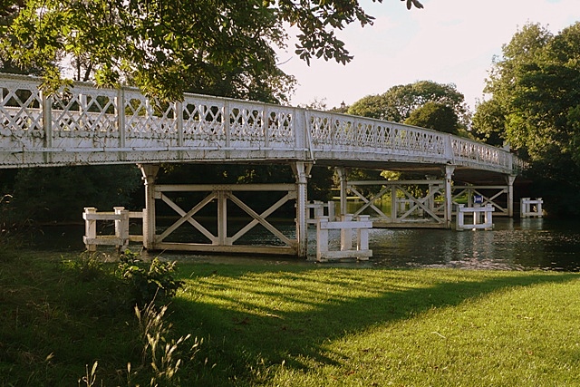
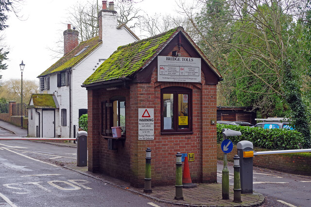
Whitchurch Bridge

Whitchurch Bridge is a toll bridge that carries the B471 road over the River Thames in England. It links the villages of Pangbourne in Berkshire, and Whitchurch...

Mapledurham Lock

Mapledurham Lock is a lock and weir situated on the River Thames in England, about 4 miles upstream of Reading. The lock was first built in 1777 by the...

The Oratory Preparatory School

The Oratory Prep School is a Roman Catholic day and boarding school for some 330 boys and girls aged from two to thirteen, founded in 1925. The school...
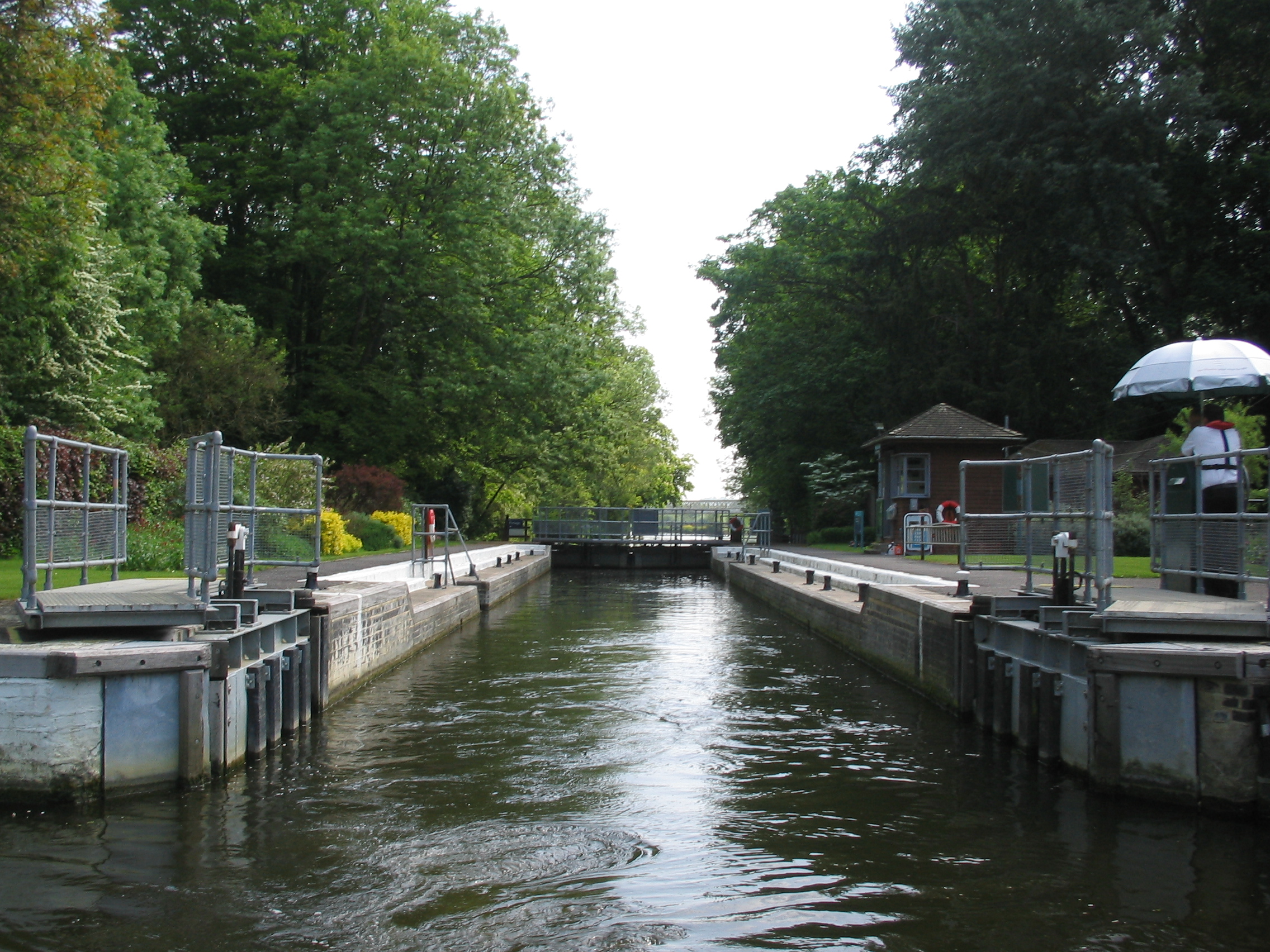
Whitchurch Lock

Whitchurch Lock is a lock and weir on the River Thames in England. It is a pound lock, built by the Thames Navigation Commissioners in 1787. It is on an...

River Pang

The River Pang is a small chalk stream river in the west of the English county of Berkshire, and a tributary of the River Thames. It runs for approximately...

Nearby Amenities

Located within 500m of 51.498437,-1.0629546
Barrier: kissing_gate
Bicycle: no
Foot: yes
Lat/Long: 51.4967956/-1.0665979
Bench
Backrest: yes
Material: wood
Note: In memory of "The Hon Lady Phoebe Rose", "29th Feb 1912 - 25th June 2003"
Seats: 3
Lat/Long: 51.4986445/-1.0568937
Barrier: kissing_gate
Foot: yes
Lat/Long: 51.5016246/-1.0603601
Post Box
Operator: Royal Mail
Ref: RG8 426
Lat/Long: 51.5014685/-1.0627802
Barrier: kissing_gate
Foot: yes
Lat/Long: 51.502122/-1.0656196
Post Box
Collection Times: Mo-Fr 16:15, Sa 08:45
Operator: Royal Mail
Post Box Type: wall
Ref: RG8 306
Royal Cypher: EIIR
Royal Cypher Wikidata: Q33102113
Lat/Long: 51.4958864/-1.0634282
Path Hill
Place: hamlet
Lat/Long: 51.5018416/-1.0628001
Direction: 200
Generator Method: photovoltaic
Generator Output Electricity: yes
Generator Solar Modules: 8
Generator Source: solar
Generator Type: solar_photovoltaic_panel
Location: roof
Power: generator
Lat/Long: 51.5017582/-1.0640216
The data included in this document is from www.openstreetmap.org. The data is made available under ODbL.

Have you been to Rosedown Wood?

Leave your review of Rosedown Wood below (or comments, questions and feedback).