Ashfield

Settlement in Shropshire

England

Ashfield

Baptist Chapel St John the Baptist Chapel, Maesbury.
Baptist Chapel Credit: J Scott

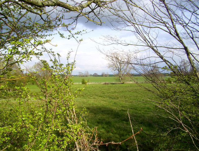
Ashfield is a small village located in the county of Shropshire, England. Situated in the West Midlands region, it lies approximately 8 miles north of the county town of Shrewsbury. The village is nestled amidst picturesque countryside, surrounded by rolling hills and farmland, offering residents and visitors a peaceful and tranquil setting.

With a population of around 400 inhabitants, Ashfield has a close-knit community that prides itself on its friendly and welcoming atmosphere. The village primarily consists of traditional stone-built houses, giving it a charming and timeless aesthetic. The local economy is mainly centered around agriculture, with many residents involved in farming and other related industries.

Ashfield is well-connected to larger towns and cities in the region, with good road links to Shrewsbury and other nearby settlements. The village also benefits from a regular bus service, providing convenient transportation options for those who do not own a car.

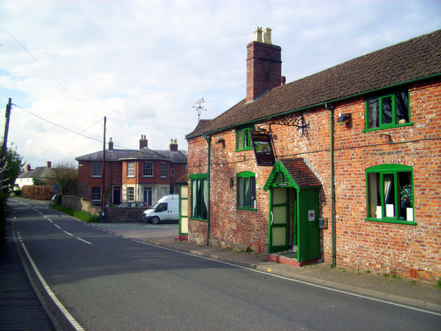
In terms of amenities, Ashfield boasts a village hall that serves as a hub for community activities and events. There is also a local pub, where residents can gather for a drink or enjoy a meal. For recreational activities, the surrounding countryside offers opportunities for walking, hiking, and exploring nature.

Overall, Ashfield offers a idyllic rural lifestyle, characterized by its natural beauty and close community ties. It provides an escape from the hustle and bustle of urban life, while still being within reach of the amenities and services offered by larger towns in the region.

If you have any feedback on the listing, please let us know in the comments section below.

Ashfield Images

Images are sourced within 2km of 52.818102/-3.0252854 or Grid Reference SJ3125. Thanks to Geograph Open Source API. All images are credited.

Baptist Chapel St John the Baptist Chapel, Maesbury.
Baptist Chapel
St John the Baptist Chapel, Maesbury.
Public Footpath Footpath entrance just West of Morton Bridge, leading from the B4396 to Crickheath.
Public Footpath
Footpath entrance just West of Morton Bridge, leading from the B4396 to Crickheath.
Bridge 78, Montgomery Canal This is getting towards the end of the currently navigable section.
I'm told that cruising on this section is restricted to 12 boats a day.
Bridge 78, Montgomery Canal
This is getting towards the end of the currently navigable section. I'm told that cruising on this section is restricted to 12 boats a day.
Landmark at St Winifred's Well This ancient building started out as a chapel built above a holy spring.
Following the suppression of such superstitious stuff at the reformation the chapel became a manorial court house. 
The well became popular as a bathing place where as usual people enjoyed themselves so much that in 1755 it had to be closed down to protect them from fun.
The building was converted into a cottage which is how it stayed until the Landmark Trust acquired it and added it to their list of attractive and unusual holiday properties.
Landmark at St Winifred's Well
This ancient building started out as a chapel built above a holy spring. Following the suppression of such superstitious stuff at the reformation the chapel became a manorial court house. The well became popular as a bathing place where as usual people enjoyed themselves so much that in 1755 it had to be closed down to protect them from fun. The building was converted into a cottage which is how it stayed until the Landmark Trust acquired it and added it to their list of attractive and unusual holiday properties.
Navigation Inn and Canal Office A cluster of former canal buildings is beside the bridge at Maesbury Marsh, with an old warehouse now The Navigation Inn, and the spacious canal company house in the background, which looks unoccupied at the moment.
Navigation Inn and Canal Office
A cluster of former canal buildings is beside the bridge at Maesbury Marsh, with an old warehouse now The Navigation Inn, and the spacious canal company house in the background, which looks unoccupied at the moment.
Evening at Maesbury Marsh The Montgomery Canal on a cold April afternoon with nothing moving on the water.
The landlord at the Navigation Inn by the bridge told me navigation on the Montgomery is rationed to 12 boats a day.
Evening at Maesbury Marsh
The Montgomery Canal on a cold April afternoon with nothing moving on the water. The landlord at the Navigation Inn by the bridge told me navigation on the Montgomery is rationed to 12 boats a day.
Moorings at Maesbury Marsh
Canal Central, Maesbury Marsh A recent canalside facility with shop, tearoom and accommodation upstairs.<span class="nowrap"><a title="http://www.canalcentral.co.uk/" rel="nofollow ugc noopener" href="http://www.canalcentral.co.uk/">Link</a><img style="margin-left:2px;" alt="External link" title="External link - shift click to open in new window" src="https://s1.geograph.org.uk/img/external.png" width="10" height="10"/></span>
Canal Central, Maesbury Marsh
A recent canalside facility with shop, tearoom and accommodation upstairs.LinkExternal link
Gronwen Wharf This lonely spot is the present end of navigation on the section of Montgomery canal that is connected to the main canal system. You can just make out the barrier under the bridge.
There is a small boatyard here on a short side arm, which is also where boats have to turn round.
Beyond the bridge the canal looks in very good order so maybe boats will be allowed through soon.
Gronwen Wharf
This lonely spot is the present end of navigation on the section of Montgomery canal that is connected to the main canal system. You can just make out the barrier under the bridge. There is a small boatyard here on a short side arm, which is also where boats have to turn round. Beyond the bridge the canal looks in very good order so maybe boats will be allowed through soon.
Lower House Farm, Woolston All the photo action in this square is understandably around the canal.
Away from that the area is mostly pasture.
Lower House Farm, Woolston
All the photo action in this square is understandably around the canal. Away from that the area is mostly pasture.
Pasture near Maesbury Marsh All the photo action in this square is understandably around the canal.
Away from that the area is all pasture.
Pasture near Maesbury Marsh
All the photo action in this square is understandably around the canal. Away from that the area is all pasture.
Montgomery Canal near Woolston The canal has been restored at great expense but sees little use due to deliberate restrictions on visitor numbers.
Montgomery Canal near Woolston
The canal has been restored at great expense but sees little use due to deliberate restrictions on visitor numbers.
Up and Under Crofts Mill lift bridge in action.
Up and Under
Crofts Mill lift bridge in action.
Working Narrow Boat Hadar moored at Maesbury Marsh Working Narrow Boat Hadar moored at Maesbury Marsh, Montgomery canal, May 2012.
Working Narrow Boat Hadar moored at Maesbury Marsh
Working Narrow Boat Hadar moored at Maesbury Marsh, Montgomery canal, May 2012.
Dog in Woolston Yawn.....some guy with a camera.....better go and bark at him, I suppose....second thoughts, let's just pose....less effort....
Dog in Woolston
Yawn.....some guy with a camera.....better go and bark at him, I suppose....second thoughts, let's just pose....less effort....
The Baths at St. Winifred's Well St Winifred's Well is a spring which comes up into a stone chamber underneath the well house, originally a chapel.
It then flows into these lower pools which at one time were a popular place for bathing.
The spring is on a tributary of the River Morda in the Severn catchment.
The Baths at St. Winifred's Well
St Winifred's Well is a spring which comes up into a stone chamber underneath the well house, originally a chapel. It then flows into these lower pools which at one time were a popular place for bathing. The spring is on a tributary of the River Morda in the Severn catchment.
Path Crosses Drive A footpath crossing over the track between Bromwich Park and an isolated house on the canal bank.
Apart from the canal, this square is mostly all pasture.
Path Crosses Drive
A footpath crossing over the track between Bromwich Park and an isolated house on the canal bank. Apart from the canal, this square is mostly all pasture.
Montgomery Canal near Morton Farm A reverse of the view in <a href="https://www.geograph.org.uk/photo/585216">SJ3024 : Canal restoration, the final touches</a> taken five years later. The canal is looking in fine condition, but still no boats.
Montgomery Canal near Morton Farm
A reverse of the view in SJ3024 : Canal restoration, the final touches taken five years later. The canal is looking in fine condition, but still no boats.
Show me another place!

Ashfield is located at Grid Ref: SJ3125 (Lat: 52.818102, Lng: -3.0252854)

Unitary Authority: Shropshire

Police Authority: West Mercia

What 3 Words

///existence.lasts.festivity. Near Pant, Shropshire

Nearby Locations

Ashfield Maesbury Marsh

Related Wikis

Maesbury

Maesbury is a small scattered community in Shropshire, England, south of the town of Oswestry, falling within the Oswestry Rural parish. The name is derived...

Ashfield, Shropshire

Ashfield is a hamlet in Shropshire, England. It is situated about a minor crossroads, just to the northwest of Maesbury Marsh, at an elevation of 84 metres...

Woolston, north Shropshire

Woolston, in the north of the county of Shropshire, England, is a hamlet located in the parish of Oswestry Rural, just to the south east of Maesbury Marsh...
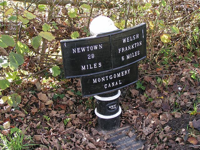
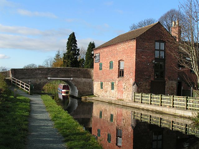
Montgomery Canal

The Montgomery Canal (Welsh: Camlas Trefaldwyn), known colloquially as "The Monty", is a partially restored canal in eastern Powys and northwest Shropshire...

Nearby Amenities

Located within 500m of 52.818102,-3.0252854
Maesbury Marsh
Is In: Shropshire
Place: village
Source: npe
Lat/Long: 52.8197359/-3.0202181
Pub
Navigation Inn
Addr City: Oswestry
Addr Country: GB
Addr Postcode: SY10 8JB
Addr Street: Maesbury Marsh
Fhrs Authority: Shropshire
Fhrs Id: 100872
Fhrs Local Authority Id: 32674
Lat/Long: 52.8186205/-3.019544
Generator Method: photovoltaic
Generator Output Electricity: yes
Generator Source: solar
Generator Type: solar_photovoltaic_panel
Location: roof
Power: generator
Lat/Long: 52.8168035/-3.0184293
Sanitary Dump Station
Maesbury Elsan Point
Access: customers
Centralkey: crt_watermate
Operator: Canal and River Trust
Sanitary Dump Station: yes
Sanitary Dump Station Accepted: black_water
Sanitary Dump Station Basin: yes
Sanitary Dump Station Pump-out: yes
Waste: toilet
Waterway: sanitary_dump_station
Lat/Long: 52.8182766/-3.0201238
Water Point
Maesbury Water Point
Access: customers
Centralkey: crt_watermate
Drinking Water: yes
Man Made: water_tap
Operator: Canal and River Trust
Waterway: water_point
Lat/Long: 52.8182305/-3.0202449
Give Way
Direction: forward
Lat/Long: 52.8196486/-3.0216923
The data included in this document is from www.openstreetmap.org. The data is made available under ODbL.

Have you been to Ashfield?

Leave your review of Ashfield below (or comments, questions and feedback).