Ashfield

Settlement in Argyllshire

Scotland

Ashfield

Loch Sween 30 knots in the Jura Passenger Ferry <span class="nowrap"><a title="http://www.jurapassengerferry.com/," rel="nofollow ugc noopener" href="http://www.jurapassengerferry.com/,">Link</a><img style="margin-left:2px;" alt="External link" title="External link - shift click to open in new window" src="https://s1.geograph.org.uk/img/external.png" width="10" height="10"/></span> on the way to Craighouse from Tayvallich.
Loch Sween Credit: Bob Jones

Ashfield is a small village located in the picturesque region of Argyllshire, Scotland. Situated on the western coast of the country, this charming settlement offers breathtaking views of the surrounding natural beauty. With a population of around 200 residents, Ashfield is known for its tranquility and closely-knit community.

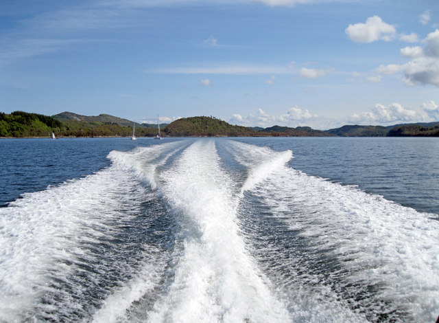
The village is characterized by its traditional Scottish architecture, with stone cottages and houses dotting the landscape. The nearby hills and lochs provide ample opportunities for outdoor enthusiasts, offering activities such as hiking, fishing, and bird-watching. The stunning Loch Fyne, one of Scotland's largest sea lochs, is just a short distance away, attracting visitors from far and wide.

Ashfield is also home to a few local amenities, including a village shop and a quaint pub where locals and visitors can gather and socialize. The village celebrates its rich heritage through various community events and festivals, showcasing traditional music, dance, and traditional Scottish cuisine.

In terms of accessibility, Ashfield is well-connected to the larger towns in Argyllshire, with regular bus services and good road connections. The village serves as a peaceful retreat for those seeking solace in nature's embrace, while still being within reach of urban conveniences.

Overall, Ashfield, Argyllshire offers a charming and idyllic escape for nature lovers and those seeking a close-knit community atmosphere. With its stunning surroundings and warm hospitality, it is a hidden gem that captures the essence of rural Scotland.

If you have any feedback on the listing, please let us know in the comments section below.

Ashfield Images

Images are sourced within 2km of 56.005453/-5.594458 or Grid Reference NR7685. Thanks to Geograph Open Source API. All images are credited.

Loch Sween 30 knots in the Jura Passenger Ferry <span class="nowrap"><a title="http://www.jurapassengerferry.com/," rel="nofollow ugc noopener" href="http://www.jurapassengerferry.com/,">Link</a><img style="margin-left:2px;" alt="External link" title="External link - shift click to open in new window" src="https://s1.geograph.org.uk/img/external.png" width="10" height="10"/></span> on the way to Craighouse from Tayvallich.
Loch Sween
30 knots in the Jura Passenger Ferry LinkExternal link on the way to Craighouse from Tayvallich.
The Lussa at Kilmichael of Inverlussa With an early clump of Snowdrops by the bank.
The Lussa at Kilmichael of Inverlussa
With an early clump of Snowdrops by the bank.
Cattle grid on track This track leads from Kilmichael of Inverlussa towards the forestry.
Cattle grid on track
This track leads from Kilmichael of Inverlussa towards the forestry.
Ruined building above Kilmichael of Inverlussa
Hydro scheme power house Taking water from the dam on The Lussa somewhat further up the hill.
Hydro scheme power house
Taking water from the dam on The Lussa somewhat further up the hill.
A view to Tayvallich and the Isle of Scarba
Forestry road and quarry
Kilmichael of Inverlussa Looking across Loch Sween into Knapdale Forest.
Kilmichael of Inverlussa
Looking across Loch Sween into Knapdale Forest.
Forestry road Heading towards Ashfield.
Forestry road
Heading towards Ashfield.
Farm at Ashfield Looking beyond the farm buildings is Loch Sween, with Tayvallich nestling at the head of the bay opposite.
Farm at Ashfield
Looking beyond the farm buildings is Loch Sween, with Tayvallich nestling at the head of the bay opposite.
Kilmichael of Inverlussa As seen when descending the track out of the forest.
Kilmichael of Inverlussa
As seen when descending the track out of the forest.
Kilmichael of Inverlussa Parish Church (disused) Also known as North Knapdale Parish Church, the building is now disused.
It is B-listed and was built in 1820.
More information at <span class="nowrap"><a title="https://canmore.org.uk/site/39068" rel="nofollow ugc noopener" href="https://canmore.org.uk/site/39068">Link</a><img style="margin-left:2px;" alt="External link" title="External link - shift click to open in new window" src="https://s1.geograph.org.uk/img/external.png" width="10" height="10"/></span>
Kilmichael of Inverlussa Parish Church (disused)
Also known as North Knapdale Parish Church, the building is now disused. It is B-listed and was built in 1820. More information at LinkExternal link
Wooded shore of Loch Sween
Woodland on Sròn Bheith
Wooded shore of Loch Sween
Grassy track near Ashfield
Stone wall separating fields near Ashfield
Forestry road near Daltote
Show me another place!

Ashfield is located at Grid Ref: NR7685 (Lat: 56.005453, Lng: -5.594458)

Unitary Authority: Argyll and Bute

Police Authority: Argyll and West Dunbartonshire

What 3 Words

///famed.tangling.typist. Near Ardrishaig, Argyll & Bute

Nearby Locations

Coille nam Muc Ashfield

Related Wikis

Eilean Loain

Eilean Loain is a small island in Loch Sween and one of the Inner Hebrides of Scotland. It is about 2 kilometres (1 mi) west of the settlement of Kilmichael...

Ashfield, Argyll and Bute

Ashfield is a village in the civil parish of North Knapdale, in Knapdale, in the council area of Argyll and Bute, Scotland. It has a sheep farm and cottage...

Taynish National Nature Reserve

Taynish National Nature Reserve (Scottish Gaelic: Tèarmann Nàdair Nàiseanta Taighnis) is situated southwest of the village of Tayvallich in the council...

Tayvallich

Tayvallich (pronounced TAY-vee-AL-ich; Scottish Gaelic: Taigh a' Bhealaich [t̪ʰɤj ə ˈvjal̪ˠɪç]) is a small village in the Knapdale area of Argyll and Bute...

Achnamara

Achnamara (Scottish Gaelic: Achadh na Mara) is a village in the Scottish council area of Argyll and Bute. Its location is approximately 56°1' N 5°34' W...

Knapdale

Knapdale (Scottish Gaelic: Cnapadal, IPA: [ˈkɾaʰpət̪əl̪ˠ]) forms a rural district of Argyll and Bute in the Scottish Highlands, adjoining Kintyre to the...
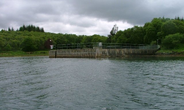
Loch Sween

Loch Sween (Scottish Gaelic: Loch Suain or Loch Suibhne) is a sea loch located near Lochgilphead, Argyll and Bute, Scotland. Castle Sween is located on...
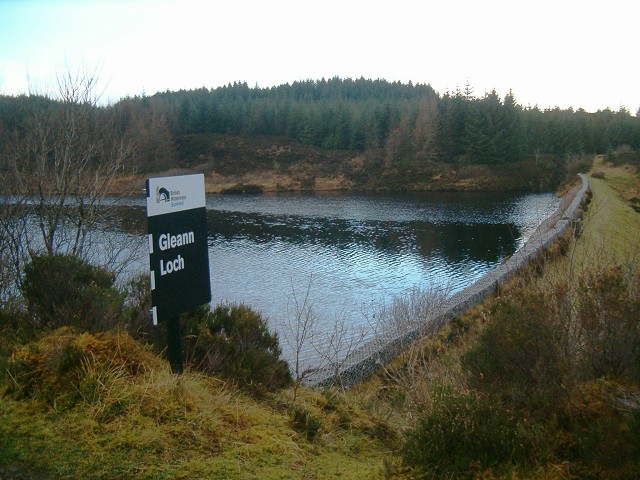
Gleann Loch

The loch runs south west to north east and is an impounding reservoir located to the west of Lochgilphead, Scotland. It is one of a number of lochs supplying...

Nearby Amenities

Located within 500m of 56.005453,-5.594458
Source: PGS
Lat/Long: 56.0094472/-5.5961127
Source: PGS
Lat/Long: 56.0088725/-5.5967252
Source: PGS
Lat/Long: 56.0083493/-5.597508
Source: PGS
Lat/Long: 56.0067352/-5.5995939
Source: PGS
Lat/Long: 56.0065741/-5.5997866
Source: PGS
Lat/Long: 56.0052536/-5.6011758
Source: PGS
Lat/Long: 56.0045538/-5.6018428
Source: PGS
Lat/Long: 56.0097991/-5.5955079
Source: PGS
Lat/Long: 56.0096223/-5.5958116
Source: PGS
Lat/Long: 56.0075362/-5.5986348
Source: PGS
Lat/Long: 56.0069964/-5.5992822
Source: PGS
Lat/Long: 56.0068719/-5.5994295
Source: PGS
Lat/Long: 56.0063538/-5.5999857
Source: PGS
Lat/Long: 56.0062332/-5.6000792
Source: PGS
Lat/Long: 56.0055953/-5.600948
Source: PGS
Lat/Long: 56.0048991/-5.6015127
Source: PGS
Lat/Long: 56.0041964/-5.6021821
Power: pole
Lat/Long: 56.0023976/-5.5995694
Power: pole
Lat/Long: 56.0038672/-5.5972965
Power: pole
Lat/Long: 56.0063456/-5.5947935
Power: pole
Lat/Long: 56.0052125/-5.5961814
Power: pole
Lat/Long: 56.0039045/-5.5992782
Power: pole
Lat/Long: 56.003659/-5.5982549
Power: pole
Lat/Long: 56.007078/-5.5919027
Power: pole
Lat/Long: 56.0067874/-5.5930498
Power: pole
Lat/Long: 56.0072274/-5.5935583
Power: pole
Lat/Long: 56.0074046/-5.5937573
Power: pole
Lat/Long: 56.0029804/-5.598668
Power: pole
Lat/Long: 56.0035511/-5.5977854
Power: pole
Lat/Long: 56.0039017/-5.5992712
Power: pole
Lat/Long: 56.0040797/-5.6000097
Power: pole
Lat/Long: 56.0047354/-5.5992648
Power: pole
Lat/Long: 56.0052871/-5.598618
Power: pole
Lat/Long: 56.0059236/-5.5978883
Power: pole
Lat/Long: 56.0064283/-5.5979036
Power: pole
Lat/Long: 56.0068968/-5.5978909
Power: pole
Lat/Long: 56.0076685/-5.5979316
Power: pole
Lat/Long: 56.008349/-5.5970148
Power: pole
Lat/Long: 56.0087491/-5.5964826
Power: pole
Lat/Long: 56.0091905/-5.5959058
Power: pole
Lat/Long: 56.0095941/-5.5953557
Power: pole
Lat/Long: 56.0098432/-5.5942645
Power: pole
Lat/Long: 56.0045216/-5.596754
Power: pole
Lat/Long: 56.0057565/-5.595515
Power: pole
Lat/Long: 56.0065638/-5.5939323
Power: pole
Lat/Long: 56.0073705/-5.590755
Power: pole
Lat/Long: 56.0076616/-5.5896128
Power: pole
Lat/Long: 56.0079923/-5.5883148
The data included in this document is from www.openstreetmap.org. The data is made available under ODbL.

Have you been to Ashfield?

Leave your review of Ashfield below (or comments, questions and feedback).