Ashfield

Settlement in Perthshire

Scotland

Ashfield

A9, northbound The A9 is a strategic link between the Highlands of Scotland and the Central Belt. It runs 279 miles from junction 5 of the M9 at Polmont to Scrabster. Originally it ran from Edinburgh.
<span class="nowrap"><a title="https://www.sabre-roads.org.uk/wiki/index.php?title=A9" rel="nofollow ugc noopener" href="https://www.sabre-roads.org.uk/wiki/index.php?title=A9">Link</a><img style="margin-left:2px;" alt="External link" title="External link - shift click to open in new window" src="https://s1.geograph.org.uk/img/external.png" width="10" height="10"/></span>
A9, northbound Credit: N Chadwick

Ashfield is a charming village located in the heart of Perthshire, Scotland. Situated approximately 8 miles northwest of the city of Perth, Ashfield offers a peaceful and picturesque setting for its residents and visitors alike. Nestled amidst rolling green hills and surrounded by lush countryside, the village is renowned for its natural beauty and tranquil atmosphere.

The village of Ashfield is relatively small, with a population of around 500 people. It features a mix of traditional stone houses and modern buildings, giving it a charming and timeless appeal. The community is close-knit, with a strong sense of camaraderie among its residents.

A notable feature of Ashfield is its close proximity to Loch Leven, a stunning freshwater loch located just a short distance to the north. The loch offers a range of recreational activities, including fishing, boating, and birdwatching. It is particularly renowned for its diverse bird population, making it a popular spot for bird enthusiasts.

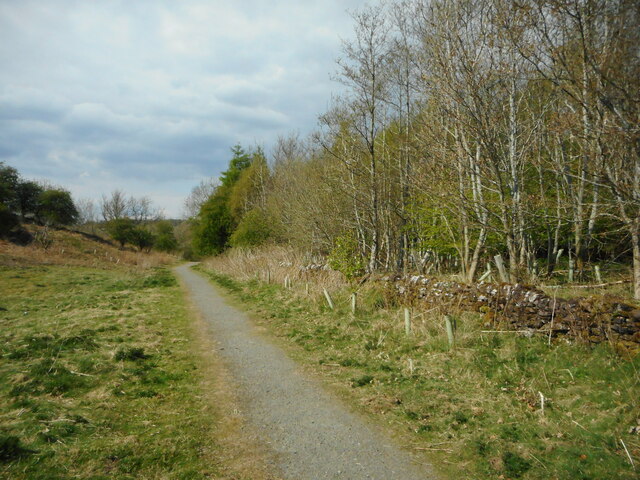
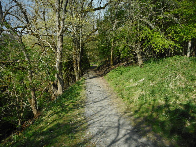
For those seeking outdoor adventures, Ashfield is surrounded by numerous walking trails and cycling routes. The surrounding countryside is dotted with picturesque villages and historic landmarks, providing ample opportunities for exploration and sightseeing.

Ashfield benefits from its proximity to Perth, which offers a wider range of amenities, including shops, supermarkets, schools, and healthcare facilities. The village also has good transport links, with regular bus services connecting it to Perth and other nearby towns.

In summary, Ashfield is a peaceful and idyllic village in Perthshire, offering a tranquil lifestyle and stunning natural beauty. With its close proximity to Loch Leven and the surrounding countryside, it is a haven for outdoor enthusiasts and nature lovers.

If you have any feedback on the listing, please let us know in the comments section below.

Ashfield Images

Images are sourced within 2km of 56.212602/-3.9588387 or Grid Reference NN7803. Thanks to Geograph Open Source API. All images are credited.

A9, northbound The A9 is a strategic link between the Highlands of Scotland and the Central Belt. It runs 279 miles from junction 5 of the M9 at Polmont to Scrabster. Originally it ran from Edinburgh.
<span class="nowrap"><a title="https://www.sabre-roads.org.uk/wiki/index.php?title=A9" rel="nofollow ugc noopener" href="https://www.sabre-roads.org.uk/wiki/index.php?title=A9">Link</a><img style="margin-left:2px;" alt="External link" title="External link - shift click to open in new window" src="https://s1.geograph.org.uk/img/external.png" width="10" height="10"/></span>
A9, northbound
The A9 is a strategic link between the Highlands of Scotland and the Central Belt. It runs 279 miles from junction 5 of the M9 at Polmont to Scrabster. Originally it ran from Edinburgh. LinkExternal link
Allan Water Near Kinbuck
Allan Water
Near Kinbuck
A9, northbound The A9 is a strategic link between the Highlands of Scotland and the Central Belt. It runs 279 miles from junction 5 of the M9 at Polmont to Scrabster. Originally it ran from Edinburgh.
<span class="nowrap"><a title="https://www.sabre-roads.org.uk/wiki/index.php?title=A9" rel="nofollow ugc noopener" href="https://www.sabre-roads.org.uk/wiki/index.php?title=A9">Link</a><img style="margin-left:2px;" alt="External link" title="External link - shift click to open in new window" src="https://s1.geograph.org.uk/img/external.png" width="10" height="10"/></span>
A9, northbound
The A9 is a strategic link between the Highlands of Scotland and the Central Belt. It runs 279 miles from junction 5 of the M9 at Polmont to Scrabster. Originally it ran from Edinburgh. LinkExternal link
A9 crossing Allan Water The A9 is a strategic link between the Highlands of Scotland and the Central Belt. It runs 279 miles from junction 5 of the M9 at Polmont to Scrabster. Originally it ran from Edinburgh.
<span class="nowrap"><a title="https://www.sabre-roads.org.uk/wiki/index.php?title=A9" rel="nofollow ugc noopener" href="https://www.sabre-roads.org.uk/wiki/index.php?title=A9">Link</a><img style="margin-left:2px;" alt="External link" title="External link - shift click to open in new window" src="https://s1.geograph.org.uk/img/external.png" width="10" height="10"/></span>
A9 crossing Allan Water
The A9 is a strategic link between the Highlands of Scotland and the Central Belt. It runs 279 miles from junction 5 of the M9 at Polmont to Scrabster. Originally it ran from Edinburgh. LinkExternal link
B8033 bridge, A9 The A9 is a strategic link between the Highlands of Scotland and the Central Belt. It runs 279 miles from junction 5 of the M9 at Polmont to Scrabster. Originally it ran from Edinburgh.
<span class="nowrap"><a title="https://www.sabre-roads.org.uk/wiki/index.php?title=A9" rel="nofollow ugc noopener" href="https://www.sabre-roads.org.uk/wiki/index.php?title=A9">Link</a><img style="margin-left:2px;" alt="External link" title="External link - shift click to open in new window" src="https://s1.geograph.org.uk/img/external.png" width="10" height="10"/></span>
B8033 bridge, A9
The A9 is a strategic link between the Highlands of Scotland and the Central Belt. It runs 279 miles from junction 5 of the M9 at Polmont to Scrabster. Originally it ran from Edinburgh. LinkExternal link
A9, northbound The A9 is a strategic link between the Highlands of Scotland and the Central Belt. It runs 279 miles from junction 5 of the M9 at Polmont to Scrabster. Originally it ran from Edinburgh.
<span class="nowrap"><a title="https://www.sabre-roads.org.uk/wiki/index.php?title=A9" rel="nofollow ugc noopener" href="https://www.sabre-roads.org.uk/wiki/index.php?title=A9">Link</a><img style="margin-left:2px;" alt="External link" title="External link - shift click to open in new window" src="https://s1.geograph.org.uk/img/external.png" width="10" height="10"/></span>
A9, northbound
The A9 is a strategic link between the Highlands of Scotland and the Central Belt. It runs 279 miles from junction 5 of the M9 at Polmont to Scrabster. Originally it ran from Edinburgh. LinkExternal link
A9, Strathallan The A9 is a strategic link between the Highlands of Scotland and the Central Belt. It runs 279 miles from junction 5 of the M9 at Polmont to Scrabster. Originally it ran from Edinburgh.
<span class="nowrap"><a title="https://www.sabre-roads.org.uk/wiki/index.php?title=A9" rel="nofollow ugc noopener" href="https://www.sabre-roads.org.uk/wiki/index.php?title=A9">Link</a><img style="margin-left:2px;" alt="External link" title="External link - shift click to open in new window" src="https://s1.geograph.org.uk/img/external.png" width="10" height="10"/></span>
A9, Strathallan
The A9 is a strategic link between the Highlands of Scotland and the Central Belt. It runs 279 miles from junction 5 of the M9 at Polmont to Scrabster. Originally it ran from Edinburgh. LinkExternal link
Footpath, Laigh Hills Park
Woodland path In Laigh Hills Park.
Woodland path
In Laigh Hills Park.
Allan Water north of Dunblane
A boggy corner near the Allan Water This image was taken from the railway line.
The bank beyond the fence corner suggests that this may have been a meander of the river before the railway line was built, cutting it off.
A boggy corner near the Allan Water
This image was taken from the railway line. The bank beyond the fence corner suggests that this may have been a meander of the river before the railway line was built, cutting it off.
Track to High Craigton
The dual carriageway looking northeast
Entrance to Glassingall Gateside From A9
Entrance to Glassingall Gateside
From A9
Lay by on A9 at Glassingall
Field, Lower Whiteston A frosty morning on the A9.
Field, Lower Whiteston
A frosty morning on the A9.
Line works on new pylon by A9
Show me another place!

Ashfield is located at Grid Ref: NN7803 (Lat: 56.212602, Lng: -3.9588387)

Unitary Authority: Stirling

Police Authority: Forth Valley

What 3 Words

///bleat.certified.ratty. Near Dunblane, Stirling

Nearby Locations

Ashfield

Related Wikis

Ashfield, Stirling

Ashfield (Scottish Gaelic: Achadh an Uinnsinn) is a small village in the Registration county of Perth and the local government district of Stirling, Scotland...

Kinbuck railway station

Kinbuck railway station served the hamlet of Kinbuck, Stirlingshire, Scotland from 1848 to 1956 on the Scottish Central Railway. == History == The station...

Kinbuck

Kinbuck is a hamlet in Stirlingshire, Scotland. It lies by the Allan Water and the Stirling-Perth Railway line. It is four miles north of Dunblane....
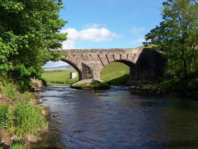
Kinbuck Bridge

Kinbuck Bridge or Bridge of Kinbuck is a category B listed structure in the hamlet of Kinbuck in Stirling. == History == The present structure is dated...

Cromlix House

Cromlix is a luxury hotel near Kinbuck, Stirlingshire, Scotland. It was constructed as a Victorian mansion, then first operated as a hotel from the early...
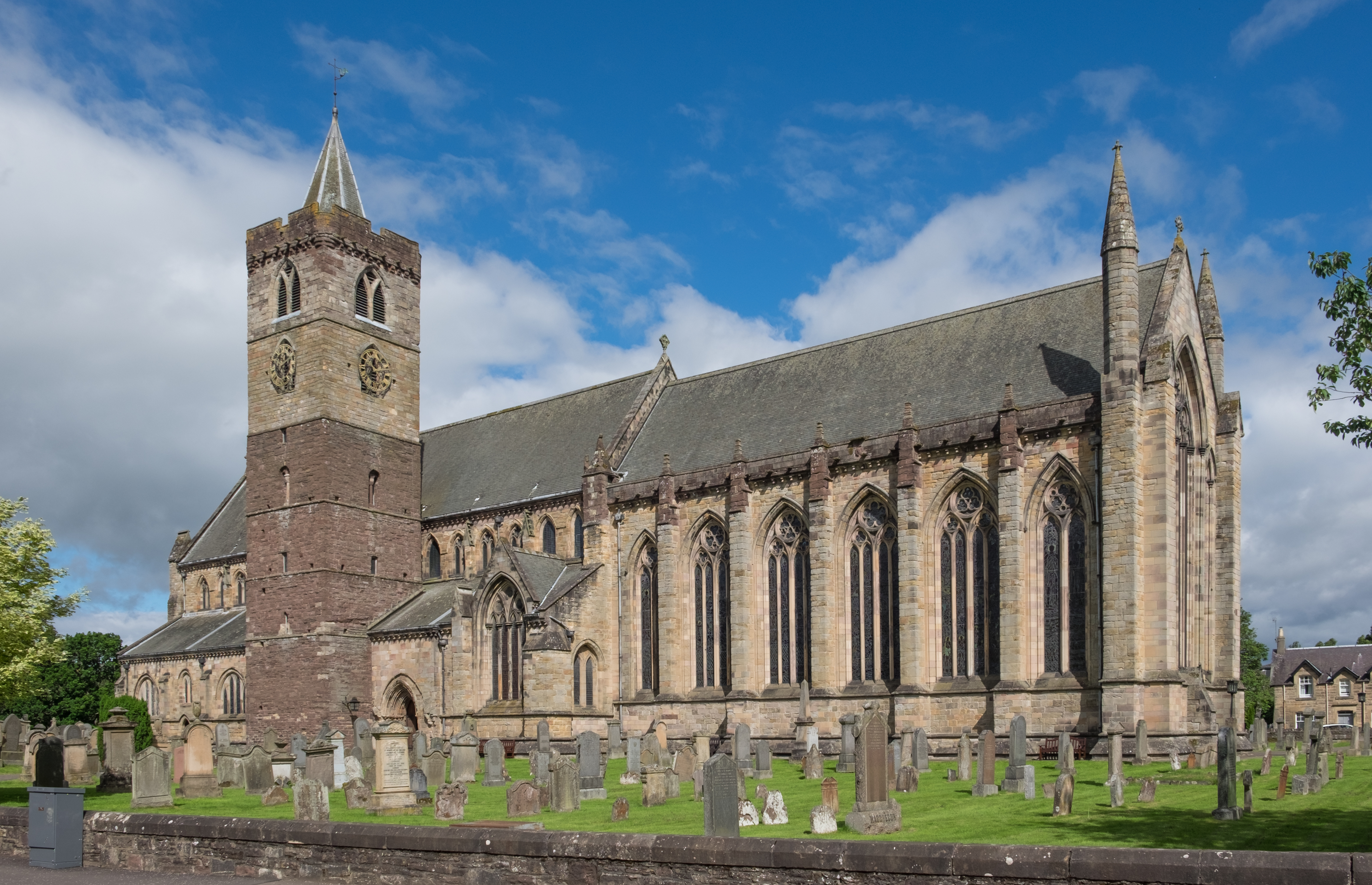
Dunblane Cathedral

Dunblane Cathedral is the larger of the two Church of Scotland parish churches serving Dunblane, near the city of Stirling, in central Scotland. The lower...

Diocese of Dunblane

The Diocese of Dunblane or Diocese of Strathearn was one of the thirteen historical dioceses of Scotland, before the abolition of episcopacy in the Scottish...

Dunblane Museum

Dunblane Museum is a historic building in the Scottish town of Dunblane, Stirling. Located in The Cross, immediately to the south of Dunblane Cathedral...

Nearby Amenities

Located within 500m of 56.212602,-3.9588387
Ashfield
Is In: Stirlingshire, Scotland
Name Gd: Achadh an Uinnsinn
Place: village
Population: 139
Wikidata: Q4804953
Wikipedia: en:Ashfield, Stirling
Lat/Long: 56.2113729/-3.9614269
Ashfield Weir
Rapids: 4
Waterway: weir
Lat/Long: 56.2119958/-3.9635705
Whitewater: put_in
Lat/Long: 56.2130573/-3.9582358
Material: wood
Power: pole
Lat/Long: 56.2105347/-3.9658806
Material: wood
Power: pole
Lat/Long: 56.2113978/-3.9656588
Material: wood
Power: pole
Lat/Long: 56.2124227/-3.9654246
Material: wood
Power: pole
Lat/Long: 56.2133358/-3.9652217
Material: wood
Power: pole
Lat/Long: 56.2140768/-3.9650627
Material: wood
Power: pole
Lat/Long: 56.2149992/-3.9644017
Material: wood
Power: pole
Lat/Long: 56.2157994/-3.9638432
Material: wood
Power: pole
Lat/Long: 56.2147061/-3.9646255
Material: wood
Power: pole
Lat/Long: 56.2127018/-3.9666482
Material: wood
Power: pole
Lat/Long: 56.2133544/-3.9659789
Material: wood
Power: pole
Lat/Long: 56.2138127/-3.9655187
Material: wood
Power: pole
Lat/Long: 56.2141989/-3.9651213
Material: wood
Power: pole
Lat/Long: 56.2152911/-3.9640252
Material: wood
Power: pole
Lat/Long: 56.2158878/-3.9634186
Material: wood
Power: pole
Lat/Long: 56.2164985/-3.9628141
Post Box
Collection Plate: CP7
Collection Plate Date: 2022-02-28
Collection Times: Mo-Fr 16:00; Sa 10:30
Operator: Royal Mail
Post Box Mounting: pier
Post Box Type: lamp
Ref: FK15 101
Royal Cypher: scottish_crown
Source: survey
Lat/Long: 56.2120647/-3.9602889
Bench
Backrest: yes
Lat/Long: 56.2119393/-3.9597349
Bench
Backrest: yes
Lat/Long: 56.2106397/-3.9610968
The data included in this document is from www.openstreetmap.org. The data is made available under ODbL.

Have you been to Ashfield?

Leave your review of Ashfield below (or comments, questions and feedback).