Abbot's Spinney

Wood, Forest in Leicestershire Charnwood

England

Abbot's Spinney

Commercial premises, Waterside Road, Hamilton Business Park
Commercial premises, Waterside Road, Hamilton Business Park Credit: Jonathan Thacker

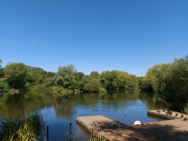
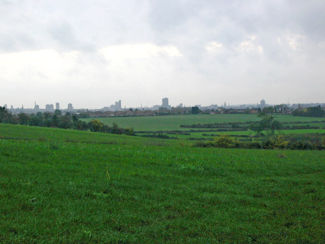
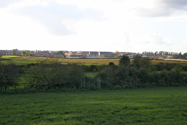
Abbot's Spinney is a charming woodland located in Leicestershire, England. Situated within the heart of the county, it covers an area of approximately 50 acres, making it a perfect retreat for nature enthusiasts and outdoor adventurers alike.

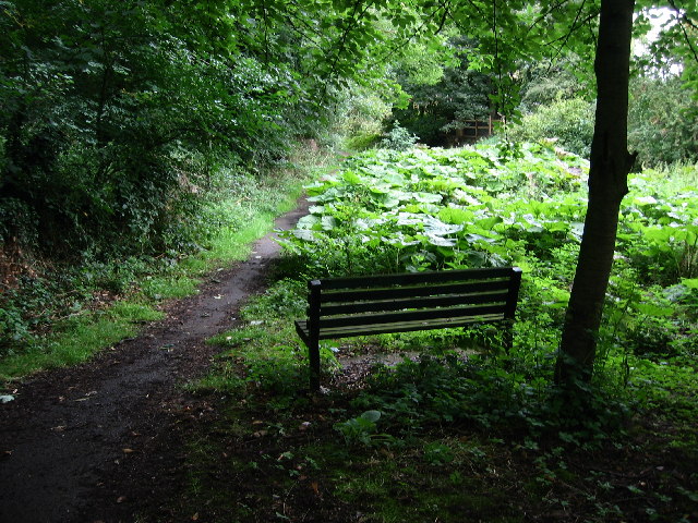
The woodland is named after the nearby village of Ab Kettleby, and "spinney" refers to a small wood or thicket. The site is rich in biodiversity, boasting an array of native tree species such as oak, birch, and beech, which create a diverse and vibrant ecosystem. The forest floor is adorned with a carpet of wildflowers, including bluebells, primroses, and wood anemones, adding a burst of color to the landscape during spring.

Abbot's Spinney is home to a variety of wildlife, providing a sanctuary for numerous species. Birdwatchers can spot a range of avian friends, including woodpeckers, owls, and various songbirds. If lucky, visitors may even catch a glimpse of elusive mammals like foxes, badgers, and deer, which inhabit the woodland.

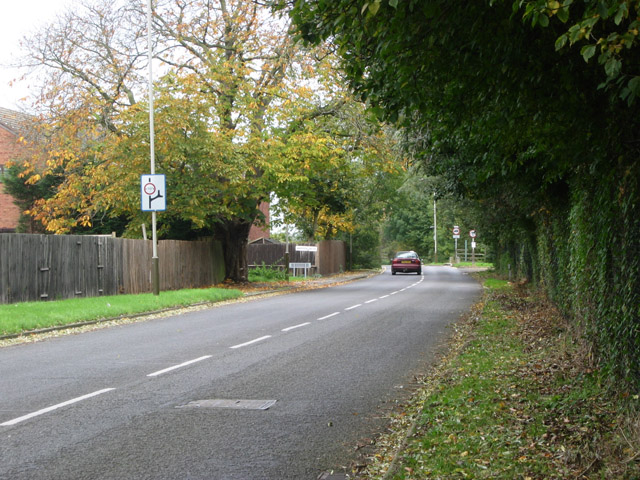
The forest offers several walking trails, allowing visitors to explore its beauty at their own pace. The well-maintained paths wind through the trees, offering glimpses of picturesque views and peaceful spots to sit and soak up the tranquility. Additionally, there are picnic areas where visitors can enjoy a packed lunch amidst the natural surroundings.

Abbot's Spinney is a haven for those seeking solace in nature, offering a serene and enchanting woodland experience in the heart of Leicestershire.

If you have any feedback on the listing, please let us know in the comments section below.

Abbot's Spinney Images

Images are sourced within 2km of 52.673008/-1.0636462 or Grid Reference SK6308. Thanks to Geograph Open Source API. All images are credited.

Commercial premises, Waterside Road, Hamilton Business Park
Development land south of Barkby Thorpe Work is shortly to start here as part of the construction of Thorpebury, a settlement 0f 4,500 houses.
Development land south of Barkby Thorpe
Work is shortly to start here as part of the construction of Thorpebury, a settlement 0f 4,500 houses.
The White House Farm. Barkby Dates from the early nineteenth century <span class="nowrap"><a title="https://historicengland.org.uk/listing/the-list/list-entry/1307496?section=official-list-entry" rel="nofollow ugc noopener" href="https://historicengland.org.uk/listing/the-list/list-entry/1307496?section=official-list-entry">Link</a><img style="margin-left:2px;" alt="External link" title="External link - shift click to open in new window" src="https://s1.geograph.org.uk/img/external.png" width="10" height="10"/></span>
The White House Farm. Barkby
Dates from the early nineteenth century LinkExternal link
The Midland Main Line entering Leicester through Thurmaston
Hamilton Park Lake Part of the 39 acre park on the north-east edge of Leicester
Hamilton Park Lake
Part of the 39 acre park on the north-east edge of Leicester
Entrance to Hamilton Park  beneath Sandshill Avenue, Leicester
Entrance to Hamilton Park beneath Sandshill Avenue, Leicester
Barkby cemetery
Barkby cemetery
Barkby, near Leicester St Mary's Church and the Malt Shovel on Main Street, Barkby
Barkby, near Leicester
St Mary's Church and the Malt Shovel on Main Street, Barkby
Footpath at Barkby, near Leicester A leafy walk alongside the Barkby Brook which runs behind the houses on Main Street
Footpath at Barkby, near Leicester
A leafy walk alongside the Barkby Brook which runs behind the houses on Main Street
The Humberstone A glacial erratic of red granite, the nearest source being the Mountsorrel area. According to the Modern Antiquarian website its name derives from "Hunbeort's Stan".
The Humberstone
A glacial erratic of red granite, the nearest source being the Mountsorrel area. According to the Modern Antiquarian website its name derives from "Hunbeort's Stan".
Silverdale Drive, Thurmaston, Leicester This area is called the Dales because all the roads names end in "dale', Parkdale, Dovedale, Ivydale for example.
Silverdale Drive, Thurmaston, Leicester
This area is called the Dales because all the roads names end in "dale', Parkdale, Dovedale, Ivydale for example.
Colby Drive, Thurmaston, Leicester This estate road, originally built in the 1940's, was obviously meant to go further, but it ends abruptly with an officious looking metal fence. Are they trying to keep the townies in or the country bumpkins out?
Colby Drive, Thurmaston, Leicester
This estate road, originally built in the 1940's, was obviously meant to go further, but it ends abruptly with an officious looking metal fence. Are they trying to keep the townies in or the country bumpkins out?
Looking towards Thurmaston, Leicester Looking from Barkby Thorpe Lane towards Colby Drive: <a title="https://www.geograph.org.uk/photo/72993" href="https://www.geograph.org.uk/photo/72993">Link</a> is at the far right of the housing.
Looking towards Thurmaston, Leicester
Looking from Barkby Thorpe Lane towards Colby Drive: Link is at the far right of the housing.
View of Leicester city skyline Looking SSE from the view point. The edge of the featured grid square runs through the hedges in the centre about three fields down. Thurmaston is on the far right and Hamilton and Humberstone straight ahead
View of Leicester city skyline
Looking SSE from the view point. The edge of the featured grid square runs through the hedges in the centre about three fields down. Thurmaston is on the far right and Hamilton and Humberstone straight ahead
Barkby Thorpe Road, near Thurmaston, Leicester Looking NE up Barkby Thorpe Road to the edge of the City. Barkby Thorpe is a small village about a mile up the road, with the larger Barkby just a little further on <a href="https://www.geograph.org.uk/gridref/SK6309">SK6309</a>
Barkby Thorpe Road, near Thurmaston, Leicester
Looking NE up Barkby Thorpe Road to the edge of the City. Barkby Thorpe is a small village about a mile up the road, with the larger Barkby just a little further on SK6309
Warren Avenue, near Thurmaston, Leicester Modern housing estate on the edge of the city.
Warren Avenue, near Thurmaston, Leicester
Modern housing estate on the edge of the city.
Hamilton, near Leicester A large residential development, Hamilton is located in the north-east of Leicester and is one of two major ‘Urban Extensions’ in the City. The other is Ashton Green, not yet built but planned for the fields here:<a href="https://www.geograph.org.uk/photo/70978">SK5709 : Farmland near Birstall, Leicester</a>
Hamilton, near Leicester
A large residential development, Hamilton is located in the north-east of Leicester and is one of two major ‘Urban Extensions’ in the City. The other is Ashton Green, not yet built but planned for the fields here:SK5709 : Farmland near Birstall, Leicester
Hamilton, near Leicester Looking SW across the square towards the new urban development of Hamilton. This is farmland at risk of disappearing
Hamilton, near Leicester
Looking SW across the square towards the new urban development of Hamilton. This is farmland at risk of disappearing
Show me another place!

Abbot's Spinney is located at Grid Ref: SK6308 (Lat: 52.673008, Lng: -1.0636462)

Administrative County: Leicestershire

District: Charnwood

Police Authority: Leicestershire

What 3 Words

///asleep.skirt.living. Near Syston, Leicestershire

Related Wikis

Barkby Thorpe

Barkby Thorpe is a hamlet and civil parish in the Charnwood district of Leicestershire, England. The hamlet has a population of around 50, and is close...

Barkby

Barkby is a village and civil parish in the Charnwood district of Leicestershire, England. It is situated north-east of Leicester, and only a short way...

St Mary's Church, Barkby

St Mary's Church, Barkby is the Church of England Parish Church for Barkby, Leicestershire, England. The church mostly dates from the 13th century. It...

Humberstone and Hamilton

Humberstone and Hamilton is an electoral ward and administrative division of the City of Leicester, England. It comprises the north-eastern Leicester suburbs...

Gipsy Lane Pit

Gipsy Lane Pit is a 0.5 hectares (1.2 acres) geological Site of Special Scientific Interest in Leicester. It is a Geological Conservation Review site.This...

Highfield Rangers F.C.

Highfield Rangers F.C. is an English football club based in the Rushey Mead area of Leicester. They are currently members of the Leicestershire Senior...

Thurmaston

Thurmaston is a village and civil parish in Leicestershire, England, located within the Borough of Charnwood. At the 2011 census, it had a population of...

Orchard Mead Academy

Orchard Mead Academy, previously known as Hamilton Community College, is a co-educational secondary school located in Leicester, England, taking children...

Nearby Amenities

Located within 500m of 52.673008,-1.0636462
Hill Top Farm
Place: farm
Source: Bing
Lat/Long: 52.6756657/-1.0597811
Cafe
Roots Farm Shop and Coffee Shop
Lat/Long: 52.6764479/-1.0605209
Manor Farm
Place: farm
Source: Bing
Lat/Long: 52.6763481/-1.0631263
Thorpe Farm
Place: farm
Source: Bing
Lat/Long: 52.6763975/-1.0600427
Barkby Thorpe
Is In County: Leicestershire
Is In District: Charnwood
Lat/Long: 52.6761583/-1.0609929
Toilets
Access: customers
Toilets Disposal: flush
Unisex: yes
Lat/Long: 52.6764452/-1.0602782
The data included in this document is from www.openstreetmap.org. The data is made available under ODbL.

Have you been to Abbot's Spinney?

Leave your review of Abbot's Spinney below (or comments, questions and feedback).