Cremorne Wood

Wood, Forest in Nottinghamshire Newark and Sherwood

England

Cremorne Wood

Abandoned road near Culloden, Sherwood Forest Park
Abandoned road near Culloden, Sherwood Forest Park Credit: Jonathan Thacker

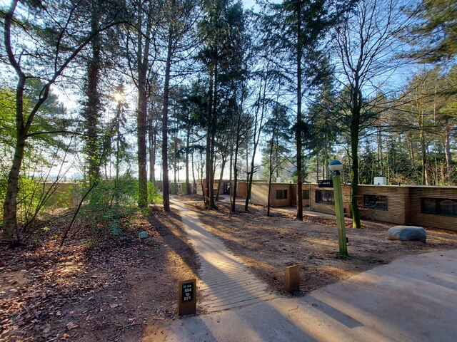
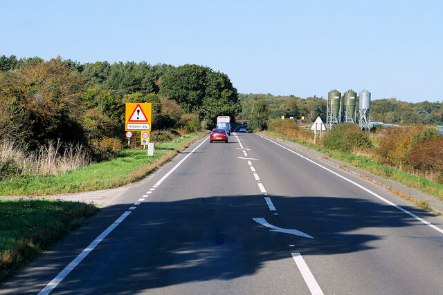
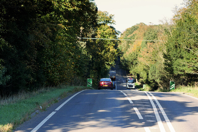
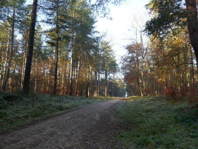
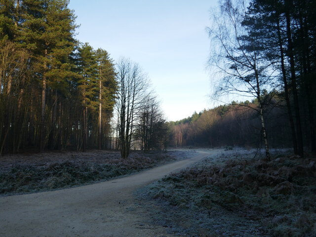
Cremorne Wood is a picturesque woodland located in Nottinghamshire, England. Covering an area of approximately 100 acres, the wood is renowned for its natural beauty and tranquil atmosphere. Situated on the outskirts of the village of Cremorne, it is a popular destination for nature lovers and outdoor enthusiasts.

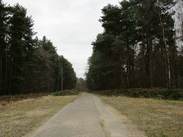
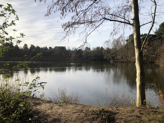
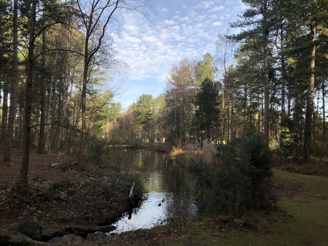
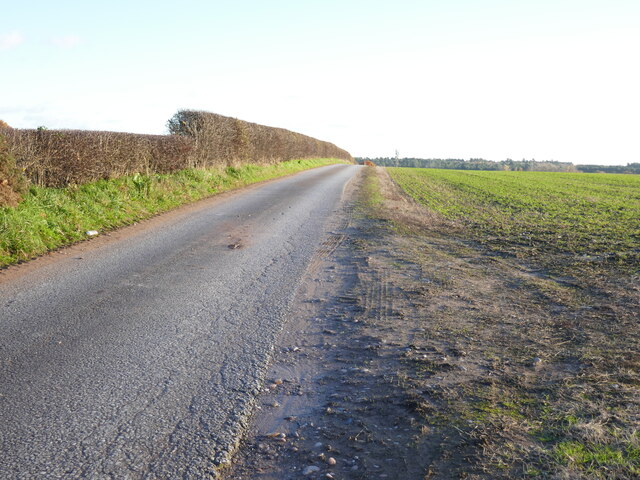
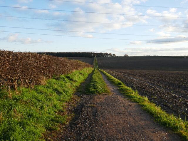
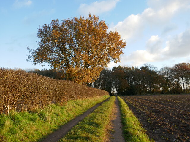
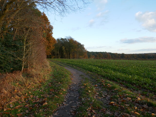
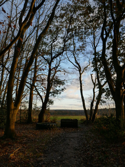
The woodland is predominantly made up of a mixture of deciduous and coniferous trees, creating a diverse and vibrant landscape. Towering oak, beech, and ash trees provide a dense canopy, while spruce and pine trees add a touch of evergreen throughout the seasons. The forest floor is covered with a carpet of mosses, ferns, and wildflowers, further enhancing the area's natural charm.

Several well-maintained footpaths and trails wind through the woods, allowing visitors to explore and appreciate the area's natural wonders. These paths offer opportunities for walking, jogging, and cycling, making it a popular spot for outdoor exercise. The wood is also home to an abundance of wildlife, including deer, foxes, and various bird species, providing nature enthusiasts with ample opportunities for birdwatching and wildlife observation.

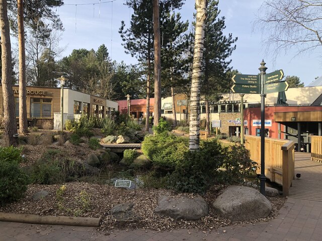
Cremorne Wood is well-served by amenities, with a car park and picnic area available for visitors. The serene setting and peaceful ambiance make it an ideal location for picnics, family outings, and leisurely strolls. The wood is open to the public year-round, with no entry fee.

Overall, Cremorne Wood is a delightful destination for those seeking a peaceful retreat in the heart of nature. Its picturesque scenery, diverse flora and fauna, and accessible trails make it a must-visit location for both locals and tourists alike.

If you have any feedback on the listing, please let us know in the comments section below.

Cremorne Wood Images

Images are sourced within 2km of 53.164977/-1.0686218 or Grid Reference SK6263. Thanks to Geograph Open Source API. All images are credited.

Abandoned road near Culloden, Sherwood Forest Park
Village Square, Center Parcs Sherwood Forest
The Lake, Center Parcs Sherwood Forest
Small woodland lake, Center Parcs Sherwood Forest
Center Parcs
Center Parcs
Pig Farm at Primrose Hill
Pig Farming, Primrose Hill
Traffic Cameras on the A614 at Primrose Hill
A614 near Primrose Hill
A614, Old Rufford Road, near Center Parcs Sherwood Forest
Roadway to Fir Tree Farm
Bridleway to Rufford Part of the Robin Hood Way.
Bridleway to Rufford
Part of the Robin Hood Way.
Approaching Broadoak Brake On a bridleway which is part of the Robin Hood Way.
Approaching Broadoak Brake
On a bridleway which is part of the Robin Hood Way.
Bridleway alongside Broadoak Brake Part of the Robin Hood Way.
Bridleway alongside Broadoak Brake
Part of the Robin Hood Way.
Bridleway through Broadoak Brake
Prepared fields near Lidgett Eastfield Cottage in the centre of the picture.
Prepared fields near Lidgett
Eastfield Cottage in the centre of the picture.
Track in Clipstone Forest
Track in Sherwood Pines Forest Park
Show me another place!

Cremorne Wood is located at Grid Ref: SK6263 (Lat: 53.164977, Lng: -1.0686218)

Administrative County: Nottinghamshire

District: Newark and Sherwood

Police Authority: Nottinghamshire

What 3 Words

///unfit.crockery.supported. Near King's Clipstone, Nottinghamshire

Nearby Locations

Cremorne Wood Blooms Gorse

Related Wikis

Edwinstowe

Edwinstowe is a village and civil parish in the Newark and Sherwood district of Nottinghamshire, England, on the edge of Sherwood Forest and the Dukeries...

Rufford, Nottinghamshire

Rufford, in Nottinghamshire, is the site of two villages whose inhabitants were evicted in the 12th century. Cistercian monasteries were established and...

King John's Palace

King John's Palace is the remains of a former medieval royal residence in Clipstone, north-west Nottinghamshire. The name "King John's Palace" has been...

Rufford Abbey

Rufford Abbey is a country estate in Rufford, Nottinghamshire, England, two miles (4 km) south of Ollerton. Originally a Cistercian abbey, it was converted...

Kings Clipstone

Kings Clipstone is a settlement and civil parish, in the Newark and Sherwood district, in the county of Nottinghamshire, England. The parish lies in the...

Clipstone

Clipstone in north Nottinghamshire is a small ex-coal mining village built on the site of an old army base and close to the site of a medieval royal palace...

Edwinstowe railway station

Edwinstowe railway station is a former railway station in Edwinstowe, Nottinghamshire, England. == History == The station was opened by the Lancashire...

Clipstone Colliery

Clipstone Colliery was a coal mine in the village of Clipstone, Nottinghamshire, part of the area known as The Dukeries. The colliery opened in 1922 and...

Nearby Amenities

Located within 500m of 53.164977,-1.0686218
Crossing
Crossing: marked
Lat/Long: 53.1645971/-1.0623082
Wifi
Lat/Long: 53.1629967/-1.064809
Recycling
Location: overground
Recycling Cans: yes
Recycling Glass Bottles: yes
Recycling Paper: yes
Recycling Plastic: yes
Recycling Type: container
Lat/Long: 53.1621791/-1.06283
Telephone
Lat/Long: 53.1624301/-1.0632836
Recycling
Location: overground
Recycling Cans: yes
Recycling Glass Bottles: yes
Recycling Paper: yes
Recycling Plastic: yes
Recycling Type: container
Lat/Long: 53.1642417/-1.0615878
Recycling
Location: overground
Recycling Cans: yes
Recycling Glass Bottles: yes
Recycling Paper: yes
Recycling Plastic: yes
Recycling Type: container
Lat/Long: 53.1621911/-1.0638756
Recycling
Location: overground
Recycling Cans: yes
Recycling Glass Bottles: yes
Recycling Paper: yes
Recycling Plastic: yes
Recycling Type: container
Lat/Long: 53.1617305/-1.0640663
Recycling
Location: overground
Recycling Cans: yes
Recycling Glass Bottles: yes
Recycling Paper: yes
Recycling Plastic: yes
Recycling Type: container
Lat/Long: 53.1610325/-1.0660682
Telephone
Lat/Long: 53.1609614/-1.0660452
Recycling
Location: overground
Recycling Cans: yes
Recycling Glass Bottles: yes
Recycling Paper: yes
Recycling Plastic: yes
Recycling Type: container
Lat/Long: 53.1615192/-1.0661578
Recycling
Location: overground
Recycling Cans: yes
Recycling Glass Bottles: yes
Recycling Paper: yes
Recycling Plastic: yes
Recycling Type: container
Lat/Long: 53.1617529/-1.0663398
Recycling
Location: overground
Recycling Cans: yes
Recycling Glass Bottles: yes
Recycling Paper: yes
Recycling Plastic: yes
Recycling Type: container
Lat/Long: 53.1620215/-1.0668279
Recycling
Location: overground
Recycling Cans: yes
Recycling Glass Bottles: yes
Recycling Paper: yes
Recycling Plastic: yes
Recycling Type: container
Lat/Long: 53.161992/-1.0672265
Bus Stop
Bus: yes
Note: activity pick up point
Public Transport: platform
Lat/Long: 53.1627418/-1.0662791
Recycling
Location: overground
Recycling Cans: yes
Recycling Glass Bottles: yes
Recycling Paper: yes
Recycling Plastic: yes
Recycling Type: container
Lat/Long: 53.1652181/-1.0656924
Recycling
Location: overground
Recycling Cans: yes
Recycling Glass Bottles: yes
Recycling Paper: yes
Recycling Plastic: yes
Recycling Type: container
Lat/Long: 53.1652317/-1.0661664
Recycling
Location: overground
Recycling Cans: yes
Recycling Glass Bottles: yes
Recycling Paper: yes
Recycling Plastic: yes
Recycling Type: container
Lat/Long: 53.1645118/-1.067543
Recycling
Location: overground
Recycling Cans: yes
Recycling Glass Bottles: yes
Recycling Paper: yes
Recycling Plastic: yes
Recycling Type: container
Lat/Long: 53.1640815/-1.0686579
Life Ring
Emergency: life_ring
Lat/Long: 53.1658106/-1.0638103
Recycling
Location: overground
Recycling Cans: yes
Recycling Glass Bottles: yes
Recycling Paper: yes
Recycling Plastic: yes
Recycling Type: container
Lat/Long: 53.166038/-1.0631559
Life Ring
Emergency: life_ring
Lat/Long: 53.165697/-1.0619417
Note: Dog Area
Note1: check tags
Lat/Long: 53.1677981/-1.0636436
Recycling
Location: overground
Recycling Cans: yes
Recycling Glass Bottles: yes
Recycling Paper: yes
Recycling Plastic: yes
Recycling Type: container
Lat/Long: 53.1674504/-1.0646961
Recycling
Location: overground
Recycling Cans: yes
Recycling Glass Bottles: yes
Recycling Paper: yes
Recycling Plastic: yes
Recycling Type: container
Lat/Long: 53.1678336/-1.064221
Shelter
Source: Bing:survey
Lat/Long: 53.1647326/-1.0719976
Crossing
Crossing: marked
Lat/Long: 53.1642638/-1.0651146
Entrance: yes
Lat/Long: 53.1628748/-1.0659269
Entrance: main
Lat/Long: 53.1629267/-1.0662337
Entrance: yes
Lat/Long: 53.1630223/-1.065472
The data included in this document is from www.openstreetmap.org. The data is made available under ODbL.

Have you been to Cremorne Wood?

Leave your review of Cremorne Wood below (or comments, questions and feedback).