Ashcombe

Settlement in Devon Teignbridge

England

Ashcombe

Lane to Thorns Cross From which <a href="https://www.geograph.org.uk/photo/3356848">SX8980 : Field and wood, Waddon Brakes</a> was taken, looking to the right; this looks up the lane on the right of <a href="https://www.geograph.org.uk/photo/748890">SX8980 : Field near Thorns Cross</a>.
Lane to Thorns Cross Credit: Derek Harper

Ashcombe is a small village located in the county of Devon, in the southwestern part of England. Situated approximately 5 miles east of the town of Dawlish, Ashcombe is nestled within the beautiful countryside of the region. The village is surrounded by rolling hills and vast green fields, offering picturesque views for its residents and visitors.

With a population of just over 200 people, Ashcombe is a close-knit community that exudes a peaceful and tranquil atmosphere. The village is characterized by its charming thatched-roof cottages, which add to its traditional English countryside charm. The local church, St. Nectan's, is a prominent feature within the village, showcasing stunning architecture and a rich history.

Despite its small size, Ashcombe is conveniently located near several amenities and attractions. The nearby town of Dawlish provides residents with access to various shops, restaurants, and services. Additionally, the beautiful beaches of the English Riviera are just a short drive away, offering opportunities for seaside leisure and relaxation.

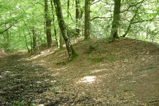
Ashcombe is also a prime location for outdoor enthusiasts, as it is surrounded by numerous walking and cycling trails. The area is home to an abundance of wildlife, making it an ideal destination for nature lovers and birdwatchers.

Overall, Ashcombe offers a peaceful and idyllic lifestyle, with its scenic surroundings and close proximity to amenities and attractions. It is a place where residents can enjoy the tranquility of the countryside while still having easy access to nearby towns and the stunning coastline.

If you have any feedback on the listing, please let us know in the comments section below.

Ashcombe Images

Images are sourced within 2km of 50.605787/-3.536907 or Grid Reference SX9179. Thanks to Geograph Open Source API. All images are credited.

Lane to Thorns Cross From which <a href="https://www.geograph.org.uk/photo/3356848">SX8980 : Field and wood, Waddon Brakes</a> was taken, looking to the right; this looks up the lane on the right of <a href="https://www.geograph.org.uk/photo/748890">SX8980 : Field near Thorns Cross</a>.
Lane to Thorns Cross
From which SX8980 : Field and wood, Waddon Brakes was taken, looking to the right; this looks up the lane on the right of SX8980 : Field near Thorns Cross.
Lane to Mistletoe Farm A little way down the hill on the right of <a href="https://www.geograph.org.uk/photo/166464">SX8980 : Junction near Waddon Brakes</a> and <a href="https://www.geograph.org.uk/photo/748890">SX8980 : Field near Thorns Cross</a> with a lowering evening sun (it's 20:13).
Lane to Mistletoe Farm
A little way down the hill on the right of SX8980 : Junction near Waddon Brakes and SX8980 : Field near Thorns Cross with a lowering evening sun (it's 20:13).
Edge of field near Waddon Brakes This must have been taken from the same spot as <a href="https://www.geograph.org.uk/photo/748890">SX8980 : Field near Thorns Cross</a>, looking to the left along the top edge of the field; the horses in <a href="https://www.geograph.org.uk/photo/166464">SX8980 : Junction near Waddon Brakes</a> are riding along the lane which runs behind the field boundary.
Edge of field near Waddon Brakes
This must have been taken from the same spot as SX8980 : Field near Thorns Cross, looking to the left along the top edge of the field; the horses in SX8980 : Junction near Waddon Brakes are riding along the lane which runs behind the field boundary.
Former link road, isolated between carriageways on the A380
North-bound carriageway on the A380 to Exeter
Farmland, Mamhead Bottom Looking left from <a href="https://www.geograph.org.uk/photo/6833852">SX9279 : Sheep pasture by Oakpark Wood</a>, with woods clothing the slopes of Great Haldon.
Farmland, Mamhead Bottom
Looking left from SX9279 : Sheep pasture by Oakpark Wood, with woods clothing the slopes of Great Haldon.
Lane to Westley Manor Looking the other way from <a href="https://www.geograph.org.uk/photo/6833897">SX9279 : Lane by Kiln Brake</a>. This stretch of lane is always damp.
Lane to Westley Manor
Looking the other way from SX9279 : Lane by Kiln Brake. This stretch of lane is always damp.
Cereal crop below Mamhead Bottom Looking right from <a href="https://www.geograph.org.uk/photo/6833897">SX9279 : Lane by Kiln Brake</a>, and left from <a href="https://www.geograph.org.uk/photo/7003379">SX9280 : Lane to Westley Manor</a>, up a field that is central to <a href="https://www.geograph.org.uk/photo/7003214">SX9280 : Farmland, Mamhead Bottom</a> and <a href="https://www.geograph.org.uk/photo/6834331">SX9280 : Farmland below Mamhead Bottom</a>.
Cereal crop below Mamhead Bottom
Cereal crop below Mamhead Bottom Looking right from <a href="https://www.geograph.org.uk/photo/7003395">SX9280 : Cereal crop below Mamhead Bottom</a>, and left from <a href="https://www.geograph.org.uk/photo/7003379">SX9280 : Lane to Westley Manor</a>.
Cereal crop below Mamhead Bottom
Lane to Ashcombe A reverse view of <a href="https://www.geograph.org.uk/photo/7003379">SX9280 : Lane to Westley Manor</a>.
Lane to Ashcombe
A reverse view of SX9280 : Lane to Westley Manor.
Lane to Westley Manor Looking the other way from <a href="https://www.geograph.org.uk/photo/7003452">SX9280 : Lane to Ashcombe</a>.
Lane to Westley Manor
Looking the other way from SX9280 : Lane to Ashcombe.
Holm oak near Westley Manor By the lane from Ashcombe.
Holm oak near Westley Manor
By the lane from Ashcombe.
Trees near Westley Manor At the bend where <a href="https://www.geograph.org.uk/photo/6834452">SX9279 : Valley below Westley Manor</a> was taken, looking right.
Trees near Westley Manor
At the bend where SX9279 : Valley below Westley Manor was taken, looking right.
Farmland and woods near Mamhead Grange From a gateway on the left of the bend shown in <a href="https://www.geograph.org.uk/photo/7003495">SX9280 : Trees near Westley Manor</a>.
Farmland and woods near Mamhead Grange
From a gateway on the left of the bend shown in SX9280 : Trees near Westley Manor.
Farmland and woods near Mamhead Grange Looking right from <a href="https://www.geograph.org.uk/photo/7004198">SX9280 : Farmland and woods near Mamhead Grange</a>. The trees on the left can be seen in <a href="https://www.geograph.org.uk/photo/6834248">SX9280 : Trees near Westley Manor</a>.
Farmland and woods near Mamhead Grange
Looking right from SX9280 : Farmland and woods near Mamhead Grange. The trees on the left can be seen in SX9280 : Trees near Westley Manor.
Gate near Westley Manor From which <a href="https://www.geograph.org.uk/photo/6834452">SX9279 : Valley below Westley Manor</a> was taken.
Gate near Westley Manor
From which SX9279 : Valley below Westley Manor was taken.
Westley House and Manor A spring version of <a href="https://www.geograph.org.uk/photo/3081440">SX9280 : Westley Manor Farm</a>.
Westley House and Manor
A spring version of SX9280 : Westley Manor Farm.
Westley Manor Farm Seen from the lane from Ashcombe.
Westley Manor Farm
Seen from the lane from Ashcombe.
Show me another place!

Ashcombe is located at Grid Ref: SX9179 (Lat: 50.605787, Lng: -3.536907)

Administrative County: Devon

District: Teignbridge

Police Authority: Devon and Cornwall

What 3 Words

///otter.shaver.erupt. Near Chudleigh, Devon

Nearby Locations

Ashcombe Woodoffice Copse

Related Wikis

Ashcombe

Ashcombe is a village and civil parish in the Teignbridge district of Devon, England, about eight miles south of the city of Exeter. The parish is surrounded...

Ideford Common

Ideford Common is a Site of Special Scientific Interest consisting of an area of lowland heath in Devon, England. The site is a habitat for nightjars and...
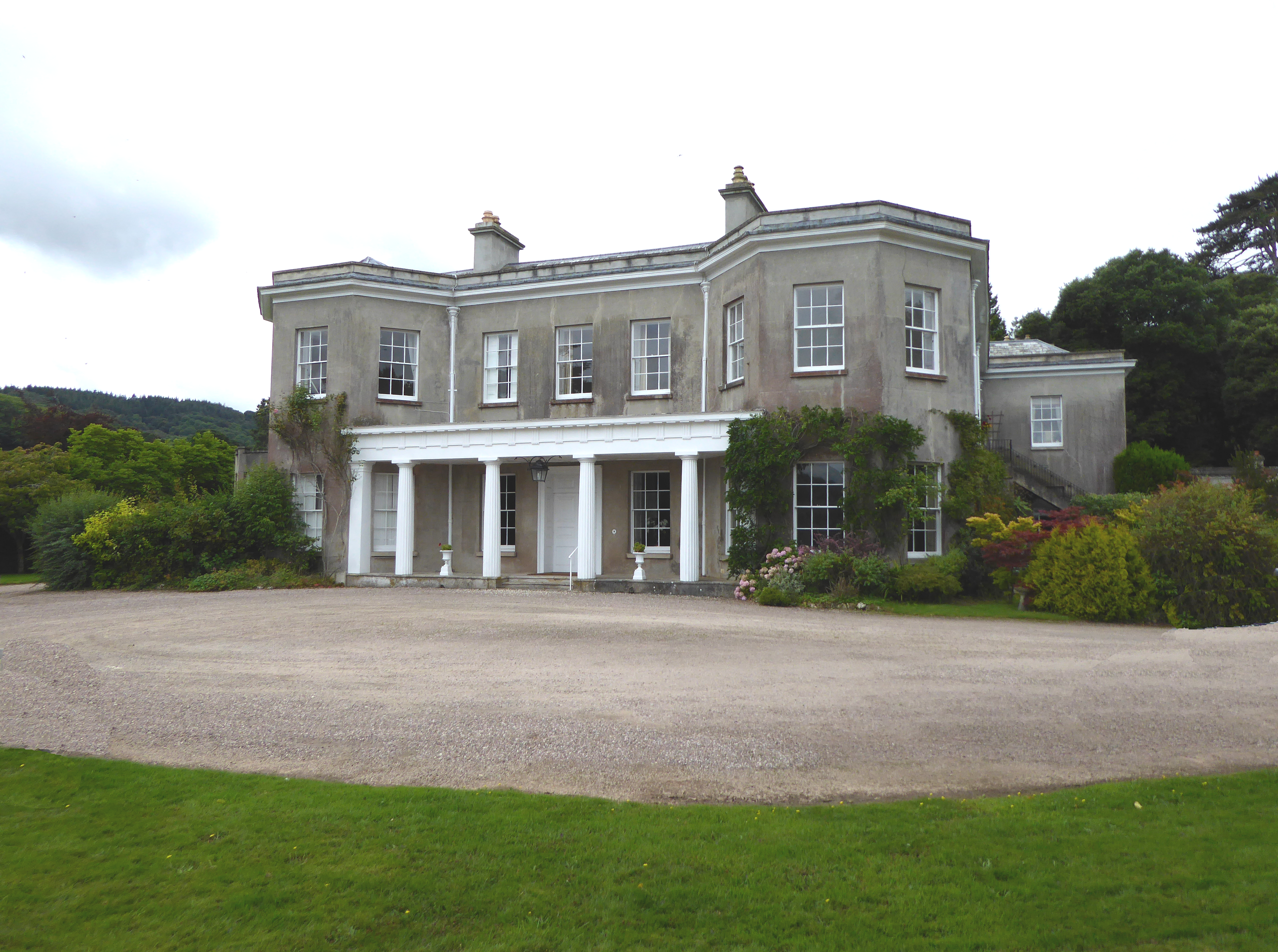
Mamhead House

Mamhead House, Mamhead, Devon, is a country house dating from 1827. Its origins are older but the present building was constructed for Robert William Newman...

Mamhead

Mamhead is a rural village and civil parish near Dawlish and Kenton in Devon, South West England, in the Teignbridge local authority area. Current community...

Castle Dyke

Castle Dyke is an Iron Age hill fort situated between Chudleigh and Dawlish in Devon, England. The fort is situated on a hilltop at approximately 140 metres...

Luton, Teignbridge

Luton is a village in Devon, England, within Teignbridge local authority area. Historically Luton formed part of Ashcombe Hundred.The village is in the...

Oxton, Kenton

Oxton in the parish of Kenton in South Devon is a historic estate long held by the Martyn family, a junior branch of the Norman family of FitzMartin, feudal...

Ideford

Ideford (or Ideford Parish) is a village in the Teignbridge district of Devon, England. It is 5 miles (8 km) north of Newton Abbot. To the west is the...

Nearby Amenities

Located within 500m of 50.605787,-3.536907
Ashcombe
Is In: Devon, England, UK
Place: hamlet
Lat/Long: 50.6058344/-3.5367719
Post Box
Brand: Royal Mail
Brand Wikidata: Q638098
Brand Wikipedia: en:Royal Mail
Collection Times: Mo-Fr 16:15; Sa 08:45; Su off
Operator: Royal Mail
Operator Wikidata: Q638098
Post Box Design: type_b
Post Box Mounting: brick_pillar
Post Box Type: wall
Ref: EX7 13
Royal Cypher: GR
Royal Cypher Wikidata: Q33102273
Source: survey;streetlevel imagery;aerial imagery
Lat/Long: 50.6046395/-3.5345613
The data included in this document is from www.openstreetmap.org. The data is made available under ODbL.

Have you been to Ashcombe?

Leave your review of Ashcombe below (or comments, questions and feedback).