Old Barn Plantation

Wood, Forest in Yorkshire Hambleton

England

Old Barn Plantation

Oulston Reservoir
Oulston Reservoir Credit: Ian S

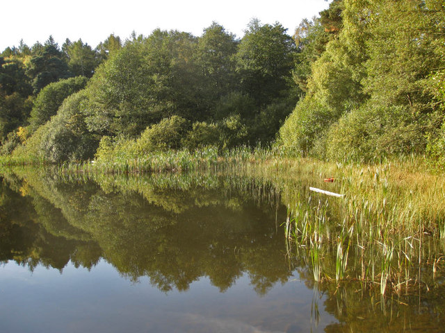
Old Barn Plantation, located in Yorkshire, is a picturesque and historic woodland area that is renowned for its natural beauty and diverse flora and fauna. Covering an expansive area, the plantation is nestled within the heart of the stunning Yorkshire countryside.

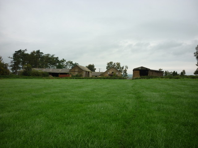
The plantation is aptly named after the old barn that stands proudly within its boundaries, serving as a reminder of its rich agricultural past. The barn itself is an architectural gem, with its weathered stone walls and traditional timber beams, offering a glimpse into the region's rural history.

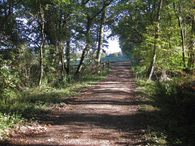
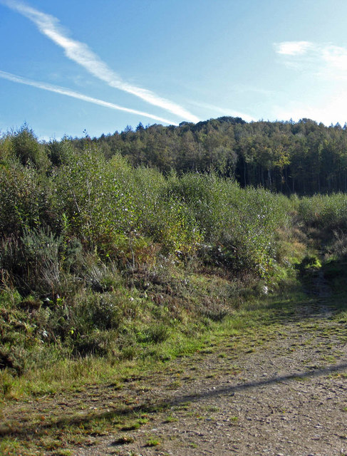
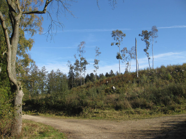
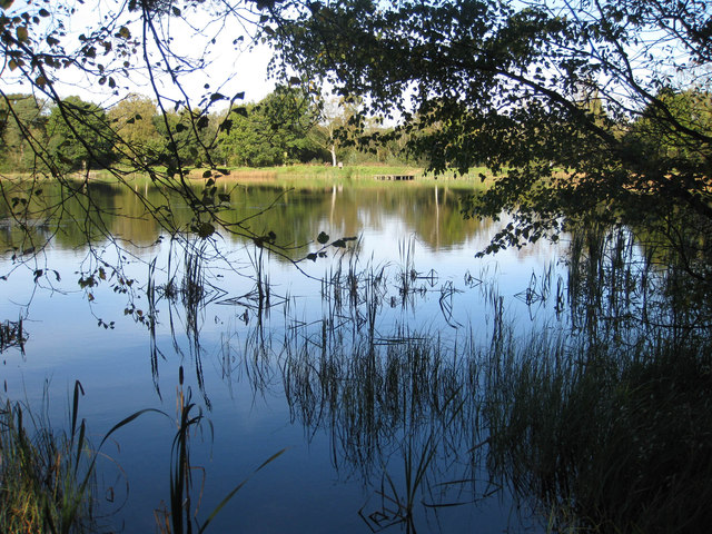
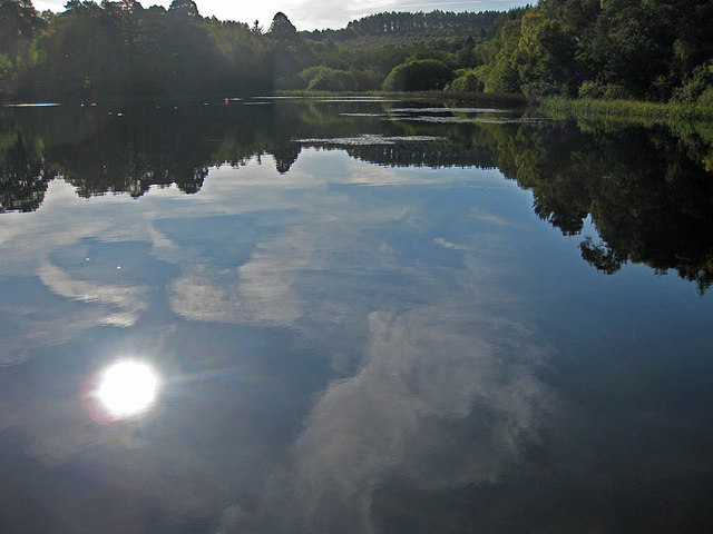
The woodland of Old Barn Plantation is a haven for nature enthusiasts and outdoor lovers. It boasts a variety of tree species, including oak, birch, beech, and ash, which create a dense canopy and provide a home to numerous bird species and small mammals. Walking through the plantation, visitors can enjoy the tranquility of the forest, accompanied by the soothing sounds of birdsong and the rustling of leaves underfoot.

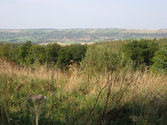
The plantation is also home to a network of well-maintained walking trails, allowing visitors to explore its enchanting surroundings. These trails offer stunning views of the surrounding countryside, with rolling hills and meandering streams adding to the plantation's allure.

Old Barn Plantation is a popular destination for outdoor activities such as hiking, birdwatching, and photography. Its natural charm and serene atmosphere make it an ideal spot for those seeking solace in nature or looking to immerse themselves in the region's rich history and picturesque landscapes.

Overall, Old Barn Plantation in Yorkshire is a treasured natural gem, offering visitors a chance to connect with nature and experience the beauty of the English countryside.

If you have any feedback on the listing, please let us know in the comments section below.

Old Barn Plantation Images

Images are sourced within 2km of 54.174497/-1.1193689 or Grid Reference SE5775. Thanks to Geograph Open Source API. All images are credited.

Oulston Reservoir
Oulston Reservoir
A path leading to Yearsley
Walking towards High Lions Lodge
Walking towards Low Lions Lodge
A wind turbine at Thorpe Grange
Looking North from Yearsley Forest Looking North from the deserted farmhouse in Yearsley Forest, Ampleforth in the distance.
Looking North from Yearsley Forest
Looking North from the deserted farmhouse in Yearsley Forest, Ampleforth in the distance.
Track near the lower fish pond Heading towards Park House.
Track near the lower fish pond
Heading towards Park House.
Mixed woodland Park Wood.
Mixed woodland
Park Wood.
Cleared woodland A few spindly specimens remain in the cleared area east of the lower fish pond.
Cleared woodland
A few spindly specimens remain in the cleared area east of the lower fish pond.
Lower Fish Pond A tranquil pond on the Ampleforth Abbey Estate which covers over 2000 acres. The Estate is carefully managed and encompasses grassland, farmland and woodland and is located in an AONB.
Lower Fish Pond
A tranquil pond on the Ampleforth Abbey Estate which covers over 2000 acres. The Estate is carefully managed and encompasses grassland, farmland and woodland and is located in an AONB.
Lower Fish Pond A tranquil pond on the Ampleforth Abbey Estate which covers over 2000 acres. The Estate is carefully managed and encompasses grassland, farmland and woodland and is located in an AONB. The Higher Fish Ponds lie to the Southeast in Park Wood.
Lower Fish Pond
A tranquil pond on the Ampleforth Abbey Estate which covers over 2000 acres. The Estate is carefully managed and encompasses grassland, farmland and woodland and is located in an AONB. The Higher Fish Ponds lie to the Southeast in Park Wood.
Reedbed in the Lower Fish Pond A tranquil pond on the Ampleforth Abbey Estate which covers over 2000 acres. The Estate is carefully managed and encompasses grassland, farmland and woodland and is located in an AONB.
Reedbed in the Lower Fish Pond
A tranquil pond on the Ampleforth Abbey Estate which covers over 2000 acres. The Estate is carefully managed and encompasses grassland, farmland and woodland and is located in an AONB.
Road to Redcar House This is nearing the end of the metalled road as it passes to the north of the Lower Fish Pond.
Road to Redcar House
This is nearing the end of the metalled road as it passes to the north of the Lower Fish Pond.
Winter wheat and a line of oaks 20th October and the leaves on the oaks are still a deep green.
Winter wheat and a line of oaks
20th October and the leaves on the oaks are still a deep green.
Oak in arable field The odd tinge of autumn colour can be seen on the trees in the distance but this oak is still in deep green foliage.
Oak in arable field
The odd tinge of autumn colour can be seen on the trees in the distance but this oak is still in deep green foliage.
Approaching the dismantled railway line Cattle like to gather in the corner of the field ahead churning up the footpath into a bog.
Approaching the dismantled railway line
Cattle like to gather in the corner of the field ahead churning up the footpath into a bog.
Dismantled railway A choice of routes from this point: to Ampleforth, Yearsley & Gilling East or Colley Broach Road via Redcar House.
Dismantled railway
A choice of routes from this point: to Ampleforth, Yearsley & Gilling East or Colley Broach Road via Redcar House.
Clearing, Elder Slack
Show me another place!

Old Barn Plantation is located at Grid Ref: SE5775 (Lat: 54.174497, Lng: -1.1193689)

Division: North Riding

Administrative County: North Yorkshire

District: Hambleton

Police Authority: North Yorkshire

What 3 Words

///originate.confronts.kickbacks. Near Easingwold, North Yorkshire

Related Wikis

Ampleforth railway station

Ampleforth railway station, served the village of Ampleforth, in the Northern English county of North Yorkshire. It was located on a line which ran from...

Yearsley

Yearsley is a small village and civil parish in the district of Hambleton in North Yorkshire, England. The population of the civil parish was less than...

Newburgh, North Yorkshire

Newburgh is a village and civil parish located in the Hambleton district of North Yorkshire, England. The population at the 2011 Census was less than 100...

Ampleforth

Ampleforth is a village and civil parish in North Yorkshire, England, 20 miles (32 km) north of York. The village is situated on the edge of the North...

Oulston

Oulston is a village and civil parish in Hambleton district of North Yorkshire, England. It lies about 3 miles (5 km) north-east of Easingwold. Remains...

Newburgh Priory

Newburgh Priory is a Grade 1 listed Tudor building near Coxwold, North Yorkshire, England. Originally a house of Augustinian canons, it was founded in...

Gilling Castle

Gilling Castle is a Grade I listed country house near Gilling East, North Yorkshire, England (grid reference SE611768). == History == The castle was originally...

St Martin's Ampleforth

St Martin's Ampleforth (SMA) was a private school and the preparatory school for Ampleforth College, which closed in July 2020. Until 2018 it was at Gilling...

Nearby Amenities

Located within 500m of 54.174497,-1.1193689
Barrier: stile
Step Count: 2
Stile: stepover
Lat/Long: 54.1710663/-1.1175286
Note: I didn't get the sense that this was a place in its own right
Source: survey
Lat/Long: 54.1704437/-1.1178675
Barrier: stile
Step Count: 2
Stile: stepover
Lat/Long: 54.1709794/-1.1175109
Passing Place
Lat/Long: 54.1756253/-1.1152703
The data included in this document is from www.openstreetmap.org. The data is made available under ODbL.

Have you been to Old Barn Plantation?

Leave your review of Old Barn Plantation below (or comments, questions and feedback).