Dudley Hill

Settlement in Yorkshire

England

Dudley Hill

Tong Cemetery
Tong Cemetery Credit: Betty Longbottom

Dudley Hill is a small village located in the metropolitan borough of Bradford, West Yorkshire, England. Situated approximately three miles south-east of Bradford city centre, it falls within the boundaries of the historic county of Yorkshire. The village is positioned on a slight hill, which offers panoramic views of the surrounding area.

Dudley Hill is primarily residential, with a mix of modern housing developments and traditional stone-built houses. The village is known for its close-knit community and friendly atmosphere. Amenities in Dudley Hill include a local convenience store, a post office, and a few small businesses. For more extensive shopping and entertainment options, residents can easily access the nearby city of Bradford.

The village is well-connected to the rest of Yorkshire, with good transport links. Dudley Hill is located near the A6037 road, which connects the village to Bradford and other nearby towns. The village also benefits from regular bus services, allowing residents to easily travel to surrounding areas.

Nature enthusiasts will appreciate the proximity of Dudley Hill to the beautiful Yorkshire countryside. The village is surrounded by green fields and rolling hills, making it an ideal location for outdoor activities such as walking, hiking, and cycling. Additionally, the nearby Tong Valley offers picturesque trails and nature reserves for nature lovers to explore.

In conclusion, Dudley Hill is a charming village in Yorkshire, offering a peaceful residential setting with easy access to nearby amenities and the natural beauty of the surrounding countryside.

If you have any feedback on the listing, please let us know in the comments section below.
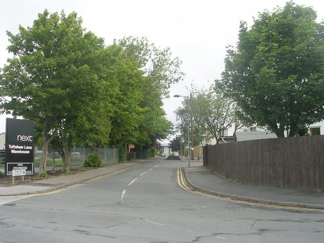
Dudley Hill Images

Images are sourced within 2km of 53.773759/-1.72457 or Grid Reference SE1830. Thanks to Geograph Open Source API. All images are credited.

Tong Cemetery
Tong Cemetery
Edgemoor Close - looking towards Toftshaw Lane
Stead Road - Toftshaw Lane
Thorverton Drive - Stead Road
Thorverton Grove - Stead Road
Next Warehouse - off Toftshaw Lane
Footpath - Bradford Road
Bradford Road - viewed from end of Tong Street
Westgate Hill Street - viewed from end of Tong Street
Footpath - Edgemoor Close
Footpath - Toftshaw Lane
Toftshaw Lane - near Raikes Lane
Raikes Lane - viewed from Toftshaw Lane
Footpath - Toftshaw Lane to East Bierley
Footpath - Raikes Lane
Cliff Hollins Lane - off Raikes Lane
Entrance to Moorside Farm - off Bradford Road
Scrapyard - off Bradford Road
Show me another place!

Dudley Hill is located at Grid Ref: SE1830 (Lat: 53.773759, Lng: -1.72457)

Division: West Riding

Unitary Authority: Bradford

Police Authority: West Yorkshire

What 3 Words

///event.candle.strong. Near Bradford, West Yorkshire

Nearby Locations

Dudley Hill

Related Wikis

Dudley Hill railway station

Dudley Hill railway station was a railway station that served Dudley Hill, West Yorkshire, England. == History == The line was open to passengers on 20...

Dudley Hill

Dudley Hill is a village in the borough of City of Bradford, West Yorkshire, England and is in Tong ward. == History == There are a few mentions of the...

Bradford Academy, West Yorkshire

Bradford Academy is a Diocese of West Yorkshire sponsored all-through Academy in south-east Bradford. It has grown to approximately 1800 pupils. Bradford...

St John the Evangelist, Bierley

The Church of St John the Evangelist is a Grade II* listed church situated in what is now the City of Bradford, in Yorkshire, England. A private chapel...

Nearby Amenities

Located within 500m of 53.773759,-1.72457
Pub
Cross Keys
Addr City: Bradford
Addr Housenumber: 465
Addr Postcode: BD4 7SE
Addr Street: Rooley Lane
Fhrs Id: 326261
Source Addr: FHRS Open Data
Lat/Long: 53.7742973/-1.7300129
Place Of Worship
Ebenezer Methodist Church Centre
Religion: christian
Lat/Long: 53.7757968/-1.7282868
Mini Roundabout
Direction: clockwise
Lat/Long: 53.7740091/-1.7181772
Dudley Hill
Historic Railway: station
Railway: site
Wikidata: Q5311889
Wikipedia: en:Dudley Hill railway station
Lat/Long: 53.7720788/-1.7210377
Bus Stop
Wakefield Road Corban Street
Bench: no
Bin: no
Bus: yes
Local Ref: 45013816
Naptan AtcoCode: 450013816
Naptan Bearing: S
Naptan CommonName: Wakefield Road Corban Street
Naptan Crossing: Corban Street
Naptan Indicator: Stop 45013816
Naptan Landmark: Dudley Hill Roundabout
Naptan PlusbusZoneRef: LEEDS
Naptan ShortCommonName: Corban Street
Naptan Street: Wakefield Road
Naptan Verified: no
Public Transport: platform
Shelter: yes
Source: naptan_import
Lat/Long: 53.7768265/-1.7274493
Bus Stop
Tong Street Harry Street
Bus: yes
Local Ref: 45013817
Naptan AtcoCode: 450013817
Naptan Bearing: SE
Naptan CommonName: Tong Street Harry Street
Naptan Crossing: Harry Street
Naptan Indicator: Stop 45013817
Naptan Landmark: Adj Slip Road from Sticker Lane
Naptan PlusbusZoneRef: LEEDS
Naptan ShortCommonName: Harry Street
Naptan Street: Tong Street
Naptan Verified: no
Public Transport: platform
Source: naptan_import
Lat/Long: 53.7744319/-1.7258412
Bus Stop
Tong Street Rook Lane
Bus: yes
Local Ref: 45013818
Naptan AtcoCode: 450013818
Naptan Bearing: SE
Naptan CommonName: Tong Street Rook Lane
Naptan Crossing: Rook Lane
Naptan Indicator: Stop 45013818
Naptan Landmark: Wilco Motosave
Naptan PlusbusZoneRef: LEEDS
Naptan ShortCommonName: Rook Lane
Naptan Street: Tong Street
Naptan Verified: no
Public Transport: platform
Source: naptan_import
Lat/Long: 53.7727728/-1.7235305
Bus Stop
Tong Street Prince Street
Bus: yes
Layby: yes
Local Ref: 45013819
Naptan AtcoCode: 450013819
Naptan Bearing: SE
Naptan CommonName: Tong Street Prince Street
Naptan Crossing: Prince Street
Naptan Indicator: Stop 45013819
Naptan Landmark: Bank
Naptan PlusbusZoneRef: LEEDS
Naptan ShortCommonName: Prince Street
Naptan Street: Tong Street
Public Transport: platform
Shelter: yes
Source: naptan_import
Lat/Long: 53.7719692/-1.7219578
Bus Stop
Tong Street Prince Street
Bus: yes
Local Ref: 45013840
Naptan AtcoCode: 450013840
Naptan Bearing: NW
Naptan CommonName: Tong Street Prince Street
Naptan Crossing: Prince Street
Naptan Indicator: Stop 45013840
Naptan Landmark: The De Lacy PH
Naptan PlusbusZoneRef: LEEDS
Naptan ShortCommonName: Prince Street
Naptan Street: Tong Street
Naptan Verified: no
Public Transport: platform
Shelter: yes
Source: naptan_import
Lat/Long: 53.7714735/-1.7213845
Bus Stop
Tong Street Knowles Street
Bus: yes
Local Ref: 45013841
Naptan AtcoCode: 450013841
Naptan Bearing: NW
Naptan CommonName: Tong Street Knowles Street
Naptan Crossing: Knowles Street
Naptan Indicator: Stop 45013841
Naptan Landmark: Prospect House
Naptan Notes: OSR taken place 050905
Naptan PlusbusZoneRef: LEEDS
Naptan ShortCommonName: Knowles Street
Naptan Street: Tong Street
Naptan Verified: no
Public Transport: platform
Source: naptan_import
Lat/Long: 53.772332/-1.7233817
Bus Stop
Tong Street Melford Street
Bus: yes
Local Ref: 45013842
Naptan AtcoCode: 450013842
Naptan Bearing: NW
Naptan CommonName: Tong Street Melford Street
Naptan Crossing: Melford Street
Naptan Indicator: Stop 45013842
Naptan Landmark: Milestone PH
Naptan Notes: Adshel shelter removed 050705 to be replaced by TF
Naptan PlusbusZoneRef: LEEDS
Naptan ShortCommonName: Melford Street
Naptan Street: Tong Street
Naptan Verified: no
Public Transport: platform
Source: naptan_import
Lat/Long: 53.7733701/-1.7252867
Bus Stop
Tong Street Factory Street
Local Ref: 45013843
Naptan AtcoCode: 450013843
Naptan Bearing: N
Naptan CommonName: Tong Street Factory Street
Naptan Crossing: Factory Street
Naptan Indicator: Stop 45013843
Naptan Landmark: Police Station
Naptan Notes: Removed Adshel shelter 040308
Naptan PlusbusZoneRef: LEEDS
Naptan ShortCommonName: Factory Street
Naptan Street: Tong Street
Naptan Verified: no
Source: naptan_import
Lat/Long: 53.7750639/-1.727051
Bus Stop
Bowling Hall Road Rooley Lane
Bus: yes
Local Ref: 45013895
Naptan AtcoCode: 450013895
Naptan Bearing: NW
Naptan CommonName: Bowling Hall Road Rooley Lane
Naptan Crossing: Rooley Lane
Naptan Indicator: Stop 45013895
Naptan Landmark: Bowling Special School
Naptan Notes: OSR taken place size 1 case fitted 300905
Naptan PlusbusZoneRef: LEEDS
Naptan ShortCommonName: Rooley Lane
Naptan Street: Bowling Hall Road
Naptan Verified: yes
Public Transport: platform
Ref: 45013895
Source: naptan_import
Lat/Long: 53.7737336/-1.7310199
Bus Stop
Bowling Hall Road Rooley Lane
Bus: yes
Local Ref: 45013896
Naptan AtcoCode: 450013896
Naptan Bearing: SE
Naptan CommonName: Bowling Hall Road Rooley Lane
Naptan Crossing: Rooley Lane
Naptan Indicator: Stop 45013896
Naptan Landmark: Bowling Special School
Naptan Notes: OSR taken place 300905
Naptan PlusbusZoneRef: LEEDS
Naptan ShortCommonName: Rooley Lane
Naptan Street: Bowling Hall Road
Naptan Verified: no
Public Transport: platform
Source: naptan_import
Lat/Long: 53.7736967/-1.7305953
Bus Stop
Sticker Lane Heshbon Street
Bus: yes
Local Ref: 45014531
Naptan AtcoCode: 450014531
Naptan Bearing: SW
Naptan CommonName: Sticker Lane Heshbon Street
Naptan Crossing: Heshbon Street
Naptan Indicator: Stop 45014531
Naptan Landmark: Dudley Hill Roundabout
Naptan PlusbusZoneRef: LEEDS
Naptan ShortCommonName: Heshbon Street
Naptan Street: Sticker Lane
Naptan Verified: no
Public Transport: platform
Source: naptan_import
Lat/Long: 53.7762652/-1.7257078
Bus Stop
Sticker Lane Heshbon Street
Bus: yes
Local Ref: 45014532
Naptan AtcoCode: 450014532
Naptan Bearing: NE
Naptan CommonName: Sticker Lane Heshbon Street
Naptan Crossing: Heshbon Street
Naptan Indicator: Stop 45014532
Naptan Notes: Signature shelter replaced by Trueform Enclosed due to RTA
Naptan PlusbusZoneRef: LEEDS
Naptan ShortCommonName: Heshbon Street
Naptan Street: Sticker Lane
Naptan Verified: no
Public Transport: platform
Source: naptan_import
Lat/Long: 53.7764008/-1.7260104
Bus Stop
Rooley Lane Wakefield Road
Bench: yes
Bus: yes
Local Ref: 45014533
Naptan AtcoCode: 450014533
Naptan Bearing: SW
Naptan CommonName: Rooley Lane Wakefield Road
Naptan Crossing: Wakefield Road
Naptan Indicator: Stop 45014533
Naptan PlusbusZoneRef: LEEDS
Naptan ShortCommonName: Wakefield Road
Naptan Street: Rooley Lane
Naptan Verified: no
Public Transport: platform
Shelter: yes
Source: naptan_import
Lat/Long: 53.7751393/-1.7286134
Bus Stop
Rooley Lane Bowling Hall Road
Bench: no
Bus: yes
Local Ref: 45014534
Naptan AtcoCode: 450014534
Naptan Bearing: N
Naptan CommonName: Rooley Lane Bowling Hall Road
Naptan Crossing: Bowling Hall Road
Naptan Indicator: Stop 45014534
Naptan Landmark: Cross Keys PH
Naptan Notes: OSR taken place 031005
Naptan PlusbusZoneRef: LEEDS
Naptan ShortCommonName: Bowling Hall Road
Naptan Street: Rooley Lane
Naptan Verified: no
Public Transport: platform
Shelter: no
Source: naptan_import
Lat/Long: 53.773659/-1.7298217
Bus Stop
Rooley Lane Bowling Hall Road
Bus: yes
Local Ref: 45014535
Naptan AtcoCode: 450014535
Naptan Bearing: N
Naptan CommonName: Rooley Lane Bowling Hall Road
Naptan Crossing: Bowling Hall Road
Naptan Indicator: Stop 45014535
Naptan Landmark: Cross Keys PH
Naptan PlusbusZoneRef: LEEDS
Naptan ShortCommonName: Newman Street
Naptan Street: Rooley Lane
Naptan Verified: no
Public Transport: platform
Source: naptan_import
Lat/Long: 53.7740819/-1.7300162
Bus Stop
Dudley Hill Rooley Lane
Bus: yes
Local Ref: 45014536
Naptan AtcoCode: 450014536
Naptan Bearing: NE
Naptan CommonName: Dudley Hill Rooley Lane
Naptan Crossing: Nr-At Wakefield Road
Naptan Indicator: Stop 45014536
Naptan Landmark: Church
Naptan Notes: OSR taken place size 1 case fitted 310905
Naptan PlusbusZoneRef: LEEDS
Naptan ShortCommonName: Dudley Hill
Naptan Street: Rooley Lane
Naptan Verified: no
Public Transport: platform
Source: naptan_import
Lat/Long: 53.7755167/-1.7285655
Bus Stop
Knowles Lane Holme Wood
Bus: yes
Local Ref: 45022802
Naptan AtcoCode: 450022802
Naptan Bearing: SW
Naptan CommonName: Knowles Lane Holme Wood
Naptan Crossing: Nr Tong Street
Naptan Indicator: Stop 45022802
Naptan Landmark: Dudley Hill Business Centre
Naptan PlusbusZoneRef: LEEDS
Naptan ShortCommonName: Tong Street
Naptan Street: Knowles Lane
Naptan Verified: no
Public Transport: platform
Source: naptan_import
Lat/Long: 53.7730178/-1.7206611
Bus Stop
Knowles Lane Tong Street
Bus: yes
Local Ref: 45022803
Naptan AtcoCode: 450022803
Naptan Bearing: NE
Naptan CommonName: Knowles Lane Tong Street
Naptan Crossing: Nr Tong Street
Naptan Indicator: Stop 45022803
Naptan Landmark: European Lamp Group
Naptan PlusbusZoneRef: LEEDS
Naptan ShortCommonName: Playing Fields
Naptan Street: Knowles Lane
Naptan Verified: no
Public Transport: platform
Source: naptan_import
Lat/Long: 53.7731704/-1.7205691
Bus Stop
Knowles Lane St Margarets Avenue
Bus: yes
Local Ref: 45022804
Naptan AtcoCode: 450022804
Naptan Bearing: W
Naptan CommonName: Knowles Lane St Margarets Avenue
Naptan Crossing: St Margarets Avenue
Naptan Indicator: Stop 45022804
Naptan PlusbusZoneRef: LEEDS
Naptan ShortCommonName: St. Margarets Av
Naptan Street: Knowles Lane
Naptan Verified: no
Public Transport: platform
Source: naptan_import
Lat/Long: 53.7740446/-1.7177106
Bus Stop
Knowles Lane Bridgeway
Bus: yes
Local Ref: 45022805
Naptan AtcoCode: 450022805
Naptan Bearing: E
Naptan CommonName: Knowles Lane Bridgeway
Naptan Crossing: Bridgeway
Naptan Indicator: Stop 45022805
Naptan Landmark: Knowleswood Primary School
Naptan PlusbusZoneRef: LEEDS
Naptan ShortCommonName: Bridgeway
Naptan Street: Knowles Lane
Naptan Verified: no
Public Transport: platform
Source: naptan_import
Lat/Long: 53.7741608/-1.7174671
Bus Stop
Wakefield Road Harcourt Street
Bus: yes
Local Ref: 45022857
Naptan AtcoCode: 450022857
Naptan Bearing: NW
Naptan CommonName: Wakefield Road Harcourt Street
Naptan Crossing: Harcourt Street
Naptan Indicator: Stop 45022857
Naptan Notes: OSR taken place size 1 case fitted 050805Adshel shelter removed on 29/1/08. New TF shelter installed on 31/1/08. Awaiting survey.
Naptan PlusbusZoneRef: LEEDS
Naptan ShortCommonName: Harcourt Street
Naptan Street: Wakefield Road
Naptan Verified: no
Public Transport: platform
Source: naptan_import
Lat/Long: 53.7768731/-1.7281925
Recycling
Lat/Long: 53.7733351/-1.7319088
Traffic Signals
Crossing: traffic_signals
Crossing Ref: pelican
Tactile Paving: no
Lat/Long: 53.7708563/-1.7195316
Reflections Kitchen, Bathroom & Tiles
Shop: doityourself
Lat/Long: 53.7706291/-1.7192302
Plumbase Heating Supplies
Shop: doityourself
Lat/Long: 53.7705041/-1.7193554
Fast Food
Five Star Wook
Addr City: Bradford
Addr Housenumber: 1
Addr Postcode: BD4 6HN
Addr Street: Dawson Lane
Addr Suburb: Tong
Cuisine: chinese
Fhrs Id: 328113
Source Addr: FHRS Open Data
Lat/Long: 53.7703846/-1.7207979
Barrier: bollard
Lat/Long: 53.7704092/-1.7213264
Access: no
Barrier: bollard
Bicycle: yes
Bollard: fixed
Foot: yes
Height: 1
Horse: yes
Material: concrete
Motor Vehicle: no
Lat/Long: 53.7705096/-1.7208685
Betfred
Brand: Betfred
Brand Wikidata: Q4897425
Brand Wikipedia: en:Betfred
Shop: bookmaker
Lat/Long: 53.7711335/-1.720546
Distinctive Kitchens
Shop: doityourself
Lat/Long: 53.7711704/-1.7206932
Fast Food
Supreme Sandwich Bar
Cuisine: sandwich
Lat/Long: 53.7712337/-1.7208761
Fuel
Euro Ring Road Service Station (Esso Snack & Shop)
Addr City: Bradford
Addr Postcode: BD4 7SJ
Addr Street: Rooley Lane
Lat/Long: 53.7719159/-1.7308586
Crossing
Lat/Long: 53.7724401/-1.7284499
United Footwear
Shop: clothes
Lat/Long: 53.7752053/-1.7279003
Barrier: bollard
Bicycle: yes
Foot: yes
Lat/Long: 53.7709517/-1.7243818
Bank
HSBC UK
Brand: HSBC UK
Brand Wikidata: Q64767453
Lat/Long: 53.7718779/-1.7224897
Barrier: bollard
Lat/Long: 53.770088/-1.7212313
Cafe
Deli Sandwiches
Lat/Long: 53.7711506/-1.7213302
Toppers Hairdressing
Shop: hairdresser
Lat/Long: 53.7711802/-1.7214189
St Vincent's
Shop: clothes
Lat/Long: 53.7711915/-1.7215148
Southfield Minimarket
Addr City: Bradford
Addr Housenumber: 110
Addr Postcode: BD4 6HD
Addr Street: Tong Street
Fhrs Id: 326402
Shop: supermarket
Source Addr: FHRS Open Data
Lat/Long: 53.7712989/-1.7216448
Tattoo Studio
Shop: tattoo
Lat/Long: 53.7712258/-1.7215926
Chelwood Butchers
Shop: butcher
Lat/Long: 53.7713869/-1.721666
Step 2
Shop: clothes
Lat/Long: 53.7714484/-1.7215998
Funnacliffe & Lambert Opticians
Shop: optician
Lat/Long: 53.7715126/-1.721562
Disused Pub
De Lacy Hotel
Lat/Long: 53.771613/-1.7219383
Post Box
Operator: Royal Mail
Post Box Type: pillar
Ref: BD4 254
Royal Cypher: GR
Royal Cypher Wikidata: Q33102273
Lat/Long: 53.7713695/-1.7211066
Telephone
Atm: yes
Booth: KXPlus
Covered: booth
Lat/Long: 53.7713941/-1.7211716
Speedy Hire
Shop: doityourself
Lat/Long: 53.7729712/-1.7247577
Traffic Signals
Crossing: traffic_signals
Crossing Ref: puffin
Kerb: flush
Tactile Paving: yes
Lat/Long: 53.7722261/-1.7227686
Morrisons Distribution Warehouse
Building: yes
Lat/Long: 53.7758903/-1.7221734
Barrier: bollard
Lat/Long: 53.7737129/-1.7187909
Post Box
Operator: Royal Mail
Post Box Type: pillar
Ref: BD4 324
Lat/Long: 53.7740002/-1.7179335
Adult Superstore
Shop: toys
Lat/Long: 53.7728608/-1.7233065
Motosave
Shop: car
Lat/Long: 53.7726886/-1.7229135
Post Box
Collection Times: Mo-Fr 09:00; Sa 07:00
Operator: Royal Mail
Post Box Type: pillar
Ref: BD4 14
Royal Cypher: EIIR
Royal Cypher Wikidata: Q33102113
Lat/Long: 53.7781055/-1.7235606
Police
West Yorkshire Police Data Centre
Lat/Long: 53.7756589/-1.7257974
Fast Food
Rook lane Fisheries
Addr City: Bradford
Addr Housenumber: 77
Addr Postcode: BD4 9NE
Addr Street: Compton Street
Cuisine: fish_and_chips
Fhrs Id: 327687
Source Addr: FHRS Open Data
Lat/Long: 53.7728721/-1.727853
Fast Food
Cosy corner
Cuisine: sandwich
Lat/Long: 53.7728975/-1.7266567
Robert Mcbride factory
Addr City: Bradford
Addr Postcode: BD4 9NU
Addr Street: Rook lane
Building: yes
Lat/Long: 53.7723902/-1.7283841
Fast Food
Cuisine: sandwich
Lat/Long: 53.7728499/-1.7253961
Fast Food
Rapeedo pizza
Addr City: Bradford
Addr Housenumber: 20a
Addr Postcode: BD4 9LU
Addr Street: Tong Street
Cuisine: pizza
Fhrs Id: 801535
Source Addr: FHRS Open Data
Lat/Long: 53.7738581/-1.7263295
Place Of Worship
St Columba's Catholic church
Denomination: roman_catholic
Religion: christian
Lat/Long: 53.7709604/-1.7193075
Cafe
Java Joe
Addr City: Bradford
Addr Housenumber: 1
Addr Postcode: BD4 8RH
Addr Street: Corban Street
Fhrs Id: 922817
Source Addr: FHRS Open Data
Lat/Long: 53.7763625/-1.7269855
Crossing
Lat/Long: 53.7710089/-1.7288584
Crossing
Lat/Long: 53.7712364/-1.7290974
Crossing
Lat/Long: 53.7716223/-1.7293355
Generator Method: photovoltaic
Generator Output Electricity: yes
Generator Source: solar
Generator Type: solar_photovoltaic_panel
Location: roof
Power: generator
Lat/Long: 53.7735713/-1.7181614
Generator Method: photovoltaic
Generator Output Electricity: yes
Generator Source: solar
Generator Type: solar_photovoltaic_panel
Location: roof
Power: generator
Lat/Long: 53.7735539/-1.7181078
Generator Method: photovoltaic
Generator Output Electricity: yes
Generator Source: solar
Generator Type: solar_photovoltaic_panel
Location: roof
Power: generator
Lat/Long: 53.7760631/-1.7191806
Generator Method: photovoltaic
Generator Output Electricity: yes
Generator Source: solar
Generator Type: solar_photovoltaic_panel
Location: roof
Power: generator
Lat/Long: 53.7760758/-1.7190546
Generator Method: photovoltaic
Generator Output Electricity: yes
Generator Source: solar
Generator Type: solar_photovoltaic_panel
Location: roof
Power: generator
Lat/Long: 53.7760029/-1.7191324
Generator Method: photovoltaic
Generator Output Electricity: yes
Generator Source: solar
Generator Type: solar_photovoltaic_panel
Location: roof
Power: generator
Lat/Long: 53.7759379/-1.7189768
Generator Method: photovoltaic
Generator Output Electricity: yes
Generator Source: solar
Generator Type: solar_photovoltaic_panel
Location: roof
Power: generator
Lat/Long: 53.775949/-1.7188346
Generator Method: photovoltaic
Generator Output Electricity: yes
Generator Source: solar
Generator Type: solar_photovoltaic_panel
Location: roof
Power: generator
Lat/Long: 53.7759014/-1.7187595
Generator Method: photovoltaic
Generator Output Electricity: yes
Generator Source: solar
Generator Type: solar_photovoltaic_panel
Location: roof
Power: generator
Lat/Long: 53.7757699/-1.7187837
Generator Method: photovoltaic
Generator Output Electricity: yes
Generator Source: solar
Generator Type: solar_photovoltaic_panel
Location: roof
Power: generator
Lat/Long: 53.7756906/-1.7182821
Generator Method: photovoltaic
Generator Output Electricity: yes
Generator Source: solar
Generator Type: solar_photovoltaic_panel
Location: roof
Power: generator
Lat/Long: 53.7756304/-1.7184377
Generator Method: photovoltaic
Generator Output Electricity: yes
Generator Source: solar
Generator Type: solar_photovoltaic_panel
Location: roof
Power: generator
Lat/Long: 53.7755305/-1.7184082
Generator Method: photovoltaic
Generator Output Electricity: yes
Generator Source: solar
Generator Type: solar_photovoltaic_panel
Location: roof
Power: generator
Lat/Long: 53.7754513/-1.7183062
Generator Method: photovoltaic
Generator Output Electricity: yes
Generator Source: solar
Generator Type: solar_photovoltaic_panel
Location: roof
Power: generator
Lat/Long: 53.7755337/-1.717684
Generator Method: photovoltaic
Generator Output Electricity: yes
Generator Source: solar
Generator Type: solar_photovoltaic_panel
Location: roof
Power: generator
Lat/Long: 53.7754481/-1.7178717
Generator Method: photovoltaic
Generator Output Electricity: yes
Generator Source: solar
Generator Type: solar_photovoltaic_panel
Location: roof
Power: generator
Lat/Long: 53.7753482/-1.7178288
Generator Method: photovoltaic
Generator Output Electricity: yes
Generator Source: solar
Generator Type: solar_photovoltaic_panel
Location: roof
Power: generator
Lat/Long: 53.7752848/-1.7176437
Generator Method: photovoltaic
Generator Output Electricity: yes
Generator Source: solar
Generator Type: solar_photovoltaic_panel
Location: roof
Power: generator
Lat/Long: 53.7746698/-1.7178422
Generator Method: photovoltaic
Generator Output Electricity: yes
Generator Source: solar
Generator Type: solar_photovoltaic_panel
Location: roof
Power: generator
Lat/Long: 53.774608/-1.7180005
Generator Method: photovoltaic
Generator Output Electricity: yes
Generator Source: solar
Generator Type: solar_photovoltaic_panel
Location: roof
Power: generator
Lat/Long: 53.7745129/-1.7179656
Generator Method: photovoltaic
Generator Output Electricity: yes
Generator Source: solar
Generator Type: solar_photovoltaic_panel
Location: roof
Power: generator
Lat/Long: 53.7744416/-1.7178074
Generator Method: photovoltaic
Generator Output Electricity: yes
Generator Source: solar
Generator Type: solar_photovoltaic_panel
Location: roof
Power: generator
Lat/Long: 53.7745985/-1.7171583
Generator Method: photovoltaic
Generator Output Electricity: yes
Generator Source: solar
Generator Type: solar_photovoltaic_panel
Location: roof
Power: generator
Lat/Long: 53.774337/-1.7174614
Generator Method: photovoltaic
Generator Output Electricity: yes
Generator Source: solar
Generator Type: solar_photovoltaic_panel
Location: roof
Power: generator
Lat/Long: 53.774337/-1.7173085
Generator Method: photovoltaic
Generator Output Electricity: yes
Generator Source: solar
Generator Type: solar_photovoltaic_panel
Location: roof
Power: generator
Lat/Long: 53.7745605/-1.7174265
Generator Method: photovoltaic
Generator Output Electricity: yes
Generator Source: solar
Generator Type: solar_photovoltaic_panel
Location: roof
Power: generator
Lat/Long: 53.7744828/-1.7172763
Traffic Signals
Traffic Signals: signal
Traffic Signals Direction: backward
Lat/Long: 53.7736078/-1.7251437
Traffic Signals
Traffic Signals: signal
Traffic Signals Direction: forward
Lat/Long: 53.7736593/-1.7250424
Turning Circle
Lat/Long: 53.7776937/-1.7257719
Give Way
Direction: forward
Lat/Long: 53.7768539/-1.7249785
Give Way
Lat/Long: 53.7765971/-1.7243485
Crossing
Crossing: marked
Crossing Island: yes
Crossing Ref: zebra
Tactile Paving: yes
Lat/Long: 53.7767039/-1.7229917
Crossing
Crossing: marked
Crossing Island: yes
Crossing Ref: zebra
Tactile Paving: yes
Lat/Long: 53.7766934/-1.7231142
Traffic Signals
Traffic Signals: signal
Lat/Long: 53.7762487/-1.7271686
Traffic Signals
Traffic Signals: signal
Lat/Long: 53.7761471/-1.7272137
Access: private
Booth: K6
Man Made: telephone_box
Lat/Long: 53.7780836/-1.7231641
The data included in this document is from www.openstreetmap.org. The data is made available under ODbL.

Have you been to Dudley Hill?

Leave your review of Dudley Hill below (or comments, questions and feedback).