Hawk Croft Copse

Wood, Forest in Berkshire

England

Hawk Croft Copse

The road to Hampstead Norreys
The road to Hampstead Norreys Credit: Steve Daniels

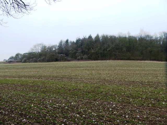
Hawk Croft Copse is a picturesque woodland located in the county of Berkshire, England. Covering an area of approximately 50 acres, it is situated near the village of Hawkridge and is easily accessible from the nearby town of Newbury.

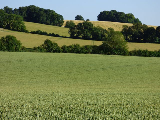
The copse is characterized by its dense vegetation, consisting mainly of native broadleaf trees such as oak, beech, and ash. These towering trees create a lush canopy that provides shade and shelter for a diverse range of wildlife. The forest floor is covered in a thick carpet of ferns, bluebells, and other wildflowers, adding to the enchanting atmosphere of the woodland.

Due to its secluded location, Hawk Croft Copse offers a tranquil and peaceful retreat from the hustle and bustle of everyday life. The copse is a popular destination for nature enthusiasts, hikers, and birdwatchers, who can explore the numerous walking trails that meander through the forest.

The woodland is also home to a rich variety of fauna. Birds such as woodpeckers, owls, and thrushes can be spotted among the treetops, while mammals like deer, foxes, and badgers roam the forest floor. In spring and summer, the copse comes alive with the songs of birds and the buzzing of insects, creating a symphony of natural sounds.

Hawk Croft Copse is not only a haven for wildlife but also serves as an important ecological site, contributing to the conservation of woodland habitats in the area. It is a cherished natural treasure and a beloved destination for those seeking solace in the beauty of nature.

If you have any feedback on the listing, please let us know in the comments section below.

Hawk Croft Copse Images

Images are sourced within 2km of 51.507305/-1.2481854 or Grid Reference SU5278. Thanks to Geograph Open Source API. All images are credited.

The road to Hampstead Norreys
Field of wheat near Compton
Ilsley Road in Compton
The lych gate to St Mary and St Nicholas Church
St Mary and St Nicholas Church in Compton
Disused railway bridge over Aldworth Road The bridge carried the Didcot, Newbury and Southampton Railway over Aldworth Road.
Disused railway bridge over Aldworth Road
The bridge carried the Didcot, Newbury and Southampton Railway over Aldworth Road.
The Compton Swan on High Street
Track to Cheseridge Farm
Farmland near Compton
Field at Cheeseridge Farm
Mayfield Road, Compton A no through road accessing various downland properties above Compton.
The concrete kiosk houses a monitoring borehole belonging to the Environment Agency.
Mayfield Road, Compton
A no through road accessing various downland properties above Compton. The concrete kiosk houses a monitoring borehole belonging to the Environment Agency.
Paddocks by Downs Road It's quite horsey round here.
Paddocks by Downs Road
It's quite horsey round here.
Farmland, Hampstead Norreys Fields of wheat, oil-seed rape and barley rising on the south-eastern side of Hackney Bottom.
Farmland, Hampstead Norreys
Fields of wheat, oil-seed rape and barley rising on the south-eastern side of Hackney Bottom.
Farmland, Compton A crop of wheat alongside the dismantled railway near New Farm.
Farmland, Compton
A crop of wheat alongside the dismantled railway near New Farm.
Farmland, Hampstead Norreys A field of wheat at Ramsworth Cottages and the hillside below Perborough Castle.
Farmland, Hampstead Norreys
A field of wheat at Ramsworth Cottages and the hillside below Perborough Castle.
Ilsley Road, Compton On this evidence, Compton is an unremarkable village somewhere in West Berkshire east of the A34. It used to have a branch of the Pirbright Institute until the good folks at Pirbright, Surrey (where the HQ is) took the view that West Berkshire was just a bit too far west to be considered civilized <span class="nowrap"><a title="https://en.wikipedia.org/wiki/Pirbright_Institute" rel="nofollow ugc noopener" href="https://en.wikipedia.org/wiki/Pirbright_Institute">Link</a><img style="margin-left:2px;" alt="External link" title="External link - shift click to open in new window" src="https://s1.geograph.org.uk/img/external.png" width="10" height="10"/></span>
Ilsley Road, Compton
On this evidence, Compton is an unremarkable village somewhere in West Berkshire east of the A34. It used to have a branch of the Pirbright Institute until the good folks at Pirbright, Surrey (where the HQ is) took the view that West Berkshire was just a bit too far west to be considered civilized LinkExternal link
West along Ilsley Road, Compton This road takes travellers straight out of Compton <span class="nowrap"><a title="https://www.imdb.com/title/tt1398426/?ref_=ttfc_fc_tt" rel="nofollow ugc noopener" href="https://www.imdb.com/title/tt1398426/?ref_=ttfc_fc_tt">Link</a><img style="margin-left:2px;" alt="External link" title="External link - shift click to open in new window" src="https://s1.geograph.org.uk/img/external.png" width="10" height="10"/></span>
West along Ilsley Road, Compton
This road takes travellers straight out of Compton LinkExternal link
The Foinavon, Compton Photo taken at about 15 minutes before sunset on an August evening.

Earlier Geographs show that this pub was - until a few years ago - known as the 'Compton Swan', in Greene King's ownership.  

The present pub-sign shows a black horse jumping a fence.  A quick web-search reveals that Foinavon - trained at a local yard - was the winner of the 1967 Grand National, at odds of 100-1.  His victory came about after a number of horses fell at the 23rd fence, while others pulled up.  Foinavon's rider kept a cool head, cleared the fence and left the rest of the field standing.  <span class="nowrap"><a title="https://en.wikipedia.org/wiki/Foinavon" rel="nofollow ugc noopener" href="https://en.wikipedia.org/wiki/Foinavon">Link</a><img style="margin-left:2px;" alt="External link" title="External link - shift click to open in new window" src="https://s1.geograph.org.uk/img/external.png" width="10" height="10"/></span>

When I first posted this item I guessed that the pub had been renamed in 1967 after the victory at Aintree.  But Fly <a title="https://www.geograph.org.uk/photo/3878799" href="https://www.geograph.org.uk/photo/3878799">Link</a>   - who lives locally - tells me that the change (from 'The Swan') came much later, when it was taken over by the present owners.  

I had also conjectured that the pub's owners in 1967 might have been Arkell's, but Fly tells me that it was a Morland's house.

Both Foinavon and his stable-mate Arkle were named after quartzite-capped mountains in north-west Sutherland:

<a title="https://www.geograph.org.uk/photo/2220176" href="https://www.geograph.org.uk/photo/2220176">Link</a>   <a title="https://www.geograph.org.uk/photo/2893" href="https://www.geograph.org.uk/photo/2893">Link</a>
Mick Garratt links mountains and horses: <a title="https://www.geograph.org.uk/photo/6209424" href="https://www.geograph.org.uk/photo/6209424">Link</a>

In my own experience, north-west Sutherland is quite the wildest place on the British mainland.  It was strange to be reminded of its existence by a pub name in a cosy Berkshire village.
The Foinavon, Compton
Photo taken at about 15 minutes before sunset on an August evening. Earlier Geographs show that this pub was - until a few years ago - known as the 'Compton Swan', in Greene King's ownership. The present pub-sign shows a black horse jumping a fence. A quick web-search reveals that Foinavon - trained at a local yard - was the winner of the 1967 Grand National, at odds of 100-1. His victory came about after a number of horses fell at the 23rd fence, while others pulled up. Foinavon's rider kept a cool head, cleared the fence and left the rest of the field standing. LinkExternal link When I first posted this item I guessed that the pub had been renamed in 1967 after the victory at Aintree. But Fly Link - who lives locally - tells me that the change (from 'The Swan') came much later, when it was taken over by the present owners. I had also conjectured that the pub's owners in 1967 might have been Arkell's, but Fly tells me that it was a Morland's house. Both Foinavon and his stable-mate Arkle were named after quartzite-capped mountains in north-west Sutherland: Link Link Mick Garratt links mountains and horses: Link In my own experience, north-west Sutherland is quite the wildest place on the British mainland. It was strange to be reminded of its existence by a pub name in a cosy Berkshire village.
Show me another place!

Hawk Croft Copse is located at Grid Ref: SU5278 (Lat: 51.507305, Lng: -1.2481854)

Unitary Authority: West Berkshire

Police Authority: Thames Valley

What 3 Words

///consoles.lame.bumpy. Near Compton, Berkshire

Related Wikis

The Downs School, Compton

The Downs School is a comprehensive secondary school in the village of Compton, Berkshire, England. It is a state school run by West Berkshire Education...

Compton railway station

Compton railway station was a station on the Didcot, Newbury and Southampton Railway in England. Compton was the largest station between Newbury, Berkshire...

Compton, Berkshire

Compton is a village and civil parish in the River Pang valley in the Berkshire Downs about 6 miles (9.7 km) south of Didcot. == Geography == Compton is...

East Ilsley

East Ilsley is a village and civil parish in the Berkshire Downs in West Berkshire, north of Newbury. The village is centred immediately east of the A34...

Perborough Castle

Perborough Castle is the site of an Iron Age univallate hillfort located at Compton in Berkshire. The site covers approximately 14 acres (5.7 ha), and...

Ashridge Wood

Ashridge Wood is a 15.9-hectare (39-acre) biological Site of Special Scientific Interest south-west of Compton in Berkshire. It is in the North Wessex...

Hampstead Norris railway station

Hampstead Norris railway station was a station on the Didcot, Newbury and Southampton Railway in England. It served the village of Hampstead Norreys in...

Hampstead Norreys

Hampstead Norreys (alternatively spelt Hampstead Norris as it is pronounced) is a village and civil parish in Berkshire, England. It is centred on the...

Nearby Amenities

Located within 500m of 51.507305,-1.2481854
Barrier: kissing_gate
Foot: yes
Lat/Long: 51.5079607/-1.2428477
Barrier: kissing_gate
Foot: yes
Lat/Long: 51.5058557/-1.2422205
Power: pole
Source: Bing
Lat/Long: 51.5090414/-1.2430351
Power: pole
Source: Bing
Lat/Long: 51.5104486/-1.2475601
Power: pole
Source: Bing
Lat/Long: 51.5091699/-1.2438531
The data included in this document is from www.openstreetmap.org. The data is made available under ODbL.

Have you been to Hawk Croft Copse?

Leave your review of Hawk Croft Copse below (or comments, questions and feedback).