Clarke's Plantation

Wood, Forest in Yorkshire Hambleton

England

Clarke's Plantation

Minor road in Scugdale The road is seen looking east; it ends as a public road about two kilometres distant at Scugdale Hall.
Minor road in Scugdale Credit: Trevor Littlewood

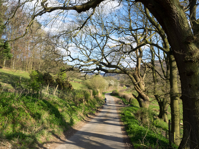
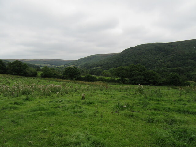
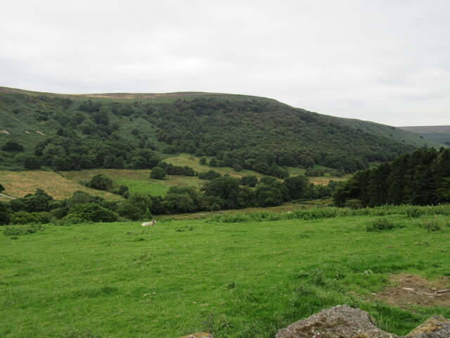
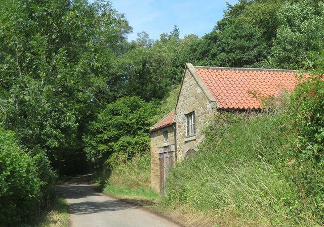
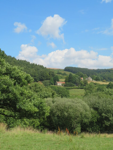
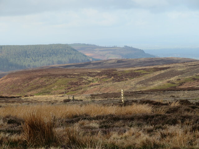
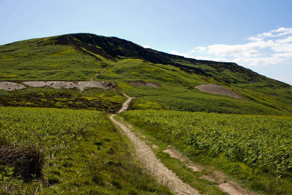
Clarke's Plantation is a picturesque woodland located in the county of Yorkshire, England. Situated near the village of Wood, the plantation covers a vast area of forested land, offering visitors a tranquil and serene escape from the hustle and bustle of urban life.

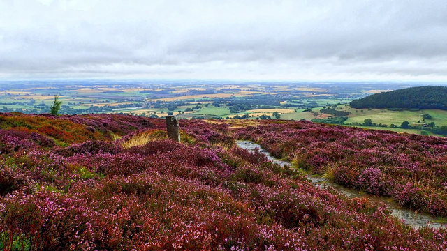
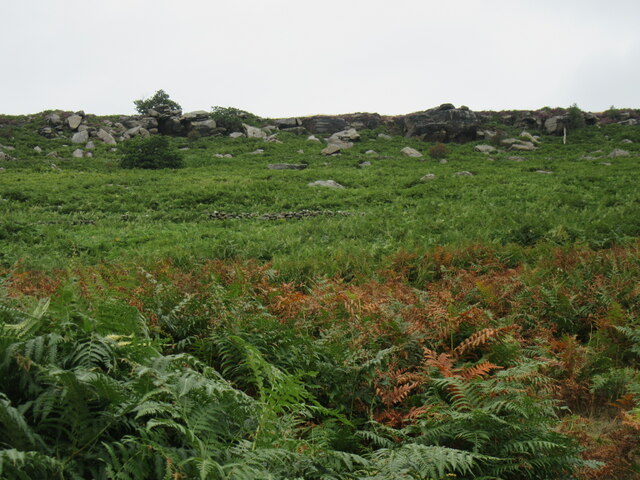
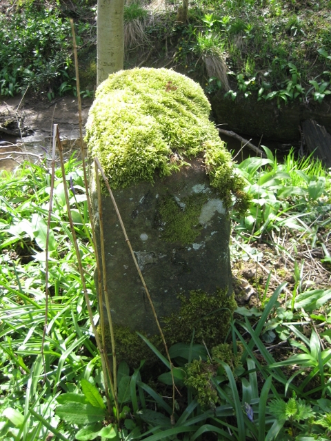
The plantation is characterized by its diverse range of tree species, including oak, beech, and pine, which create a vibrant and thriving ecosystem. The dense foliage provides a natural habitat for numerous wildlife species, making it a popular spot for nature enthusiasts and bird watchers.

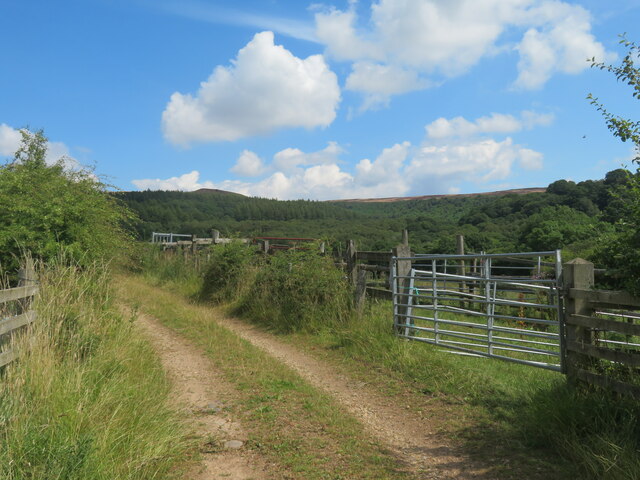
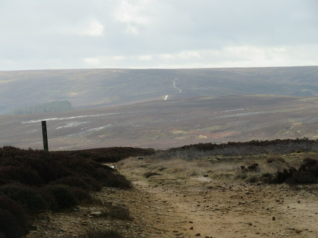
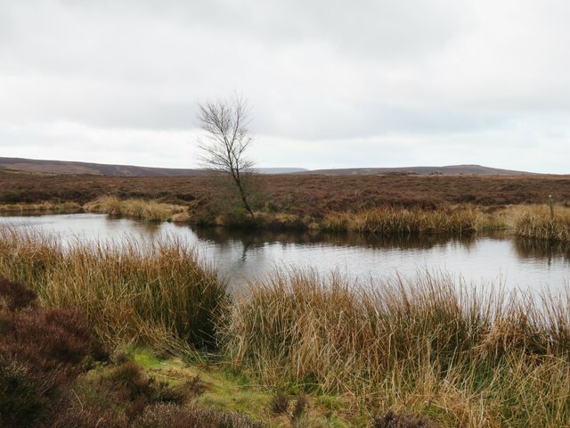
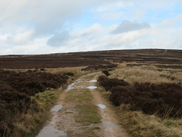
Walking through Clarke's Plantation, visitors can explore a network of well-maintained trails that wind their way through the forest. These trails offer stunning views of the surrounding countryside and lead to hidden gems such as a small lake, where visitors can enjoy a peaceful picnic or simply relax and soak in the serene atmosphere.

The plantation is also home to a variety of flora, with wildflowers and ferns dotting the forest floor. During the spring months, the woodland comes alive with a burst of color as bluebells and daffodils bloom, creating a truly enchanting sight.

Clarke's Plantation is open to the public year-round, and admission is free. The plantation also offers guided nature walks and educational programs for children, promoting a greater understanding and appreciation for the natural world.

Overall, Clarke's Plantation in Yorkshire is a hidden gem, offering visitors a chance to connect with nature and experience the beauty of a traditional English woodland.

If you have any feedback on the listing, please let us know in the comments section below.

Clarke's Plantation Images

Images are sourced within 2km of 54.393575/-1.2084485 or Grid Reference NZ5100. Thanks to Geograph Open Source API. All images are credited.

Minor road in Scugdale The road is seen looking east; it ends as a public road about two kilometres distant at Scugdale Hall.
Minor road in Scugdale
The road is seen looking east; it ends as a public road about two kilometres distant at Scugdale Hall.
On Faceby Bank There’s only a week or two of the purple haze so I have to make the most of the heather, providing some colour on a wet morning when the horizon is lost to the mist. The view is down to Swainby with wooded Whorl Hill on the right.

From my blog <span class="nowrap"><a title="http://www.fhithich.uk/?p=20075" rel="nofollow ugc noopener" href="http://www.fhithich.uk/?p=20075">Link</a><img style="margin-left:2px;" alt="External link" title="External link - shift click to open in new window" src="https://s1.geograph.org.uk/img/external.png" width="10" height="10"/></span>
On Faceby Bank
There’s only a week or two of the purple haze so I have to make the most of the heather, providing some colour on a wet morning when the horizon is lost to the mist. The view is down to Swainby with wooded Whorl Hill on the right. From my blog LinkExternal link
Old Boundary Marker on Round Hill by the Cleveland Way Boundary Marker on Round Hill, by the Cleveland Way, in parish of Faceby (Hambleton District).

Surveyed

Milestone Society National ID: YN_FACWHO04bm
Old Boundary Marker on Round Hill by the Cleveland Way
Boundary Marker on Round Hill, by the Cleveland Way, in parish of Faceby (Hambleton District). Surveyed Milestone Society National ID: YN_FACWHO04bm
Scugdale near Sparrow Hall Looking SE from the road.
Scugdale near Sparrow Hall
Looking SE from the road.
Near Scugdale Road Looking SW from the road.
Near Scugdale Road
Looking SW from the road.
Barker's Crags Looking north up at Barker's Crags from the track that climbs up to Barker's Ridge.
Barker's Crags
Looking north up at Barker's Crags from the track that climbs up to Barker's Ridge.
Barker's Ridge view Looking NE into Raisdale.
Barker's Ridge view
Looking NE into Raisdale.
Boundary Stone Boundary stone with F carved into it near Barker's Crags.
Boundary Stone
Boundary stone with F carved into it near Barker's Crags.
Bilsdale West Moor Near the demolished gliding club.
Bilsdale West Moor
Near the demolished gliding club.
Old Guide Stone, Scugdale Beck The guide stone is located between the road and the ford, on the verge on the south west side of the road. Parish of Whorlton (Hambleton District). Carved stone post. Faded inscription on 2 sides.

Milestone Society National ID: YN_XNZ5000
Old Guide Stone, Scugdale Beck
The guide stone is located between the road and the ford, on the verge on the south west side of the road. Parish of Whorlton (Hambleton District). Carved stone post. Faded inscription on 2 sides. Milestone Society National ID: YN_XNZ5000
Roadside barn, Scugdale Barn, or possible coach house by the side of the Scugdale road close to Sunny Side. There's an OS cut mark at the bottom of the archway.
Roadside barn, Scugdale
Barn, or possible coach house by the side of the Scugdale road close to Sunny Side. There's an OS cut mark at the bottom of the archway.
A view across Scugdale Taken on a perfect July day. The view across the dale towards Sparrow Hall and Fog Close.
A view across Scugdale
Taken on a perfect July day. The view across the dale towards Sparrow Hall and Fog Close.
It's not a dale There's an old story, repeated in Harry Mead's book 'A prospect of the North York Moors' that during the preparation of early OS maps, a surveyor asked a local what the name of this 'dale' was. 'It's not a dale' was the alleged reply, and that is why it is now called Snotterdale.
It's not a dale
There's an old story, repeated in Harry Mead's book 'A prospect of the North York Moors' that during the preparation of early OS maps, a surveyor asked a local what the name of this 'dale' was. 'It's not a dale' was the alleged reply, and that is why it is now called Snotterdale.
Downhill on the way up the dale The dead end road in Scugdale makes a short descent from a corner near Sparrow Hall.
Downhill on the way up the dale
The dead end road in Scugdale makes a short descent from a corner near Sparrow Hall.
Grouse butts on the moor Definitely third class grouse butts, being just a rudimentary wooden screen. Looking west across the depths of Scugdale towards the wooded flanks of Whorlton Moor and Beacon Hill beyond.
Grouse butts on the moor
Definitely third class grouse butts, being just a rudimentary wooden screen. Looking west across the depths of Scugdale towards the wooded flanks of Whorlton Moor and Beacon Hill beyond.
Miles of moorland On the high ground of Bilsdale West Moor, looking south along a track which continues for several miles before eventually dropping into upper Ryedale.
Miles of moorland
On the high ground of Bilsdale West Moor, looking south along a track which continues for several miles before eventually dropping into upper Ryedale.
Brian's Pond Small pond on the moor at the meeting point of several paths. Directly behind the small windblown tree can be seen the distant ridge that is Black Hambleton. Nearer and to the right is Whorlton Moor.
Brian's Pond
Small pond on the moor at the meeting point of several paths. Directly behind the small windblown tree can be seen the distant ridge that is Black Hambleton. Nearer and to the right is Whorlton Moor.
Path across the moor Looking north from near Brian's Pond, but is this the bridleway? The map would suggest otherwise as the clear track appears to be some 10-20m west of the official BW line which runs through some boggy heather.
Path across the moor
Looking north from near Brian's Pond, but is this the bridleway? The map would suggest otherwise as the clear track appears to be some 10-20m west of the official BW line which runs through some boggy heather.
Show me another place!

Clarke's Plantation is located at Grid Ref: NZ5100 (Lat: 54.393575, Lng: -1.2084485)

Division: North Riding

Administrative County: North Yorkshire

District: Hambleton

Police Authority: North Yorkshire

What 3 Words

///goodnight.furniture.dolphin. Near Bilsdale, North Yorkshire

Related Wikis

Cleveland Hills

The Cleveland Hills are a range of hills on the north-west edge of the North York Moors in North Yorkshire, England, overlooking Cleveland and Teesside...

Cringle Moor

Cringle Moor (also known as Cranimoor), at 432 m (1,417 ft), is the third-highest hill in the North York Moors, England, and the highest point west of...

Faceby

Faceby is a small village and civil parish in North Yorkshire, England. It is at the north-west corner of the North York Moors and near Stokesley. ��2...

Whorlton, North Yorkshire

Whorlton is a hamlet and civil parish in the Hambleton District of North Yorkshire, England. It is very near Swainby and the A19, and 6 miles south west...

Busby Hall

Busby Hall is a Grade II* listed Country House in Little Busby, North Yorkshire, England, close to the village of Carlton-in-Cleveland. The house and parkland...

Whorlton Castle

Whorlton Castle is a ruined medieval castle situated near the abandoned village of Whorlton (at grid reference NZ4802) in North Yorkshire, England. It...

Swainby

Swainby is a village in the Hambleton District of North Yorkshire, England. It is situated on the A172 road, 8 miles (13 km) north-east from Northallerton...

Carlton in Cleveland

Carlton in Cleveland is a village in the district of North Yorkshire, England, and on the edge of the North York Moors National Park. It is situated approximately...

Nearby Amenities

Located within 500m of 54.393575,-1.2084485
Parking
Lat/Long: 54.3937827/-1.2067984
Barrier: stile
Lat/Long: 54.3963016/-1.2045931
Barrier: stile
Lat/Long: 54.3947803/-1.2136378
Barrier: stile
Lat/Long: 54.395917/-1.2053123
Scugdale Hall
Place: isolated_dwelling
Lat/Long: 54.3929546/-1.204053
The data included in this document is from www.openstreetmap.org. The data is made available under ODbL.

Have you been to Clarke's Plantation?

Leave your review of Clarke's Plantation below (or comments, questions and feedback).