Brier Plantation

Wood, Forest in Nottinghamshire Ashfield

England

Brier Plantation

Track and Bridleway off Annesley Road Heading in the direction of Thurland Hall Farm.
Track and Bridleway off Annesley Road Credit: Jonathan Clitheroe

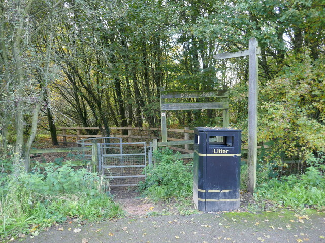
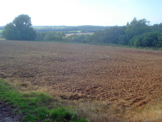
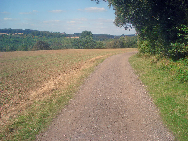
Brier Plantation is a picturesque woodland located in Nottinghamshire, England. Spanning across a vast area, the plantation is renowned for its rich biodiversity and tranquil atmosphere. It is situated within the larger Sherwood Forest, a legendary forest associated with the tales of Robin Hood.

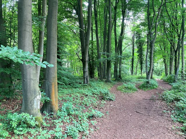
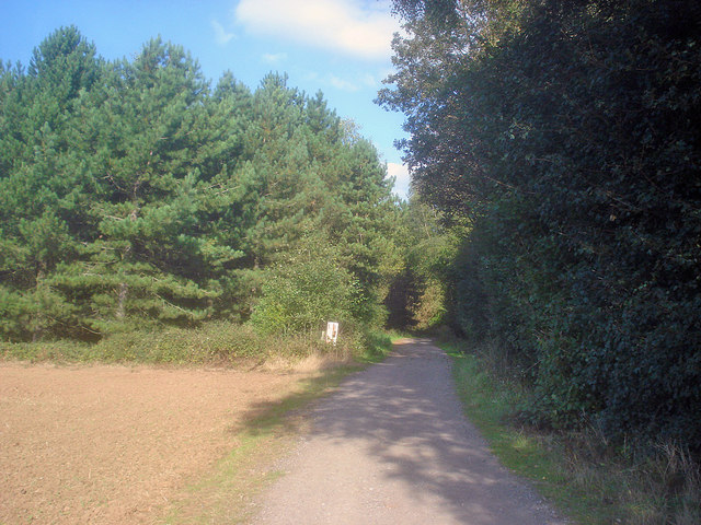
The woodland is primarily composed of native trees such as oak, birch, and beech, creating a dense and verdant canopy that provides a habitat for numerous species of flora and fauna. The forest floor is carpeted with ferns, bluebells, and other wildflowers, enhancing its natural beauty.

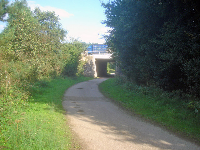
Brier Plantation offers a multitude of recreational activities for nature enthusiasts. There are well-maintained trails that wind through the woodland, allowing visitors to explore its hidden gems. These trails are popular among hikers, joggers, and cyclists who seek a peaceful escape from the bustle of everyday life. Birdwatchers can also spot a variety of species in the plantation, including woodpeckers, owls, and songbirds.

The plantation is managed by a dedicated team of conservationists and foresters who work tirelessly to preserve its ecological integrity. They undertake regular tree planting initiatives and monitor the health of the existing trees to ensure the sustainability of the woodland.

Brier Plantation is not only a haven for nature lovers but also plays a vital role in carbon sequestration and climate regulation. Its dense vegetation acts as a carbon sink, absorbing and storing carbon dioxide from the atmosphere, contributing to mitigating the effects of climate change.

Overall, Brier Plantation is a cherished natural asset in Nottinghamshire, offering a serene and enriching experience for all who visit.

If you have any feedback on the listing, please let us know in the comments section below.

Brier Plantation Images

Images are sourced within 2km of 53.036277/-1.2407974 or Grid Reference SK5149. Thanks to Geograph Open Source API. All images are credited.

Track and Bridleway off Annesley Road Heading in the direction of Thurland Hall Farm.
Track and Bridleway off Annesley Road
Heading in the direction of Thurland Hall Farm.
Entrance to Dob Park Dob Park is a 20 hectare community woodland.
Entrance to Dob Park
Dob Park is a 20 hectare community woodland.
Footpath to Bramble Grove, Wighay
Woodland near Beauvale Priory Unofficial path is situated in an area of the wood marked as Callis Hagg. We are also close to Robin Hood's Well here although I didn't find any evidence on the ground today.
Woodland near Beauvale Priory
Unofficial path is situated in an area of the wood marked as Callis Hagg. We are also close to Robin Hood's Well here although I didn't find any evidence on the ground today.
Beauvale Priory and Abbey Farm Pictured from the access road to the south of the location. The priory can be seen by visitors when the tea room nearby is open. It wasn't on this day and I was shunted off.
Beauvale Priory and Abbey Farm
Pictured from the access road to the south of the location. The priory can be seen by visitors when the tea room nearby is open. It wasn't on this day and I was shunted off.
Remains of Beauvale Priory This priory was built for Carthusian monks in 1343 - one of only a handful to be built in England for this order. They resisted Henry VIII's Oath of Supremacy and two members of the charterhouse later achieved martyrdom. A small portion of the remains are located outside this grid square in SK4950.
Remains of Beauvale Priory
This priory was built for Carthusian monks in 1343 - one of only a handful to be built in England for this order. They resisted Henry VIII's Oath of Supremacy and two members of the charterhouse later achieved martyrdom. A small portion of the remains are located outside this grid square in SK4950.
If only! 50 mile per hour signs in the M1 roadworks as the traffic continues to be gridlocked going North.
If only!
50 mile per hour signs in the M1 roadworks as the traffic continues to be gridlocked going North.
Motorway bridge at Park Springs Wood Looking east along Kennel Lane to the M1.
Motorway bridge at Park Springs Wood
Looking east along Kennel Lane to the M1.
Farm track enters Park Springs Wood Heading north-east as the track reaches the conifer forest.
Farm track enters Park Springs Wood
Heading north-east as the track reaches the conifer forest.
Arable land near Park Springs Wood View north-west from the edge of the wood. An autumn-sown crop is just breaking through the ground.
Arable land near Park Springs Wood
View north-west from the edge of the wood. An autumn-sown crop is just breaking through the ground.
Farm track near Park Springs Wood Leading northwards along the edge of the wood. More woodland at The Dumbles on the other side of the field.
Farm track near Park Springs Wood
Leading northwards along the edge of the wood. More woodland at The Dumbles on the other side of the field.
Winter Cycling An area of outstanding beauty and history; Moorgreen has a rich heritage and is now a popular area for all kinds of outdoor pursuits.  In the upper valley lies the ruins of Beauvale Priory is situated in the grounds of Beauvale Manor Farm.
Winter Cycling
An area of outstanding beauty and history; Moorgreen has a rich heritage and is now a popular area for all kinds of outdoor pursuits. In the upper valley lies the ruins of Beauvale Priory is situated in the grounds of Beauvale Manor Farm.
Blue Bells Blue Bells along an unofficial path near Felly Mill.
Blue Bells
Blue Bells along an unofficial path near Felly Mill.
Notts - Moorgreen NG16 Track leading to Beauvale Abbey Farm with the remains of Beauvale Priory behind it. This track is a left turn off New Road, which in turn is a right-hand turning off the B600 in the village of Moorgreen. The priory was founded in 1343. When Henry VIII dissolved the monasteries in the 1530s Prior Webster journeyed to London to protest. He was never seen again. His successor, Prior Thomas Woodcock and his brethren finally surrendered the monastery to the King on July 24, 1540. An annual pilgrimage is made to the site led by the Bishop of Nottingham, otherwise the ruins can be visited almost daily, except on Mondays and Tuesdays.
Notts - Moorgreen NG16
Track leading to Beauvale Abbey Farm with the remains of Beauvale Priory behind it. This track is a left turn off New Road, which in turn is a right-hand turning off the B600 in the village of Moorgreen. The priory was founded in 1343. When Henry VIII dissolved the monasteries in the 1530s Prior Webster journeyed to London to protest. He was never seen again. His successor, Prior Thomas Woodcock and his brethren finally surrendered the monastery to the King on July 24, 1540. An annual pilgrimage is made to the site led by the Bishop of Nottingham, otherwise the ruins can be visited almost daily, except on Mondays and Tuesdays.
Notts - Moorgreen NG16 A section of New Road, (a right-hand turning out of the village of Moorgreen) and two houses, between which runs the farm track that leads to Beauvale Abbey Farm and the ruins of Beauvale Priory. These may be visited almost daily, except for Tuesdays.
Notts - Moorgreen NG16
A section of New Road, (a right-hand turning out of the village of Moorgreen) and two houses, between which runs the farm track that leads to Beauvale Abbey Farm and the ruins of Beauvale Priory. These may be visited almost daily, except for Tuesdays.
Notts - Beauvale Priory NG16 A view of the farmhouse (Beauvale Abbey Farm) and the remains of Beauvale Priory situated off New Road, a right-hand turning out of the village of Moorgreen. Prior Thomas Woodcock and his brethren very reluctantly surrendered the monastery to King Henry VIII on July 24, 1540. A pilgrimage is made to the site once a year led by the Bishop of Nottingham, otherwise the ruins can be visited almost daily except on Tuesdays.
Notts - Beauvale Priory NG16
A view of the farmhouse (Beauvale Abbey Farm) and the remains of Beauvale Priory situated off New Road, a right-hand turning out of the village of Moorgreen. Prior Thomas Woodcock and his brethren very reluctantly surrendered the monastery to King Henry VIII on July 24, 1540. A pilgrimage is made to the site once a year led by the Bishop of Nottingham, otherwise the ruins can be visited almost daily except on Tuesdays.
Moss covered branches In a hedge beside a wood which appears to be called Callis Hagg.
Moss covered branches
In a hedge beside a wood which appears to be called Callis Hagg.
Path beside Callis Hagg
Show me another place!

Brier Plantation is located at Grid Ref: SK5149 (Lat: 53.036277, Lng: -1.2407974)

Administrative County: Nottinghamshire

District: Ashfield

Police Authority: Nottinghamshire

What 3 Words

///crate.record.thinks. Near Hucknall, Nottinghamshire

Related Wikis

The Holgate Academy

The Holgate Academy (formerly Holgate School) is a coeducational secondary school and sixth form with academy status, located in Hucknall, Nottinghamshire...

Church of St Peter and St Paul, Hucknall

The Church of St Peter and St Paul, Hucknall is a parish church in the Church of England in the Westville suburb of Hucknall, Nottinghamshire. == History... ==

Beauvale Priory

Beauvale Priory (also known as Beauvale Charterhouse) was a Carthusian monastery in Beauvale, Nottinghamshire. It is a scheduled ancient monument. ��2...

Beauvale

Beauvale, or Beauvale Newthorpe, is a village in Nottinghamshire, England. It is located 1 mile to the east of Eastwood. It is in Greasley parish. Beauvale...

Westville, Nottinghamshire

Westville is a residential area to the west of Hucknall. It is approximately eight miles north-west of Nottingham, England. It has many new build houses...

The National Academy

The National Church of England Academy, formerly known as The National School, is a Church of England secondary school in the Ashfield district of Nottinghamshire...

Hucknall Town F.C.

Hucknall Town Football Club is a football club based in the town of Hucknall, Nottinghamshire, England. The club is a member of the United Counties League...

Hucknall Central railway station

Hucknall Central railway station, originally known as Hucknall Town, was a station in Hucknall on the Great Central Railway's main line from Manchester...

Nearby Amenities

Located within 500m of 53.036277,-1.2407974
Barrier: cycle_barrier
Motor Vehicle: no
Lat/Long: 53.0328414/-1.2364113
Direction: 120
Generator Method: photovoltaic
Generator Output Electricity: yes
Generator Solar Modules: 10
Generator Source: solar
Generator Type: solar_photovoltaic_panel
Location: roof
Power: generator
Lat/Long: 53.0327707/-1.2367054
Direction: 215
Generator Method: photovoltaic
Generator Output Electricity: yes
Generator Solar Modules: 16
Generator Source: solar
Generator Type: solar_photovoltaic_panel
Location: roof
Power: generator
Lat/Long: 53.033017/-1.2371038
Direction: 215
Generator Method: photovoltaic
Generator Output Electricity: yes
Generator Solar Modules: 16
Generator Source: solar
Generator Type: solar_photovoltaic_panel
Location: roof
Power: generator
Lat/Long: 53.0331347/-1.2372891
Direction: 215
Generator Method: photovoltaic
Generator Output Electricity: yes
Generator Solar Modules: 7
Generator Source: solar
Generator Type: solar_photovoltaic_panel
Location: roof
Power: generator
Lat/Long: 53.0335556/-1.2372594
Direction: ESE
Generator Method: photovoltaic
Generator Output Electricity: yes
Generator Solar Modules: 12
Generator Source: solar
Generator Type: solar_photovoltaic_panel
Location: roof
Power: generator
Lat/Long: 53.0333741/-1.2360795
Direction: 35
Generator Method: photovoltaic
Generator Output Electricity: yes
Generator Solar Modules: 9
Generator Source: solar
Generator Type: solar_photovoltaic_panel
Location: roof
Power: generator
Lat/Long: 53.033592/-1.2372483
Barrier: entrance
Lat/Long: 53.035922/-1.2436763
Barrier: entrance
Lat/Long: 53.0369837/-1.2464802
Barrier: entrance
Lat/Long: 53.0388714/-1.238274
Man Made: tower
Tower Type: communication
Lat/Long: 53.0359119/-1.2401515
Beacon Hill
Natural: peak
Lat/Long: 53.0364727/-1.2337628
The data included in this document is from www.openstreetmap.org. The data is made available under ODbL.

Have you been to Brier Plantation?

Leave your review of Brier Plantation below (or comments, questions and feedback).