Bagley Wood

Wood, Forest in Berkshire Vale of White Horse

England

Bagley Wood

Houses on Brumcombe Lane, Bayworth
Houses on Brumcombe Lane, Bayworth Credit: David Howard

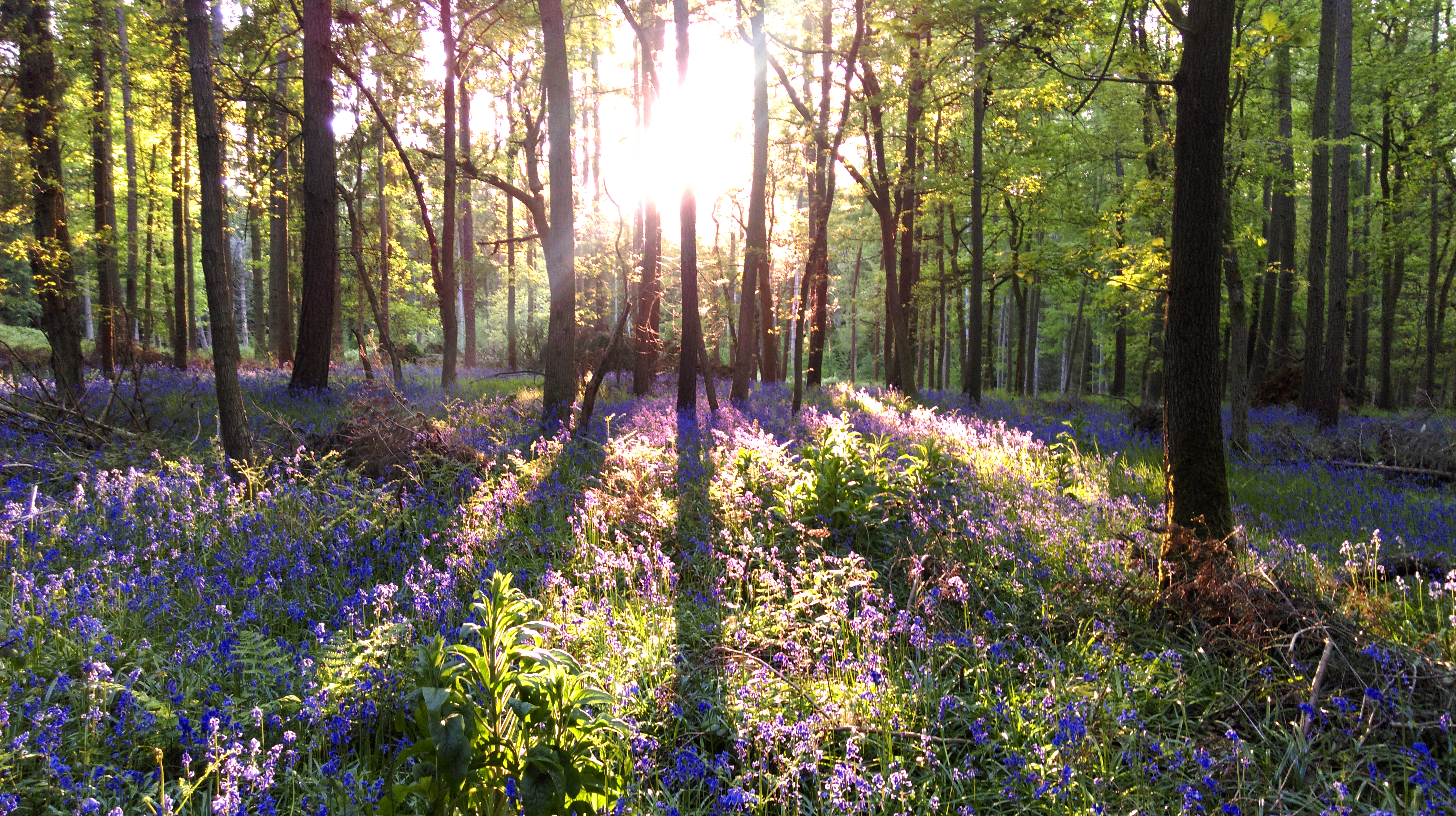
Bagley Wood is a picturesque woodland located in Berkshire, England. Covering an area of approximately 130 acres, it is a popular destination for nature lovers and outdoor enthusiasts alike. The wood is situated just a few miles south of the city of Oxford, making it easily accessible for visitors from both Berkshire and Oxfordshire.

Bagley Wood is primarily composed of deciduous trees, including oak, beech, and ash, which create a stunning canopy of greenery throughout the year. The woodland floor is adorned with a diverse range of flora, such as bluebells, wild garlic, and wood anemones, providing a vibrant and colorful display during the spring and summer months.

The wood is home to a variety of wildlife, including deer, foxes, badgers, and a plethora of bird species. Birdwatchers can often spot woodpeckers, nuthatches, and various types of owls in the area. Additionally, Bagley Wood is known for its butterfly population, with species such as the silver-washed fritillary and purple hairstreak gracing the woodland with their presence.

The wood offers numerous walking trails and paths, allowing visitors to explore its beauty at their own pace. There are also designated picnic areas, providing a perfect spot for a leisurely lunch amidst the tranquil surroundings. Furthermore, the wood is well-maintained, with clear signage and information boards, making it easy for visitors to navigate and learn about the different aspects of the woodland.

Overall, Bagley Wood offers a serene and enchanting escape from the hustle and bustle of everyday life. Whether you are an avid nature lover or simply seeking some peace and tranquility, this woodland gem in Berkshire is sure to captivate and delight.

If you have any feedback on the listing, please let us know in the comments section below.

Bagley Wood Images

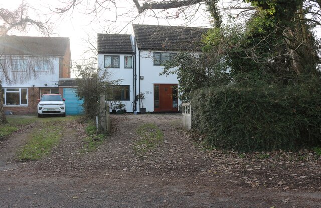
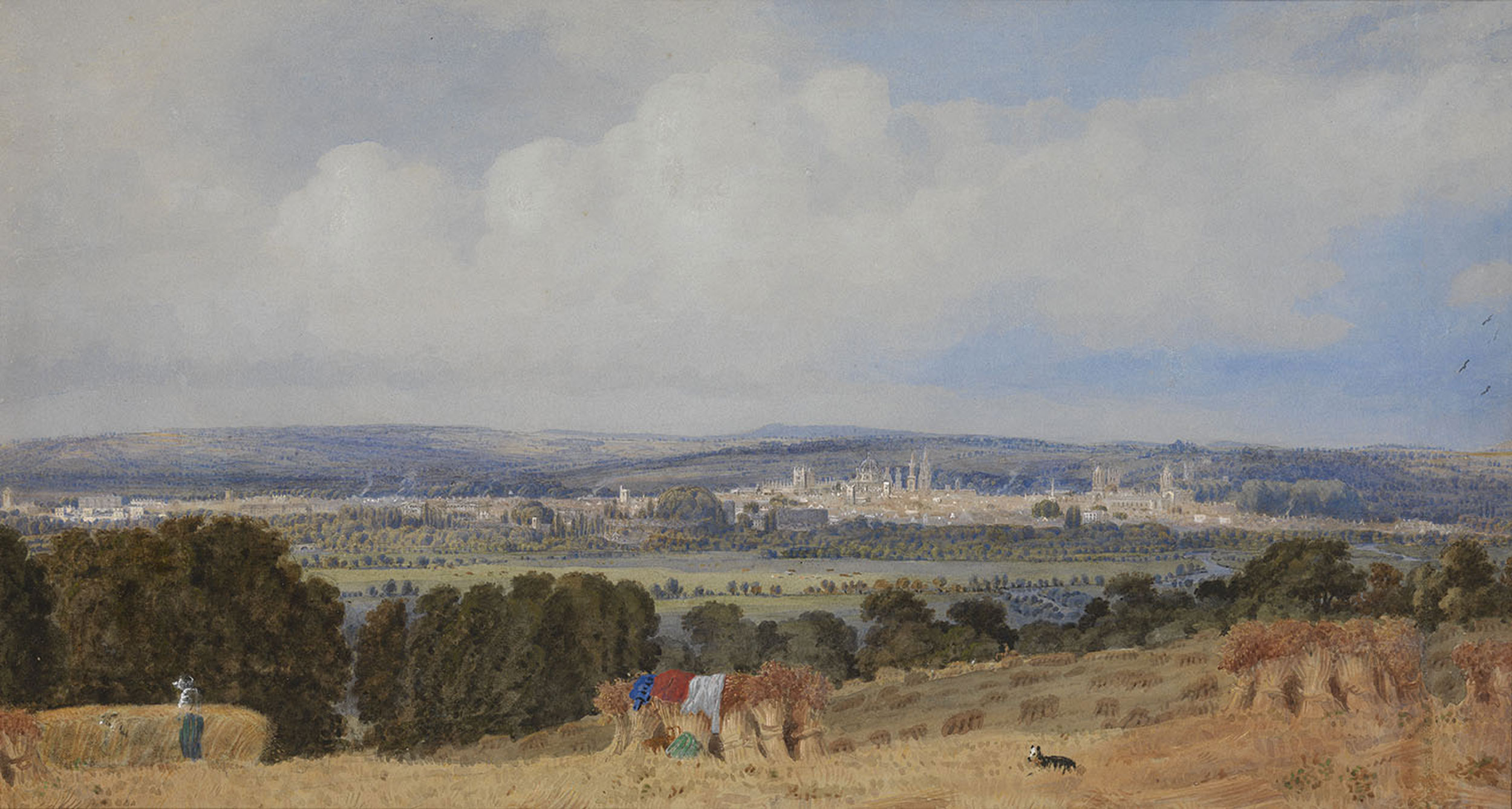
Images are sourced within 2km of 51.717689/-1.2626235 or Grid Reference SP5102. Thanks to Geograph Open Source API. All images are credited.

Houses on Brumcombe Lane, Bayworth
Bayworth Lane, Boars Hill
Brumcombe Lane, Bayworth
Old Berkeley Golf Course The first piece of land acquired by the Oxford Preservation Trust. More info. at <span class="nowrap"><a title="http://www.oxfordpreservation.org.uk" rel="nofollow ugc noopener" href="http://www.oxfordpreservation.org.uk">Link</a><img style="margin-left:2px;" alt="External link" title="External link - shift click to open in new window" src="https://s1.geograph.org.uk/img/external.png" width="10" height="10"/></span> . Some of the 'Dreaming Spires' of Oxford can just be seen in the far distance.
Old Berkeley Golf Course
The first piece of land acquired by the Oxford Preservation Trust. More info. at LinkExternal link . Some of the 'Dreaming Spires' of Oxford can just be seen in the far distance.
Road junction in Boars Hill
Benchmark and letter box, Foxcombe Lane The wall is the boundary wall of Overdale Lodge at the junction of Foxcombe Road and Lincombe Lane. The Ordnance Survey cut mark benchmark is described on the Bench Mark Database at <span class="nowrap"><a title="http://www.bench-marks.org.uk/bm27417" rel="nofollow ugc noopener" href="http://www.bench-marks.org.uk/bm27417">Link</a><img style="margin-left:2px;" alt="External link" title="External link - shift click to open in new window" src="https://s1.geograph.org.uk/img/external.png" width="10" height="10"/></span>
Benchmark and letter box, Foxcombe Lane
The wall is the boundary wall of Overdale Lodge at the junction of Foxcombe Road and Lincombe Lane. The Ordnance Survey cut mark benchmark is described on the Bench Mark Database at LinkExternal link
Overdale Lodge at Foxcombe Road / Lincombe Lane junction There is an OS benchmark <a href="https://www.geograph.org.uk/photo/3379038">SP4901 : Benchmark and letter box, Foxcombe Lane</a> on the wall pier beneath the George VI letterbox
Overdale Lodge at Foxcombe Road / Lincombe Lane junction
There is an OS benchmark SP4901 : Benchmark and letter box, Foxcombe Lane on the wall pier beneath the George VI letterbox
Benchmark on roadside farm building wall, Foxcombe Road Ordnance Survey cut mark benchmark described on the Bench Mark Database at <span class="nowrap"><a title="http://www.bench-marks.org.uk/bm47749" rel="nofollow ugc noopener" href="http://www.bench-marks.org.uk/bm47749">Link</a><img style="margin-left:2px;" alt="External link" title="External link - shift click to open in new window" src="https://s1.geograph.org.uk/img/external.png" width="10" height="10"/></span>
Benchmark on roadside farm building wall, Foxcombe Road
Ordnance Survey cut mark benchmark described on the Bench Mark Database at LinkExternal link
Junction of Berkeley Road and Foxcombe Road There is an OS benchmark <a href="https://www.geograph.org.uk/photo/3379710">SP4901 : Benchmark on roadside farm building wall, Foxcombe Road</a> on the wall pier right of the SV sign, itself right of the road name sign. The wall is in fact one boundary wall of a farm 3-sided roofless enclosure.
Junction of Berkeley Road and Foxcombe Road
There is an OS benchmark SP4901 : Benchmark on roadside farm building wall, Foxcombe Road on the wall pier right of the SV sign, itself right of the road name sign. The wall is in fact one boundary wall of a farm 3-sided roofless enclosure.
Brumcombe Lane at the Bayworth boundary There is an overgrown culvert, at the far side of the former gateway on the left hand side of the road beside the 'No footway for 400yds' sign, which may conceal an Ordnance Survey rivet benchmark, see <span class="nowrap"><a title="http://www.bench-marks.org.uk/bm27416" rel="nofollow ugc noopener" href="http://www.bench-marks.org.uk/bm27416">Link</a><img style="margin-left:2px;" alt="External link" title="External link - shift click to open in new window" src="https://s1.geograph.org.uk/img/external.png" width="10" height="10"/></span>
Brumcombe Lane at the Bayworth boundary
There is an overgrown culvert, at the far side of the former gateway on the left hand side of the road beside the 'No footway for 400yds' sign, which may conceal an Ordnance Survey rivet benchmark, see LinkExternal link
Benchmark on 'Bayford' Ordnance Survey cut mark benchmark described on the Bench Mark Database at <span class="nowrap"><a title="http://www.bench-marks.org.uk/bm47858" rel="nofollow ugc noopener" href="http://www.bench-marks.org.uk/bm47858">Link</a><img style="margin-left:2px;" alt="External link" title="External link - shift click to open in new window" src="https://s1.geograph.org.uk/img/external.png" width="10" height="10"/></span>
Benchmark on 'Bayford'
Ordnance Survey cut mark benchmark described on the Bench Mark Database at LinkExternal link
View to Bayworth Looking south east from Boars Hill.
View to Bayworth
Looking south east from Boars Hill.
Footpath on Boars Hill
The Old Berkeley Golf Course A late Summer view over this area of grassy hillside managed by the Oxford Preservation Trust.
The Old Berkeley Golf Course
A late Summer view over this area of grassy hillside managed by the Oxford Preservation Trust.
Foxcombe Road, Boars Hill
Footpath through cow field
'Bayford', Foxcombe Road There is an OS benchmark <a href="https://www.geograph.org.uk/photo/3386854">SP4902 : Benchmark on 'Bayford'</a> on the side of the jut on the right hand side of the path to the front door
'Bayford', Foxcombe Road
There is an OS benchmark SP4902 : Benchmark on 'Bayford' on the side of the jut on the right hand side of the path to the front door
Show me another place!

Bagley Wood is located at Grid Ref: SP5102 (Lat: 51.717689, Lng: -1.2626235)

Administrative County: Oxfordshire

District: Vale of White Horse

Police Authority: Thames Valley

What 3 Words

///tricks.spare.plenty. Near Radley, Oxfordshire

Related Wikis

Bagley Wood

Bagley Wood is a wood in the parish of Kennington between Oxford and Abingdon in Oxfordshire, England (in Berkshire until 1974). It is traversed from...

Hinksey Hill

Hinksey Hill is a hill and residential area 2 miles (3.2 km) south of the centre of Oxford. It is in South Hinksey civil parish, about 0.5 miles (800 m...

Kennington, Oxfordshire

Kennington is a village and civil parish in the Vale of White Horse district of Oxfordshire, just south of Oxford. The village occupies a narrow stretch...
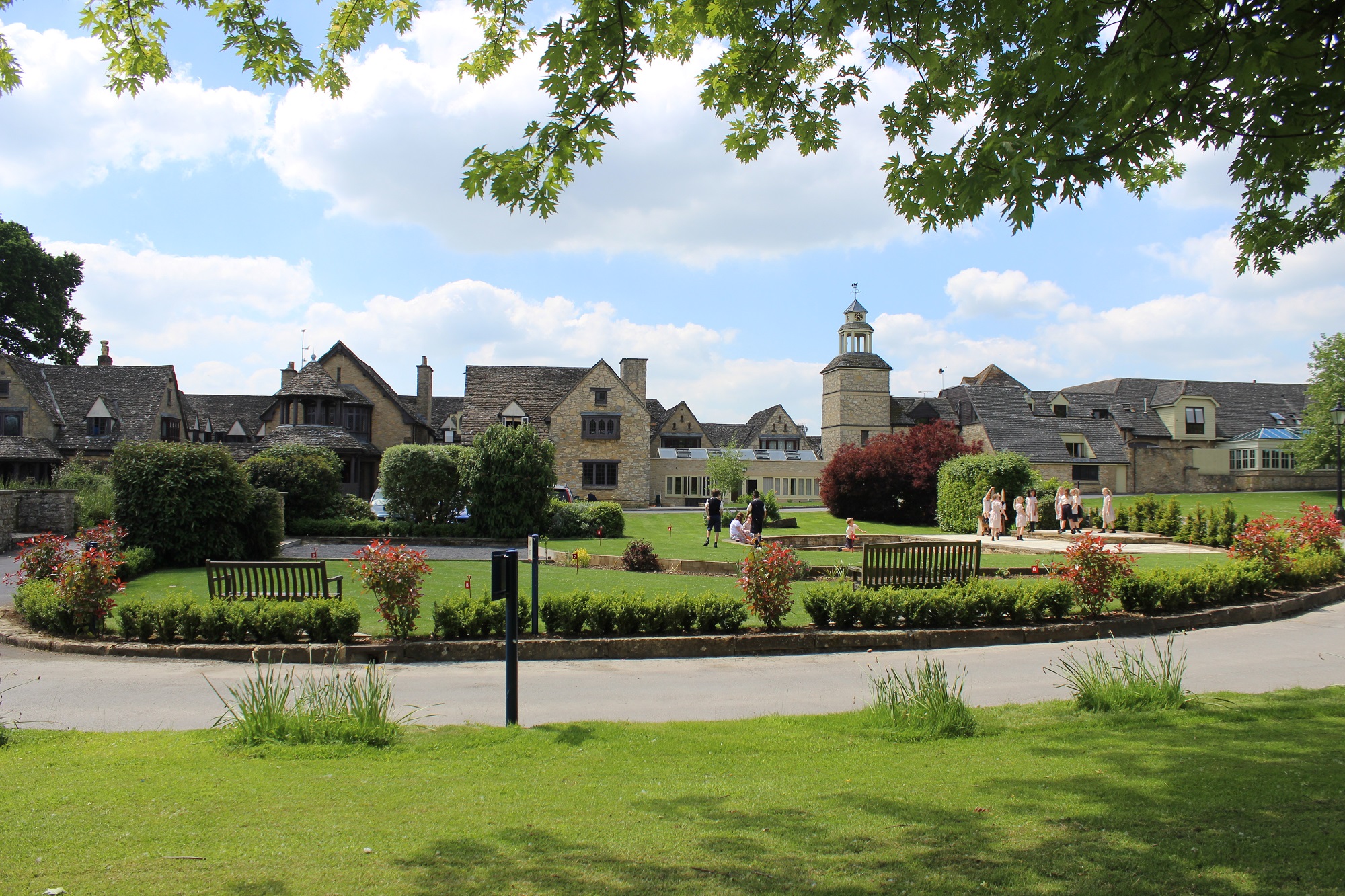
Chandlings

Chandlings, or Chandlings Prep School, known until 2007 as Chandlings Manor School, is an independent co-educational preparatory school at Bagley Wood...

Nearby Amenities

Located within 500m of 51.717689,-1.2626235
Bus Stop
Sawmill
Bus: yes
Local Ref: adj
Naptan AtcoCode: 340001380CNR
Naptan Bearing: N
Naptan CommonName: Sawmill
Naptan Indicator: Outside
Naptan Landmark: Sawmill
Naptan NaptanCode: oxfagpaj
Naptan Street: Oxford Road
Naptan Verified: no
Public Transport: platform
Source: naptan_import
Lat/Long: 51.7136318/-1.2657415
Bus Stop
Sawmill
Bench: yes
Bin: no
Bus: yes
Lit: no
Local Ref: opp
Naptan AtcoCode: 340001380OPP
Naptan Bearing: S
Naptan CommonName: Sawmill
Naptan Indicator: Opposite
Naptan Landmark: Sawmill
Naptan NaptanCode: oxfagpag
Naptan Street: Oxford Road
Naptan Verified: no
Public Transport: platform
Shelter: no
Source: naptan_import
Tactile Paving: no
Lat/Long: 51.7143703/-1.2659322
Ford: yes
Lat/Long: 51.7161735/-1.2683761
Hinksey Hill
Direction: S
Traffic Sign: city_limit
Lat/Long: 51.7207759/-1.2676093
The data included in this document is from www.openstreetmap.org. The data is made available under ODbL.

Have you been to Bagley Wood?

Leave your review of Bagley Wood below (or comments, questions and feedback).