Verge Wood

Wood, Forest in Nottinghamshire Broxtowe

England

Verge Wood

Postbox on Maws Lane
Postbox on Maws Lane Credit: David Lally

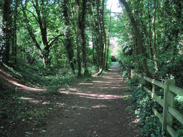
Verge Wood is a picturesque forest located in Nottinghamshire, England. Spread over a vast area of land, this woodland is a popular destination for nature enthusiasts and outdoor adventurers alike. The wood is situated near the village of Wood, providing a natural haven for locals and visitors to escape the hustle and bustle of everyday life.

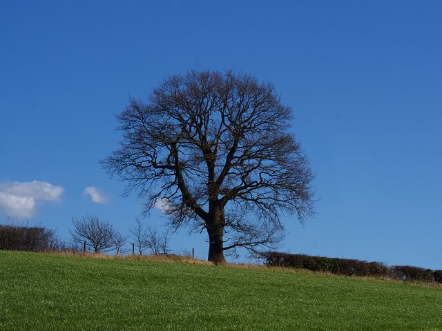
Verge Wood boasts a diverse range of flora and fauna, making it a haven for biodiversity. The forest is primarily composed of deciduous trees, including oak, ash, and beech, which offer a stunning display of colors during the autumn months. This vibrant foliage attracts hikers and photographers, seeking to capture the beauty of nature's transformation.

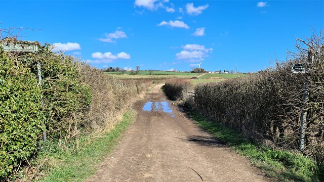
The wood is crisscrossed by a network of well-maintained trails, ensuring easy access for walkers, joggers, and cyclists. These paths wind through the woodland, offering glimpses of tranquil ponds, babbling brooks, and enchanting glades. Birdwatchers will be delighted by the variety of avian species that call Verge Wood home, including woodpeckers, owls, and thrushes.

For those seeking a more immersive experience, Verge Wood provides designated camping areas where visitors can spend a night under the stars, surrounded by nature's serenity. Additionally, guided nature walks and educational programs are often organized, providing valuable insights into the local ecosystem and conservation efforts.

Verge Wood is a true gem of Nottinghamshire, offering a peaceful retreat for individuals and families alike. Whether exploring its trails, observing wildlife, or simply enjoying a picnic amidst the trees, a visit to this woodland is sure to rejuvenate and inspire all who venture within its leafy embrace.

If you have any feedback on the listing, please let us know in the comments section below.

Verge Wood Images

Images are sourced within 2km of 52.991843/-1.2436921 or Grid Reference SK5044. Thanks to Geograph Open Source API. All images are credited.

Postbox on Maws Lane
The Great Northern Railway Path The former Great Northern line between Nottingham and Derby was a casualty of the Beeching era, closing to passengers in 1964 and completely four years later. Here the old trackbed has been converted into a path and cycleway
The Great Northern Railway Path
The former Great Northern line between Nottingham and Derby was a casualty of the Beeching era, closing to passengers in 1964 and completely four years later. Here the old trackbed has been converted into a path and cycleway
St Paul's Court The former St Paul's Methodist Church has been converted to residential use.
St Paul's Court
The former St Paul's Methodist Church has been converted to residential use.
Winter tree on the skyline In a field boundary above Swingate Farm.
Winter tree on the skyline
In a field boundary above Swingate Farm.
Swingate Water Tower Opened in 1950 but no longer operational, the tower on Babbington Lane is visible for miles.
Swingate Water Tower
Opened in 1950 but no longer operational, the tower on Babbington Lane is visible for miles.
Former St Paul's Methodist Church, Kimberley
Swingate Water Tower Brought into use in 1950 but no longer operational
Swingate Water Tower
Brought into use in 1950 but no longer operational
Lane by Strelley Park Farm
Gates to Strelley Park Farm
Carved Tree In a tiny nature reserve.
Carved Tree
In a tiny nature reserve.
Access to Strelley Park Farm Access to the farm.
Access to Strelley Park Farm
Access to the farm.
Footpath near Strelley Park Farm Public footpath adopting the wide track to Swingate Farm.
Footpath near Strelley Park Farm
Public footpath adopting the wide track to Swingate Farm.
Woodland Footpath, Kimberley A short footpath (Johnny's Hill) through woodland linking Oak Lodge Drive (Hardy Street) with the playground and park on Eastwood Road.
Woodland Footpath, Kimberley
A short footpath (Johnny's Hill) through woodland linking Oak Lodge Drive (Hardy Street) with the playground and park on Eastwood Road.
Playground, Kimberley Playground in Queen Elizabeth II Diamond Fields, Kimberley or locally known as Hall Om Wong, its unusual name from old English summarised as “Mr Hall’s home piece of land”. References date back to the 1700’s.
Playground, Kimberley
Playground in Queen Elizabeth II Diamond Fields, Kimberley or locally known as Hall Om Wong, its unusual name from old English summarised as “Mr Hall’s home piece of land”. References date back to the 1700’s.
Hall Om Wong Open Space
New entrance to woods at Watnall
Watnall roofscape Modern housing to the north of the village
Watnall roofscape
Modern housing to the north of the village
Reservoir below ground here, and water tower on horizon
Show me another place!

Verge Wood is located at Grid Ref: SK5044 (Lat: 52.991843, Lng: -1.2436921)

Administrative County: Nottinghamshire

District: Broxtowe

Police Authority: Nottinghamshire

What 3 Words

///send.custom.rush. Near Kimberley, Nottinghamshire

Nearby Locations

Verge Wood Knowle Wood

Related Wikis

Kimberley Town F.C.

Kimberley Town Football Club was a football club based in Kimberley, Nottinghamshire, England. They joined the Midland League in 1971. They reached the...

Kimberley Miners Welfare F.C.

Kimberley Miners Welfare Football Club is a football club based in Kimberley, Nottinghamshire, England. They are currently members of the United Counties...

Nuthall

Nuthall is a village and civil parish located in Nottinghamshire, England, neighbouring Kimberley, Watnall, Cinderhill and Basford. The population of the...

St Patrick's Church, Nuthall

St Patrick's Church, Nuthall is a Grade II* listed parish church in the Church of England in Nuthall. == History == The church was first built in the 13th...

Swingate, Nottinghamshire

Swingate is a small English village positioned between of Kimberley and Babbington, in the Broxtowe district, in the county of Nottinghamshire. == History... ==

Kimberley, Nottinghamshire

Kimberley is a town and civil parish in the Borough of Broxtowe in Nottinghamshire, England, lying 6 miles northwest of Nottingham along the A610. The...
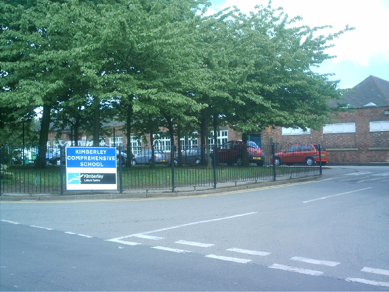
Kimberley School

The Kimberley School, formerly Kimberley Comprehensive School, is a secondary school in Kimberley, Nottinghamshire, England. It has academy status. Part...

Kimberley East railway station

Kimberley East Railway Station was a station serving the town of Kimberley in Nottinghamshire, England. == History == It was opened by the Great Northern...

Nearby Amenities

Located within 500m of 52.991843,-1.2436921
Bus Stop
Oak Drive
Bus: yes
Naptan AtcoCode: 3300BR0228
Naptan NaptanCode: ntsdadag
Public Transport: platform
Shelter: no
Lat/Long: 52.995008/-1.2445119
Bus Stop
Larkfield Road
Bus: yes
Naptan AtcoCode: 3300BR0231
Naptan NaptanCode: ntsdadap
Public Transport: platform
Lat/Long: 52.9941166/-1.2457317
Bus Stop
Larkfield Road
Bus: yes
Naptan AtcoCode: 3300BR0232
Naptan NaptanCode: ntsdadat
Public Transport: platform
Lat/Long: 52.9943091/-1.2437058
Bus Stop
Edward Road
Bus: yes
Naptan AtcoCode: 3300BR0233
Naptan Bearing: W
Naptan CommonName: Edward Road
Naptan Crossing: Edward Road
Naptan Indicator: adj
Naptan NaptanCode: ntsdadaw
Naptan Notes: none
Naptan Street: Kimberley Road
Naptan Verified: no
Public Transport: platform
Source: naptan_import
Lat/Long: 52.9943248/-1.241538
Bus Stop
Maple Drive
Bus: yes
Naptan AtcoCode: 3300BR0234
Naptan Bearing: W
Naptan CommonName: Maple Drive
Naptan Crossing: Maple Drive
Naptan Indicator: opp
Naptan NaptanCode: ntsdadga
Naptan Notes: none
Naptan Street: Kimberley Road
Naptan Verified: no
Public Transport: platform
Source: naptan_import
Lat/Long: 52.9946913/-1.2384027
Bus Stop
Oak Drive
Bus: yes
Naptan AtcoCode: 3300BR0242
Naptan NaptanCode: ntsawjdt
Public Transport: platform
Shelter: no
Lat/Long: 52.9953251/-1.2446296
Bus Stop
Edward Road
Bus: yes
Naptan AtcoCode: 3300BR0287
Naptan Bearing: E
Naptan CommonName: Edward Road
Naptan Crossing: Edward Road
Naptan Indicator: opp
Naptan NaptanCode: ntsawmtj
Naptan Notes: none
Naptan Street: Kimberley Road
Naptan Verified: no
Public Transport: platform
Source: naptan_import
Lat/Long: 52.9944895/-1.2405815
Post Box
Collection Times: Mo-Fr 16:45; Sa 11:00
Operator: Royal Mail
Operator Wikidata: Q638098
Post Box Type: pillar
Ref: NG16 366
Royal Cypher: EIIR
Royal Cypher Wikidata: Q33102113
Source: survey
Lat/Long: 52.9945582/-1.239221
Barrier: stile
Lat/Long: 52.989901/-1.2485951
Barrier: stile
Lat/Long: 52.9916126/-1.249872
Barrier: stile
Lat/Long: 52.9926173/-1.2506209
Generator Method: photovoltaic
Generator Output Electricity: yes
Generator Source: solar
Generator Type: solar_photovoltaic_panel
Location: roof
Power: generator
Lat/Long: 52.994984/-1.2459087
Generator Method: photovoltaic
Generator Output Electricity: yes
Generator Source: solar
Generator Type: solar_photovoltaic_panel
Location: roof
Power: generator
Lat/Long: 52.9959688/-1.2433686
Generator Method: photovoltaic
Generator Output Electricity: yes
Generator Source: solar
Generator Type: solar_photovoltaic_panel
Location: roof
Power: generator
Lat/Long: 52.9935834/-1.2461401
Generator Method: photovoltaic
Generator Output Electricity: yes
Generator Source: solar
Generator Type: solar_photovoltaic_panel
Location: roof
Power: generator
Lat/Long: 52.9939225/-1.2420481
Give Way
Direction: forward
Lat/Long: 52.9942028/-1.2482451
The data included in this document is from www.openstreetmap.org. The data is made available under ODbL.

Have you been to Verge Wood?

Leave your review of Verge Wood below (or comments, questions and feedback).