Bondhay Plantation

Wood, Forest in Derbyshire Bolsover

England

Bondhay Plantation

Direction Sign – Signpost on Harthill Field Road, Harthill with Woodall parish Located in Harthill, on the southwest side of the T junction of Harthill Field Road and Common Road, Harthill with Woodall parish. 1 arm and a lost annulus finial. Made by the Royal Label Factory.

Milestone Society National ID: YW_SK4980
Direction Sign – Signpost on Harthill Field Road, Harthill with Woodall parish Credit: C Minto

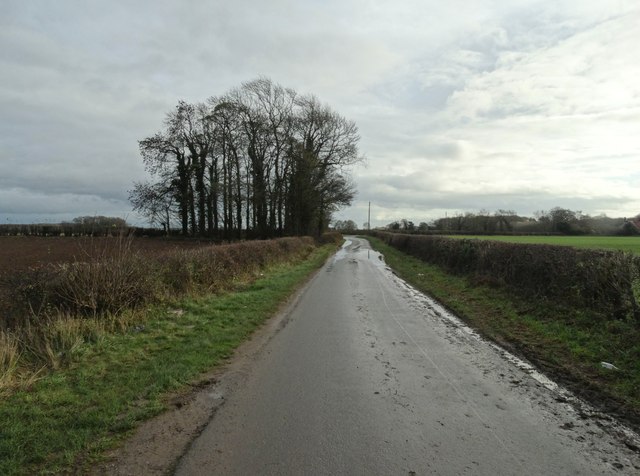
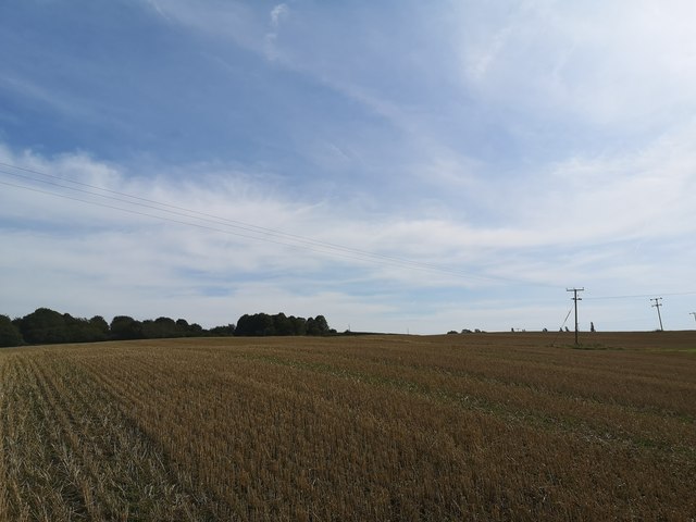
Bondhay Plantation is a picturesque woodland located in Derbyshire, England. Situated near the village of Whitwell, the plantation covers an area of approximately 150 acres, making it a significant natural feature in the region. With its diverse range of trees, including oak, beech, and birch, Bondhay Plantation offers a tranquil and scenic environment for visitors.

The woodland is known for its well-maintained trails, which allow visitors to explore its natural beauty. These paths wind through the plantation, providing opportunities for walking, jogging, and cycling. The plantation is particularly popular among nature enthusiasts, who appreciate the abundance of wildlife that can be spotted here, such as deer, squirrels, and a variety of bird species.

Bondhay Plantation also offers recreational facilities for visitors, including a picnic area and a children's playground. These amenities make it a great destination for families and groups looking to enjoy a day out in nature. Additionally, the plantation hosts various events throughout the year, such as guided walks and educational programs, which aim to promote environmental awareness and wildlife conservation.

The plantation is easily accessible, with ample parking available for visitors. Its proximity to nearby towns and cities, such as Worksop and Sheffield, makes it a convenient destination for both locals and tourists. Overall, Bondhay Plantation offers a serene and natural escape for those seeking to immerse themselves in the beauty of Derbyshire's woodlands.

If you have any feedback on the listing, please let us know in the comments section below.

Bondhay Plantation Images

Images are sourced within 2km of 53.3026/-1.23973 or Grid Reference SK5078. Thanks to Geograph Open Source API. All images are credited.

Direction Sign – Signpost on Harthill Field Road, Harthill with Woodall parish Located in Harthill, on the southwest side of the T junction of Harthill Field Road and Common Road, Harthill with Woodall parish. 1 arm and a lost annulus finial. Made by the Royal Label Factory.

Milestone Society National ID: YW_SK4980
Direction Sign – Signpost on Harthill Field Road, Harthill with Woodall parish
Located in Harthill, on the southwest side of the T junction of Harthill Field Road and Common Road, Harthill with Woodall parish. 1 arm and a lost annulus finial. Made by the Royal Label Factory. Milestone Society National ID: YW_SK4980
Walls Lane -  looking eastwards
Walls Lane - looking eastwards
Access track to Harthill Service Reservoir
Minor road at Nitticarhill
Field off Winney Lane
Centre of Whitwell Wood Two paths heading NW and NE from the centre of the wood
Centre of Whitwell Wood
Two paths heading NW and NE from the centre of the wood
Southard's Lane Leaving Whitwell Woods towards Thorpe Salvin
Southard's Lane
Leaving Whitwell Woods towards Thorpe Salvin
A619 at Springfield Farm entrance
A619 at Whitwell Common
Little Wood Lane Piggery
Footpath to Harthill Easy to follow.
Footpath to Harthill
Easy to follow.
Alongside Packman Lane Loscar Wood in front.
Alongside Packman Lane
Loscar Wood in front.
Part of Loscar Farm Wind Farm What this photograph cannot convey is the pungent aroma from a large heap of the cleanings from a pig farm which was just out of the picture to the left.
Part of Loscar Farm Wind Farm
What this photograph cannot convey is the pungent aroma from a large heap of the cleanings from a pig farm which was just out of the picture to the left.
Loscar Wind Farm Two of the three wind turbines on Loscar Common, near Harthill in South Yorkshire
Loscar Wind Farm
Two of the three wind turbines on Loscar Common, near Harthill in South Yorkshire
Ramblers crossing Loscar Common Heading towards Littlewood Farm near Thorpe Salvin, Rotherham-based rambling group “Bus 'n' Boots” cross Loscar Common on a trek from Harthill via Turnerwood on the Chesterfield Canal to North Anston. To the right, just off the picture, are two of the three wind turbines of Loscar Wind Farm.
Ramblers crossing Loscar Common
Heading towards Littlewood Farm near Thorpe Salvin, Rotherham-based rambling group “Bus 'n' Boots” cross Loscar Common on a trek from Harthill via Turnerwood on the Chesterfield Canal to North Anston. To the right, just off the picture, are two of the three wind turbines of Loscar Wind Farm.
Loscar Common Taken from near the stile on Common Road, this shot looks slightly south of east across Loscar Common and Packman Lane to Little Wood and Little Wood Lane Piggery near Thorpe Salvin.  The three wind turbines at Loscar Wind Farm are immediately to the right, just out of the picture.

What can be seen from here?
From this same vantage point on a clear day, it is just possible to make out Cottam Power Station on the distant horizon, to the right of Little Wood.  When conditions allow, it is also possible with binoculars to make out Lincoln Cathedral, 30 miles away as the crow flies.
Loscar Common
Taken from near the stile on Common Road, this shot looks slightly south of east across Loscar Common and Packman Lane to Little Wood and Little Wood Lane Piggery near Thorpe Salvin. The three wind turbines at Loscar Wind Farm are immediately to the right, just out of the picture. What can be seen from here? From this same vantage point on a clear day, it is just possible to make out Cottam Power Station on the distant horizon, to the right of Little Wood. When conditions allow, it is also possible with binoculars to make out Lincoln Cathedral, 30 miles away as the crow flies.
Loscar Common Taken from near the stile on Common Road, this shot looks slightly south of east across Loscar Common and Packman Lane to Little Wood and Little Wood Lane Piggery near Thorpe Salvin. The three wind turbines at Loscar Wind Farm are immediately to the right, just out of the picture.

What can be seen from here?
From this same vantage point on, it is just possible to make out Cottam Power Station on the distant horizon, to the right of Little Wood.  When conditions allow, it is also possible with binoculars to make out Lincoln Cathedral, 30 miles away as the crow flies.
Loscar Common
Taken from near the stile on Common Road, this shot looks slightly south of east across Loscar Common and Packman Lane to Little Wood and Little Wood Lane Piggery near Thorpe Salvin. The three wind turbines at Loscar Wind Farm are immediately to the right, just out of the picture. What can be seen from here? From this same vantage point on, it is just possible to make out Cottam Power Station on the distant horizon, to the right of Little Wood. When conditions allow, it is also possible with binoculars to make out Lincoln Cathedral, 30 miles away as the crow flies.
Loscar Wind Turbines Two of the three wind turbines on Loscar Common, near Harthill in South Yorkshire as seen from Common Road.
Loscar Wind Turbines
Two of the three wind turbines on Loscar Common, near Harthill in South Yorkshire as seen from Common Road.
Show me another place!

Bondhay Plantation is located at Grid Ref: SK5078 (Lat: 53.3026, Lng: -1.23973)

Administrative County: Derbyshire

District: Bolsover

Police Authority: Derbyshire

What 3 Words

///cloak.printouts.slower. Near Harthill, South Yorkshire

Related Wikis

Whitwell Common

Whitwell Common is a village, in Bolsover District, Derbyshire, lying just North-West of Whitwell, straddling the A619, which runs between Chesterfield...

Harthill, South Yorkshire

Harthill is a village in the Metropolitan Borough of Rotherham (part of South Yorkshire, England), on the border with Derbyshire. It lies between Killamarsh...

Whitwell Old Hall

Whitwell Old Hall is an early 17th-century manor house at Whitwell, Derbyshire. It is a Grade II* listed building. The manor of Whitwell was purchased...

St Lawrence's Church, Whitwell

St Lawrence's Church, Whitwell is a Grade I listed parish church in the Church of England in Whitwell, Derbyshire. == History == The church dates from...

Clowne Rural District

Clowne was a rural district in Derbyshire, England from 1894 to 1974. It was created by the Local Government Act 1894 as that part of the Worksop rural...

All Hallows' Church, Harthill

The All Hallows Church is an Anglican parish church in the Diocese of Sheffield, located in Harthill, South Yorkshire, England. It is a Grade I listed...

Whitwell, Derbyshire

Whitwell is a village in Derbyshire, England. The population of the civil parish (including Whitwell Common) taken at the 2011 Census was 3,900.Although...

Barlborough Hall

Barlborough Hall is a Grade I listed 16th-century country house in Barlborough, Chesterfield, Derbyshire. It was built in around 1583-84 for Sir Francis...

Nearby Amenities

Located within 500m of 53.3026,-1.23973
Barrier: stile
Step Count: 1
Stile: stepover
Lat/Long: 53.3012352/-1.2433735
Barrier: kissing_gate
Lat/Long: 53.3050208/-1.2364055
Noexit: yes
Note: Path blocked.
Lat/Long: 53.3066038/-1.2381294
1
Golf: pin
Lat/Long: 53.3021903/-1.2323923
2
Golf: pin
Lat/Long: 53.3035013/-1.233703
3
Golf: pin
Lat/Long: 53.3038725/-1.233208
5
Golf: pin
Lat/Long: 53.3045897/-1.2344596
6
Golf: pin
Lat/Long: 53.3052873/-1.2352114
9
Golf: pin
Lat/Long: 53.3044864/-1.2331262
The data included in this document is from www.openstreetmap.org. The data is made available under ODbL.

Have you been to Bondhay Plantation?

Leave your review of Bondhay Plantation below (or comments, questions and feedback).