Castle Hill

Hill, Mountain in Derbyshire Bolsover

England

Castle Hill

Direction Sign – Signpost on Harthill Field Road, Harthill with Woodall parish Located in Harthill, on the southwest side of the T junction of Harthill Field Road and Common Road, Harthill with Woodall parish. 1 arm and a lost annulus finial. Made by the Royal Label Factory.

Milestone Society National ID: YW_SK4980
Direction Sign – Signpost on Harthill Field Road, Harthill with Woodall parish Credit: C Minto

Castle Hill is a prominent hill located in the county of Derbyshire, England. Rising to an elevation of 352 meters above sea level, it is a popular destination for locals and tourists alike due to its stunning natural beauty and historical significance.

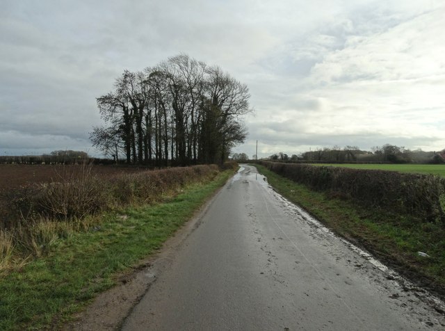
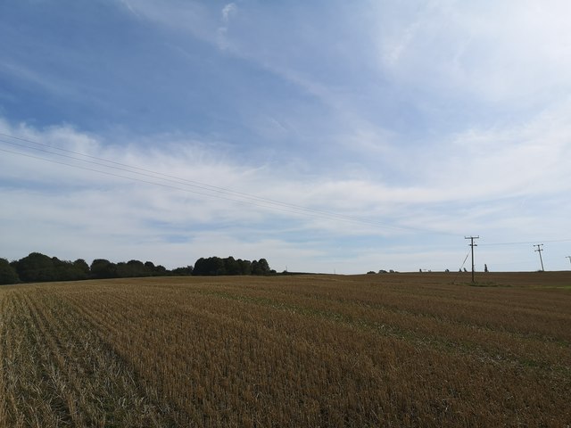
Situated within the Peak District National Park, Castle Hill offers breathtaking panoramic views of the surrounding countryside, including the nearby towns of Bakewell and Matlock. The hill is known for its distinctive shape, with its summit forming a gently undulating plateau that is covered in grassland and heather.

The name Castle Hill originates from the remnants of an ancient hillfort that once stood on its summit. Dating back to the Iron Age, the hillfort was believed to have been occupied by a Celtic tribe known as the Corieltauvi. Although the fortification is now mostly eroded, the remnants of its defensive ditches and ramparts are still visible, providing valuable insights into the area's ancient history.

The hill is also home to a variety of flora and fauna, including several species of birds and wildflowers. Its diverse ecosystems make it an ideal location for nature enthusiasts and birdwatchers, who can often spot birds of prey such as kestrels and peregrine falcons soaring above the hill.

In addition to its natural beauty, Castle Hill offers a range of recreational activities for visitors. Hiking and walking trails crisscross the hill, allowing visitors to explore its various features and enjoy the picturesque scenery. The hill is also a popular spot for picnicking and photography, with many visitors capturing the stunning vistas on camera.

Overall, Castle Hill in Derbyshire is a charming and historically significant hill that offers a delightful blend of natural beauty, cultural heritage, and recreational opportunities.

If you have any feedback on the listing, please let us know in the comments section below.

Castle Hill Images

Images are sourced within 2km of 53.300531/-1.2509006 or Grid Reference SK5078. Thanks to Geograph Open Source API. All images are credited.

Direction Sign – Signpost on Harthill Field Road, Harthill with Woodall parish Located in Harthill, on the southwest side of the T junction of Harthill Field Road and Common Road, Harthill with Woodall parish. 1 arm and a lost annulus finial. Made by the Royal Label Factory.

Milestone Society National ID: YW_SK4980
Direction Sign – Signpost on Harthill Field Road, Harthill with Woodall parish
Located in Harthill, on the southwest side of the T junction of Harthill Field Road and Common Road, Harthill with Woodall parish. 1 arm and a lost annulus finial. Made by the Royal Label Factory. Milestone Society National ID: YW_SK4980
A619 Worksop Road with wind turbine ahead
Walls Lane -  looking eastwards
Walls Lane - looking eastwards
Access track to Harthill Service Reservoir
Minor road at Nitticarhill
Field off Winney Lane
Pebley Pond Pebley Pond, or Pebley Reservoir, on the Derbyshire/South Yorkshire border near Harthill, was originally constructed around 1776 as a water supply for the Chesterfield Canal.  Flowing via Harthill Reservoir and thence by Broad Bridge Dike, the supply enters the canal via a cascade just west of Dog Kennel Bridge at Kiveton Park Station. The 27-acre reservoir has one island and the depth ranges from 2 to 18 feet.  Today, Pebley Reservoir is used for private fishing, although its primary purpose remains as a key water supply for the canal.
Pebley Pond
Pebley Pond, or Pebley Reservoir, on the Derbyshire/South Yorkshire border near Harthill, was originally constructed around 1776 as a water supply for the Chesterfield Canal. Flowing via Harthill Reservoir and thence by Broad Bridge Dike, the supply enters the canal via a cascade just west of Dog Kennel Bridge at Kiveton Park Station. The 27-acre reservoir has one island and the depth ranges from 2 to 18 feet. Today, Pebley Reservoir is used for private fishing, although its primary purpose remains as a key water supply for the canal.
A619 at Springfield Farm entrance
Loscar Wind Farm Two of the three wind turbines on Loscar Common, near Harthill in South Yorkshire
Loscar Wind Farm
Two of the three wind turbines on Loscar Common, near Harthill in South Yorkshire
Loscar Wind Turbines Two of the three wind turbines on Loscar Common, near Harthill in South Yorkshire as seen from Common Road.
Loscar Wind Turbines
Two of the three wind turbines on Loscar Common, near Harthill in South Yorkshire as seen from Common Road.
Walls Farm 'Tudor-Jacobean farmhouse behind an early 18th Century facade.' <span class="nowrap"><a title="http://www.wlhg.co.uk/survey/phase1/north_walls_farm.htm" rel="nofollow ugc noopener" href="http://www.wlhg.co.uk/survey/phase1/north_walls_farm.htm">Link</a><img style="margin-left:2px;" alt="External link" title="External link - shift click to open in new window" src="https://s1.geograph.org.uk/img/external.png" width="10" height="10"/></span>
Walls Farm
'Tudor-Jacobean farmhouse behind an early 18th Century facade.' LinkExternal link
Public Footpath Footpath connecting Gipsyhill Lane and Bondhay Lane
Public Footpath
Footpath connecting Gipsyhill Lane and Bondhay Lane
Harthill Field Road As its name suggests Harthill Field Road leads to Harthill Field which is situated to the SE of the village.  It is likely that this would have been a field from the mediaeval three field system?
Harthill Field Road
As its name suggests Harthill Field Road leads to Harthill Field which is situated to the SE of the village. It is likely that this would have been a field from the mediaeval three field system?
Wind Pump Situated just off Harthill Field Road this wind powered water pump has now fallen into disrepair.
Wind Pump
Situated just off Harthill Field Road this wind powered water pump has now fallen into disrepair.
Bondhay Dyke This dyke joins the River Ryton at Shireoaks.
Bondhay Dyke
This dyke joins the River Ryton at Shireoaks.
Gypsyhill Lane Gypsyhill Lane at the point where it joins Bondhay Lane.
Gypsyhill Lane
Gypsyhill Lane at the point where it joins Bondhay Lane.
Castle Hill Farm The farm to the centre of the horizon is Castle Hill Farm.  It sits on the western edge of this square and the picture was taken from the SE corner and shows circa 75% of this square.
Castle Hill Farm
The farm to the centre of the horizon is Castle Hill Farm. It sits on the western edge of this square and the picture was taken from the SE corner and shows circa 75% of this square.
Walls Lane near Whitwell
Show me another place!

Castle Hill is located at Grid Ref: SK5078 (Lat: 53.300531, Lng: -1.2509006)

Administrative County: Derbyshire

District: Bolsover

Police Authority: Derbyshire

What 3 Words

///enrolling.feasted.attention. Near Harthill, South Yorkshire

Related Wikis

Whitwell Common

Whitwell Common is a village, in Bolsover District, Derbyshire, lying just North-West of Whitwell, straddling the A619, which runs between Chesterfield...

Barlborough Hall

Barlborough Hall is a Grade I listed 16th-century country house in Barlborough, Chesterfield, Derbyshire. It was built in around 1583-84 for Sir Francis...

Harthill, South Yorkshire

Harthill is a village in the Metropolitan Borough of Rotherham (part of South Yorkshire, England), on the border with Derbyshire. It lies between Killamarsh...

Clowne Rural District

Clowne was a rural district in Derbyshire, England from 1894 to 1974. It was created by the Local Government Act 1894 as that part of the Worksop rural...

Related Videos

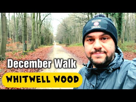
Whitwell Wood Walk in December

Whitwell Wood is just outside the small Derbyshire town of Whitwell on the outskirts of Worksop. The woods cover over 171 ...

Harthill Reservoir Snowy walk with the THAT’S ON! family.

I don't really post a lot of personal stuff on here, but seeing as we had a bit of snow and we walk around the res daily I thought I'd ...

Fuel prices will a diesel engine run on cooking oil? cheap alternative to diesel chip fat veg oil

will a diesel van run on cooking oil? due to the war in @Politicalanalystnew and Putin's mass war crimes fuel prices have sky ...

The Ultimate approach to simple Skimmer fishing using basic feeder fishing tactics.

When bites drop and you're approach is backed into a corner the first thing we do is jump on a different swim, change rigs or even ...

Nearby Amenities

Located within 500m of 53.300531,-1.2509006
Barrier: stile
Step Count: 1
Stile: stepover
Lat/Long: 53.3005252/-1.2486611
Barrier: stile
Step Count: 1
Stile: stepover
Lat/Long: 53.3008145/-1.2507388
Barrier: stile
Step Count: 1
Stile: stepover
Lat/Long: 53.3005857/-1.2505918
Barrier: stile
Step Count: 1
Stile: stepover
Lat/Long: 53.3007674/-1.2506908
The data included in this document is from www.openstreetmap.org. The data is made available under ODbL.

Have you been to Castle Hill?

Leave your review of Castle Hill below (or comments, questions and feedback).