Batt's Copse

Wood, Forest in Hampshire Basingstoke and Deane

England

Batt's Copse

Path on former railway embankment
Path on former railway embankment Credit: David Martin

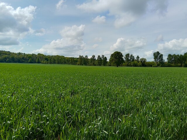
Batt's Copse is a picturesque woodland located in Hampshire, England. Covering an area of approximately 20 acres, this enchanting forest is nestled within the rural countryside, offering a serene and tranquil escape for nature enthusiasts and walkers alike.

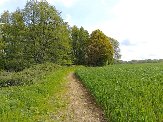
The copse features a diverse range of tree species, including oak, beech, and ash, creating a rich and vibrant canopy that provides shade during the summer months. The forest floor is adorned with an array of wildflowers, ferns, and mosses, adding to the copse's natural beauty.

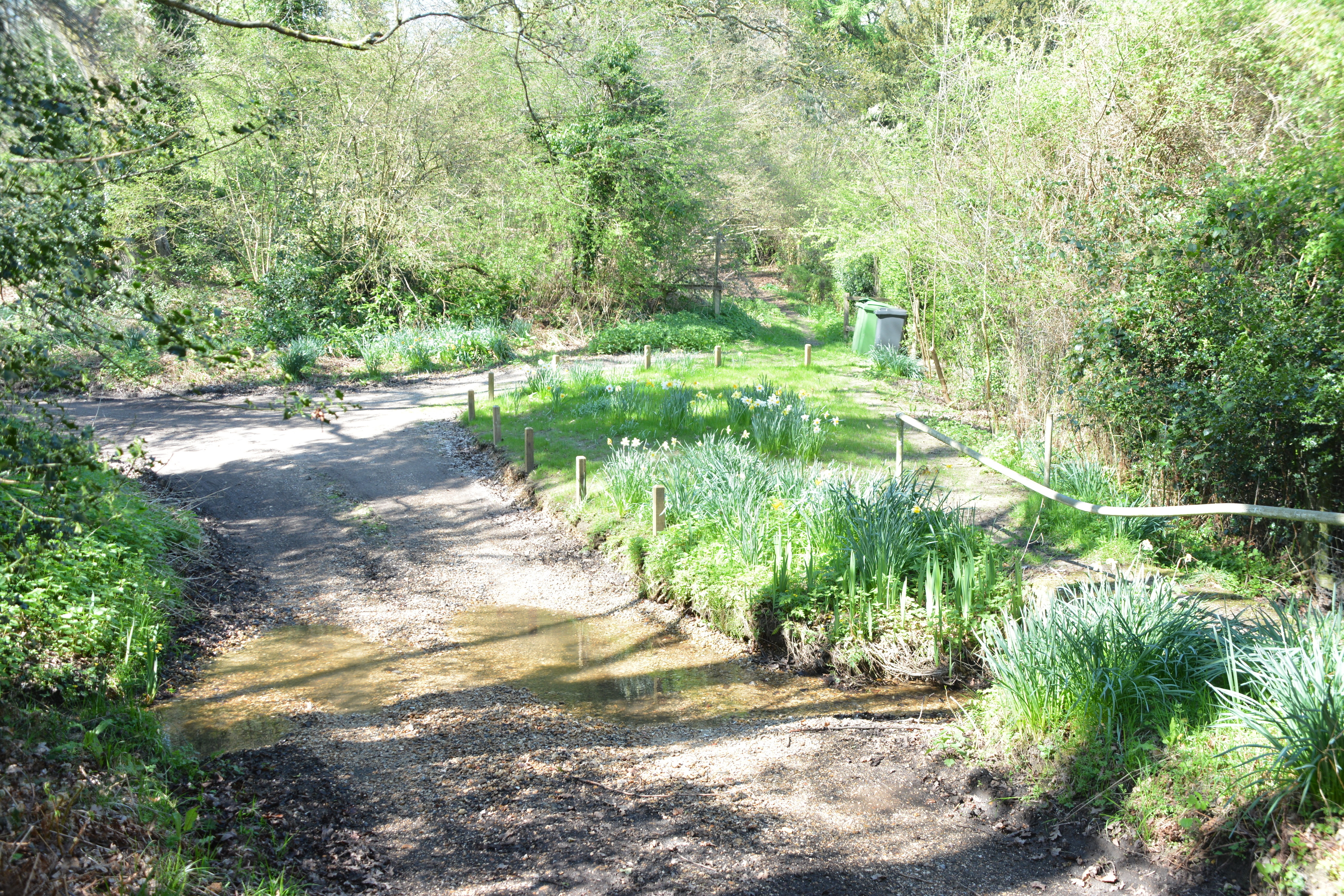
Traversing through Batt's Copse, visitors can explore a network of well-maintained footpaths, allowing them to immerse themselves in the peaceful ambiance while marveling at the ancient trees that have stood for centuries. The copse is also home to a variety of wildlife, including deer, birds, and small mammals, providing ample opportunities for nature photography and observation.

In addition to its natural wonders, Batt's Copse also boasts a small picnic area where visitors can relax and enjoy a packed lunch amidst the idyllic surroundings. The copse is a popular spot for families, dog walkers, and nature enthusiasts who seek a tranquil retreat from the hustle and bustle of everyday life.

Whether it's to take a leisurely stroll, enjoy a picnic, or simply appreciate the beauty of nature, Batt's Copse offers a serene and rejuvenating experience for all who visit. Its idyllic setting and abundant wildlife make it a must-see destination for those seeking solace in Hampshire's enchanting woodlands.

If you have any feedback on the listing, please let us know in the comments section below.

Batt's Copse Images

Images are sourced within 2km of 51.349163/-1.3133521 or Grid Reference SU4761. Thanks to Geograph Open Source API. All images are credited.

Path on former railway embankment
Well Street, beside former railway embankment
Country Road from Well Street to Duncroft Farm This square is mostly farmland and is quite hilly in the southern half of the square. This view looks along the road towards the fork which is at the bottom of the hill amongst the trees.
Country Road from Well Street to Duncroft Farm
This square is mostly farmland and is quite hilly in the southern half of the square. This view looks along the road towards the fork which is at the bottom of the hill amongst the trees.
Duncroft Farm, Burghclere Viewed from the byway that crosses the hill from Whitway.
Duncroft Farm, Burghclere
Viewed from the byway that crosses the hill from Whitway.
Farmland, Burghclere A cereal crop at Earlstone Manor viewed from the footpath to the east of the house.
Farmland, Burghclere
A cereal crop at Earlstone Manor viewed from the footpath to the east of the house.
Farmland, Burghclere A tree in arable farmland and late sunshine to the east of Earlstone Manor.
Farmland, Burghclere
A tree in arable farmland and late sunshine to the east of Earlstone Manor.
Farmland near Hobb's Copse An area of farmland near to Hobb's Copse, south east of Burghclere.
Farmland near Hobb's Copse
An area of farmland near to Hobb's Copse, south east of Burghclere.
Farmland near Earlstone Manor Farmland near to Earlstone Manor, south east of Burghclere.
Farmland near Earlstone Manor
Farmland near to Earlstone Manor, south east of Burghclere.
Footpath towards Earlstone Manor A public footpath around the edge of a field of farmland.
Footpath towards Earlstone Manor
A public footpath around the edge of a field of farmland.
Footpath towards Woodstone Farm A public footpath around the edge of farmland heads towards Woodstone Farm.
Footpath towards Woodstone Farm
A public footpath around the edge of farmland heads towards Woodstone Farm.
Footpath towards Earlstone Manor A public footpath enters the woodland near Earlstone Manor, after skirting around an area of farmland.
Footpath towards Earlstone Manor
A public footpath enters the woodland near Earlstone Manor, after skirting around an area of farmland.
Farmland south east of Burghclere Farmland to the south east of Burghclere, viewed from a public footpath.
Farmland south east of Burghclere
Farmland to the south east of Burghclere, viewed from a public footpath.
Stream near Earlstone Manor A stream in a small woodland near to Earlstone Manor.
Stream near Earlstone Manor
A stream in a small woodland near to Earlstone Manor.
Footpath towards Earlstone Manor A public footpath passes through a small area of woodland past a pond, towards Earlstone Manor.
Footpath towards Earlstone Manor
A public footpath passes through a small area of woodland past a pond, towards Earlstone Manor.
Bridge in the woods A blocked off bridge in the woodland south east of Burghclere.
Bridge in the woods
A blocked off bridge in the woodland south east of Burghclere.
Woodland pond A pond in a small woodland south east of Burghclere.
Woodland pond
A pond in a small woodland south east of Burghclere.
Footpath towards Burghclere A public footpath through woodland south east of Burghclere.
Footpath towards Burghclere
A public footpath through woodland south east of Burghclere.
Footpath towards Burghclere A public footpath through woodland south east of Burghclere.
Footpath towards Burghclere
A public footpath through woodland south east of Burghclere.
Show me another place!

Batt's Copse is located at Grid Ref: SU4761 (Lat: 51.349163, Lng: -1.3133521)

Administrative County: Hampshire

District: Basingstoke and Deane

Police Authority: Hampshire

What 3 Words

///votes.gentlemen.smiled. Near Greenham, Berkshire

Related Wikis

Clere School

The Clere School is a small co-educational community secondary school in Burghclere. Although its postcode locates to Reading via Newbury, it is in Hampshire...

Herbert Plantation

Herbert Plantation is a 25.6-hectare (63-acre) Local Nature Reserve north of Burghclere in Hampshire. It is owned by Hampshire County Council and managed...

Sandham Memorial Chapel

Sandham Memorial Chapel is in the village of Burghclere, Hampshire, England. It is a Grade I listed, 1920s decorated chapel, designed by Lionel Godfrey...

North Sydmonton

North Sydmonton is a small village in the Basingstoke and Deane district of Hampshire, England. Its nearest town is Newbury, which lies approximately 4...

Highclere railway station

Highclere railway station was a station on the Didcot, Newbury and Southampton Railway in England. It shares the name of the nearby village of Highclere...

Newtown Common

Newtown Common is a village in the Basingstoke and Deane district of Hampshire, England. Its nearest town is Newbury, which lies approximately 2.5 miles...

Adbury

Adbury is a village in Hampshire, United Kingdom. The settlement is within the civil parish of Burghclere, and is located approximately 2.5 miles (4.0...

Horris Hill School

Horris Hill, is an independent day and boarding preparatory school for boys aged 4–13. It is located in Berkshire in England, south of Newbury in West...

Nearby Amenities

Located within 500m of 51.349163,-1.3133521
Bicycle Parking
Lat/Long: 51.3499827/-1.3203576
Post Box
Collection Times: Mo-Fr 16:45; Sa 07:00
Post Box Type: wall
Ref: RG20 234
Royal Cypher: GVIR
Royal Cypher Wikidata: Q33102169
Lat/Long: 51.3497901/-1.3197819
Earlstone House
Building: house
Source: OS_OpenData_StreetView
Lat/Long: 51.3510728/-1.3174482
The data included in this document is from www.openstreetmap.org. The data is made available under ODbL.

Have you been to Batt's Copse?

Leave your review of Batt's Copse below (or comments, questions and feedback).