Ash Mill

Settlement in Devon North Devon

England

Ash Mill

Knowstone: towards West Welland Looking north west. East Welland is hidden by the bush on the right
Knowstone: towards West Welland Credit: Martin Bodman

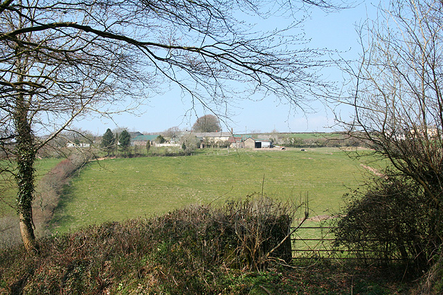
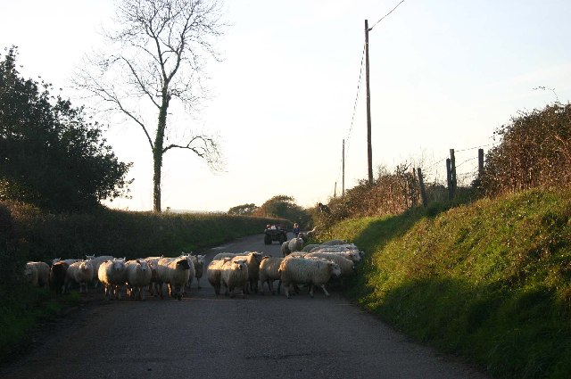
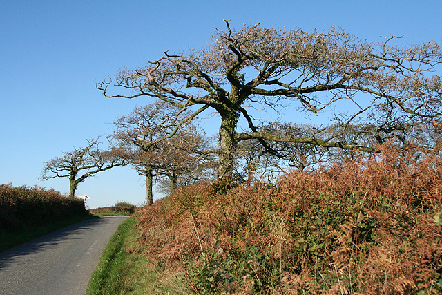
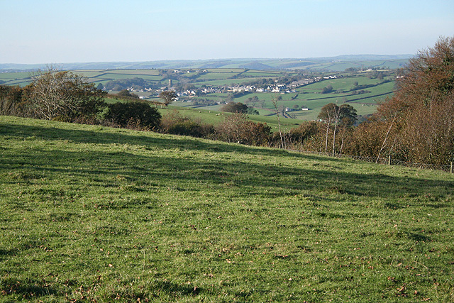
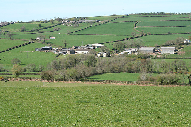
Ash Mill is a small village located in the county of Devon, in southwestern England. Situated in the heart of the beautiful North Devon countryside, Ash Mill is surrounded by rolling hills, lush green fields, and picturesque farmland. The village is nestled in the Torridge Valley, an area renowned for its natural beauty and tranquility.

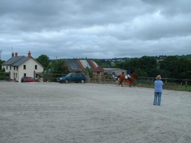
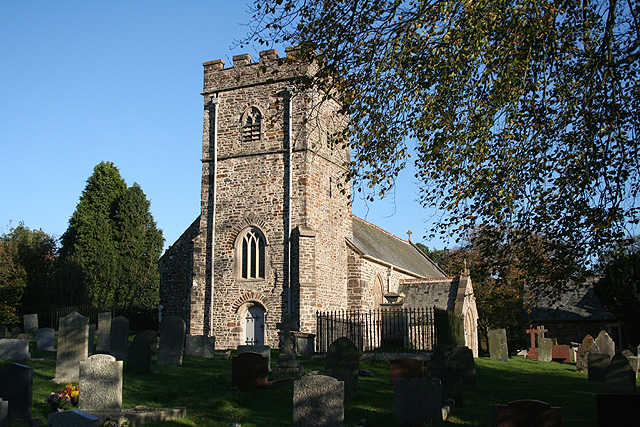
Ash Mill is a quintessential rural village, with a population of around 200 residents. The village is characterized by its charming, traditional cottages, many of which date back to the 18th and 19th centuries. The village church, St. Mary's, is a notable landmark and is believed to have been built in the 13th century.

Despite its small size, Ash Mill has a strong sense of community, with regular social events and gatherings taking place throughout the year. The village pub, The Ash Mill Inn, is a popular meeting place for locals and visitors alike, offering a warm and friendly atmosphere.

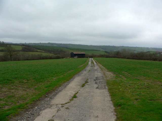
Surrounded by unspoiled countryside, Ash Mill offers ample opportunities for outdoor activities such as hiking, cycling, and fishing. The village is also within easy reach of the stunning North Devon coastline, with its sandy beaches and rugged cliffs, making it an ideal base for exploring the area.

Overall, Ash Mill is a tranquil and idyllic village, offering a peaceful retreat for those seeking a break from the hustle and bustle of city life.

If you have any feedback on the listing, please let us know in the comments section below.

Ash Mill Images

Images are sourced within 2km of 50.995545/-3.732644 or Grid Reference SS7823. Thanks to Geograph Open Source API. All images are credited.

Knowstone: towards West Welland Looking north west. East Welland is hidden by the bush on the right
Knowstone: towards West Welland
Looking north west. East Welland is hidden by the bush on the right
East Quince Farm Near South Molton
East Quince Farm
Near South Molton
Road into Ashill, Northern side of village
North Devon link road by South Hayne Plantation
Rose Ash church Rose Ash was formerly Ralph Esse, the local manor house having been owned by Ralph de Esse <span class="nowrap"><a title="http://genuki.cs.ncl.ac.uk/DEV/RoseAsh/" rel="nofollow ugc noopener" href="http://genuki.cs.ncl.ac.uk/DEV/RoseAsh/">Link</a><img style="margin-left:2px;" alt="External link" title="External link - shift click to open in new window" src="https://s1.geograph.org.uk/img/external.png" width="10" height="10"/></span>.
Rose Ash church
Rose Ash was formerly Ralph Esse, the local manor house having been owned by Ralph de Esse LinkExternal link.
Sheep on the road to Avercombe
Hill north of Rose Ash - looking North towards Exmoor
Rose Ash: Quince Cross Approaching the crossroads from the south: looking roughly north
Rose Ash: Quince Cross
Approaching the crossroads from the south: looking roughly north
Rose Ash: above Swincombe Looking north west towards Bishop’s Nympton, two squares away, in mid distance
Rose Ash: above Swincombe
Looking north west towards Bishop’s Nympton, two squares away, in mid distance
Rose Ash: St Peter’s church Before the Reformation the dedication was to All Saints. The fenced tomb by the tower commemorates members of the Tanner family of Nethercott, a farm to the south east. Looking east-north-east
Rose Ash: St Peter’s church
Before the Reformation the dedication was to All Saints. The fenced tomb by the tower commemorates members of the Tanner family of Nethercott, a farm to the south east. Looking east-north-east
Rose Ash: near Bickwill Looking west-north-west over farmland
Rose Ash: near Bickwill
Looking west-north-west over farmland
Bishop’s Nympton: nearing South Port Neighbouring farms are East Port, Middle Port and West Port, perhaps parts of an earlier estate. Looking west-north-west on the lane to Combsland New Cross. The public footpath links South Port, East Port and Little Kerscott
Bishop’s Nympton: nearing South Port
Neighbouring farms are East Port, Middle Port and West Port, perhaps parts of an earlier estate. Looking west-north-west on the lane to Combsland New Cross. The public footpath links South Port, East Port and Little Kerscott
Bishop’s Nympton: edge of Week Wood The track leads through the farm buildings ahead and on to Poadmarsh and Rose Ash. Looking south west
Bishop’s Nympton: edge of Week Wood
The track leads through the farm buildings ahead and on to Poadmarsh and Rose Ash. Looking south west
Bishop’s Nympton: barns at Higher Week By the lane from Knowstone to Ash Mill, looking west-north-west
Bishop’s Nympton: barns at Higher Week
By the lane from Knowstone to Ash Mill, looking west-north-west
Rose Ash: track to Poadmarsh In the 1970s this track was still a lane maintained by Devon County Council and in places the tarmac is still evident. Looking north-north-west
Rose Ash: track to Poadmarsh
In the 1970s this track was still a lane maintained by Devon County Council and in places the tarmac is still evident. Looking north-north-west
Rose Ash: towards Great Avercombe With East Avercombe to the right. Looking north-north-west
Rose Ash: towards Great Avercombe
With East Avercombe to the right. Looking north-north-west
Muckford Towards the end of a long mostly unfenced road heading south, this beautiful house close to a stream is surrounded by pretty daffodils and primroses.
Muckford
Towards the end of a long mostly unfenced road heading south, this beautiful house close to a stream is surrounded by pretty daffodils and primroses.
Muckford Barn The open road going south-west to Muckford leads to the barn before continuing to the house.
Muckford Barn
The open road going south-west to Muckford leads to the barn before continuing to the house.
Show me another place!

Ash Mill is located at Grid Ref: SS7823 (Lat: 50.995545, Lng: -3.732644)

Administrative County: Devon

District: North Devon

Police Authority: Devon and Cornwall

What 3 Words

///crackled.toned.writings. Near South Molton, Devon

Related Wikis

Ash Mill

Ash Mill is a village in Devon, England.Ashmill was the site of Ashwater station on the former L.S.W.R. North Cornwall line which closed in the 1960s....

Rose Ash

Rose Ash, formerly Ralph-Esse, is a village and civil parish in North Devon district, Devon, England. In the 2011 census it was recorded as having a population...

Bishop's Nympton

Bishop's Nympton is a village and civil parish in the North Devon district of Devon, England, about three miles east of South Molton. According to the...

Mariansleigh

Mariansleigh is a village and civil parish in Devon, England. In 2021 the parish had a population of 170. == External links == GENUKI Mariansleigh Page

Meshaw

Meshaw is a village and civil parish in the North Devon district of Devon, England. Its nearest town is South Molton, which lies approximately 5.9 miles...

Knowstone

Knowstone is a village and civil parish situated in the North Devon district of Devon, England, halfway between the Mid Devon town of Tiverton, Devon and...

Creacombe

Creacombe is a small village and former civil parish, now in the parish of Rackenford, in the North Devon district of Devon, England. Its nearest town...

Whitechapel, Bishops Nympton

Whitechapel is an ancient former manor within the parish of Bishops Nympton, in north Devon. It was the earliest known residence of the locally influential...

Nearby Amenities

Located within 500m of 50.995545,-3.732644
Ash Mill
Place: hamlet
Source: OS_OpenData_StreetView
Wikidata: Q4804416
Lat/Long: 50.9967289/-3.7325612
Power: pole
Source: bing
Lat/Long: 50.9997525/-3.7327927
Power: pole
Source: bing
Lat/Long: 50.9994191/-3.7338053
Power: pole
Source: bing
Transformer: distribution
Lat/Long: 50.9977085/-3.7344363
Power: pole
Source: bing
Lat/Long: 50.9983025/-3.7342237
Power: pole
Source: bing
Lat/Long: 50.9989355/-3.7339823
Power: pole
Source: bing
Lat/Long: 50.9992469/-3.7294601
Power: pole
Source: bing
Lat/Long: 50.9993203/-3.730934
Power: pole
Source: bing
Lat/Long: 50.9995752/-3.7320095
Power: pole
Source: bing
Lat/Long: 50.9998678/-3.7335825
Power: pole
Source: bing
Lat/Long: 50.9997035/-3.7353046
The data included in this document is from www.openstreetmap.org. The data is made available under ODbL.

Have you been to Ash Mill?

Leave your review of Ash Mill below (or comments, questions and feedback).