Ball Copse

Wood, Forest in Devon North Devon

England

Ball Copse

Knowstone: towards West Welland Looking north west. East Welland is hidden by the bush on the right
Knowstone: towards West Welland Credit: Martin Bodman

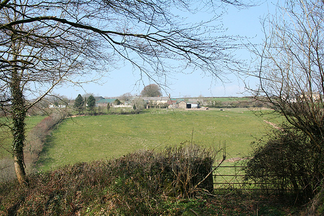
Ball Copse is a picturesque woodland located in the county of Devon in southwest England. Nestled in the heart of the beautiful countryside, it covers an area of approximately 20 acres and is known for its diverse range of tree species and abundant wildlife.

The woodland is predominantly made up of native broadleaf trees, such as oak, beech, and ash, which create a dense canopy that provides shade and shelter. These ancient trees, some of which are over 200 years old, contribute to the unique character and charm of Ball Copse.

The forest floor is covered with a rich carpet of wildflowers, ferns, and mosses, adding to the enchanting atmosphere of the wood. Bluebells, primroses, and wood anemones bloom in spring, painting the forest with vibrant colors.

Ball Copse is a haven for wildlife enthusiasts and nature lovers. It is home to a variety of bird species, including woodpeckers, owls, and warblers, whose melodic songs can be heard throughout the day. Squirrels scamper among the branches, while foxes, deer, and badgers can occasionally be spotted exploring the undergrowth.

The woodland offers several walking trails, allowing visitors to explore its beauty at their own pace. The paths wind through the trees, offering glimpses of the surrounding countryside and providing an opportunity to connect with nature in a tranquil setting.

Ball Copse is a true gem of Devon, offering a peaceful retreat for those seeking solace in the beauty of the natural world.

If you have any feedback on the listing, please let us know in the comments section below.
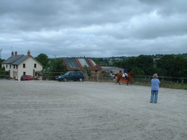
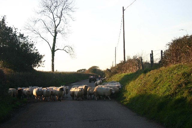
Ball Copse Images

Images are sourced within 2km of 51.001262/-3.7323885 or Grid Reference SS7823. Thanks to Geograph Open Source API. All images are credited.

Knowstone: towards West Welland Looking north west. East Welland is hidden by the bush on the right
Knowstone: towards West Welland
Looking north west. East Welland is hidden by the bush on the right
East Quince Farm Near South Molton
East Quince Farm
Near South Molton
Road into Ashill, Northern side of village
North Devon link road by South Hayne Plantation
Corner of South Hayne Plantation
Sheep on the road to Avercombe
Hill north of Rose Ash - looking North towards Exmoor
Bishop’s Nympton: near Combsland Cross Looking west towards South Molton, its church tower almost on the skyline
Bishop’s Nympton: near Combsland Cross
Looking west towards South Molton, its church tower almost on the skyline
Bishop’s Nympton: Combsland New Cross The Audi is turning off the old Wiveliscombe-Bampton-South Molton turnpike and heading north towards Twitchen and Molland. Looking north east
Bishop’s Nympton: Combsland New Cross
The Audi is turning off the old Wiveliscombe-Bampton-South Molton turnpike and heading north towards Twitchen and Molland. Looking north east
Bishop’s Nympton: nearing South Port Neighbouring farms are East Port, Middle Port and West Port, perhaps parts of an earlier estate. Looking west-north-west on the lane to Combsland New Cross. The public footpath links South Port, East Port and Little Kerscott
Bishop’s Nympton: nearing South Port
Neighbouring farms are East Port, Middle Port and West Port, perhaps parts of an earlier estate. Looking west-north-west on the lane to Combsland New Cross. The public footpath links South Port, East Port and Little Kerscott
Bishop’s Nympton: towards the B3227 The road was built as a 19th century turnpike linking Bampton with South Molton. It was once the A361 but has since been downgraded from that designation following the opening of the North Devon Link Road from the M5 Motorway to Barnstaple. The old turnpike route runs parallel with and south of the river Yeo, keeping to the high ground
Bishop’s Nympton: towards the B3227
The road was built as a 19th century turnpike linking Bampton with South Molton. It was once the A361 but has since been downgraded from that designation following the opening of the North Devon Link Road from the M5 Motorway to Barnstaple. The old turnpike route runs parallel with and south of the river Yeo, keeping to the high ground
Bishop’s Nympton: Little Kerscott By the B3227 Bampton-South Molton Road, which was built as a 19th century turnpike road and survived as a trunk road into the late 20th century, until downgraded following the opening of the North Devon Link Road from the M5 to Barnstaple. Looking east
Bishop’s Nympton: Little Kerscott
By the B3227 Bampton-South Molton Road, which was built as a 19th century turnpike road and survived as a trunk road into the late 20th century, until downgraded following the opening of the North Devon Link Road from the M5 to Barnstaple. Looking east
Bishop’s Nympton: two roads The B3227 Bampton-South Molton Road on the left has now been superseded as the district’s trunk road by the North Devon Link Road. At this point the B3227 was itself a replacement for the original route to South Molton, seen here as the track on the right making for Combsland Cross. Looking west-south-west
Bishop’s Nympton: two roads
The B3227 Bampton-South Molton Road on the left has now been superseded as the district’s trunk road by the North Devon Link Road. At this point the B3227 was itself a replacement for the original route to South Molton, seen here as the track on the right making for Combsland Cross. Looking west-south-west
Bishop’s Nympton: by the track to North Down Seen opposite the entrance to Kerscott – where there is or was a herd of Devon Red Rubies – by the B3227 road. Looking north-north-east
Bishop’s Nympton: by the track to North Down
Seen opposite the entrance to Kerscott – where there is or was a herd of Devon Red Rubies – by the B3227 road. Looking north-north-east
Bishop’s Nympton: edge of Week Wood The track leads through the farm buildings ahead and on to Poadmarsh and Rose Ash. Looking south west
Bishop’s Nympton: edge of Week Wood
The track leads through the farm buildings ahead and on to Poadmarsh and Rose Ash. Looking south west
Bishop’s Nympton: barns at Higher Week By the lane from Knowstone to Ash Mill, looking west-north-west
Bishop’s Nympton: barns at Higher Week
By the lane from Knowstone to Ash Mill, looking west-north-west
Rose Ash: track to Poadmarsh In the 1970s this track was still a lane maintained by Devon County Council and in places the tarmac is still evident. Looking north-north-west
Rose Ash: track to Poadmarsh
In the 1970s this track was still a lane maintained by Devon County Council and in places the tarmac is still evident. Looking north-north-west
Muckford Towards the end of a long mostly unfenced road heading south, this beautiful house close to a stream is surrounded by pretty daffodils and primroses.
Muckford
Towards the end of a long mostly unfenced road heading south, this beautiful house close to a stream is surrounded by pretty daffodils and primroses.
Show me another place!

Ball Copse is located at Grid Ref: SS7823 (Lat: 51.001262, Lng: -3.7323885)

Administrative County: Devon

District: North Devon

Police Authority: Devon and Cornwall

What 3 Words

///ordeals.intruding.kings. Near South Molton, Devon

Related Wikis

Ash Mill

Ash Mill is a village in Devon, England.Ashmill was the site of Ashwater station on the former L.S.W.R. North Cornwall line which closed in the 1960s....

Rose Ash

Rose Ash, formerly Ralph-Esse, is a village and civil parish in North Devon district, Devon, England. In the 2011 census it was recorded as having a population...

Bishop's Nympton

Bishop's Nympton is a village and civil parish in the North Devon district of Devon, England, about three miles east of South Molton. According to the...

Mariansleigh

Mariansleigh is a village and civil parish in Devon, England. In 2021 the parish had a population of 170. == External links == GENUKI Mariansleigh Page

Nearby Amenities

Located within 500m of 51.001262,-3.7323885
Generator Method: photovoltaic
Generator Output Electricity: yes
Generator Source: solar
Generator Type: solar_photovoltaic_panel
Location: roof
Power: generator
Lat/Long: 50.999679/-3.7286782
Generator Method: photovoltaic
Generator Output Electricity: yes
Generator Source: solar
Generator Type: solar_photovoltaic_panel
Location: roof
Power: generator
Lat/Long: 51.0037722/-3.7326546
Power: pole
Source: bing
Lat/Long: 50.9997525/-3.7327927
Power: pole
Source: bing
Lat/Long: 51.0040824/-3.7368306
Power: pole
Source: bing
Lat/Long: 51.0038963/-3.7354186
Power: pole
Source: bing
Lat/Long: 51.0037621/-3.7344302
Power: pole
Source: bing
Transformer: distribution
Lat/Long: 51.0036279/-3.7334351
Power: pole
Source: bing
Lat/Long: 51.0046279/-3.736914
Power: pole
Source: bing
Lat/Long: 51.0032203/-3.7366873
Power: pole
Source: bing
Lat/Long: 51.0026717/-3.7361857
Power: pole
Source: bing
Lat/Long: 51.0022599/-3.7358223
Power: pole
Source: bing
Lat/Long: 50.9994191/-3.7338053
Power: pole
Source: bing
Transformer: distribution
Lat/Long: 50.9977085/-3.7344363
Power: pole
Source: bing
Lat/Long: 50.9983025/-3.7342237
Power: pole
Source: bing
Lat/Long: 50.9989355/-3.7339823
Power: pole
Source: bing
Transformer: distribution
Lat/Long: 50.9990511/-3.726908
Power: pole
Source: bing
Lat/Long: 50.9991785/-3.7279339
Power: pole
Source: bing
Lat/Long: 50.9992469/-3.7294601
Power: pole
Source: bing
Lat/Long: 50.9993203/-3.730934
Power: pole
Source: bing
Lat/Long: 50.9995752/-3.7320095
Power: pole
Source: bing
Lat/Long: 51.0015164/-3.7351316
Power: pole
Source: bing
Lat/Long: 51.0010362/-3.7346904
Power: pole
Source: bing
Lat/Long: 50.9998678/-3.7335825
Power: pole
Source: bing
Lat/Long: 51.0004184/-3.7341338
Power: pole
Source: bing
Lat/Long: 50.9997035/-3.7353046
Power: pole
Source: bing
Lat/Long: 50.9999255/-3.7364794
Power: pole
Source: bing
Lat/Long: 51.0001306/-3.7375657
Power: pole
Source: bing
Lat/Long: 51.0003255/-3.7385729
Power: pole
Source: bing
Lat/Long: 51.0004926/-3.7394258
The data included in this document is from www.openstreetmap.org. The data is made available under ODbL.

Have you been to Ball Copse?

Leave your review of Ball Copse below (or comments, questions and feedback).