Drakewalls

Settlement in Cornwall

England

Drakewalls

Metherell House (formerly a Bible Christian chapel)
Metherell House (formerly a Bible Christian chapel) Credit: Paul Barnett

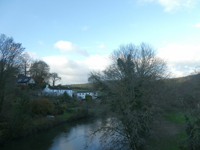
Drakewalls is a small village located in the county of Cornwall, England. Situated on the edge of Dartmoor National Park, it is nestled in a picturesque valley surrounded by rolling hills and lush green countryside. The village is part of the civil parish of Calstock and lies approximately 7 miles northeast of the town of Callington.

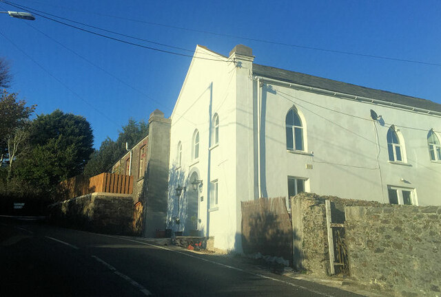
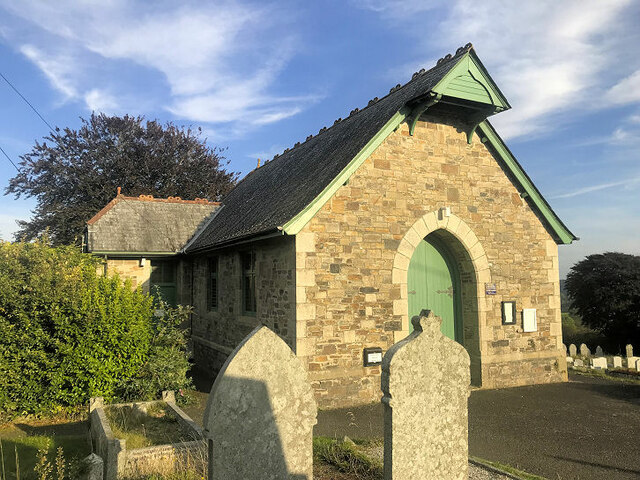
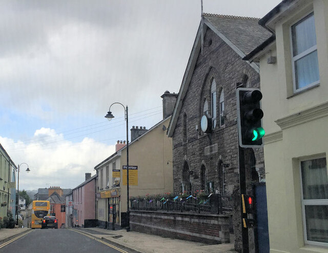
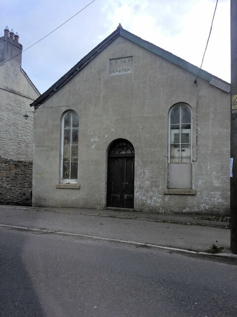
Drakewalls is known for its rich history, dating back to the early medieval period. The village was once an important mining area, with several tin, copper, and arsenic mines operating in the vicinity. Today, remnants of the mining heritage can still be seen, including old mine buildings and ruins scattered throughout the landscape.

The village itself is relatively small, with a close-knit community of residents. It offers a peaceful and tranquil atmosphere, making it an ideal destination for those seeking a retreat from the hustle and bustle of city life. The surrounding natural beauty of Drakewalls makes it a popular base for outdoor activities such as hiking, cycling, and birdwatching.

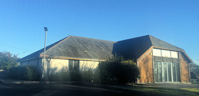
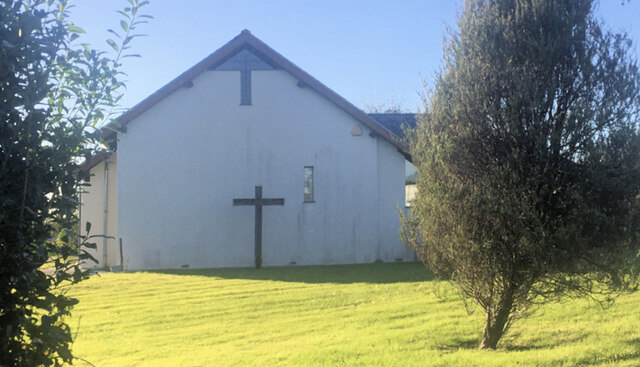
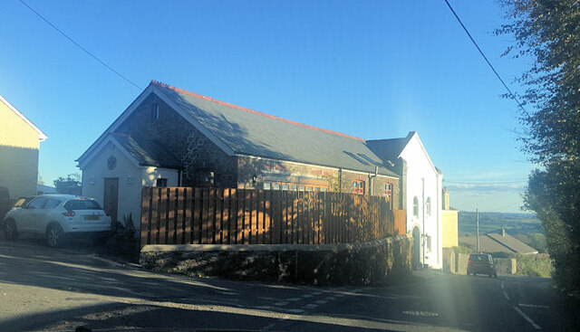
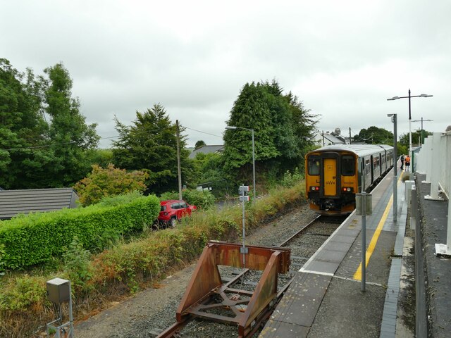
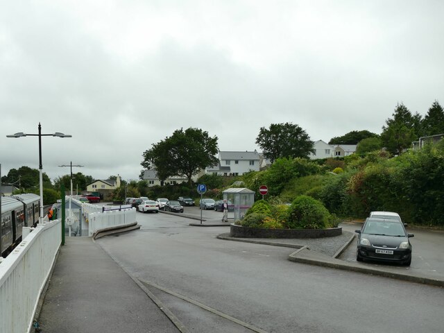
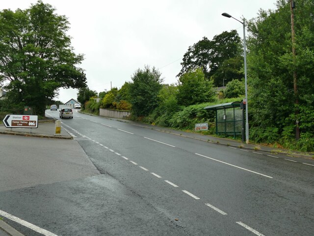
Despite its rural setting, Drakewalls benefits from good transport links. The village has a railway station, providing easy access to nearby towns and cities. It also boasts a few local amenities, including a village hall, a church, and a pub, which serves as a social hub for both locals and visitors.

In summary, Drakewalls is a charming village in Cornwall, offering a glimpse into the area's mining past and providing a tranquil escape for nature lovers.

If you have any feedback on the listing, please let us know in the comments section below.
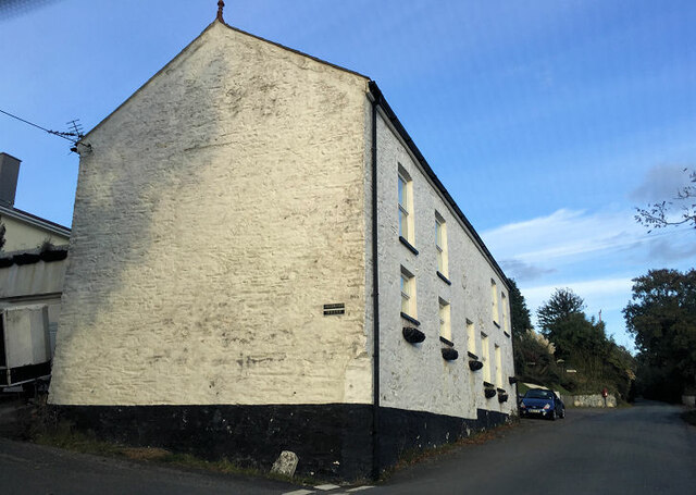
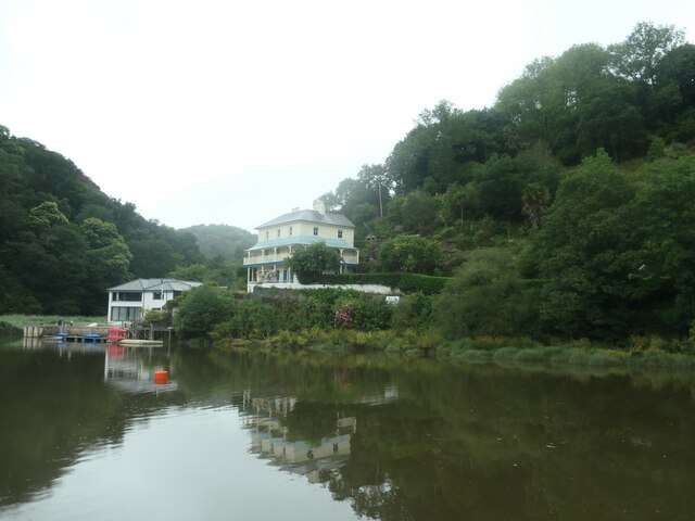
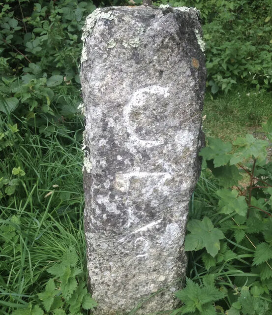
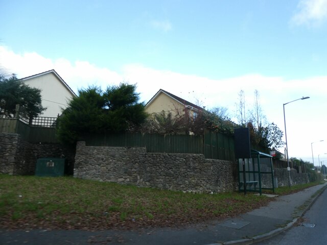
Drakewalls Images

Images are sourced within 2km of 50.515926/-4.224121 or Grid Reference SX4270. Thanks to Geograph Open Source API. All images are credited.

Metherell House (formerly a Bible Christian chapel)
Riverside houses at Danescombe In 1881 the building with the wrap-round balcony was the Ashburton Hotel.
Riverside houses at Danescombe
In 1881 the building with the wrap-round balcony was the Ashburton Hotel.
Old Milestone by UC road, half a mile west of Calstock The Milestone is located possibly by an old tramline on the side of the road.  Parish of Calstock (Caradon District). Carved stone post, erected in the 19th Century. 

Inscription reads:-
C / ½ 

Milestone Society National ID: CW_LACL10A
Old Milestone by UC road, half a mile west of Calstock
The Milestone is located possibly by an old tramline on the side of the road.  Parish of Calstock (Caradon District). Carved stone post, erected in the 19th Century. Inscription reads:- C / ½ Milestone Society National ID: CW_LACL10A
Bus shelter by A390 in St Ann's Chapel St Ann's Chapel is a hamlet in the parish of Calstock, Cornwall. It is west of Gunnislake on the A390 between Tavistock and Liskeard. The hamlet has a pub - The Rifle Volunteer.
Bus shelter by A390 in St Ann's Chapel
St Ann's Chapel is a hamlet in the parish of Calstock, Cornwall. It is west of Gunnislake on the A390 between Tavistock and Liskeard. The hamlet has a pub - The Rifle Volunteer.
Winter light on Tamar, New Bridge The Tamar (Cornish: Dowr Tamar) is in south west England, it forms most of the border between Devon and Cornwall. 
The Tamar's source is 3 miles from the north Cornish coast, but it flows southward and its course runs across the peninsula to the south coast. The total length of the river is 61 miles. At its mouth, the Tamar flows into the Hamoaze before entering Plymouth Sound. Tributaries of the river include the rivers Inny, Ottery, Kensey and Lynher (or St Germans River) on the Cornish side, and the Deer and Tavy on the Devon side.
Winter light on Tamar, New Bridge
The Tamar (Cornish: Dowr Tamar) is in south west England, it forms most of the border between Devon and Cornwall. The Tamar's source is 3 miles from the north Cornish coast, but it flows southward and its course runs across the peninsula to the south coast. The total length of the river is 61 miles. At its mouth, the Tamar flows into the Hamoaze before entering Plymouth Sound. Tributaries of the river include the rivers Inny, Ottery, Kensey and Lynher (or St Germans River) on the Cornish side, and the Deer and Tavy on the Devon side.
Tamar Valley Methodist Church
Former Bible Christian Chapel
Cemetery chapel
Cemetery chapel
Gunnislake Village Hall
Former Wesleyan Methodist Chapel
Direction Sign - Signpost by Honicombe Corner, Calstock parish Located on the bank on the northeast side of the crossroads near Honicombe Holiday park in Calstock parish. 4 arms, 1 now missing, and pyramid finial. See <a title="https://www.geograph.org.uk/photo/6048397" href="https://www.geograph.org.uk/photo/6048397">Link</a> to see it with all four arms.

Milestone Society National ID: CW_SX4170
Direction Sign - Signpost by Honicombe Corner, Calstock parish
Located on the bank on the northeast side of the crossroads near Honicombe Holiday park in Calstock parish. 4 arms, 1 now missing, and pyramid finial. See Link to see it with all four arms. Milestone Society National ID: CW_SX4170
Gunnislake station: terminating train The train from Plymouth arrived late as it had struggled to gain traction on the tight curves and steep gradients on the climb from Calstock Viaduct in the rain.
Gunnislake station: terminating train
The train from Plymouth arrived late as it had struggled to gain traction on the tight curves and steep gradients on the climb from Calstock Viaduct in the rain.
Gunnislake station: car park The station is a railhead for several surrounding villages.
Gunnislake station: car park
The station is a railhead for several surrounding villages.
Gunnislake station: cycle parking A modest provision of three Sheffield stands. Given that there are few houses near the station and Gunnislake is at the bottom of a long hill, I expect that few people do cycle to the station.
Gunnislake station: cycle parking
A modest provision of three Sheffield stands. Given that there are few houses near the station and Gunnislake is at the bottom of a long hill, I expect that few people do cycle to the station.
Gunnislake station: 25th anniversary plaque The plaque placed in 2019 marks 25 years since the present unstaffed station opened.
Gunnislake station: 25th anniversary plaque
The plaque placed in 2019 marks 25 years since the present unstaffed station opened.
Gunnislake station: entrance from Sand Hill There is a bus shelter opposite the station entrance.
Gunnislake station: entrance from Sand Hill
There is a bus shelter opposite the station entrance.
Show me another place!

Drakewalls is located at Grid Ref: SX4270 (Lat: 50.515926, Lng: -4.224121)

Unitary Authority: Cornwall

Police Authority: Devon and Cornwall

What 3 Words

///merely.cartoons.care. Near Gunnislake, Cornwall

Nearby Locations

Drakewalls Albaston

Related Wikis

Drakewalls

Drakewalls is a small village in southeast Cornwall, England, UK. It is in Calstock parish, adjacent to Gunnislake between Callington and Tavistock.Primary...

Gunnislake railway station

Gunnislake railway station (Cornish: Dowrgonna) serves the village of Gunnislake in Cornwall, England. There are also connecting buses from here to the...

Albaston

Albaston (Cornish: Trevalba) is a hamlet in Cornwall, England, United Kingdom. It is in the civil parish of Calstock. It is located at Ordnance Survey...

Dimson

Dimson is a small village in Cornwall, England. It is situated in the Tamar Valley approximately 10+1⁄2 miles (16.9 km) north of Plymouth and around two...

Nearby Amenities

Located within 500m of 50.515926,-4.224121
Gunnislake
Internet Access: wlan
Internet Access Fee: no
Naptan AtcoCode: 9100GUNISLK
Network: National Rail
Network Website: https://www.nationalrail.co.uk/stations/gsl/
Network Wikidata: Q26334
Operator: Great Western Railway
Operator Website: https://www.gwr.com/stations-and-destinations/stations/gunnislake
Operator Wikidata: Q1419438
Public Transport: station
Railway: station
Ref Crs: GSL
Source: NPE;local knowledge
Wikidata: Q2734942
Wikipedia: en:Gunnislake railway station
Lat/Long: 50.5166278/-4.2195227
Gunnislake
Historic Railway: station
Note: NPE location - Wikipedia notes this station was moved.
Railway: site
Source: NPE
Lat/Long: 50.5178115/-4.2200764
School
Delaware Primary School
Lat/Long: 50.5151356/-4.2261937
Bus Stop
Gunnislake Railway Station
Bus: yes
Naptan AtcoCode: 0800COA10666
Naptan Bearing: S
Naptan CommonName: Gunnislake Railway Station
Naptan NaptanCode: corgagag
Naptan Street: A390
Naptan Verified: no
Public Transport: platform
Source: naptan_import
Lat/Long: 50.5167721/-4.2197504
Bus Stop
Opp Gunnislake Railway Stn
Bus: yes
Naptan AtcoCode: 0800COA10667
Naptan Bearing: NE
Naptan CommonName: Opp Gunnislake Railway Stn
Naptan NaptanCode: corgagad
Naptan Street: Sand Hill
Naptan Verified: no
Public Transport: platform
Source: naptan_import
Lat/Long: 50.5170226/-4.2198186
Bus Stop
Moorland Way
Bus: yes
Fixme: review position and direction, S-bound makes no sense here
Naptan AtcoCode: 0800COY38581
Naptan Bearing: S
Naptan CommonName: Moorland Way
Naptan NaptanCode: corgadmp
Naptan Street: Delaware Road
Naptan Verified: no
Public Transport: platform
Source: naptan_import
Lat/Long: 50.5161073/-4.2244169
Bus Stop
Delaware Court
Bus: yes
Naptan AtcoCode: 0800COY38649
Naptan Bearing: W
Naptan CommonName: Delaware Court
Naptan Crossing: Delaware Road
Naptan NaptanCode: corgadmt
Naptan Street: Delaware Court
Naptan Verified: no
Public Transport: platform
Source: naptan_import
Lat/Long: 50.5169201/-4.2242435
Tamar Valley Centre
Addr City: Gunnislake
Addr Housename: Tamar Valley Centre
Addr Postcode: PL18 9FE
Addr Street: Cemetery Road
Information: office
Tourism: information
Lat/Long: 50.514483/-4.2221208
Drakewalls Mine
Disused: yes
Historic: mine
Lat/Long: 50.5146671/-4.2222465
Albaston
Name En: Albaston
Name Kw: Trevalba
Place: hamlet
Wikidata: Q4709432
Lat/Long: 50.5116431/-4.2253138
Bicycle Parking
Bicycle Parking: stands
Capacity: 6
Covered: no
Lat/Long: 50.516241/-4.2194715
Pub
The Queens Head
Source: Bing
Lat/Long: 50.5119308/-4.2253415
Parking
Lat/Long: 50.5133002/-4.2263214
Power: pole
Lat/Long: 50.5121627/-4.227671
Power: pole
Lat/Long: 50.5134828/-4.2284167
Power: pole
Lat/Long: 50.5148029/-4.2291999
Power: pole
Lat/Long: 50.5157836/-4.2297712
Location Transition: yes
Power: pole
Lat/Long: 50.5182344/-4.2287385
Power: pole
Lat/Long: 50.5200694/-4.2266625
Power: pole
Lat/Long: 50.5199074/-4.2265445
Power: pole
Lat/Long: 50.5198682/-4.226684
Power: pole
Lat/Long: 50.5179377/-4.2285696
Power: pole
Lat/Long: 50.5185328/-4.2277515
Location Transition: yes
Power: pole
Lat/Long: 50.5194793/-4.2263514
Power: pole
Lat/Long: 50.5187366/-4.2278682
Location Transition: yes
Power: pole
Lat/Long: 50.5194504/-4.2266813
Power: pole
Lat/Long: 50.5182958/-4.2288351
Power: pole
Lat/Long: 50.5200131/-4.2267671
Generator Method: photovoltaic
Generator Output Electricity: yes
Generator Source: solar
Generator Type: solar_photovoltaic_panel
Location: roof
Power: generator
Lat/Long: 50.5184281/-4.2186847
Generator Method: photovoltaic
Generator Output Electricity: yes
Generator Source: solar
Generator Type: solar_photovoltaic_panel
Location: roof
Power: generator
Lat/Long: 50.5177851/-4.2204844
Generator Method: photovoltaic
Generator Output Electricity: yes
Generator Source: solar
Generator Type: solar_photovoltaic_panel
Location: roof
Power: generator
Lat/Long: 50.514514/-4.2221045
Generator Method: photovoltaic
Generator Output Electricity: yes
Generator Source: solar
Generator Type: solar_photovoltaic_panel
Location: roof
Power: generator
Lat/Long: 50.5125119/-4.2260935
Generator Method: photovoltaic
Generator Output Electricity: yes
Generator Source: solar
Generator Type: solar_photovoltaic_panel
Location: roof
Power: generator
Lat/Long: 50.5127354/-4.2262963
Generator Method: photovoltaic
Generator Output Electricity: yes
Generator Source: solar
Generator Type: solar_photovoltaic_panel
Location: roof
Power: generator
Lat/Long: 50.5132064/-4.2261746
Generator Method: photovoltaic
Generator Output Electricity: yes
Generator Source: solar
Generator Type: solar_photovoltaic_panel
Location: roof
Power: generator
Lat/Long: 50.5128179/-4.2264774
Generator Method: photovoltaic
Generator Output Electricity: yes
Generator Source: solar
Generator Type: solar_photovoltaic_panel
Power: generator
Lat/Long: 50.5156022/-4.2195828
Generator Method: photovoltaic
Generator Output Electricity: yes
Generator Source: solar
Generator Type: solar_photovoltaic_panel
Power: generator
Lat/Long: 50.5187684/-4.2249546
Generator Method: photovoltaic
Generator Output Electricity: yes
Generator Source: solar
Generator Type: solar_photovoltaic_panel
Power: generator
Lat/Long: 50.5155956/-4.2197385
Access: yes
Historic: chimney
Historic Civilization: industrial
Lat/Long: 50.5149251/-4.223486
Generator Method: wind_turbine
Generator Source: wind
Power: generator
Lat/Long: 50.5142855/-4.2233358
Railway: buffer_stop
Lat/Long: 50.5167688/-4.2195612
Post Box
Brand: Royal Mail
Brand Wikidata: Q638098
Brand Wikipedia: en:Royal Mail
Collection Times: Mo-Fr 15:45; Sa 07:00; Su off
Drive Through: no
Operator: Royal Mail
Operator Wikidata: Q638098
Post Box Design: 2010_pattern
Post Box Mounting: pier
Post Box Type: lamp
Ref: PL18 20
Royal Cypher: EIIR
Royal Cypher Wikidata: Q33102113
Source: survey;streetlevel imagery;aerial imagery
Lat/Long: 50.5160344/-4.2245087
Post Box
Brand: Royal Mail
Brand Wikidata: Q638098
Brand Wikipedia: en:Royal Mail
Collection Times: Mo-Fr 09:00; Sa 09:00; Su off
Drive Through: no
Operator: Royal Mail
Operator Wikidata: Q638098
Post Box Design: 2010_pattern
Post Box Mounting: pier
Post Box Type: lamp
Ref: PL18 54
Royal Cypher: EIIR
Royal Cypher Wikidata: Q33102113
Source: survey;streetlevel imagery;aerial imagery
Lat/Long: 50.5169652/-4.21965
Drakewalls Bed & Breakfast
Addr Housename: Drakewalls House
Addr Postcode: PL18 9EG
Guest House: bed_and_breakfast
Tourism: guest_house
Website: https://www.drakewallsbedandbreakfast.co.uk/
Lat/Long: 50.5159125/-4.2234519
Historic: memorial
Inscription: To commemorate the coronation of King George V June 22nd 1911 and the alteration of the gradient of Sand Hill during great distress in this parish of Calstock 1908-9
Material: stone
Memorial: memorial
Lat/Long: 50.5159713/-4.2206772
Power: pole
Lat/Long: 50.5180195/-4.2262414
Power: pole
Lat/Long: 50.5189053/-4.2272005
Power: pole
Lat/Long: 50.5193617/-4.2276107
Power: pole
Lat/Long: 50.5190746/-4.2273376
Power: pole
Lat/Long: 50.5200447/-4.2256433
Power: pole
Lat/Long: 50.5196192/-4.2262334
Location Transition: yes
Power: pole
Lat/Long: 50.5195885/-4.2262803
Barrier: bollard
Motor Vehicle: no
Lat/Long: 50.5165047/-4.2288645
St Anns
Description: OS trig pillar
Ele: 214.365
Man Made: survey_point
Note: Accurate location import for imagery offset calibration. Please do not move.
Ref: SX76/T86
Source: Ordnance Survey (OGL)
Survey Point: pillar
Lat/Long: 50.5176519/-4.2305042
Telephone
Booth: K6
Covered: booth
Man Made: telephone_box
Old Phone: +44 1822 832627
Lat/Long: 50.5118817/-4.2255701
Post Box
Brand: Royal Mail
Brand Wikidata: Q638098
Brand Wikipedia: en:Royal Mail
Collection Times: Mo-Fr 15:45; Sa 10:30; Su off
Drive Through: no
Operator: Royal Mail
Operator Wikidata: Q638098
Post Box Design: type_b
Post Box Mounting: building
Post Box Type: wall
Ref: PL18 90
Royal Cypher: GR
Royal Cypher Wikidata: Q33102273
Source: survey;streetlevel imagery;aerial imagery
Lat/Long: 50.5118992/-4.2255071
Note: Postbox was present in Aug 2009 Streetview (https://goo.gl/maps/ER9YQWNiwkQHuhLW8) but gone by Jun 2014 (https://goo.gl/maps/dmuYPiiarXH4UXiY7) and not in Royal Mail list (Feb 2022) so suggest removing
Ref: PL18 94
Removed Amenity: post_box
Lat/Long: 50.5157248/-4.2303038
Car Wash
Automated: no
Self Service: yes
Lat/Long: 50.51556/-4.2212034
Atm
Lat/Long: 50.5156808/-4.2210531
The data included in this document is from www.openstreetmap.org. The data is made available under ODbL.

Have you been to Drakewalls?

Leave your review of Drakewalls below (or comments, questions and feedback).